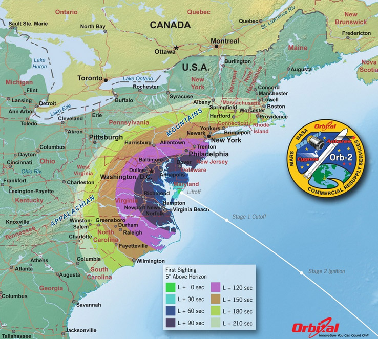
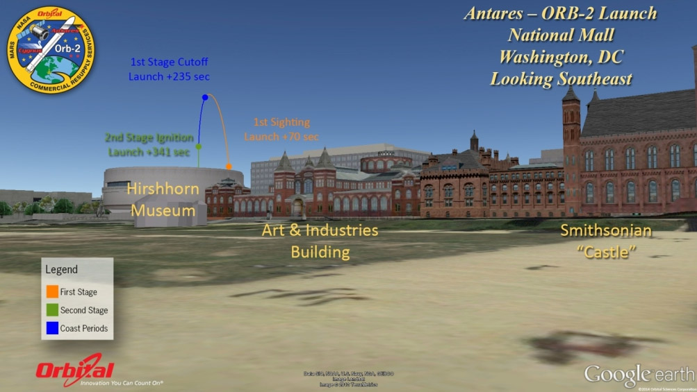
Depending on local conditions and other factors, Sunday’s launch of the Orbital-2 mission from Virginia may be partially visible from South Carolina to Massachusetts.

Launch is scheduled for July 13 at 12:52 p.m. EDT from the Mid-Atlantic Regional Spaceport’s Launch Pad 0A at NASA’s Wallops Flight Facility, along Virginia’s eastern shore. An Antares rocket will loft a Cygnus spacecraft loaded with about 3,300 pounds of supplies for the International Space Station, including science experiments to expand the research capability of the Expedition 40 crew, crew provisions, spare parts and experiment hardware.


› NASA’s Orbital website
› Latest TV launch coverage schedule
› Launch viewing maps for additional cities
› Latest Student Science Heads For Space
› Orbital Mission Delivers Delights to Station
› NASA Launches Smartphone Upgrade and CubeSat

The way you have the flight drawn on the map is a little confusing.
Just go through the stages as NASA would. Thank You, J.Kent Di Mario
A different launch visibility map from NASA’s Wallops Flight Facility is available here.
https://www.nasa.gov/sites/default/files/files/Antares_ORB2_Visibility_Map.jpg