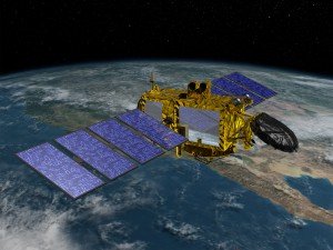
 Jason-3 is the fourth in a U.S.-European series of satellite missions that measure the height of the ocean surface, extending the time series of ocean surface topography measurements that began with the TOPEX/Poseidon satellite mission in 1992 and has continued through the currently operating missions: Jason-1, launched in 2001, and OSTM/Jason-2, launched in 2008. The Jason-3 mission is planned to last at least three years, with a goal of five years.
“In my opinion, Jason-3 and its three predecessors — Topex-Poseidon, Jason-1 and Jason-2 — provide the most accurate measurements of global sea surface heights. Think of it: a satellite orbiting that is orbiting Earth more than 1300 kilometers away is able to tell us height of the sea surface with an accuracy of less than two inches,” Jim Silva, NOAA’s Jason-3 program manager, said Friday.
“To paraphrase from Charlotte’s Web, that is some satellite.”
One major advantage of Jason-3 over earlier satellites, Silva explained, is its improved algorithms. With Jason-3, forecasters and researchers will be able to determine wind speeds and ocean currents within about a kilometer from U.S. shorelines — a significant advantage over the spacecraft’s predecessors, which could detect these features about 10 kilometers from shore. That’s especially useful for search and rescue operations in the case of downed ships close to shore.
