Today’s blog post is from Ross Beyer, a planetary scientist with the Carl Sagan Center at the SETI Institute and NASA Ames Research Center in Mountain View, California. He studies surface geomorphology, surface processes, remote sensing and photogrammetry of the solid bodies in our solar system.
I’ve always loved maps, and I’ve always loved planets and space, and the idea of exploring new places – so getting a doctorate in planetary sciences seemed to flow naturally from my interest in space, planets and exploring. My job as a research scientist, exploring the solar system vicariously through robotic spacecraft for the last two decades, has been a joy. But it wasn’t until later that I realized my work with planetary images was also connected to my love of maps. And all of these things have come together with my work on New Horizons.
After the February 2007 Jupiter flyby, I helped the mission team plan the Pluto encounter. New Horizons was going to fly through the Pluto system, as if the spacecraft was on a rail moving out from the sun. We couldn’t do loop-de-loops or any other complicated motions at Pluto; we were just moving through. However, we could pivot and point our instruments at Pluto and its moons Charon, Nix, Hydra, Styx and Kerberos, so we had to figure out that sequence of events. Our mission had to satisfy numerous specific scientific objectives, so we had to lay out a sequence of observations that used our time wisely as we zipped past. I was just one of the many, many people involved in that effort. It was hard work, frustrating at times, but ultimately very educational and also fun, as we tried (and I think succeeded in) arriving at a plan that captured a wonderful series of observations from all seven science instruments on New Horizons. Of course, I was most interested in the pictures that we were going to take!
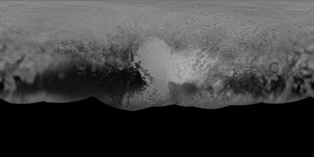
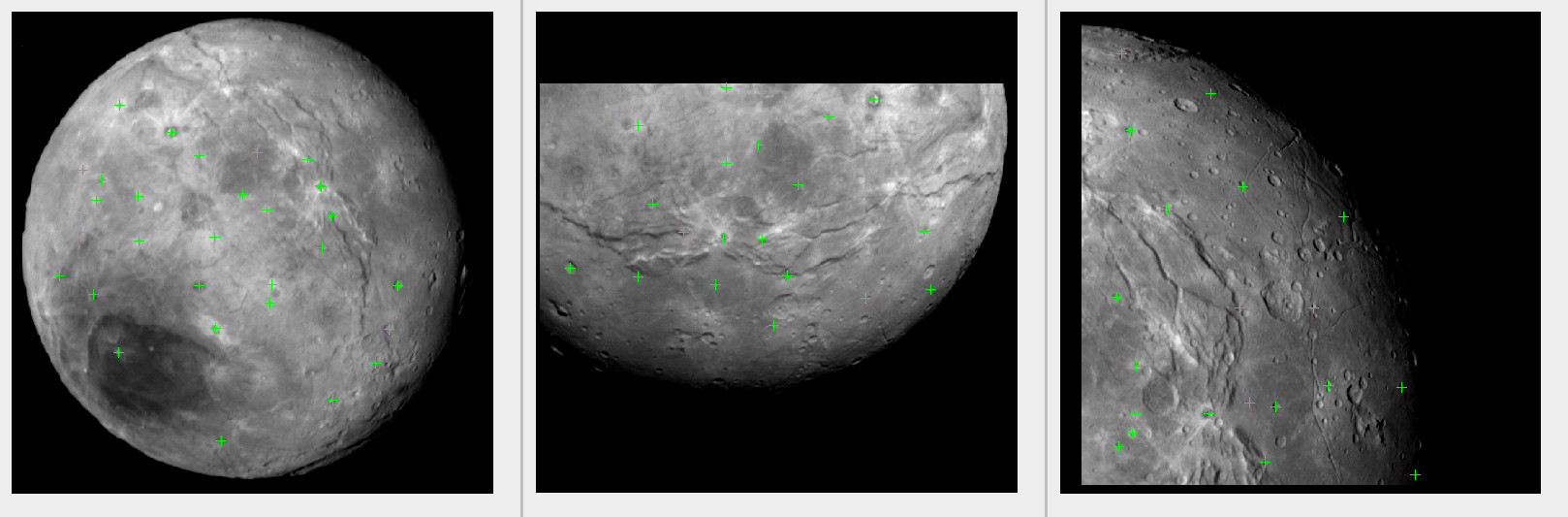
When New Horizons flew by Pluto and Charon last July, it snapped many pictures of these new worlds for the first time. As a geologist and a photogrammetrist (someone who measures things from images), it is important for me to understand correspondences between the images: where do the higher resolution images belong amongst the images taken from farther away that show more area? How is one image related to the next? To answer these questions and more, we make something called a control network, and from that we can make maps.
A control network is made from finding control points between images. So if we have two images of Pluto, and we can identify the same feature in both images – say, a crater – then we mark a spot on the crater rim in the same place in each image, and that is a control point. We do that for lots of features in each image, and then try to find those same features in other images. As you can imagine, we quickly run up a lot of points, and having a computer program to help us select and track all of these points is important.
Once we have a rich control network made up of points from all of the images we can measure, we can use a computer to perform something called a “bundle adjustment solution.” This action takes those points, and some information from the spacecraft about approximately where it was and where it was pointing when it took each image, and creates a “solution” for each image that correctly places it. This allows us to create mosaics and maps from the images. That is the key to knowing that image A is next to image B, for example, or that image C is higher resolution than either of them and is located within image A.
This kind of map allows us to not only make sense of all the images, it also allows us to combine data from the black-and-white camera and the color cameras, as well as other instruments. It helps all of the scientists on the team put their data together and tell a complete story about these amazing worlds that we have now explored!
