Weather.
Most of us are content with tuning into the news, picking up a newspaper, opening up a smartphone app, or perhaps even relying on a trick knee to get a general sense of the day’s weather outlook. Cloudy, sunny, rainy, windy, snowy. Pleasant, frigid, heat wave, cold snap.
With the daily forecast in hand, we’re armed with that perfect, universal conversation starter that gets us by as we wait for our morning dose of caffeine to take effect. Lovely weather today. Looks like rain this afternoon. Frosty morning, but things are looking up. Good day for fishing.
But, is it a good day for launching a NASA super pressure balloon?
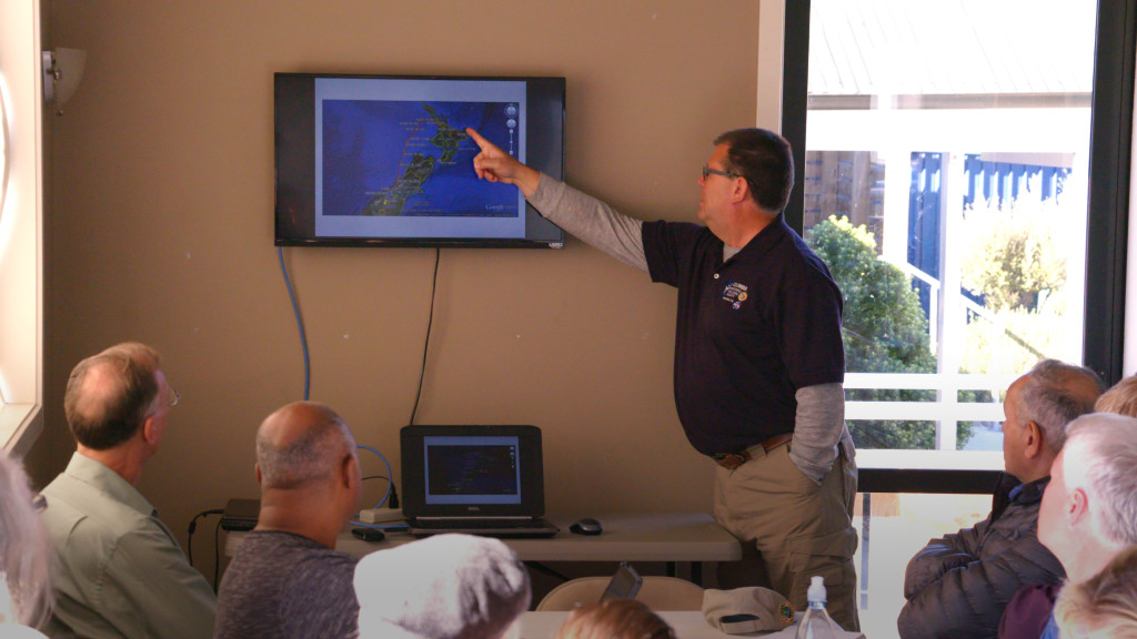
That’s the first question Robert Mullenax asks each morning as he drives into his office at Wanaka Airport under the blanket of morning darkness, long before most of us are awake. He fires up his computers, starts taking low-level wind measurements, and studies gigabytes of weather data, including sophisticated weather models, all of which help him determine if the next day is good for a launch attempt.
“There’s no model out there as good as a human being,” remarks the senior meteorologist with NASA’s Columbia Scientific Balloon Facility (CSBF).
And, there are no human meteorologists who know more about forecasting for large scientific balloons than the meteorologists of CSBF.
With 25 years of forecasting for balloon launches at diverse locations around the globe, the daily weather picture Mullenax paints is – more often than not – the driving factor behind the campaign manager’s final decision to enter a launch attempt or pass for the day.
It’s a complicated process. While Wanaka’s weather is nearly always pleasant as viewed by the layperson, to support a balloon launch, weather forecasts need to align at multiple areas of the atmosphere from the ground to the edge of space.
Timing is key. For a typical launch day, the team needs to start work around midnight, pulling the 2,200 kg payload out of the hangar to begin attaching the solar arrays that will power the instruments during flight. Winds need to be light to facilitate the work.
As launch operations progress through the early morning hours leading up to launch, surface level weather needs to be characterized by light winds flowing in a reliable direction. In addition, given the length of the balloon flight train at launch, some 250 meters, weather at that altitude is also a factor. At 250 meters, wind speeds need to be light and wind direction needs to align with the surface level direction. Opposing winds can create a shearing effect. It is the days with light/variable and opposing winds that can make a seemingly very nice day totally unacceptable for launching a large super pressure balloon.

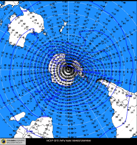
Higher up, Mullenax is also monitoring wind direction in the stratosphere at 33.5 kilometers where the balloon will fly operationally. (More precisely, as Mullenax is quick to point out, the balloon floats at a pressure altitude of 7 millibars, which roughly equates to 33.5 kilometers but can vary slightly depending on atmospheric temperatures.)
A weather phenomena known as the stratospheric winter cyclone develops this time of year in the southern hemisphere. The cyclone is characterized by wind vectors traveling easterly about Antarctica with the cyclonic behavior extending into the southern hemisphere’s mid-latitudes. “The stratospheric winter cyclone is the only stratospheric circulation that consistently sets up for 100 or more days without breaking down,” said Mullenax. “Launching into it, combined with the fact we fly mostly over water, is how you’re going to achieve long-duration balloon flight.”
Even after lift-off, the daily forecasting continues. As the balloon flies around the globe at mid-latitudes, daily forecasts are key to anticipating cold storms, which could cause a momentary drop in altitude. In addition, as the balloon nears a land mass, wind speed and direction plays into the modeling that determines whether or not the mission can continue safely or not. Avoiding densely populated areas is key. Finally, weather is a vital aspect of predicting where the payload and balloon material will land once the mission objectives are met and the flight is terminated.
Having declared the balloon and payload flight ready April 1, the team is relying on Mother Nature to make the next step. Mullenax continues to pour over copious amounts of weather data and applies the human touch to each forecast. At 11 a.m. each day, he briefs the team on his forecast for the timeframe running from midnight to launch, covering conditions on the ground, at 250 meters, and in the stratosphere at 33.5 kilometers, (errr…7 millibars). Then the decision is made.
It can be a long process waiting for the ideal day, even at a location with weather as pleasant as Wanaka’s. “There’s no perfect location for launch,” says Mullenax. “But Wanaka is a great place to launch and gives us the best chance to meet all of our criteria.”
