NASA researcher Joaquin Chaves calls it “ground truthing,” even though land is nowhere in sight.
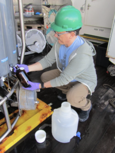
This spring, Chaves boarded the Atlantic Meridional Transect (AMT) research cruise for six weeks of sampling water and taking measurements as the ship traversed the Atlantic Ocean. His team, based at NASA’s Goddard Space Flight Center in Greenbelt, Maryland, uses that information gathered at sea to verify and improve ocean data from an array of Earth-observing satellites and instruments in orbit.
Upcoming satellites like the PACE, or Plankton, Aerosol, Cloud, ocean Ecosystem, mission launching in early 2024, will also use field campaigns like this one to help validate their sensors.

These sensors start collecting data soon after launch, but it takes time to ensure that those observations are accurate and reflect what is happening back on Earth. One of the best ways to do this is to send scientists like Chaves into the field.
On the spring cruise, Chaves was joined by another NASA Goddard scientist, Harrison Smith.
“It was a lot of work, always intense,” Chaves said. “Even before you sail, you’re setting up. Every day is a work day, there are no Saturdays or Sundays.”
During their time on the cruise, the NASA team collected two types of data to build mathematical models to validate satellite data. Validation is the practice of checking the accuracy of data before it’s processed and used by NASA and its partners.
The first data type was the optical properties of water.
“Ocean color satellites measure visible light,” Chaves said. “We must try to replicate what they measure.”

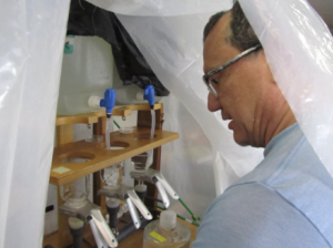
In addition to the optical measurements, the NASA scientists also gathered water samples to measure the abundance of phytoplankton pigments and various forms of carbon.
By the end of the campaign, Chaves had collected 700 samples to process, which he is now analyzing back at Goddard.
Chaves and Smith were just two of the research cruise’s passengers, which also included 25 scientists based in the UK, Europe, Africa, and Latin America. Chaves said it was one of the best field campaigns he’s been on. The researchers connected with others and talked of future collaborations.
“It’s hard work,” he said. “It remains one of my best experiences at sea because of how modern the ship was, well trained the crew were and the officers are and willing to help.”
The AMT program, which started in 1995, allows researchers from all over the world to study the ocean’s biogeochemistry, ecology, and physical properties during voyages between the United Kingdom and the South Atlantic.
Learn more about the AMT cruise here.
Header image caption: A map of where the cruise travelled for six weeks in the Atlantic Ocean. Credit: NASA/Joaquin Chaves
By Sara Blumberg, NASA Oceans Communications Lead at NASA’s Goddard Space Flight Center

