NASA Pilots Use Specialty Suits to Validate Data

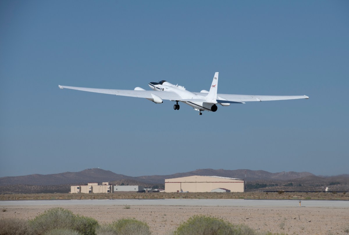
Welcome to NASA’s Plankton, Aerosol, Cloud, ocean Ecosystem Postlaunch Airborne eXperiment (PACE-PAX). We’ve been talking about this validation campaign and now are finally here. “Here” being one of three main locations where PACE-PAX validation efforts are taking place: NASA’s Armstrong Research Center at Edwards Air Force Base, California. PACE-PAX uses the unique vantage point of the ER-2 aircraft to gather data on small particles in the atmosphere and ultimately help verify the data gathered by the satellite in orbit. 

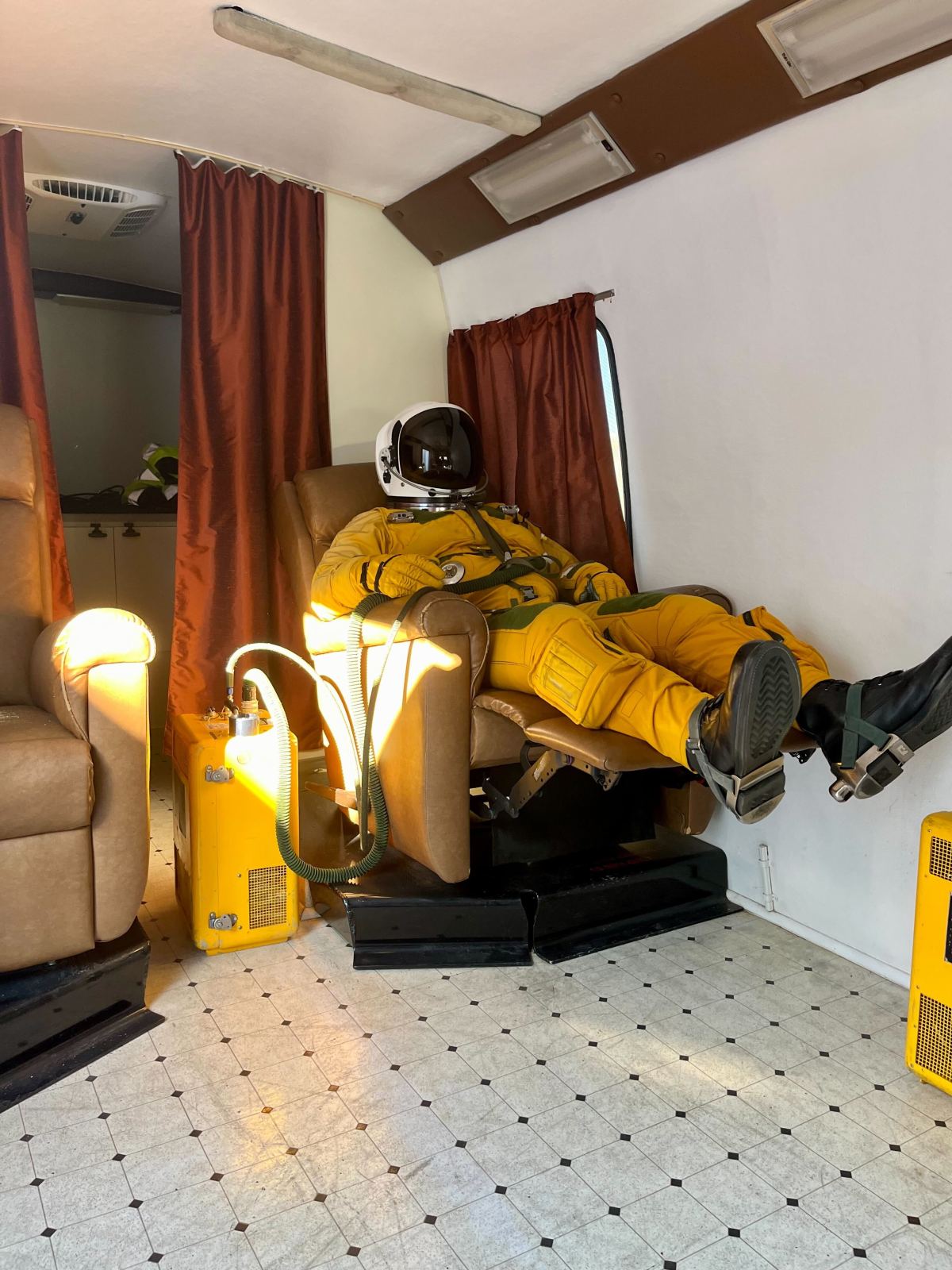
NASA’s ER-2 aircraft flies high in the sky — approximately 70,000 feet in altitude, where the pilot can see the curvature of Earth. At that high an altitude, pilots must be equipped with a uniform closer to that of an astronaut rather than a flight suit. In fact, while flying the ER-2, the pilot sports a pressurized suit that is essentially a spacesuit.  

“The spacesuit is the last line of defense against the elements at altitude,” said Kirt Stallings, an ER-2 research pilot. “If the aircraft cabin lost pressurization the spacesuit would automatically inflate protecting the pilot from the elements and allowing them to safely recover the aircraft.” 

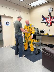
Two men stand centered in the image, facing each other. The man to the left, wearing jeans, a t-shirt, and a hat, helps secure a bright yellow spacesuit onto the man to the right.
Dowling helps zip Stallings into his spacesuit. Credit: NASA Goddard/Erica McNamee

Each pilot has their own spacesuit, which is tailored and fitted specifically to them. Stallings has been a pilot for 36 years, 22 of which have been dedicated to the ER-2 aircraft. Beneath his green and yellow suit is a mesh of netting and tubing designed to keep him safe and cool while in flight.

The suit is bulky and heavy, which means that Stallings requires a team of two other people to help him dress; on this flight Mark Dowling and Andrew Reynoso, life support technicians, are on the job.

The process is rigorous and important. Dowling and Reynoso suit him up, starting with the full body suit, pulling it taught over his legs before lifting the metal ring set to hold the helmet over his head. They tighten straps, zip up boots, fasten gloves, and attach the helmet.

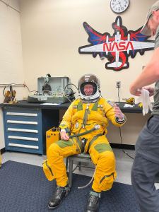
A man wearing a yellow spacesuit sits in a chair, his left arm outstretched reaching for a glove that another man just at the edge of the image is holding for him. The man in the chair also has a space helmet on and is smiling at the camera.
Stallings, nearly in the full spacesuit, smiles on as he awaits a glove for his hand. Credit: NASA Goddard/Erica McNamee

“Wearing the suit is a bit like being in your own world,” Stallings said. “It’s very quiet except for the sound of the cooling air and your breathing. Once I’m suited up it’s fairly peaceful.”

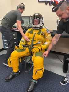
While it might seem like Stallings is ready to go, there are still several check points the team reviews. The life support technicians first run cooled oxygen through a hose attached to the suit — it can get hot quickly inside the suit, and they want to make sure the pilot is comfortable. They then run a series of checks, communicating with Stallings through a microphone in his soundproof helmet.

One of the main steps involves pumping the suit full of air — pressurizing it — to check the seals. Once the checks are complete, Stallings sits in a lounge chair, breathing in pure oxygen, to get rid of all the nitrogen from in his blood. This helps minimize the chance of decompression sickness – which happens when someone experiences large changes in pressure.

A man in a yellow spacesuit sits in a chair, his eyes closed, and the spacesuit pressurized to look fully inflated. Two other men stand to his left and right checking seals on the spacesuit.
Stallings sits while his spacesuit is inflated. Dowling and Reynoso check and test the suit for leaks. The suit has a strap that is cinched to keep Stallings in a seated position during this test, otherwise the inflated suit would cause him to straighten out. Credit: NASA Goddard/Erica McNamee

This is all taking place nearly an hour before takeoff. Stallings waits in a van until just before takeoff, where he’s then helped into the aircraft by technicians, strapped in, and prepares to take flight. He’ll spend the next several hours on his own following a precise route of flight to ensure the scientific objectives for the mission are met. Timing is critical for PACE-PAX missions as the aircraft must be perfectly aligned with the satellite passing overhead. 

“The opportunity to fly the ER-2 is certainly something I don’t take for granted,” Stallings said. “The view is something very special. It’s humbling and never gets old.” 

Header image caption: Stallings rests while he is driven to the landing pad where the ER-2 waits. Credit: NASA Goddard/Erica McNamee

By Erica McNamee, science writer at NASA’s Goddard Space Flight Center in Greenbelt, Maryland 

Stephen Broccardo: A ‘STAR’ in PACE Data Collection

Stephen Broccardo, research scientist at NASA’s Ames Research Center in California’s Silicon Valley, is the principal investigator for the Sea-going Sky-Scanning Sun-tracking Atmospheric Research Radiometer (SeaSTAR). The ship-based instrument is one of many in a campaign set out to gather data around the world to check the information that NASA’s PACE (Plankton, Aerosol, Cloud, ocean Ecosystem) satellite is collecting in orbit. Broccardo will use SeaSTAR for the first time in an upcoming PACE validation campaign. 

How are you going to be gathering your data?

I have spent about five years now building a new instrument, which I’ve called SeaSTAR. As far as I know, it’s going to be the only one of its type. It’s a custom-built Sun and sky photometer and polarimeter instrument that measures and quantifies the quantity and optical properties of atmospheric aerosols.

How does SeaSTAR compare to the instruments on PACE?

The PACE satellite is trying to quantify aerosols from space looking down. I’m trying to do it from the surface looking up. I do that in two ways. One way is just directly tracking the Sun, and the instrument measures the sunlight coming down through the atmosphere and how much was absorbed on its way through the atmosphere at various wavelengths. From that you could tell quite a lot about the aerosols in the atmosphere. The second way is a polarized mode where SeaSTAR is not tracking the Sun. Instead, it’s looking at the sky at a series of angles off the Sun and measuring the light coming in at various wavelengths and polarizations. From there, we should be able to infer not just the amount of aerosols in a column of atmosphere, but also some of their properties.

What are you most looking forward to during the validation campaign?

This will be the first deployment of SeaSTAR, which is pretty exciting. It’s been many years in the making.  I’m looking forward to seeing the first data and being able to contribute that to the PACE project.

What is one catch-all statement you would use to describe the importance of your work?

When a satellite observes the ocean from space, most of the signals it receives are not from the ocean because the ocean is dark. Instead, it’s mostly from the atmosphere. So, in order to quantify what’s in the ocean, you need to somehow subtract out the atmosphere’s signal. My job is making sure that any assumptions made in algorithms are correct. By assuring the correct equation, we get a more accurate estimate of the amount of aerosols in a column of atmosphere and some of their properties.

Editor’s Note: This SeaSTAR instrument is different than the 1997 SeaSTAR spacecraft that carried the SeaWIFS instrument.

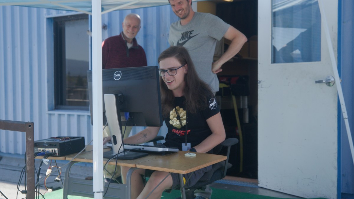
Header image caption: Stephen Broccardo looks over the shoulder of Steven Tammes, a grad student from the University of Iowa, while another onlooker peers at the computer screen too. Credit: Aaron McKinnon/NASA

By Erica McNamee, science writer at NASA’s Goddard Space Flight Center

Brice Grunert: The Great Campaign of the Great Lakes

Brice Grunert, assistant professor at Cleveland State University in Ohio, is a member of NASA’s PACE (Plankton, Aerosol, Cloud, ocean Ecosystem) validation science team. The team, called PACE Radiometry and IOPs for Novel Great Lakes Science (PRINGLS) is one of many groups participating in a campaign set out to gather data around the world to validate the accuracy of information from the PACE satellite up in orbit. He and his team recently took to the Great Lakes for one of many segments of the campaign to study light optical properties in the lake water.   

The image is split by the horizon down the middle. The bottom part of the image is of the dark blue waters of the lake. There are slight ripples on the water, but no waves. The top portion of the image shows bright blue skies with some wispy clouds, primarily closer to the horizon.
Oligotrophic waters of Lake Superior’s Keweenaw Bay, with Michigan’s Huron Mountains in the background. Credit: Brice Grunert/CSU Ohio

Where did you go for your field campaign? Why did you choose that location? 

We’re focusing on the western and central portions of Lake Erie and Lake Superior, as well as coastal Lake Michigan and the Green Bay area. The reasoning for why we’re selecting these sites is that there are really nice biogeochemical and optical gradients, or opportunities to see the transition regions. Green Bay is the best example – it receives a lot of river water input on its southern end from the Fox River, which accounts for about a third of the total phosphorus inputs to Lake Michigan. So, you have this narrow, constrained bay that receives an enormous amount of nutrients, which then joins the nutrient-poor Lake Michigan. This results in a gradient of nutrient-rich waters in the southern end, with low plant nutrients waters in the northern end, and these filaments of harmful algal blooms. You get just a ton of variability over the course of a single day of sampling – and that’s consistent with all the environments that we’re sampling within the Great Lakes. 

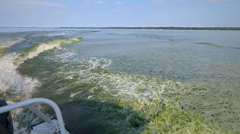
The horizon of the image is about three-quarters of the way up the picture. The bottom portion of the picture shows green waters of the lake, some portions with white peaks from waves created from the boat, which can be slightly seen on the left side of the image. The top portion of the picture shows the gray-blue colored sky.
A cyanobacteria surface scum in Green Bay, Lake Michigan in July 2024, disturbed by the research vessel. Credit: Brice Grunert/CSU Ohio

How are you gathering your data? How do they relate to PACE’s instruments? 

We’re using an above-water radiometer, which is a remote sensing instrument that measures reflectance. It is essentially measuring the same thing that PACE’s Ocean Color Instrument sensor measures – the light leaving the water surface. We also have a hyperspectral backscattering instrument, which measures the light reflected within an aquatic system. We combine information from the backscattering instrument with what we learn from water samples, which we use to measure absorption due to colored dissolved organic matter and particulate matter – for example, phytoplankton – to provide the inherent optical properties. Inherent optical properties are the fundamental pieces of an ecosystem that are going to contribute to the color of the water that the satellite is observing. 

What are some of the rewards and challenges of field campaigns? 

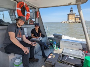
A woman and a man are sitting on a bench on a boat on the left side of the image. The man is sitting closer to the camera and is wearing a hat, a gray t-shirt, and black pants. The woman is wearing a hat, a black t-shirt, and pants. There is equipment and boxes in front of them, and an orange, circular life preserver hanging behind them. In the background are the brown-blue waters of the lake, as well as a brown building sitting on an island on the lake.
Trevor Holm, a Master of Science student, and Anshula Dhiman, a PhD student, recording station information at a western Lake Erie sampling site. Credit: Brice Grunert/CSU Ohio

You get to go to all these new locations and see how the system functions. It’s one thing to see it from satellite perspectives, but another thing to actually be out on the water and see that chlorophyll concentration that a satellite is seeing, which will look different across these unique environments. Being able to go out there and immerse yourself within that system, see the surroundings, and interact with new people is a huge reward for us.

The challenge is that you really never know what’s going to happen. For example, one time in April, the wave and wind forecasts looked good, and we got out there to find waves that were way too big to do any type of sampling. So, it’s sort of just having that mindset of accepting and being flexible with whatever comes your way.  

What is one catch-all statement you would use to describe the importance of your work? 

There really is a need for satellite observations to give us that spatial coverage and then that temporal piece that is often missing from your traditional kind of in-situ sampling campaigns. But then at the same time, the reason why we go out on these boats is because satellites have their own limitations.  

We’re trying to push the envelope of what a satellite is able to tell us about Earth systems, by leveraging the strengths of an in-situ field campaign. The goal is to try to get the two – the field campaign and the satellite – as close together as possible and have the satellites see things as well as we can see them from a ship. That’s really a goal so that we can better understand our Earth systems. 

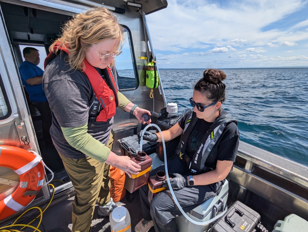
Header image caption: Kendra Herweck, a research technician, and Emily Hyland, a Master of Science student, collecting water samples in Lake Superior’s Keweenaw Bay. Credit: Brice Grunert/CSU Ohio 

By Erica McNamee, Science writer at NASA’s Goddard Space Flight Center

Joaquim Goes: Gathering Data in the Bay of Bengal

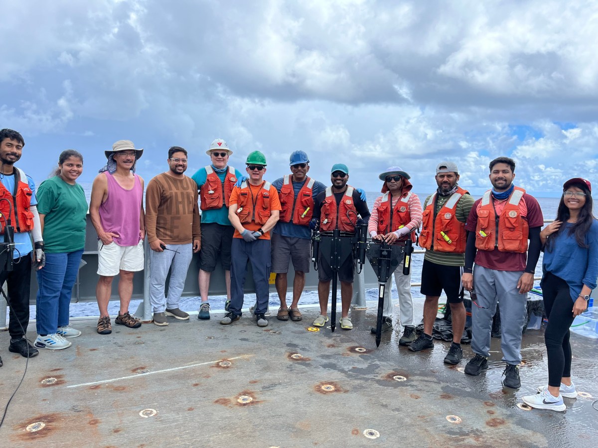
Joaquim Goes, a professor of remote sensing research at Lamont Doherty Earth Observatory at Columbia University Climate School, is a member of the PACE (Plankton, Aerosol, Cloud, ocean Ecosystem) Northern Indian Ocean Validation group. The group is one of many in a campaign set out to gather data around the world to validate the information that the PACE satellite is collecting up in orbit. In June, Goes, along with team members from NASA’s Goddard Space Flight Center in Greenbelt, Maryland; Space Applications Center (SAC); ISRO (Indian Space Research Organization); and the Indian National Center Ocean Information Systems, embarked on a research vessel to the Bay of Bengal. They gathered data on phytoplankton communities and ocean color pigments. 

Why did you choose that location for your research campaign? 

The Bay of Bengal is connected to the Indian Ocean, but it’s strongly influenced by freshwater, which makes it a little different than many other bays and seas. We wanted to go somewhere that could show us the effects of this freshwater influence, and plus there isn’t a lot of historical data from that region. It presented us with the opportunity to investigate riverine influence on phytoplankton community structure, biogeochemistry, and ocean optical properties.  

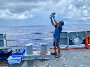
A man stands on board a ship facing the left side of the image. He is wearing a blue hard hat, a blue tshirt, gray shorts, and is holding a scientific instrument above his head, pointing it towards the sky. On the boat are tables and buckets next to the man. Just behind him are the railings of the side of the ship. The background of the image shows the flat blue water of the ocean, the horizon, which is about two thirds of the way up the image, and a gray-blue sky covered in clouds.
Joaquim Goes making sky radiance measurements with a hand-held radiometer during the Bay of Bengal Cruise. Credit: Dr. Anima Tirkey/Space Applications Centre, ISRO

How did you gather your data? 

We had several bio-optical instruments on board the research ship, some of which operated continuously as the ship moved along a pre-determined cruise track while others were deployed when the ship stopped, usually at mid-day when PACE and Oceansat-3  were passing over our study area.  

Some of the optical instruments measured the color of water using above water instruments, while others were deployed in the water allowing us to make ocean color measurements at different depths. The color of the water is the result of the interaction of sunlight with seawater and its constituents which include phytoplankton, minerals and other non-algal particles and colored dissolved organic matter. For example, if there are more phytoplankton in the water their photosynthetic pigments strongly absorb blue and green light, while scattering back green light, making the water green. The types of pigments phytoplankton contain vary, and the color they render the water can be used to deduce different phytoplankton types. 

Instruments like the FlowCam helped us image the kinds of phytoplankton in the water, while others allowed us to study their ability to photosynthesize and fix atmospheric carbon dioxide. We also filtered water samples so that we could measure the types of phytoplankton pigments as well as the absorption of light by phytoplankton and non-phytoplankton particles and colored dissolved organic matter.  

How are you planning on using PACE data? 

We are really interested in looking at outbreaks of harmful algal blooms, which are becoming a water quality issue in the Northern Indian Ocean. These blooms are so widespread that they cannot be adequately sampled by ships alone. To address this, we need data to develop algorithms that will help us identify these blooms from space. PACE data and other satellite products can be implemented into early warning systems for harmful algal blooms which are causing havoc worldwide.  

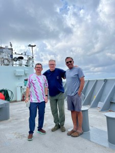
Three men stand on a boat, the man in the middle has his arms around the backs of the other two, all three facing the camera and smiling for the picture. The man on the left is wearing glasses, a white short sleeved shirt with a pink and pale green stripe pattern and blue jeans. The man in the middle is wearing glasses, a blue shirt and green pants. The man on the right is wearing sunglasses, a light blue shirt, and gray shorts. Behind them on the ship are railings to the edge of the ship as well as several pieces of machinery and equipment. The background of the image shows a blue-gray sky covered in clouds.
Joaquin Chaves and Scott Freeman from NASA’s Goddard Space Flight Center with Joaquim Goes on board the Research Vessel Thompson during the Bay of Bengal Cruise. Credit: Dr. Anima Tirkey/SAC, ISRO

What do you enjoy most about field work? 

You get to meet new people. The feeling of comradeship and building networks is so exciting to me. I’m at a point in my career where I feel that it’s important for young people, especially from developing countries, to learn how to use the latest instrumentation and connect with others to support their research endeavors. On this campaign we had a diverse group of ocean and atmospheric scientists from NASA, the University of Washington, Notre Dame, and UMass Dartmouth, as well as two institutions from India, with many young people involved. We worked very closely with them to perfect some of the data collection methods and analyses protocols. Overall, the opportunity to meet new people and explore new places is what makes field work so enjoyable.  

Header image caption: NASA PACE and ISRO Oceansat-3 calibration and validation teams from Space Applications Center, ISRO, Indian National Center for Ocean Information Services, NASA Goddard Space Flight Center and Lamont Doherty Earth Observatory, Columbia University along with Chief Scientist Dr. Craig Lee. Courtesy of Joaquim Goes 

By Erica McNamee, Science writer at NASA’s Goddard Space Flight Center

Fernanda Henderikx-Freitas: Scanning the Hawaiian Seas

Fernanda Henderikx-Freitas, assistant professor at University of Hawaii, is the lead principal investigator of the PACE validation team called the Hawaii Ocean Time-series program for validation of the PACE Mission in oligotrophic waters (HOT-PACE). The group is one of many in a campaign set out to gather data around the world to check the accuracy of information from NASA’s PACE (Plankton, Aerosol, Cloud, ocean Ecosystem) satellite up in orbit. She and her team recently took to the seas for the first segment of a three-year campaign to study the phytoplankton in the ocean surrounding Hawaii.

Where did you go for your field campaign and why did you choose that location?

We went to Station ALOHA, which is about 62.1 miles (100 kilometers) north of Oahu. It is a site that has been visited nearly monthly since 1988 as part of a long-term sampling program called the Hawaiian Ocean Time-series (HOT). We piggybacked on one of their monthly cruises, which last 4-7 days. We’re hoping to continue gathering data there for the next three years. Since there’s been oceanographic data collected at Station ALOHA for over 35 years now, we understand a lot of what the ocean properties should look like, which makes it a perfect location for a satellite validation site where data accuracy is so important.

A woman stands in the image facing toward the left. She is wearing a dark brown shirt and teal colored pants. Her right arm is lifted up toward a piece of machinery that is made of several cylindrical tubes and is surrounded by bright yellow piping.
MSc student Paige Dillen on HOT351 collecting water samples from the CTD rosette for the HOT-PACE validation project. Credit: Fernanda Henderikx-Freitas

How are you gathering your data?

We are focusing on the very basic information about how light interacts with water, which we need to validate PACE’s data. Whenever we see the clear sky overhead and we know the PACE satellite is close by, we’re going to be out there collecting water. We run seawater through special filters that get immediately frozen at minus 112 Fahrenheit (minus 80 degrees Celsius) for later analysis in the lab back on land where we determinate pigment composition and absorption properties by particles and dissolved materials in the water.

We also have a series of instruments that measure the total absorption and scattering properties of particles in the water at high resolution using a pump system where water is diverted from a depth of about 23 feet (7 meters) into the ship laboratories.

Finally, we have instruments that we throw in the water that look at the light profile in the water column, as well as another instrument that we point at the sky to look at optical properties of the atmospheric path between us and the satellite.

How do the instruments that you use compare to what PACE uses up in orbit?

PACE is a hyperspectral satellite, and on the ship we have hyperspectral sensors that look at both the absorption and scattering properties of seawater. These properties are key for informing satellite models that try to convert the raw reflectance signal that the satellite receives to meaningful quantities that we are interested in. For example, quantities of organic and inorganic carbon concentrations or phytoplankton-specific concentrations. Throughout our first cruise, which lasted five days, we had these instruments on the entire time, so that maximizes the chance of us getting a match up with the satellite.

We also have a hyperspectral radiometer that we use to profile the water column once a day while on the cruise — this radiometer has as many wavelengths as PACE has, and provides the closest type of data to the data measured by the satellite, which makes it incredibly important and useful in validation and calibration efforts.

How are you planning on using PACE data in your own research?

We are very interested in better understanding the relationships between bulk optical properties of the water and phytoplankton community structure, a research area that we think PACE is very well poised to help advance. Paige Dillen is a graduate student on our team who will go on every cruise to collect validation data for PACE and will also base her whole project on PACE. She’ll be looking at the relationships between pigment composition and phytoplankton absorption, which could help develop and improve satellite algorithms in the future.

What do you enjoy about field work?

I love seeing the night sky out here. You just look up and you see the Milky Way and meteor showers because you’re so remote. You can’t get it anywhere else. Seeing all the wonderful microscopic creatures is also amazing — we have a series of microscopes and imaging tools onboard that really help us feel connected with the water we are sampling. There is something very special about being able to collect your own data, it makes you feel like you’re completely involved in your research.

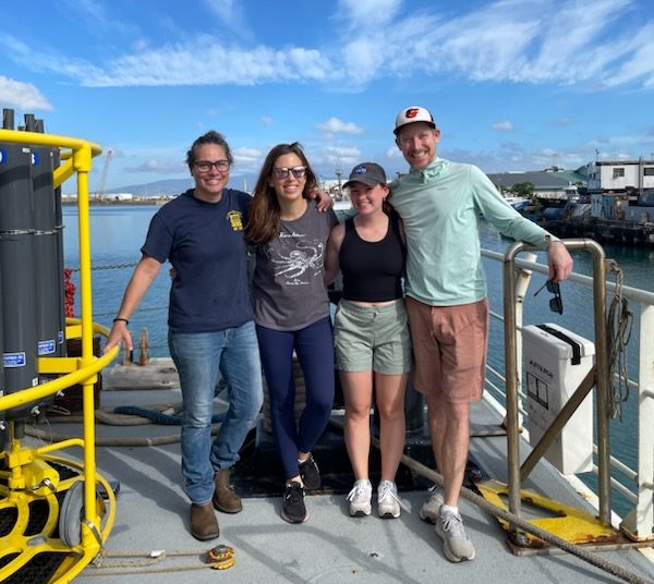
Header image caption: HOT-PACE team on HOT 351, July 2024, onboard the R/V Kilo Moana: From left to right: Angelicque White, Fernanda Henderikx-Freitas, Paige Dillen, Tully Rohrer. “We are so excited to have a role in providing these essential datasets!” said Henderikx-Freitas. Credit: Brandon Brenes. 

By Erica McNamee, Science writer at NASA’s Goddard Space Flight Center

Dennis Henry Captures the People – and Hardware – of PACE

Dennis Henry is the PACE project photographer at NASA’s Goddard Space Flight Center in Greenbelt, Maryland.

A man wearing a white clean room suit is seen from the shoulders up. He is facing away from the camera, arms outstretched and holding onto a large piece of a scientific instrument. The instrument is circular shaped. There is a circle in the center that is surrounded by another ring of a black circle. The center circle reflects the face of the man, who has a mask that covers his nose and mouth.
One of Denny’s favorite images that he took of PACE. Senior Engineer George Hilton adjusts a polarizer during GSE testing of the Ocean Color Instrument Engineering Test Unit at NASA Goddard Space Flight Center on December 10th, 2020. Image Credit: Dennis Henry

What is your background and what do you do for PACE?

I’ve been at NASA for about four years, but before that I was a freelance photographer, and a long time before that I wanted to be an aerospace engineer. I studied engineering for about a year and a half before I realized that it wasn’t what I actually wanted to do. So, I switched to photography! I came to NASA specifically to photograph PACE and Ocean Color Instrument. I feel like coming here brought me back to my previous space interests, and I was able to feed that interest while doing what I’m good at.

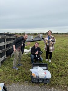
Two men and a woman stand together on a grassy surface near a body of water. The man to the left in the image is wearing brown pants, a red shirt, and a zip-up jacket. He is leaning slightly to the right. The man in the middle is kneeling down and holding a camera on a tripod. He is wearing jeans and a black jacket. The woman is standing to the right. She is
Denny Henry, Mike Guinto, and Katie Mellos setting up a remote camera to photograph the PACE launch next to SLC-40 at Kennedy Space Center in Cape Canaveral, Florida. Image Credit: Desiree Stover

What was your favorite part of launch?

The whole photography team was there, but none of us had ever photographed a launch before. We set up a bunch of remote cameras, which we’ve never done before, and borrowed some really long lenses to photograph it. It was a learning experience, in a good way. We had a lot of fun learning how to capture this very specific event, and it was great to see all those years of hard work blasted off into the sky.

What is your favorite color and why?

My favorite color is green. I’m not sure why it’s my favorite color. I have some green shoes, and also I feel like it’s just not as common of a color for some things to be.

A man stands centered in the image wearing glasses, a green crewneck sweatshirt, and a baseball cap. He holds four woodworking tools - clamps - in his left hand. In his right hand he has another clamp which is resting on his shoulder and extends behind his head. The clamps are orange, black, and silver colored in their pieces.
Denny Henry with a bunch of woodworking clamps. Image Credit: Jackie Henry

What is a fun fact about yourself?

I do a bit of woodworking. I usually make small things like cutting boards and small boxes. My big pandemic project – that is still ongoing – is to totally redo our kitchen. I have rebuilt all the cabinets from scratch. I think I maybe bit off a bit more than I can chew with that project, since it’s been a couple of years and I’m probably only 50% of the way at this point.

What advice would you give to aspiring students looking to get where you are today?

Photography is a tough career. There’s a lot of people who want to do it, and there are not that many jobs. How well they do and where they end up is not a reflection on the quality of a photographer. In saying that, you have to love doing it.

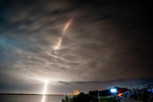
The image primarily is focused on the sky, which is dark and cloudy at night. There is a streak of light that starts near the bottom left corner and rises up to the center top of the image. The clouds surrounding this streak glow a brighter white than those that aren't illuminated by the light. The light is also reflected off of the ocean, which is seen in a small strip at the bottom of the image.
Another of Denny’s favorite images that he took of PACE. A long exposure photograph of NASA’s PACE (Plankton, Aerosol, Cloud, ocean Ecosystem) spacecraft, atop a SpaceX Falcon 9 rocket, as it successfully lifts off from Space Launch Complex 40 at Cape Canaveral Space Force Station in Florida at 1:33 a.m. EST Thursday, Feb. 8. Image Credit: Dennis Henry

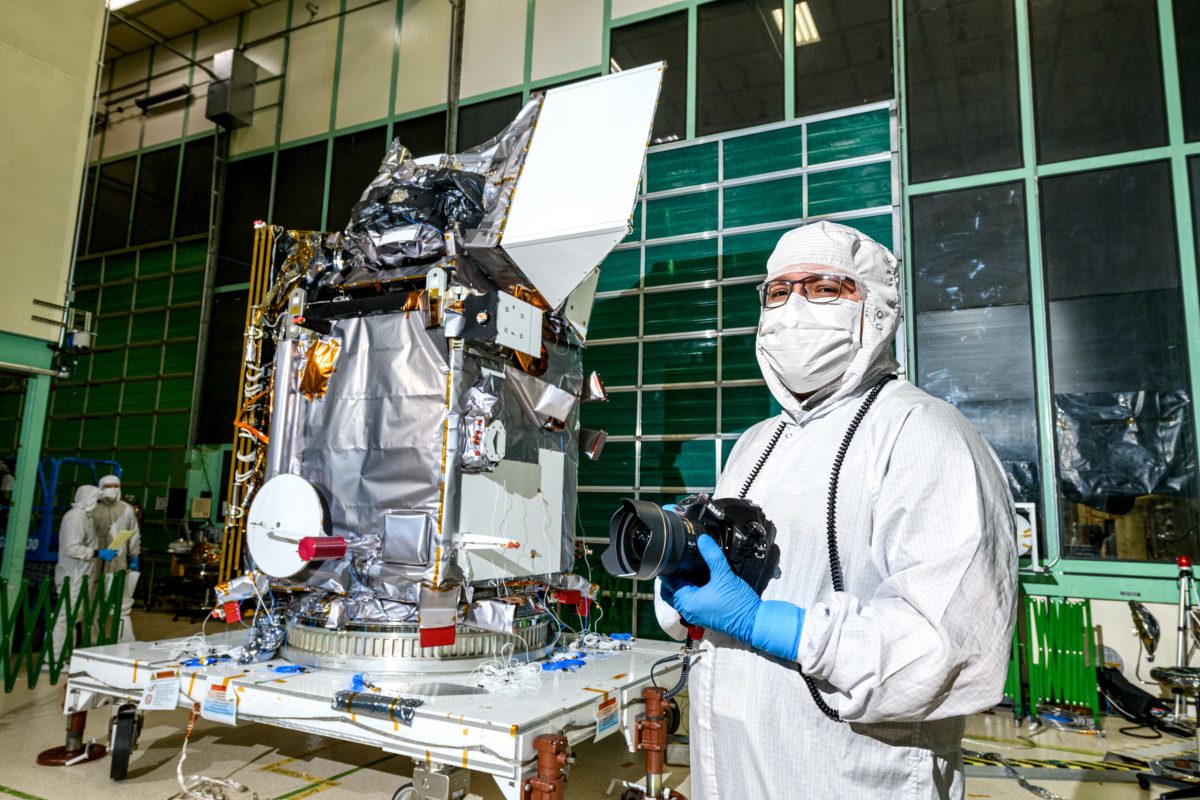
Header image caption: Denny Henry posing in front of the PACE spacecraft in the cleanroom at NASA’s Goddard Space Flight Center in Greenbelt, MD. Image credit: Katie Mellos

By Erica McNamee, Science Writer at NASA’s Goddard Space Flight Center

People of PACE: Inia Soto Ramos Studies Data from the Sea and Space

Inia M. Soto Ramos is an associate researcher and one of PACE’s data validation leads at NASA’s Goddard Space Flight Center in Greenbelt, Maryland.

A woman is seen underwater, giving the entire picture a blue hue. She is wearing a scuba mask and has a respirator in her mouth, connected to a tank on her back with several tubes. She is wearing flippers and a wet suit. Her dark hair is floating all around her head as she looks up at the camera. Behind her is a coral reef and sand at the bottom of the ocean can be seen to the right of the image too.
Soto Ramos diving in the West Coast of Puerto Rico. Courtesy of Inia Soto Ramos

What is your favorite atmospheric or ocean related book or movie?

I will go with “The Silent World” (1953) by Jacques Cousteau and Frédéric Dumas. It’s a book but was later made into a documentary. I’m a diver, so it’s really cool to see the advancements of diving over time. Back in that day, divers were attached to a cord back to the surface that provided air. Then came along the Aqua-Lung technology so they no longer needed the cord and swam free to explore. It opened our eyes to the wonders of the ocean, and it started sparking more research and more curiosity. It was risky and exciting.

What is your background?

I’ve used ocean color imagery since 2005, when I started doing my PhD. It helped me study coral reefs and the connectivity among different coral reef communities, and how river plumes can go from one reef area to another reef area. Then, I moved into studying phytoplankton from space and creating algorithms to detect harmful algal blooms.

What do you do for PACE?

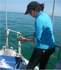
A woman stands to the right of the image, facing the left side. She is wearing a black baseball cap with her dark hair tied up. She also has on a teal shirt and black pants. She is holding a small instrument in her hands and is looking at it closely. Behind her are the blue green colors of the ocean, flat without waves. The woman is standing at the edge of a boat with a blue container in front of her.
Soto Ramos taking optical measurements during a Harmful Algal Blooms off the coast of Campeche, Mexico. Courtesy of Inia Soto Ramos

PACE data is compared with similar measurements collected in the ocean and atmosphere to make sure they agree; and that process is called satellite validation. In addition to being a part of the science team, I help the validation team by making sure we have enough field data to validate PACE data. This process allows us to know how good the data is and whether there any issues that need to be resolved. Once we know the data is good, we can use it to create algorithm to derive satellite products that are meaningful to the public and scientific community, such as water and air quality products. I am part of the SeaWiFS Bio-optical Archive and Storage System (SeaBASS) Team that archives data from scientists all around the world, which are then used to either validate the ocean color sensor data or to create algorithms. That will be the main database for PACE, so I make sure the data that is gathered goes into the system and is used for PACE validation.

What was your favorite part of watching launch?

I was at launch with my little one, so it was very exciting to be with him and to show him where the actual launch was from. The funniest thing he said to me was “no, PACE is not in space”, and I asked why, and he said it was too big to fit on the capsule! I had to explain to him that the capsule was bigger but that we were so far from it, that it looked much smaller than what it is! It was also great to see some of my long-time friends and colleagues and share this one-in a lifetime experience with them.

What are you most looking forward to once data starts coming in?

A woman stands to the left of the image, facing the right side, inside a small room and next to a countertop and sink. On the counter are several containers, bottles, and tubing. The woman, wearing a dark blue shirt and black pants, is holding a graduated cylinder out in front of her. There is a window on the back wall in the image, which is casting a bright glow into the room.
Soto Ramos filtering water for optical measurements in the Lagoa dos Patos, Brazil. Courtesy of Inia Soto Ramos

The first thing will be seeing how the PACE data matches up with the field data. Then, I’m excited to start getting some information about different types of phytoplankton and comparing that data to more advanced types of classifications of phytoplankton.

What is your favorite color and why?

I don’t have a favorite color. I have quite a bit of a flamboyant personality. I usually wear a lot of colors and I like to mix them, it’s hard for me to decide on the one color itself. You’ll see me with something red, something blue, something pink – I like them all!

A woman with dark hair sits on a moss covered rock with a small boy sitting between her legs. They are centered in the image and smiling at the camera. Behind them are several other moss covered boulders and lots of leaves and foliage. Much of the image is a bright green color because of the greenery.
Soto Ramos and her son hiking in the Shenandoah National Park, Virginia. Courtesy of Inia Soto Ramos

What’s a fun fact about yourself?

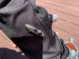
Centered in the image is a brown and black colored beetle. The beetle is facing the bottom right corner of the image. On the head of the beetle are two block spots that look like large eyes. The beetle is resting on the black fabric of pant legs which extends across the image from the top left corner to the bottom right corner. The background is red wooded planks of wood.
One cool finding during a hike Soto Ramos took with her son. It is an Eastern Eyed Click Beetle! Courtesy of Inia Soto Ramos

I like exploring and being active. Before I had my child I used to go diving, I did acro-yoga. After my son, I’ve slowed down a little bit, but we like to go hiking a lot and every year we try to go camping in a different place. We like gardening together and looking for bugs, which was not something I thought was going to be part of motherhood. We love going out and searching for bugs and creatures. Once he gets bigger, maybe we’ll go back to the more adventurous activities like diving.

What advice would you give to aspiring scientists or engineers or technicians who are looking to get where you are today?

I think persistence is the key! Even when we know what we want, life can’t be taken as a straight path and in a hurry. One of the mistakes that we do sometimes is that we think we need to go to college, we need to finish in four years, we need to keep going to the next step and finish as fast as we can. But little detours along my path helped me really find what I wanted to do, and also gave me the skills to find a job. So, I think those little detours, those opportunities, are the key to success. I strongly encourage internships and REU programs, study abroad programs, go and present at scientific meetings, participate in field campaigns, and go out of the traditional classroom!

Also, always have something to enjoy a little bit outside of work. Have a hobby to go do things that make you happy. You need something else also to keep you going, and when you’re happy you’re successful.

What is a catch all statement that you would want the public to know about the importance of PACE?

PACE is going to make an impact on communities. The science that is going to come out of PACE is really going to impact our quality of life and our enjoyment of our resources like the oceans and the air.

PACE will open our eyes about the wonders of the ocean, new things that we haven’t explored, new things that we don’t understand. I really encourage teachers and parents to use some of the resources from PACE, because young people are the ones that need to be fascinated by the ocean ­– those are the future generations that are going to take care of our resources.

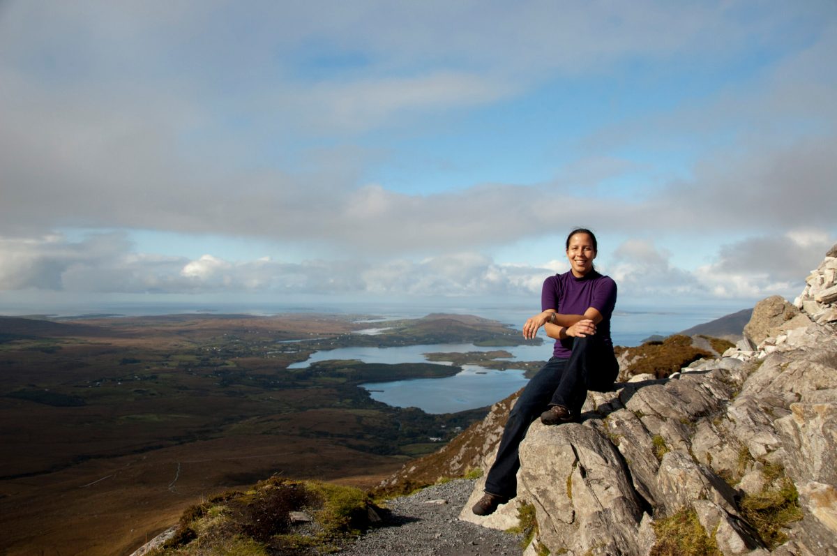
Header image caption: Soto Ramos hiking in the Connemara National Park, Ireland. Courtesy of Inia Soto Ramos

By Erica McNamee, Science Writer at NASA’s Goddard Space Flight Center

People of PACE: Marsha Gosselin Keeps PACE with the Budget

Marsha Gosselin is the financial specialist for PACE at NASA’s Goddard Space Flight Center in Greenbelt, Maryland.

What do you do for PACE?

I’m the financial specialist for PACE. I started on the project in early 2015 and worked on it continually through now. I managed all the budgets from all the engineers including helping them to create and take responsibility for their subsystem budget.  One of my responsibilities was to ensure we maintained enough money in the overall budget and monitored their funds. I worked closely with all the engineers on the project and the scientists, to make sure everybody was on the same page with their budgets. I’m just the money lady!

What was your experience with watching PACE launch?

I watched it on my iPad. I am sure it wasn’t as exciting as being at the launch in person, but I loved it! I was anxiously waiting to make sure everything occurred on time and that it was a success.

What are you most looking forward to once data starts coming in?

I’m excited to see how they’re going to use it. Everyone talking about phytoplankton has been so interesting, so that’s what I’m curious about seeing.

What is your favorite color and why?

I would say yellow because it’s bright and sunny!

What’s a fun fact about yourself that a lot of people might not know about you?

I like to exercise, it’s my favorite thing to do since it makes me feel good. I often work out very early in the morning. I like to go on long walks at a very fast pace. People often can’t keep up with me!

What advice would you give to aspiring students who are looking to get where you are today?

Always ask questions and know that perseverance is very important if you don’t get answers right away. Take training when it is available. It’s also good to get on some committees to get your name known, especially when working in the finance discipline. Once you people get to know you it becomes easier for you to move up the ladder.

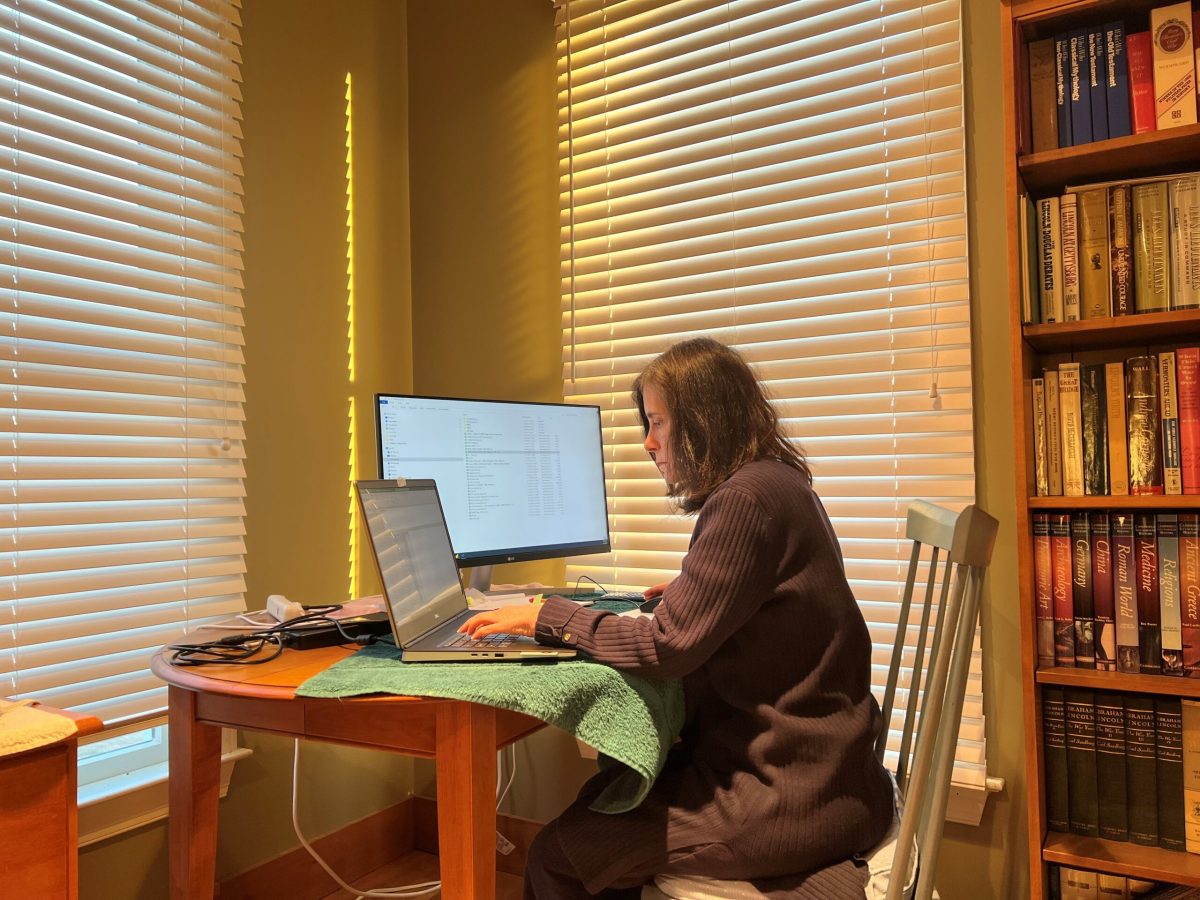
Header image caption: Gosselin working on all things PACE finance with her teleworking set up. Courtesy of Marsha Gosselin.

By Erica McNamee, Science Writer at NASA’s Goddard Space Flight Center

People of PACE: Anita Arnoldt is a Team Player, on the Softball Field and in the Cleanroom

Anita Arnoldt is the electrical lead for PACE at NASA’s Goddard Space Flight Center in Greenbelt, Maryland.

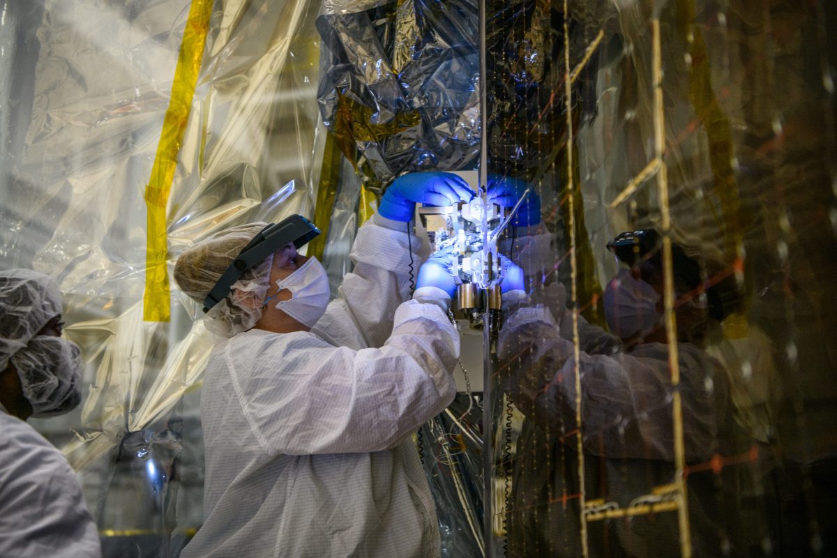
A woman stands in the left portion of the image. She is seen from the shoulders up and is wearing a white clean room suit that covers her torso, arms, and goes over her head. She also has on blue latex gloves, a white mask over her nose and mouth, and magnifying glasses. To the right of the image is a  portion of the PACE spacecraft, which is covered in a gold-colored foil-like material. The woman is holding wiring from the spacecraft and is looking closely at it.
Arnoldt working on pin retention on PACE. Image credit: Dennis Henry

What do you do for PACE?

I’m an electrical technician. I did all the harness wiring, routing, and thermal work, all the electrical work. I worked with Amy Huong, and together we did the wiring for both OCI and for the PACE spacecraft. We plugged it all in and tested it!

What are you most looking forward to once data starts coming in?

I’m looking forward to making sure everything works. If everyone is happy with the data they collect from all the spacecraft instruments, and everything is working well, then I’ll be happy.

What is your favorite color and why?

Blue, because that’s the color of the ocean and the sky. I just like looking at blue.

A man and a woman stand centered in the image, smiling at the camera. The man is taller than the woman and is wearing a blue button-up short sleeved polo with a Hawaiian shirt pattern of NASA logos, satellites, and clouds printed on it. The woman is wearing a black shirt and dark blue jeans. Behind them, positioned behind a protective sheet of plastic is the PACE spacecraft, which is covered in a silver foil like material.
Arnoldt and her husband, Jim, in front of PACE for family day. Image credit: Dennis Henry

What’s a fun fact about yourself?

I used to play softball for the Air Force. My husband is retired Air Force, so we were stationed in Italy and so I got to play on the European women’s softball team. I played first base and shortstop. We actually won that year for the European championship!

What advice would you give to aspiring scientists or engineers or technicians who are looking to get where you are today?

Try to learn as much as you can from the people that are around you. Make sure you have a really good team like we did on PACE – I think we had an excellent team from the top down. Everybody contributed so much, we communicated well, and it was just really good working together. And we had a fun time.

What is one catch all statement that you would want the public to know about the importance of PACE?

It’s important to study the climate and climate change to make sure people can make the best decisions – and PACE and OCI are going to help with that.

Header image caption: Arnoldt working on PACE’s solar panels. Image credit: Dennis Henry

By Erica McNamee, Science Writer at NASA’s Goddard Space Flight Center

People of PACE: Amir Ibrahim Understands the Atmosphere to Study the Ocean

Amir Ibrahim is the PACE (Plankton, Aerosol, Cloud, ocean Ecosystem) project science lead for atmospheric correction at NASA’s Goddard Space Flight Center in Greenbelt, Maryland.

What is your favorite atmospheric or ocean related book or movie?

A man wearing khaki pants, a black sweatshirt, and sunglasses stands to the right of the image. He is leaning against a large piece of driftwood and standing on the beach. There are three other smaller pieces of driftwood scattered throughout the picture. Majority of the picture is taken up by the beach, but the top of the image shows the horizon, some clouds, and a blue-gray colored sky.
Following a conference in Canada, Ibrahim decided to take a break and venture into Vancouver Island, dedicating part of his time to exploring Tofino. Credit: Samantha Weltz

My favorite ocean movie is “The Perfect Storm.” I know it’s not a happy movie, but I think it’s a great movie that shows us how mighty the ocean is and how important it is to our lives. The impact of the storm on the ocean also shows us how important our understanding of the interactions between our atmosphere and our oceans are.

What do you do for PACE?

The PACE mission aims to accurately study the ocean and its constituents as observed from space. The Earth’s atmosphere has small particles called aerosols and air molecules that interfere with ocean observations. My role within the PACE mission is developing algorithms to separate that ocean signal from the atmosphere and correct for these atmospheric particles in order to have a more accurate view of the ocean and phytoplankton particles.

What was your favorite part of the launch?

I was fortunate to be able to see the launch at Kennedy Space Center. It was a very joyous moment. I was able to see many years of work come to fruition with the launch of the satellite.  I am excited to be able to get the data and attempt to answer all our science questions.

What are you most looking forward to when data starts coming in?

Over the past several years, we have been building a simulator to predict what PACE is expecting to see from space. We’ve spent a lot of time and effort building that simulator in order to run through our algorithms, conduct tests and get ready for the launch. Now what I’m really excited about is actually seeing if all of our algorithms are actually functioning and working on real PACE data. Simulating data is not as much fun as the real stuff.

What is your favorite color and why?

My favorite color is blue because it’s my son’s favorite color, too. Also, growing up by the seaside in the Mediterranean, I loved the blue color of the ocean and the sky above it, and I always wanted to understand why the ocean and sky are so blue. The blue sky comes from sunlight scattered by air molecules, creating a phenomenon called Rayleigh scattering. Interestingly, that later became part of my work activities, which involves understanding the light in the atmosphere in order to correct for the different colors of the ocean below it.

A man wearing a dark shirt and a headset with a microphone attached in front of his mouth sits in the cockpit of a small airplane. He is seen from the shoulders up. The image is being taken from behind him, so he is turned around, smiling at the camera. In front of him are the controls of the plane including six circular gauges. Out of the front window of the plane is a gray sky.
Ibrahim is taking flying lessons in a small Cessna. Image Credit: Samantha Weltz

What is a fun fact about yourself?

I have a big interest in flying and have taken some flying lessons. One day, I’d love to be a pilot. Maybe when the dust settles from PACE, I’ll be able to go back and take more lessons or fly with an instrument to study the ocean from an airplane!


What advice would you give to aspiring scientists looking to get where you are today?

A man stands at the top of a small orange step ladder, centered in the image. He wears jeans, a dark colored jacket, and a yellow hard hat. He is standing next to a structure that is about the same height as him and has a scientific instrument on top of it. In the background of the image is a body of water, which is blue and still. The sky is cloudy and is a light blue and gray color.
Ibrahim is in the process of setting up a hyperspectral radiometry system in Long Island Sound for the purpose of validating satellite data. Credit: Robert Foster

The three most important things to me that got me into this position are being passionate and persistent about what I do, networking, and continuously learning. Being dedicated is very important, and if you hit obstacles, you can always get around them with dedication. Connect with various scientists and other people in the field in order to have a network of people who can support you in your career. And finally, as a scientist, you should never stop learning. You have to be humble enough to know that there are things that you don’t know. So, read papers and publications, write, engage with the community, and go to conferences. Those are all really critical things that can help you with your career.

What is a catch-all statement that you would want the public to know about PACE?

PACE will revolutionize our understanding of the ocean and the atmosphere for two reasons; One, PACE will have the first hyperspectral instrument dedicated for ocean color, which is quite unique and has never been done before. And two, it will have multi-angle polarimeters that will improve our understanding of aerosols and the ocean beyond any other instrument that is currently in space. It’s an interdisciplinary mission.

Header image caption: Ibrahim posing with PACE in the integration and testing facility at NASA’s Goddard Space Flight Center. Image Credit: Dennis Henry

By Erica McNamee, Science Writer at NASA’s Goddard Space Flight Center