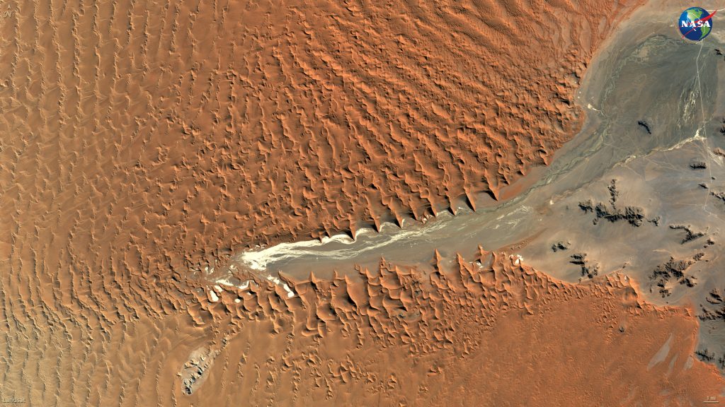
Since the launch of the first Landsat satellite in 1972, the joint NASA/USGS mission has gathered and archived more than 8 million images of Earth – including the one above of Namibia’s Namib-Naukluft National Park. These data-rich images are free and publicly available, allowing scientists to study how people and nature are changing the planet, and helping resource managers make better informed decisions.
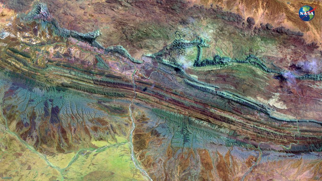
Landsat satellites detect wavelengths of light that are both visible and invisible to us. A false color image is one that uses a visible color to stand for in the signal from an invisible wavelength, such as this scene at the MacDonnell Ranges of Australia, which is a composite of visible, near-infrared and short-wave infrared wavelengths.
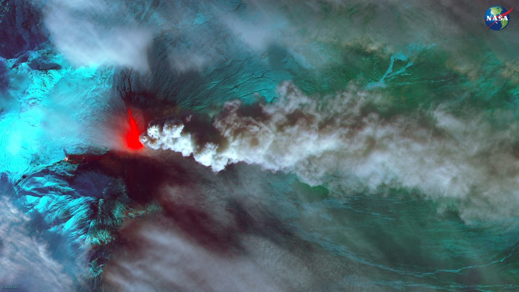
Erupting volcanoes glow in false-color images, including as this one of Klyuchevskaya in Russia, where the heat from lava flows stand from the ash and clouds.
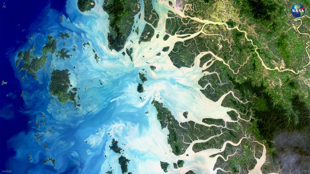
Natural color images can reveal details of Earth’s surface as well: the sediment-heavy rivers along the coast of Myanmar look white as they swirl into the deeper shades of blue of the Andaman Sea in the image above.