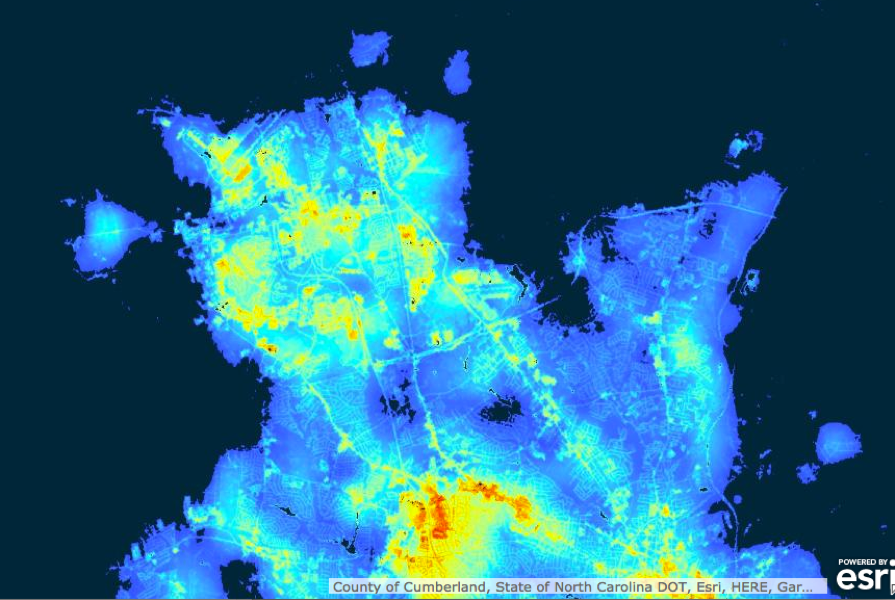
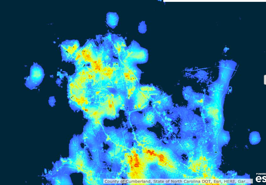
Soldiers in Fort Bragg found [NASA’s Black Marble product] useful for locating power outages on the army base. “And soldiers could see any information they needed right from their cell phones…
In September, Hurricane Florence barreled toward the U.S. East Coast bringing powerful wind, rain and catastrophic flooding that devastated cities, towns, and military bases. The U.S. Army’s Fort Bragg, just west of Fayetteville, North Carolina, was one of the hardest-hit areas. During the storm, soldiers at Fort Bragg used NASA’s Disasters Mapping Portal to identify hazardous areas and to assess power outages and residential flooding.
“The Disasters GIS [Geographic Information System] portal was a very effective way to display and disseminate information for those living in an area that was facing a major disaster,” said Chief Jason Feser of the Army Geospatial Center.
The NASA Disasters Mapping Portal hosts collective geospatial data from NASA scientists to hand off through GIS-based tools to emergency managers, first responders, and the public before, during, and after a disaster in a specific location. The use of GIS allows the Disasters Program to provide free and publicly available scientific data in a more user-friendly environment, thus bridging the gap between science and application. Emergency managers are also able to bring in NASA data and combine it with their own national, state, or local datasets to gain a better understanding of potential hazards and inform disaster response.
“The Disasters Portal allows everyone to focus on what they do best,” said Jeremy Kirkendall, NASA Disasters Mapping Portal lead. “NASA’s scientists create the products, we host them, and other agencies can easily find them in a ready-to-use format.”
Among the products Fort Bragg personnel used was NASA’s Black Marble product. Using nighttime imagery from NASA’s Suomi satellite, NASA’s Black Marble provides important information for pre-event and post-event mapping and monitoring of power outages. Black Marble has been used to assess disruptions in energy infrastructure and utility services following major disasters. Soldiers in Fort Bragg found it useful for locating power outages on the army base. “And soldiers could see any information they needed right from their cell phones,” Feser said.
The NASA Disasters Program began coordinating efforts prior to September 11, 2018, before Hurricane Florence’s landfall, and continued monitoring the disaster after the storm made landfall on September 14, 2018. Aside from the U.S. Army, the NASA Disasters program engaged with partners and stakeholders such as FEMA, National Guard Bureau, NOAA, U.S. Forest Service, U.S. Geological Survey, and U.S. Department of Interior.
To learn more about the Disasters Program please visit: https://disasters.nasa.gov to learn more about the Disasters Portal please visit: https://maps.disasters.nasa.gov
To view Black Marble imagery from Fort Bragg, North Carolina, in the Disasters GIS Portal please visit: https://maps.disasters.nasa.gov/arcgis/apps/webappviewer/index.html?id=f8bd16575eb7495ca1edb09ea0d31d67