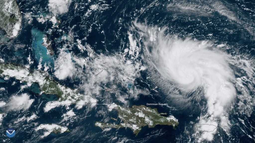
As Hurricane Dorian slowly approaches Florida’s Atlantic coast, NASA personnel have engaged with federal, state and local emergency responders in preparation for landfall as soon as Labor Day.
A team of NASA disaster coordinators from the Earth Science Division’s Disasters Program has been activated to work with emergency agencies to determine what NASA information assets derived from satellite data can be provided to help decision makers direct resources and help communities likely to be affected by the storm.
NASA has already created a map of Florida showing current soil moisture conditions to help scientists and response agencies predict the impact of heavy rainfall from Hurricane Dorian on flooding and runoff across the state. The map uses data from the NASA-NOAA Suomi NPP satellite. This and other data products are made available from the program’s mapping portal.
Program specialists cull and analyze a wide range of data derived from space-borne instruments to produce visualizations and maps of anything from power outages to the extent of flood waters and damage to ecosystems. Such information can be particularly important for remote areas where on-the-ground observations are difficult to obtain.