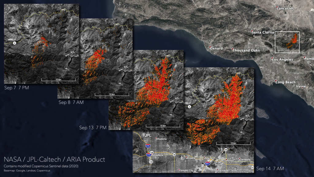
As wildfires continue to rage in the western U.S., NASA’s satellites are helping to track the burned areas and map damage in California and beyond.
One of those fires is the Bobcat Fire in Southern California, which has burned over 100,000 acres – making it one of the largest fires in Los Angeles County’s history. The Damage Proxy Map above shows areas in Angeles National Forest that were likely burned from the Bobcat Fire, ranging from moderate (yellow) to severe fire damage (red). Comparing the maps from September 7th, 8th, 13th and 14th shows how the fire spread over the course of the week, and how close the Bobcat Fire came to roads and other infrastructure.
NASA scientists with the Advanced Rapid Imaging and Analysis (ARIA) team at NASA’s Jet Propulsion Laboratory and California Institute of Technology created the maps using satellite data collected before and during the fires.
The NASA Earth Applied Sciences Disasters Program is working to provide maps like this one and other materials to regional agencies – including the California State Guard and the Federal Emergency Management Agency – to improve understanding of the impacts from the western U.S. fires and the potential risks to people, infrastructure, and the environment. Learn more about NASA’s efforts supporting the western U.S. fires on the NASA Disasters Mapping Portal and NASA Disasters website. – Sofie Bates
