Observations from the SIERRA UAV crew chief

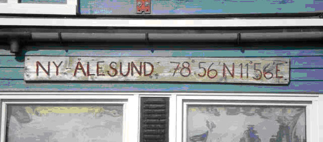
I enjoy the location of our hangar back home at Ames. Since it is one of the closest buildings to the runway and for that we get to watch a lot of air traffic flying in the area. We see the Blackhawks from 248, police helicopters, the H211 LLC airliners and Alpha Jet, also, the Zeppelin airship and the occasional F-18. I feel we have it pretty good back home. However none of it compares to the view from our “hangar” here at Ny-Alesund. While I’m performing the inspections in-between flights I can look out the roll up door and see a beautiful snow capped mountain. Take a few steps outside and you have a view of the entire fjords. Three glaciers that terminate in the water at the far end and handfuls more that don’t quite reach water are everywhere you turn. You can stop and watch the many research and cruise ships sail past or get out the binoculars and see what researches are doing at the cabin on the beach that is a half-mile down the cliffs. Our hangar here was actually built as a rocket assembly and launch control facility. The main work area is well sealed and has heat, which has been very nice on the particularly cold and windy days. The launch control room that we have been using as an office is built from solid concrete that we figure was designed to survive a failed rocket launch. Things have worked quite well in our home away from Ames aside from a few items plugged into 220v power that should not have been.

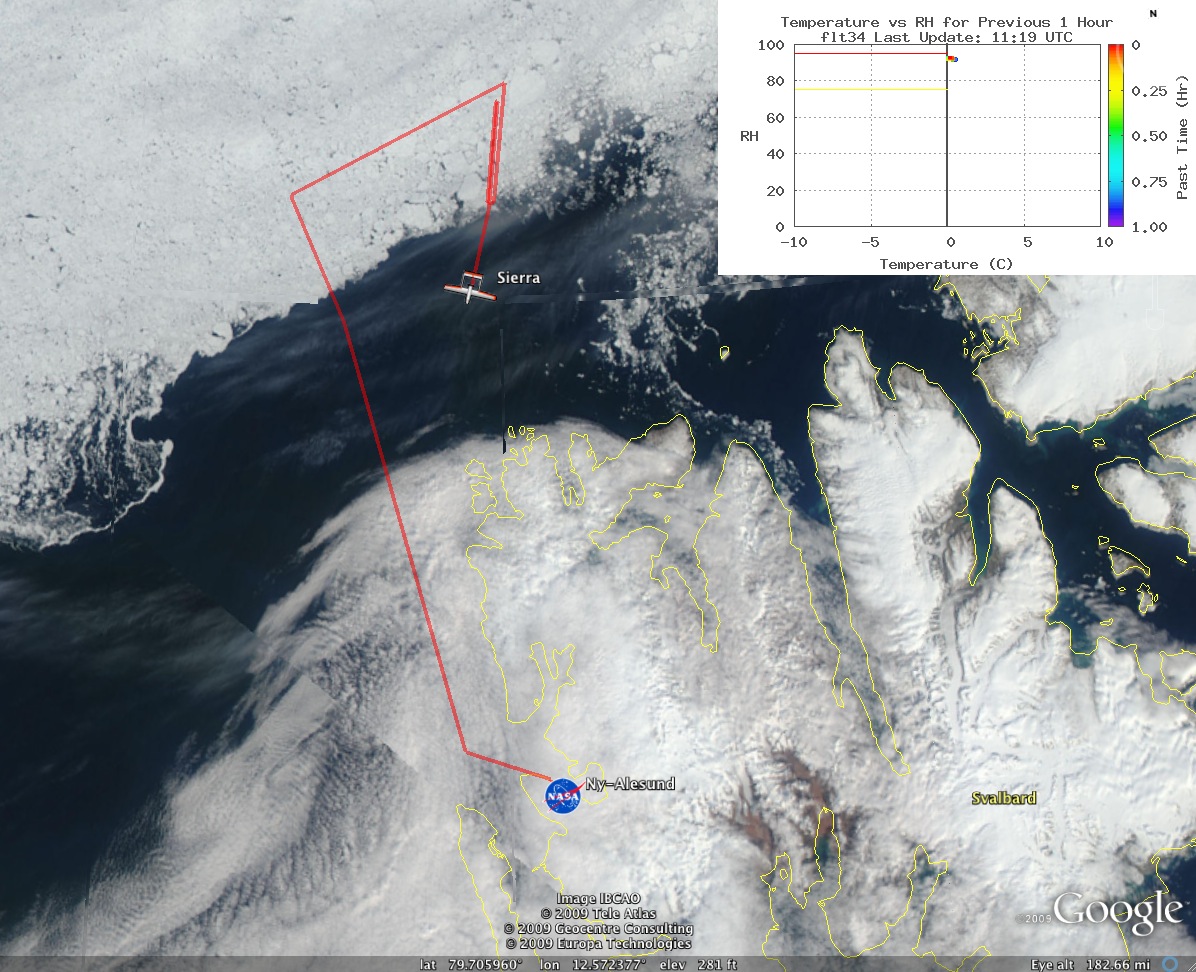
As for the operation of SIERRA things have gone mostly as expected. We had a few teething problems which was expected when operating such a young airplane in such harsh conditions. One operation item that we changed was to eliminate all taxiing. This has proven to reduce damage to the propeller because of small rocks kicked up by the exhaust and propeller. After the first inadvertent flight through clouds we sealed up the airplane much better. This added a little time on the runway for last minute sealing of seams but proved to help keep the insides dry. Speaking of the runway it can be cold and very windy. Most days after preflight of the airplane we had to perform a personal clothing preflight as well. This included wind proof pants and jacket plus gloves and a warm hat. After landing at the end of the day it was very easy to lose track of time while performing the post flight inspection because of the lack of darkness. There were multiple times that we walked out of the hangar after 11:00pm greeted by the shinning sun.

This has been a wonderful trip meeting new people and proving this aircraft as a valid platform. We flew a lot even having to ask for a flight extension. While we had some problems we overcame them in time to complete the mission. I will echo what others have said about the staff and facilities here. They are great people and we could not have dreamed of having such nice accommodations.

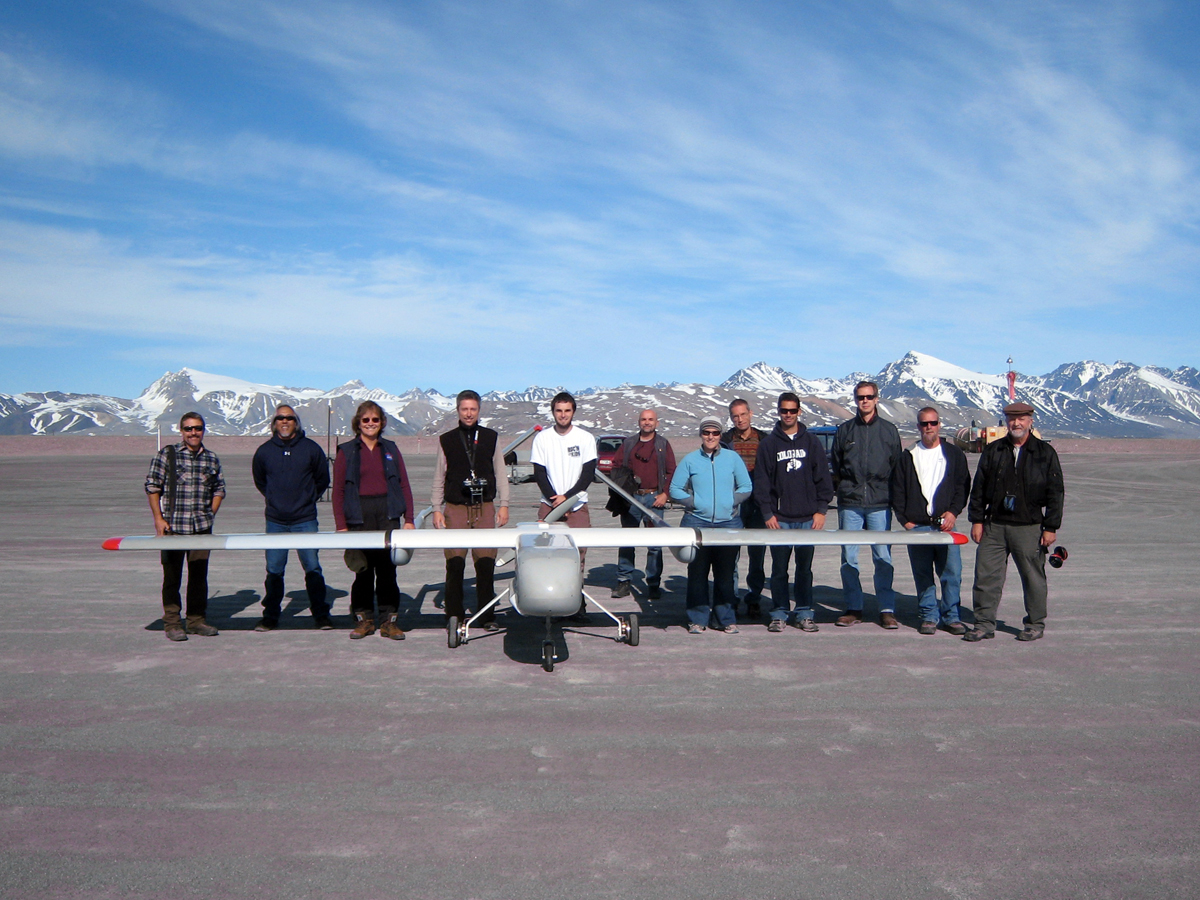
– Posted by Phil Schuyler, SIERRA crew chief

The Final CASIE flight

Due to fog and low visibility today (31st), the team will pull the plug on this deployment and prepare the aircraft and support equipment for shipment back to the USA. This weather has stopped all airline service to Ny-Alesund, so the flights are backing up. Most all of us will be departing on Monday (weather permitting!).

 The SIERRA performed very well during this op, especially considering that it is a prototype with low flight hours. In fact, this deployment way more than doubled the number of flight hours on the platform. The aircraft unintentionally flew through clouds and potential icing conditions. The engine, flight controls and other aircraft systems never missed a beat. For the most part, we were able to work around the unreliability of the Iridium link. This is an issue the team will fully address upon our return to the USA

The only issue related to flight safety was a broken thrust link on the engine that was discovered after flight #7. Apparently, there were sufficient alternate load paths available to carry the propeller loads into the airframe. A little bit of luck is a necessary commodity when flying UAS in harsh environments and the gods were smiling upon us. The thrust link was replaced with a spare and reinforced with some aluminum provided by one of the repair shops here. You just can’t have enough spares, so bring everything you have because you won’t know what you’ll need (note to self: remember 3-hole punch next time, they don’t have them here).

The project also had to get an extension of hours to continue flying. There are established inspection schedules and we were up against one that would have required significant disassembly of the aircraft. We did not have the time to complete it, so we asked the Airworthiness and Flight Safety Review Board to allow us to fly two additionial flights without doing the inspection. After a thorough discussion about the nature of the inspection and developing some risk mitigations, the Board granted approval. The team appreciates the dedication and resposiveness of the Board in finding a way to allow the flight op to move forward safely.

Of course, the last flight (#11 on 29 July) could not have been easy and uneventful. What’s the fun in that? Satellite imagery showed mostly cloudy conditions over the sea ice, but does not tell you where the cloud bases are. The flight plan involved a long transect to the northwest and imaging local glaciers with a total mission distance of 1000 km. For most of the flight, the relative humidity was reading 95%, but since the outside air temperature was +5 C there was no potential for icing. The aircraft was redirected north in an attempt to find clearer skies.

After returning from the sea ice mission, the aircraft was to be tasked to fly 60 nm over the local glaciers to provide imagery for our PI and the British and German research teams. Unexpected weather had descended on Ny-Alesund and the ceiling was only 300 ft with ½ mile visibility. The SIERRA is not equipped with autoland and must be flown with a manual RC controller for takeoff and landing. The team was quite concerned about our ability to recover the aircraft safely.

During the early check flights, the team had optimized several autonomous approaches for landing in poor weather and that preparation really paid off. We selected a right hand pattern for runway 12 in light wind and fog. The SIERRA entered this pattern at 1000 ft MSL and although we could not see the aircraft we could certainly hear her with those straight pipes on the engine. The GCS operator commanded the autonomous approach pattern which caused the aircraft to descend and make passes up the runway at 200 ft AGL. It was very erie seeing the aircraft emerge from the fog, but then disappear again. We had no choice but to lower the altitude over the runway and we did that twice before feeling like we could pick up the aircraft far enough out to make a landing. With full engine idle and full flaps commanded on the RC handset, I engaged manual control on short final at 125 ft AGL as the aircraft just became visible. The autopilot had done a great job of altitude control and ground track accuracy, so the descent and flare to landing were uneventful (see link to video). Anticipating potential problems and formulating solutions ahead of time makes people look smarter than they probably are. Luck still favors the prepared, though.

It has been an excellent deployment and we’ve made lots of new friends from many different countries. The folks at Kings Bay do an amazing job supporting the researchers and the infrastructure here is second to none. The team hopes to return some day.

 
Final Numbers:

59.9 hours on this deployment from 11 flights

2923 kilometers flown over sea ice (goal was 2500 km)

To view a short video of the final approach and landing click on the link below.

http://geo.arc.nasa.gov/casie/FoggyLanding.avi

 
– Posted by Mark Sumich, SIERRA Chief Pilot


Advice for newcomers to Svalbard

Recently, a new group of Americans arrived in town, comprised of 6 undergraduates from various universities, accompanied by a middle school teacher from Idaho, and two directors of the program. The first time I heard them in the dining hall, I thought I was going crazy because the American accent didn’t sound familiar. You get so used to hearing Norwegian, Italian, German, Chinese, etc, that it’s unnatural to hear your own mother tongue. As with any new arrivals, you try to impart some advice about this unique place:

  • Remember to squeegee the bathroom floor after a shower, and don’t get too close to the hot water pipe on the side of the wall, otherwise you’ll burn your back or bum when picking up dropped soap.
  • Beware of the terns, beautiful but vicious birds who will dive-bomb your head with their sharp red beaks if you get too close to their nests (which just happen to be located by the dorms, dog kennels, intersection, and pretty much any popular place in town). So, walk with a stick or arm raised above your head. That makes for great photo opportunities.
  • A rifle held high will also do, and since you’ll be carrying one of those around everywhere you go to protect yourself from the polar bears (we’re starting to think they’re just a tourist attraction), you’ll always be prepared.
  • All of your shoes will become slippers, including those heavy-duty, up-to-your-knees all-weather boots. By the end of the first day, you’ll get so tired of untying and tying your laces, that you’re willing to sacrifice your feet for flip-flops. You’ll also be able to tell who’s at lunch and who’s missing just by scanning the footwear outside the messa.
  • Don’t bother asking, “What’s that? And how do I eat it?” at lunch and dinner. Just watch a local and follow his lead. Think of it as another cultural experience.
  • And forget about fruits and vegetables. We only get them canned, pickled, or frozen around these parts. I do hear we’re getting a shipment of “fresh” veggies on Thursday, but that may just be a rumor spread in order to quell an uprising.
  • Speaking of food, plan on skipping meals on weekdays when the meals are spaced 3 hours apart, but don’t forget to pack a sandwich or two for weekends, when you have an 8-hour food break between brunch and dinner.
  • We dress up for dinner on Saturday in appreciation of the kitchen staff giving us tablecloths and setting the tables. “Dress up” is one of those relative terms around here (kind of like “mild weather”), so taking a shower and putting on a clean shirt will do.
  • For these special occasions, BYOW (Bring Your Own Wine). You can buy as much as you want at the store, but anything harder (port or liquor) or weaker (beer or cider) is heavily regulated. And don’t forget to bring your plane ticket to the shop in order to prove that you are indeed leaving this island; otherwise they won’t sell you any. Unless you smile pretty.
  • The shop only sells alcohol on Monday and Thursday nights, unless a cruise ship is in town, then the hours change. But you won’t know that until you go over to the store and find it closed.
  • Regardless, we welcome the cruise ship passengers here, even if they triple the town population simply by stepping off the boat. If you happen to be carrying a rifle through town, or are protecting yourself from the terns, don’t be surprised to get your photo taken by tourist paparazzi.
  • If you’ve finished your ration (2 liters of hard alcohol, 1 liter of port, 24 cans of beer), you can always head to the drinking hole on Wednesday and Saturday nights, where “half of a gin and tonic” means half gin, half tonic, and drinks range from Ny-Ålesund coffee with glacier ice (Ivar’s secret recipe) to boxed wine (the only kind to be had) to vodka with Fanta Orange (Svalbard’s version of a Screwdriver).
  • If you know the bartender, which you should since everyone in town gets bar duty at one point or another (including our very own Ric Kolyer), you can request a song for the Saturday dance party. But don’t get too rowdy because you’re bound to run into the man (or men) who proposed marriage to you the night before, at least once the next day. He may even be the captain of your next boat trip. It’s a small world over here.
  • And last but not least, venture out of town on a day off. Spend the night in an old trapper’s hut, kayak around glaciers and icebergs, or if it’s particularly “warm”, grab a survival suit and hit the water for some waterskiing.

After all, this is an Arctic researcher’s paradise!

– Posted by Kasia Wegrzyn, CASIE Scientist

Life at the top of the world

Greetings from the northernmost community in the world, along with the northernmost gym, hot tub, post office, bar, and the list goes on. With all the science updates, I’m sure you’re wondering what it’s like to live in this village of 150 people, secluded from all forms of civilization, and surrounded by scientists and researchers from over a dozen different countries. Well, it’s amazing and many of us would prefer to extend our stay a little bit longer.

Ny-Ålesund is primarily a research town owned and operated by a government public corporation called Kings Bay AS. They employ a permanent staff of 30 – 35 people who live here year-round, running the various research stations and making it possible for us to conduct our research in quite comfortable living conditions. Although experiments run year-round, the majority of scientists arrive in the summer months and increase the population to about 150 people. This creates a unique atmosphere where dozens of disciplines are combined with just as many nationalities, and individual projects often become international collaborations.

This cross-cultural atmosphere also extends to the social life of the town and its inhabitants. I’ve learned more random phrases in more languages than I will ever be able to use or remember. Strangers instantly become friends and opportunities arise simply from overhearing random conversations at a meal or on the street. Yesterday, I took the huskies for a walk (more like they walked me), while Don Herith and Mark Sumich challenged the Chinese to a game of badminton and ping pong (not surprisingly, they lost to a little Chinese girl). And something as simple as a housewarming party turns into a “rager” when the whole town shows up, which isn’t that impressive considering the size of the population. National holidays become town holidays, as was the case with Bastille Day, which we celebrated last week in the workshop of the French research station. Besides the fact that there weren’t any French, I could sense something was wrong. While indoors, I still had shoes on my feet! The tradition of taking off your shoes inside any building dates back to the coal-mining days when, in order to prevent tracking in any dust from the mines, everyone took their shoes off before going indoors.

While at first quite annoying, this practice makes me appreciate the cleanliness and the novelty of going to a bar in my socks. But alas, Bastille Day was different, yet like any other day at the same time. In Ny-Ålesund, an international holiday is just another excuse to get together, play some guitar, and grill in the basking sunlight. In that respect, the midnight sun helps foster such a social atmosphere, but it definitely took some getting used to. Double sets of blinds, sleeping pills, and eye masks were the norm for most of us for the first few days. But now, we’re all sound sleepers, or we’re just so tired from work that it doesn’t matter. Back on the mainland (yes, that’s what the rest of the world is called), I never carried a watch because I could generally tell what time of day it was just by the position of the sun. No such luck here. Time, like age, is just a number.

We can’t forget about the polar bears. Within town, you’re safe from the wrath of these adorable creatures who top the Arctic food chain (technically even we fall below them since they’re a protected endangered species). However, once you pass that sign at the end of the road, you’re fair game, which is where the Polar Bear and Rifle Training comes in handy. A few within our group (myself included) took the course and were taught generally to avoid the gentle giants. If all else fails, all five of us turned out to be pretty good shots, so the bear stands no chance.

Although the likelihood of seeing a bear, let alone being attacked by one, is very slim, no one takes any risks. All doors within Ny-Ålesund are unlocked to allow people to escape to safety if one does come into town, and rifles are a common sight. If you try to leave Ny-Ålesund, the town watchman will drive by in his truck and politely ask you to come back and get a gun. As you can tell, this town is very unique and special to all who visit and live for any length of time. I hope I was able to give you a small glimpse into our world.

– Posted by Kasia Wegrzyn, CASIE Scientist

CASIE science team update from Ian Crocker

Hello from 79°N! I bid you a happy Saturday. Despite the fact that it is the weekend, we are hard at work here in Ny-Alesund. We have long since abandoned the Monday through Friday 9 to 5 routine, and our schedule is now dictated by the weather. The local and expected weather conditions over the sea ice are favorable for flying and data collection, so we press on. We are currently in the midst of our second science flight over the ice, and I am filled with great anticipation. Today, SIERRA has been programmed to fly a fairly complex grid pattern in order to optimize the performance of the laser altimeter and SAR payloads, and to provide a dense sampling of measurements over a localized area of ice. The total flight distance is approximately 480 km, which is expected to take around 5 hours. During this time of waiting for the plane to return I will take a moment to give you my personal perspective on our operations.

Dr. James Maslanik (a.k.a. Jim) is acting as our local meteorologist. He is continually checking a variety of data sets, ranging from satellite imagery to atmospheric soundings and forecast models, to get a feel for the weather that can be expected in the upcoming days. The team is interested in the local weather conditions here at the airport, which impacts our ability to launch and recover the plane, and the conditions over the ice, up to 500 km away, which impacts our ability to collect valuable data. We have found that it is rather difficult to predict the conditions over the ice, due to a complete lack of in situ observations, and that the conditions over the ice can be dramatically different than those found locally. This fact was clearly illustrated during our first science flight a few days ago. At that time there were scattered cloud cover in the vicinity of the airport, with a cloud base around 1000 m. Since we fly our missions at a maximum of 100 meters, we sent the plane out and expected it to fly below the clouds. However, the plane had water droplets on it upon landing, and the imagery and laser data collected during flight were contaminated by visible moisture while over the ice. It quickly became evident that SIERRA was flying through clouds. Additionally, we found that there can be a dramatic difference in cloud conditions over the open ocean and over the ice, making it difficult to know the conditions SIERRA will encounter.

Every evening the team meets in our lounge to discuss the next day’s events. Jim provides his weather predictions, and we decide if we will fly a mission the following day. Come morning, we asses the weather one last time and make the final go/no-go decision. Today, the conditions were favorable, and despite the 15 knot winds and freezing temperature we had a clean takeoff in front of a rather large group of spectators. We were joined by a number of local residents and scientists who have heard about our mission and were interested in watching our operations. We were also joined by an American contingent consisting of several undergraduate students from around the country who are here gaining experience in Arctic field research. Today they had the opportunity to witness Arctic UAS operations first hand, and I think we gave them a good show.

The data collected here will form the basis for my Ph.D. thesis, so I feel like I have a lot riding on the success of this mission. I am primarily interested in the data collected by the laser altimeter system and the still and video cameras. SIERRA is also outfitted with a suite of radiation sensors and spectrometers, but those are of secondary importance to me. The altimeter system consist of two range detecting IR lasers, one pointing nadir and one angled out 15 degrees from nadir, a GPS receiver, and an inertial measurement unit (IMU). The lasers measure the range from the aircraft to the surface and the GPS provides the altitude of the aircraft. With these two pieces of information it is possible to extract the topography/roughness of the underlying ice surface. To maximize the accuracy of the topography measurements, the IMU data is used to correct for off-nadir laser slant range measurements resulting from aircraft attitude (roll and pitch), and GPS base stations are leveraged to perform differential GPS corrections. The imagery is used to help interpret the topography measurements, and can can be use to identify various ice regimes and melt pond extent. The general goal of my thesis is to relate the small scale topography and roughness measurements to other parameters, such as ice age, ice thickness, and melt extent. It may then be possible to correlate these parameters to large scale satellite observations, which can in turn be used to characterize the sea ice and its morphology throughout the Arctic basin.

SIERRA Flight Range depicted on Google Earth

SIERRA is now flying it’s course, and although I am very confident in the plane, everyone’s individual abilities, and the performance and reliability of the instruments, I am always quite anxious during the flights. There is always a sense of unknown and “what-if” that runs through my mind. I find myself continually hoping that the plane returns safely and the instruments collect valuable data. It becomes mentally taxing over time, so writing this blog has been a great way to keep my mind preoccupied. I sincerely hope you will hear about the success of this mission long into the future. Thanks for reading.

– Posted by Ian Crocker, CASIE mission scientist

Flying in the Arctic

   
This is my first science deployment with the SIERRA UAS and of course it had to be to the arctic. We were told to expect just about anything in terms of weather. Conditions have ranged from sunny, calm and relatively warm to foggy, windy and very cold. Our last flight was launched in near freezing temperatures in 20 kt winds. Fortunately, the wind was mostly down the runway but there was enough of a crosswind component to require 1/2 left rudder stick to keep the UAS tracking down the centerline. The bird is heavy enough to ignore most gusts and there is no yaw coupling into the roll axis which keeps the workload low on the ailerons.

Usually the primary and backup pilots manually fly the aircraft for a short time in the local pattern before handing it off to the GCS operator. Not this time, though. The team had cold soaked for more than an hour on the runway setting up the aircraft. Additional time was also needed to trim the throttle actuator since it had been replaced the night before. By that time, I didn’t have much sensation in my fingers which is not good when using an RC controller. Fortunately, one of the guys had a pair of chemical hand warmers which worked great placed inside my gloves. After cranking the engine over several times, it fired up and we let it “warm up” for 5 minutes. The cylinders never did get very warm in these conditions. I pulled off my gloves, the ground crew pulled chocks and we did a normal takeoff. We used to do high speed taxi runs before takeoff, but now we position the aircraft so it is ready to takeoff immediately. Minimizing taxi is reducing the rate of damage to the leading edge of the propeller from the fine pebbles on the dirt runway surface. The startup area is also well swept prior to cranking the engine.

Getting airborne and turning crosswind, I told the backup pilot to get ready to accept control and transfer to AP (autopilot). We takeoff and land the SIERRA with a 2.4 GHz RC controller and to smoothly transfer control to the AP, we must first have the 900 MHz manual controller active and then switch to AP. The cold conditions motivated us to execute one of the faster switchovers yet. With the autopilot in control, we could scurry back to the warm hangar, sip hot tea and watch the aircraft on the moving map display.

Icing is always a concern in freezing temperatures combined with high relative humidity. The aircraft has an ice warning system which monitors these parameters and issues warnings when it determines the aircraft is in clouds or potential icing conditions. Flying out over the sea ice in visible moisture put the aircraft right on the edge of icing. In one instance, we lost the long-range (Iridium) control link and by the time we regained link the cloud and ice warning flags had been triggered. Autonomous flight in icing conditions is definitely not something you want to do. Once we got the aircraft down to a lower altitude and away from the sea ice, the icing potential dropped to a safe value. We realized the aircraft had flown through lots of moisture when water poured out of the back of the tailbooms when the nose was lifted to put it on the trailer. Doesn’t take a NASA engineer to figure that one out. Sealing the seams and holes and strategically placing drain holes has prevented further water intrusion. 

Tomorrow the nasty weather pattern should break and reward us with sunny skies and 1-2 m/s winds. Conditions over the sea ice are also expected to improve. The aircraft and payload are ready and the airspace clearances are coordinated. The Norwegian Civil Aviation Authority has been wonderful to work with and our flight will be scheduled between the commercial carriers operating here.

– Posted by Mark Sumich, Chief Pilot, NASA SIERRA UAS

Behind the scenes of a NASA airborne science mission

NASA conducts Earth Science field campaigns around the globe studying climate change, pollution transport, and hurricanes, among many other things. To make scientific research on these campaigns both productive and meaningful, a lot of careful planning is required in the weeks, months, and even years leading up to the start of a mission. Before the scientists arrive and begin to take data, a team of engineers, technicians, mechanics, computer specialists, and even managers (ha!), have been busy planning and preparing for the science deployment.

After NASA had selected a science team to study arctic sea ice using an unmanned aircraft, and the platform and instruments to get the right science data had been identified, the mission planning could begin. Spitsbergen (or Svalbard) was favored early on, since it was closest to the sea ice of interest, flowing southward from the pole in the Fraim Strait off the east coast of Greenland. But we had to know the place was, in fact, right for the mission. That could only be done in person, so at the beginning of March, Don Herlth and Mike Gaunce went to the research station at Ny-Alesund to see the facilities and accommodations, look at the airfield and local terrain, and meet with local officials who would need to fit us in with all the other international research teams competing for the same limited resources.

Ny-Alesund lies at 79 deg north of the equator, and is the northernmost permanently inhabited settlement in the world. While this place is one of the most remote on the planet, Norway has nevertheless built a well-maintained research station devoted to polar research. This includes limited access via boat and plane, accommodations and laboratories, reliable power, and blazingly high bandwidth internet. Still, it’s not like home. Cell phones don’t work here, walking from building to building requires a continuous donning and doffing of coats and shoes, and the nearest McDonald’s is about 700 miles to the south on the Norwegian mainland.

Spitsbergen Island in the summer

In the weeks leading up to the deployment, a day-by-day schedule for the team is laid out, and the team reserves airline flights and hotels, and makes sure their passports and visas are ready. Some of us also underwent medical exams to ensure we had a clean bill of health. An unplanned medical emergency could end the mission.

The team must identify all the equipment it might need to operate the plane in the field (there’s no ‘going to the store’ to pick up things that were forgotten). The equipment and the plane must be carefully packed and shipped, whether by boast, plane, or truck. Some mission locations are so remote only a military airlift or charter ship can get us there.


Many NASA Earth Science missions require military airlifts to get unique equipment to remote locations


Cargo ship ‘Norbjorn’ or ‘Northern Bear’ in Tromso, Norway ready to depart to Svalbard with SIERRA aircraft on-board

Working overseas requires a whole series of domestic and international agreements and approvals by differing governmental agencies for airspace access authorization, export control, environmental impacts, customs, diplomatic overflight clearances, and foreign government permission to operate in their territory. NASA management also conducts configuration, safety, and management reviews to ensure the project is ready to meet the mission goals of the field campaign.

The CASIE deployment team arrived in Ny-Alesund on the island of Spitsbergen, Norway on July 8, 2009.


The mission team arrives in Ny-Alesund on July 8, 2009 (note the palm trees in the background)

When the team and the shipment finally arrived in Ny-Alesund, a flurry of unpacking, set-up, and check out takes place. The aircraft is assembled, electronic systems are tested, day-to-day operations procedures and team communications are established. Weather conditions and forecasts, along with satellite imagery of the area, such as from NASA’s MODIS instrument, are studied to find the best flight targets. Three days after our arrival, the aircraft started checkout flights in the local area. There are always bugs, glitches, and gremlins that pop up, to be fixed, one by one.

Time in the field is limited, with only a few days or weeks to obtain the right data. Each day, the team assesses the weather over the airfield, the weather over the target several hundred miles away, and whether the target is still of interest since the last good satellite pass, since thick clouds in this area can last for days. Other constraints, such as local air traffic, may further limit fight opportunities. Most important, the aircraft and instruments have to be working and ready to go. When all these conditions align, we can fly.


CASIE mission team and SIERRA aircraft prior to first flight from Ny-Alesund

– Posted by Mike Gaunce, NASA Earth Science Projects Office

Update from the CASIE Science Team

We had two productive back-to-back missions on Wednesday and today. I’m very impressed by the performance of the aircraft and the NASA team. Today, the SIERRA flew over 1000 km, which is what I’d hoped for but really expect would be possible. The ice conditions we’re seeing in the data are exactly the types of conditions I’d hoped we would encounter. Now, we just need to keep racking up the flight hours in conjunction with good performance from the sensors. Being in this location, with this aircraft, sensor package, and team, is a rare opportunity of which we hope to take full advantage.


This is an example of an image from Jim Maslanik’s tracking camera. The image below is an
inset of the lower left corner
showing what appear to be polar bear tracks.

As for flying conditions over the ice, low level cloud continues to be our main problem in terms of collecting a full suite of ideal data. The cameras can still see surface features through these low, thin clouds, and our imaging radar is unaffected by clouds, so we continue to accumulate useful information. The LIDAR system, though, needs to get mostly clear view of the ice without too many liquid water droplets between the aircraft and the surface. The type of clouds we’re encountering (actually, more like a fog) form when the warm air passes over the cold ice. This is essentially the same thing that happens when you open your freezer on a hot, humid day – the moist, warm air hits the cold air, and condenses into fog. Conditions over the next few days and into early next week are favorable for good sky conditions.

-Posted by CASIE PI James Maslanik

Reflections on the first CASIE science flight

It was great to see the SIERRA head off over the horizon yesterday, on its first science mission. This first science flight targeted a range of sea ice conditions to the north of Ny-Alesund by flying a box pattern with a short “mapping” segment (flight tracks closely aligned to provide full coverage with camera and radar imagery). The flight length and location was designed to provide good science return while keeping the aircraft within relatively close range for this first flight. The total pattern covered about 500 km, with about 160 km flown over the ice (the ice edge is present about 170 km from Ny-Alesund).

From the science team’s perspective, today was a successful flight in terms of UAS and sensor performance, demonstrating that the plane can handle adverse conditions (moisture and winds), and also achieve the desired range that should permit flights of 8 to 10 hours. The digital cameras and initial examination of SAR imagery showed the hoped-for variety of ice conditions. The data show the ice pack in this location to consist of a variety of floe sizes, nearly all of which appeared to be multiyear ice, with its characteristic blue-colored melt ponds. Some floes were quite rounded, as is typical of multiyear ice, while other multiyear floes had sharper angles and edges. This suggests possible differences in overall ice age – a situation that we are hoping to observe and study as one of the main goals of the project.

One of the questions I had regarding operations was the degree to which we could revise flight plans during flight to accommodate changing conditions as observed by the aircraft on its way out to the study location. We tested this by shifting the flight pattern to take into account changes in wind direction. The ground operator was able to revise the plan quickly once I supplied the revised latitude/longitude waypoints. I did this simply by changing the flight plan in Google Earth and then e-mailing the revised pattern to the ground operator.

This first science flight also demonstrated successful operation of all of the primary sensors (data from the other sensors has not been checked yet). As it turned out, the aircraft ended up flying in thin cloud or mist conditions nearly the entire time while over the sea ice. This meant that the PLAS LIDAR did not collect useful data of the surface since the laser beams are obscured by liquid moisture in the air. However, PLAS data were collected over the open-water segment of the flight, before entering cloud and mist. Also, the camera photos and video can see through some thin cloud, so nearly all of the imagery is of value.

The imaging radar system is not affected by clouds. Initial processing of the SAR data show that it collected data successfully, but not with full coverage across the entire image swath. This is being investigated, but may be due to cross winds that caused the aircraft to point in a direction not aligned directly with the intended flight track (in other words, the plane is “crabbing” into the wind while moving along the flight track), or to variations in flight speed when the plane was flying upwind (producing a slower ground speed) or downwind (faster ground speed).

The next mission plan will include 800 km of flying, and based on current ice conditions, will map the ice cover further to the west, crossing over much of Fram Strait.

Posted by CASIE Principal Investigator, Dr. James Maslanik (CU-Boulder)

The CASIE Mission Tracker

The CASIE team includes participants from three NASA centers (ARC, GSFC, and JPL), the University of Colorado Boulder Brigham Young University, Fort Hays State University, and the National Center for Atmospheric Research. Team members from NASA Ames Research Center developed a mission planning tool using Google Earth.  The tool allows team members in Svalbard to view near-real time satellite data, weather data, and miscellaneous data.  It also allows team members not deployed to Svalbard to monitor flights as they occur. 


The CASIE team uses MODIS, QuikSCAT, and AMSR-E data displayed in Google Earth as ground overlays for flight planning. The MODIS Rapid Response System at Goddard Space Flight Center collects and generates images from the MODIS sensors onboard the Terra and Aqua satellites. The images include two true color images (one from each satellite) and a false color image from Terra. These data are converted for display in Google Earth, and they provide cloud information to the flight planners. The QuikSCAT and AMSR-E satellite data provide information on ice location and concentration, which allows the flight planners to locate target areas for data collection. The planners also have sounding data, icing and snow cover forecasts, cloud pressure, perceptible water, and surface temperature data available to complement the ground overlays. This mission planning system also allows the CASIE team to view SIERRA’s flight track during a mission. 

While in flight, SIERRA sends position, temperature, and humidity data to the base station Ny-Alesund. These data are displayed in different ways within Google Earth. NASA computers generate a flight path in Google Earth from SIERRA’s position data. We display the temperature and humidity data as an x-y plot within the Google Earth user interface, and the data provide information on potential icing on the aircraft.

The combination of satellite data, forecasts, and real-time data from the aircraft allows for multiple participants across the country to participate in the CASIE mission without being deployed to Svalbard.  You, too, can participate by opening this casie.kml file in Google Earth.

Posted by Jeremey Kerr, CASIE Mission Tracker lead