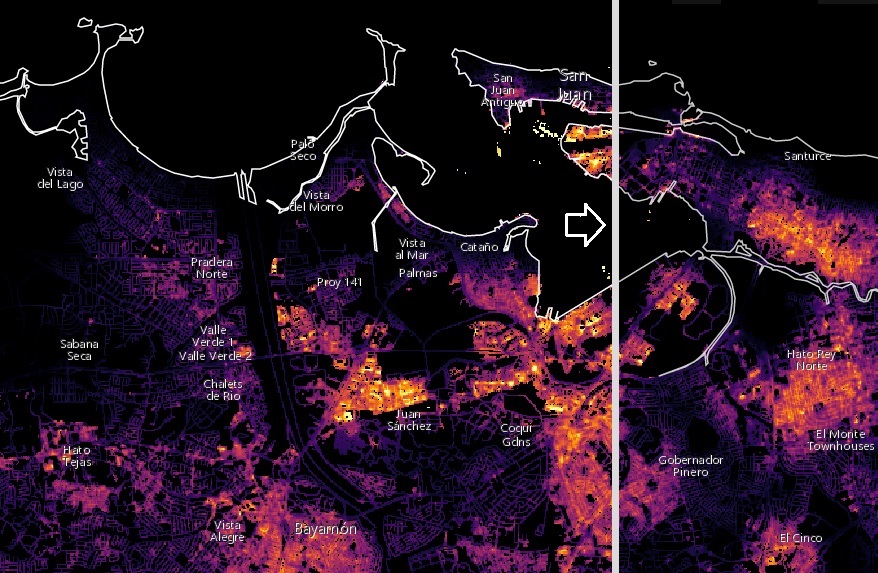
After Hurricane Maria tore across Puerto Rico, it quickly became clear that the destruction would pose daunting challenges for first responders. Most of the electric power grid and telecommunications network was knocked offline. In circumstances like this, quickly knowing where the power is out—and how long it has been out—allows first responders to better deploy rescue and repair crews and to distribute life-saving supplies.
Teams of scientists at NASA are working long days to make sure that groups like the National Guard and the Federal Emergency Management Agency (FEMA) get high-quality satellite maps of power outages in Puerto Rico.
These before-and-after images of Puerto Rico’s nighttime lights are based on data from the NASA-NOAA Suomi NPP satellite. The data detect light in a range of wavelengths from green to near-infrared, including reflected moonlight, light from fires and oil wells, lightning, and emissions from cities or other human activity.
The maps were provided to first responders in Puerto Rico by the NASA Disasters Program, part of the Earth Science Division. Dedicated teams of Earth-observation disaster specialists at NASA centers mobilize to assist in preparations for, responses to, and recovery from a wide range of natural and human-made hazards.
Click here for more information on these maps and to use an online tool to compare recent images of Puerto Rico at night with a baseline view acquired before Hurricane Maria. Click here to download high-resolution before-and-after images of the San Juan area.

