Into the Gulf


It seems to be entirely appropriate that a vessel like ET-134 must first cross the Gulf of Mexico, a body of water rich in the history of exploration, in order to reach its launch site at Kennedy Space Center and make the exploration of space by the space shuttle crews possible; a sea voyage to make possible a space voyage.


From 2004, Sea-viewing Wide Field-of-view Sensor (SeaWiFS) image of the Gulf
of Mexico. Around the circumference of the Gulf, the outflow of several rivers is visible
in colorful swirls that are probably a mixture of sediment, dissolved organic matter,
and chlorophyll from algae and
phytoplankton in coastal waters. Credit: NASA/
Goddard Space Flight Center/SeaWiFS Project/ORBIMAGE

View all blog images in this Flickr gallery

Great explorers, mostly Spanish, came this way before. Ponce de Leon, Hernando Cortez, Fernandez de Cordoba, Francisco Vasquez de Coronado, Hernando De Soto are among the explorers who either crossed the Gulf to Mexico or sailed along its shores in search of new territory or riches. The French explorer Rene Robert Cavelier, Sieur de la Salle descended the Mississippi River via Illinois and discovered the Mississippi Delta and claimed what is now Louisiana for France.  The waters of the Gulf, like the St. Lawrence River to the north, have played a very significant role in making the exploration of the Americas possible, especially North America.

The Gulf of Mexico is the ninth largest body of water in the world; a playground for millions of vacationers each year and an important crossroads for trade and maritime commerce for the United States, Mexico and the northern tier countries of South America.  At any one moment www.marinetraffic.com will display several hundred tugs, tankers, freighters, passenger ships and privately owned pleasure craft sailing the Gulf or in port along its periphery.

The Gulf is actually a tiny inlet of the Atlantic Ocean, or an ocean basin pretty much surrounded by the North American continent and the island of Cuba. It is bounded on the northeast, north and northwest by the Gulf Coast of the United States, my stomping grounds for my entire adult life, on the southwest and south by Mexico, and on the southeast by Cuba. The shape of its basin is roughly an oval and is approximately 810 nautical miles (1,500 km) wide.  Almost half of the basin is relatively shallow waters, but its deepest waters are 14,383 ft (4,384 m) called the Sigsbee Deep, an irregular trough more than 300 nautical miles (550 km) long.


Aerial image of islands in the Mississippi Sound. Credit: NASA

Liberty Star and Pegasus and of course ET-134 passed outbound between Cat Island and West Ship Island and will cross the Gulf more or less on a direct path from Gulfport, Miss., to the Straits of Florida, steering around the Dry Tortugas Islands and Key West.  The weather ahead of us today is predicted to be good, with seas of 2–3 feet and winds generally out of the SSW at 10 knots.  We expect a quiet and uneventful passage at an average speed of 9 knots as the crew bends to a routine of performing its normal duties of running and maintaining the ship and resting when possible; routine duties performed by a ship underway by a crew in much the same way sailors have done in these waters for hundreds of years.

We passed West Ship Island to our east, home to beautiful beaches, via a local ferry from Gulfport, and home to Fort Massachusetts. The fort and its many siblings such as Fort Macomb, which we have already passed in the Intracoastal Waterway, and the fort system that we find along the length of the Gulf Coast and Atlantic seaboard were envisioned to serve as a bulwark against enemy invasion fleets.  During the War of 1812 enemy fleets successfully deposited armies within striking distance of Baltimore and the nation’s capitol and in 1815 troops landed south of New Orleans, right on the doorstep of modern day Michoud Assembly Facility.

Construction of Fort Massachusetts began in June 1859 under supervision of the Army Corps of Engineers and by early 1861 the outside wall of the fort had taken shape.

In January 1861 Mississippi seceded from the Union, occupied the fort and precipitated one of the first actions of the Civil War in the state. On July 9, the Union ship Massachusetts came within range of the Confederate guns and a brief fight occurred, resulting in few injuries and little damage to either side. The action was the only military engagement in which Ship Island or the fort was ever directly involved.

Union forces occupied the island as a staging area for the Union forces’ successful capture of New Orleans in the spring of 1862. As many as 18,000 United States troops were stationed on Ship Island. The island’s harsh environment took its toll on many of the men. More than 230 Union troops eventually died and were buried on Ship Island during the Civil War. The bodies of many of these men were later reburied at Chalmette National Cemetery near New Orleans.

The Gulf of Mexico is literally strewn with history.  In 1492 only a short distance from the Gulf Spain’s Santa Maria, Pinta and Nina sailing under Christopher Columbus went ashore and began an incredible era of exploration of the Western Hemisphere.  Spanish, English, French, and Portuguese explorers came this way in the 1500s and beyond. Later, Spanish galleons loaded riches and treasure in Cartagena (modern Columbia), sailed for Spain aiming across the Gulf for passage either through the Florida Straits or the passages through the Leeward Islands, or perhaps skirting along the northern coast of South America, hoping to avoid storms, privateers or pirates.  

The Monsters of the Gulf
The Gulf is not considered particularly hostile most of the year.  But the Gulf is the feeding ground of the greatest breed of sea monster on Earth; monsters that literally rise from the surface feeding on the warm waters of late summer and early fall, pulling massive amounts of energy skyward like ocean-going demons. Throughout much of history, they remained unnamed. Today we remember and know their names very well. These are the hurricanes.

The English word for hurricanes was adopted from the Spanish word huracon which in turn was adopted from a similar word for storms used by the Arawak language of the Caribbean region. Spanish explorers, who knew well the dangers of sailing the north Atlantic, apparently were taken somewhat by surprise by the ferocity of storms in the Caribbean and Gulf and European explorers lost many valuable ships and sailors throughout the region. 

In recent years space explorers, NASA and international partner astronauts, on board the International Space Station, have provided hundreds of images of hurricanes from their position of relative safety some 200 miles overhead. Among those images is one of Hurricane Ike just about to hit the Texas and Louisiana coast, its massive Cyclops eye, staring back into space at the astronauts.
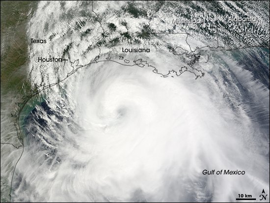

Hurricane Ike. Credit: NASA

Plowing their way across the mid Atlantic from the west coast of Africa as tropical depressions and later as tropical storms, hurricanes gather their strength, bide their time and spin up for the final dash to land.  They often turn north to die in the colder Atlantic; they often plow ahead into the Greater Antilles like Puerto Rico, Hispaniola, the Bahamas and Cuba, where they ravage the much too often ravaged. They may drive straight north into Florida proper or… they may spin their way into the Gulf, where their strength builds and towers to tens of thousands of feet of unbridled energy and then, when ready, advance relentlessly to the coast.

Waiting on shore is a host of vulnerable victims including the coastal cities of Mexico, Corpus Christi, Galveston, Houston, New Orleans, Lake Charles, Biloxi, Gulf Shores, Pensacola, Mobile, and cities east along the coast to Tampa/St. Petersburg. 

Three NASA facilities lie in their possible path; the Johnson Space Center in Houston, Texas, where space missions are controlled; the Stennis Research Center in Mississippi where space shuttle main engines and propulsion systems are tested, and the Michoud Assembly Facility in East New Orleans where external tanks like ET-134 are assembled.  In 2008 Michoud was narrowly missed by Hurricane Gustav and Johnson Space Center was damaged by Hurricane Ike. NASA does a great deal of planning to be ready for these monsters and to protect its employees.

In 1900 a hurricane came ashore with no warning in Galveston and killed 6,000. In 2008, Ike took more lives in Galveston, but not near as many as in 1900.  Carla hit Texas in 1961 with 140 mile-per-hour winds; Camille hit Mississippi in 1969 with 190 mph winds; Frederic rolled over Alabama in 1979, smashed up Gulf Shores and knocked down my television antenna in Tuscaloosa 300 miles from the coast; Opal hit the Florida panhandle in 1995 with 115 mph winds; Andrew hit Louisiana in 1992 with 115 mph winds; Ivan hit Alabama and the Florida panhandle in 2004 with 120 mph winds. In 2005 Dennis hit the Florida panhandle with 120 mph winds; Katrina hit Alabama, Mississippi and Louisiana in 2005 with 125 mph winds and caused the deaths of 2,000 and massive damage; and also in 2005, Rita followed Katrina to hit Texas and Louisiana. Depending on the source, since 1900 hurricanes have killed 9,000 and taken hundreds of billions in property on the Gulf Coast.

Two of the publics’ guardians providing advance warning against hurricanes are located nearby along the Gulf Coast, the United States Air Force 53rd Weather Recon Squadron “Hurricane Hunters” is located at Keesler Air Force Base in Biloxi, Miss. and the National Oceanic and Atmospheric Administration aircraft operations center is located at MacDill Air Force base, Tampa, Fla.

What does Liberty Star do if a hurricane is on the horizon? Liberty Star quickly gets out of the way or does not sail at all — Liberty Star with its VIP precious cargo on board Pegasus will take no chances with the untamed and unpredictable monsters of the Gulf.

Going Down To The Sea


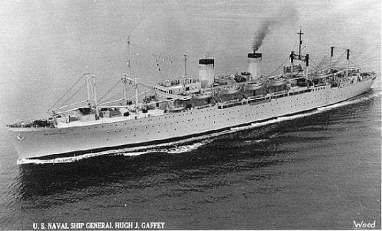
I have always enjoyed the sea and I have never passed up an opportunity to go to sea that I can remember. In the days before the families of servicemen started traveling by air to unite with fathers and mothers in exotic places like Japan, the Philippines, Guam, Okinawa and Hawaii, military families traveled by sea on converted World War II troop ships. In 1956 when I was eight years old, my mother, brother, sister and I went on board the USNS Gaffey at the Oakland Naval Yard, slipped our mooring and churned across San Francisco Bay. We celebrated one of those really neat moments in the life of a family when we sailed under that most famous of famous American icons, the Golden Gate Bridge.


USNS Gaffey carried military personnel and families from the west coast to bases
throughout the Far East during the 1950s and 1960s.  Gaffey was sunk as a target
ship in 2000. Credit: U.S. Navy 

We were outbound from the west coast for Okinawa and I don’t recall the Gaffey stopping anywhere, but my sister says we stopped at Yokohama, Japan. My brother and I turned the troopship into a wonderful playground. During our 14-day voyage we helped exhaust the ship’s store of ice cream, courtesy of the sailors and stewards who ran the ice cream station and generally made a nuisance of ourselves exploring the Gaffey’s secret passages and upper decks. Surprisingly, Gaffey lasted until the year 2000 when she was sunk as a missile target. Poor Gaffey.

Dad had flown ahead of us to Okinawa as he was an Air Force intelligence officer and was needed way ahead of us. He was at the dock to meet us. It was good to see Dad.  

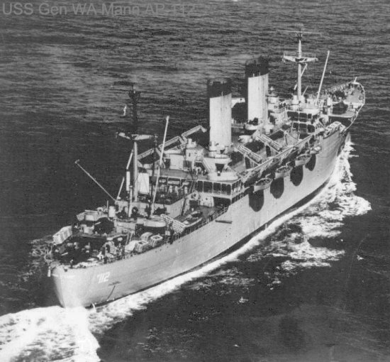
Two years later we returned to the states on another troopship, the USS Mann, via Tokyo, the Aleutian Islands and Seattle. Another fun voyage, but this trip toned down with tragedy. A baby became seriously ill and a Navy float plane, a PBY, flew out a medical team to care for the infant. Right in front of the passengers of our ship the PBY crashed on landing in the sea and her crew had to be rescued by our ship. Unfortunately, the doctor broke his leg transferring from the crashed aircraft to our ship’s launch. Of greater misfortune the baby died and was buried at sea the next day while the entire ship stood silent. The partially floating plane, now a hazard to navigation, was sunk by gunfire that evening. 


USS Mann. Credit: U.S. Navy

I had the good fortune to sail on two other very short sea voyages while serving in the Army. As a very sleepy and ravenous Ranger student I paddled in a rubber raft with ten other guys down the Yellow River in the panhandle of Florida out to a Navy LCM, Landing Craft Medium ( no amenities), in Pensacola’s East Escambia Bay. We loaded our rafts on the LCM and she took us out into the Gulf of Mexico past Santa Rosa Island to drop us off at sea for a short paddle to shore and some fun night training in the swamps of Eglin Air Force Base.  Much later, while serving with the Multinational Force and Observers in the Sinai Peninsula, I had the pleasure of a short trip in the Gulf of Aqaba on an American built, Italian crewed mine sweeper. There were real amenities on this ship…Italian cooking!!

These days I sail on fun ships with lots of amenities and silly names like Fantasy, Splendor, Paradise and Imagination and dream about ships with minimal amenities and great names like Yorktown, Lexington, PT-109, Iowa, Missouri, Intrepid, Bainbridge, Bon Homme Richard, President, Constitution, Congress, Wahoo and especially brave Heermann, and Johnson, oh, and of course, Kon Tiki. 

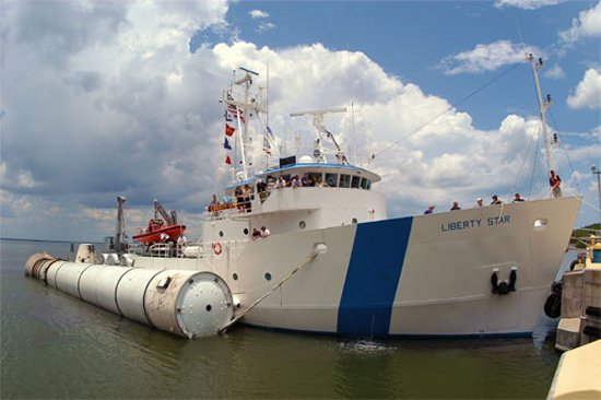
NASA has a small fleet of its own. I first saw NASA’s booster recovery ships in the fall of 1991 while driving through Cape Canaveral Air Force Station and immediately decided I wanted to sail in some capacity with NASA’s two solid rocket booster recovery ships. They are beautiful working ships. They have sharp crews and they have many important missions to perform for NASA. They have great names; Liberty Star and Freedom Star.

We’re sailing with Liberty Star from Gulfport, Miss. to Kennedy Space Center, Fla.

Welcome Aboard Liberty Star!


It’s mid-afternoon and we’re onboard the Liberty Star. Our transfer from the Pegasus barge to Liberty Star was accomplished via Gulfport pilot vessel.

Liberty Star and her sister ship Freedom Star, were built in 1980 and 1981, respectively, by Atlantic Marine Shipyard, Fort George, near Jacksonville, FL, and are owned by NASA and operated for the space program under contract by United Space Alliance of Cape Canaveral, Fla.

The primary mission of Liberty Star and Freedom Star is to recover the reusable solid rocket boosters used to propel the space shuttle to orbit. Liberty Star is commanded by Captain Mike Nicholas of Merritt Island, Fla., a 22 year veteran of work at sea.

In preparation for sailing with Liberty Star I read the entire 23 volumes of “Master and Commander,” by the well known sea faring author Patrick O’Brian (just kidding; I actually read the set some years ago). However, I do know that the front of the ship is the bow; the rear of the ship is the stern; the right side is starboard and the left side of a ship is no longer larboard, but port. Liberty Star has no sailing masts, no marines, no gun ports and much to my consternation, no 24 pounders, no grapeshot and no round shot.  But Liberty Star is no sissy and she is packed with mission capability. 

Liberty Star is propelled by two General Motors diesel engines turning two six-foot diameter propellers with controllable pitch which provide excellent response time and maneuverability. She can also be maneuvered by a 425 horsepower White Gill water jet thruster in the stern and a 425 horsepower Schottel bow thruster. These systems are particularly valuable in maneuvering the ship without the use of the main propellers where the ship is based, in Florida’s Banana River.The Banana River is home to a large manatee population and USA goes to great lengths to avoid injuring the lumbering, harmless giants. These thrusters are essential during solid rocket booster recovery operations by permitting divers to work near the ship much more safely. 

For communications and navigation, Liberty Star has Kongsberg dynamic position system and joy stick control, X-band and S-band radars, global positioning system, handheld VHF radios and GPS units, digital video and recording systems, voice and data satellite communication capability, VHF automatic direction finding, high frequency single-side band radios, electronic chart plotters, night vision and Sea Area-3 Global Maritime Distress Safety System consoles.

When recovering solid rocket boosters off the Florida coast, Liberty Star carries a crew of about 10, plus 14 additional personnel: Crane operators, technicians, and divers. She has a captain, chief mate, second mate, bosun’s mate, cook, chief engineer, assistant engineer, and three Able Bodied seamen. Liberty Star has a phenomenal cruising range of 6,000 miles and a cruising speed of 15 knots, or 17 miles per hour.  She is 176 feet long, 37 feet in the beam (greatest width), and has a draft of 12 feet. She boasts a cruising endurance of about 30 days. Her draft of 12 feet is a little too much to permit her to begin towing the Pegasus barge from Michoud Assembly Facility due to the shallow waters of the Intracoastal Waterway.

All gear on deck, including the crane, is bolt-on, bolt-off. For this trip the aft deck is stripped of virtually all equipment. For booster recovery, she carries a large Enhanced Diver Operated Plug to insert in the floating boosters to permit inflation and towing, an air cooled two stage compressor for dewatering the boosters, conventional and nitrox compressors breathing air for the divers, a four person hyperbaric chamber for diver emergencies and training, four parachute reels each with 8,000 lbs pull, a 1,200 foot air hose for booster dewatering, two Ambar work boats, a 7,500 lb deck crane, booster frustrum recovery equipment, and most recently a doppler, phased array radar for monitoring space shuttle launches.

Liberty Star is normally moored at Hangar AF on the Banana River at Cape Canaveral Air Force Station, Fla. Several dozen manatees inhabit the dock area of the recovery ships, enjoying warm, shallow waters and the recovery ships are very careful to take all precautions necessary to avoid hitting them. The manatees also share their territory with the local and prolific alligator population.  Liberty Star and Freedom Star leave Cape Canaveral Air Force Station about 24-36 hours before the launch of the space shuttle.  Before the space shuttle launch the sister ships arrive in the expected booster splash down area, located about 140 miles northeast of Kennedy Space Center, and prepare for recovery operations.

The two solid rocket boosters provide power for the shuttle’s ascent. When the boosters are spent, they are jettisoned (at two minutes, seven seconds after liftoff) and fall to the sea as the shuttle’s main engines finish lifting the spacecraft out of the Earth’s atmosphere and into orbit. At six minutes and 44 seconds into the flight, the 165,000-pound boosters under three massive 136-foot-diameter parachutes have slowed their descent speed to about 62 miles per hour and they splash down in a predetermined area. Liberty Star or Freedom Star power toward the impact area in the Atlantic Ocean, recover the boosters and tow them back to Hangar AF at Cape Canaveral Air Force Station.

When not called upon to support booster recovery operations or towing the Pegasus barge from Gulfport, Miss., the Liberty Star and Freedom Star may be found supporting research activities of the U.S. Navy or National Oceanic and Atmospheric Administration.  The crews also train to be ready to recover the space shuttle astronauts at sea should that contingency ever arise.

By way of comparison, Liberty Star weighs in, when soaking wet, at about 1,100 tons and is similar in overall size and appearance to a medium class cutter, such as USCGC Reliance of the U.S. Coast Guard, weighing in soaking wet at 1,127 tons. 

More about Liberty Star and her crew to come later…

Pegasus Under Way With Liberty Star Into the Gulf of Mexico


Dawn comes at sea while Pegasus was positioned just south of Gulfport, Miss.
Credit: NASA  
View all “Sailing With NASA’ blog photos in this Flickr gallery

Pegasus arrived off the Port of Gulfport, Miss., early this morning at about 7 a.m. CDT, but was asked to remain at sea and await passage of a Gulfport-bound freighter, the Bernado Quinnada, flagged in Nassau.  While waiting at sea, Pegasus was passed by no less than the freighter, a Coast Guard cutter,  six shrimp boats and several barges hauling fuel and grain. A very busy crossing here at Gulfport.

Once cleared to enter port, Angelica E and Emmett Eymard fired up their engines and towed Pegasus into port for a fast transfer to the Liberty Star. Upon entering the port proper, Pegasus was turned completely around facing south out of the port. The blogging passengers, Mick Speer and myself, were quickly shifted from Pegasus to a local pilot vessel and then just as quickly were placed on board the Liberty Star. Introductions went fast as the crew bent to the job of hooking up to the bridle of the Pegasus with the tow line, an evolution that was completed in only a few minutes by the obviously veteran and experienced crew.


This series of images shows the several steps the crew of Pegasus and Liberty Star
undergo to attached the Pegasus bridle and the towing line of the Liberty Star. The
entire process to complete the hook up was accomplished smoothly and only a very
few minutes. Credit: NASA

Able Bodied Seaman John Jacobs of Cocoa Beach, Fla., right next to Kennedy Space Center, performed the all important task of attaching the Pegasus bridle to the tow line of the Liberty Star. “This particular operation to secure the Pegasus bridle and Liberty Star tow line went like clockwork. It was a normal and well done hookup performed by a very experienced group of seaman,” said Jacobs.

Liberty Star is several miles out of Gulfport now, heading south toward the channel between West Ship Island and Cat Island — outbound for the Gulf of Mexico.

Pegasus Moves Along the Gulf Intracoastal Waterway to the Mississippi Sound


Immediately upon leaving Michoud Assembly Facility this afternoon, we entered the Intracoastal Waterway and headed for Gulfport, Miss. Two commercial tug boats hooked up our tow from Pegasus and without fan fare we were off on the first leg of our trip to the Kennedy Space Center. We headed east in the somewhat confined limits of the waterway in about 15 feet of water and took in the local sights along the banks. I’ve crissed-crossed the Intracoastal Waterway almost all my life, but until now I’ve never traveled along it; another first for this trip.


Seen from space in 1995: Greater New Orleans and areas north of Lake
Pontchartrain in southeastern Louisiana. Credit: NASA

The Intracoastal Waterway is a 3,000-mile waterway along the Atlantic and Gulf coasts of the United States. Some lengths consist of natural inlets, salt-water rivers, bays, and sounds; others are man-made canals. It provides a navigable route along its length without many of the hazards of travel on the open sea. If you’ve been a tourist in Texas, Louisiana, Mississippi, Alabama, Florida, the Carolinas, Maryland or Virginia, you’ve crossed the waterway many times.


A view of a portion of the Intracoastal Waterway in Louisiana. Credit: NASA

The waterway runs for most of the length of the Eastern Seaboard, from its unofficial northern terminus at the Manasquan River in New Jersey, where it connects with the Atlantic Ocean at the Manasquan Inlet, to Brownsville, Texas.

The creation of the Intracoastal Waterway was authorized by the United States Congress in 1919. It is maintained by the United States Army Corps of Engineers. Federal law provides for the waterway to be maintained at a minimum depth of 12 feet for most of its length. The waterway consists of two non-contiguous segments: the Gulf Intracoastal Waterway, extending from Brownsville, Texas to Carrabelle, Florida, and the Atlantic Intracoastal Waterway, extending from Key West, Florida to Norfolk, Virginia.

The Intracoastal Waterway has a good deal of commercial activity; barges haul petroleum, petroleum products, foodstuffs, building materials, and manufactured goods and it seems space ships, as well.  It is also used extensively for recreation. Numerous inlets connect the Gulf of Mexico with the Intracoastal Waterway.

Early in our trip we pass two waterways known as passes or inlets that intersect the Intracoastal Waterway and connect the Gulf and Lake Pontchartrain. Each of these waterways has its own silent guardian. 

The Sentinels: Fort Macomb at Chef Menteur Pass and Fort Pike at Rigolets
The first pass is Chef Menteur Pass, a short water route connecting the Gulf of Mexico to Lake Pontchartrain. An earlier fort at the site was called Fort Chef Menteur. The current brick fort was built in 1822, and renamed “Fort Wood” in 1827, and renamed again, Fort Macomb in 1851. Both forts were envisioned to keep pesky enemy fleets out of Lake Pontchartrain and hence the shores of New Orleans.

The fort was occupied by Confederate troops early in the American Civil War, and taken rather quickly without a fight by the Union in 1862. The fort and its land are now owned by the State of Louisiana.

The similar three sided, but better preserved Fort Pike is situated some 10 miles away at the Rigolets Inlet and is open to visitors.

Leaving the confines of the narrow waterway we pass into the Mississippi Sound.

The Mississippi Sound is an open body of water that runs east-west along the coast from Waveland, Miss., to the Dauphin Island Bridge , Ala., a distance of about 90 miles. We will travel only about half that distance in the Sound. The Sound is bordered on its southern edge by the barrier islands — Cat, Ship, Horn, Petit Bois and Dauphin Islands — which are part of the National Park Service’s Gulf Islands National Seashore. Those islands separate the sound from the Gulf of Mexico.

Large portions of the Mississippi Sound reach depths of about 20 feet. Part of the Gulf Intracoastal Waterway traverses the sound with a project depth of 12 ft. The waterway, maintained by the U.S. Army Corps of Engineers, is designed for towboat and barge traffic. Most of its route through the sound is merely an imaginary line through water whose depth exceeds the project depth. A section west of Cat Island and the portion north of Dauphin Island rely on dredged channels marked by aids to navigation maintained by the U.S. Coast Guard.

Deepwater ports along the Sound include Gulfport, Miss., and Pascagoula, Miss. Dredged ship channels running basically north-south connect those ports to the Gulf of Mexico, running between pairs of the barrier islands.

Gulfport and More of Katrina
In the summer of 2008, I stopped by the Port of Gulfport to observe the transfer of Pegasus from the tug boats to the Liberty Star. The transfer went much faster than I anticipated, taking only about 20 minutes. Before I could count to 100, Liberty Star had snagged the tow from the commercial tug boats and was chugging out of port into the Mississippi Sound and on to the Gulf of Mexico.


Katrina’s Category 4 hurricane force winds were observed by NASA’s QuikSCAT
satellite on August 29, 2005, just before she made landfall. Credit: NASA/JPL

 Whereas New Orleans was essentially brushed by Katrina in 2005, the Port of Gulfport was hit head on. The storm surge in the Gulfport area was relentless, 20 feet above normal sea levels and pushed well inland taking everything in its path. The Port of Gulfport lost warehousing and hundreds of sea-land vans filled with poultry and foodstuffs. So much salt water was deposited inland that it destroyed a large swath of Mississippi forest; so much so, that the loss of forest in Mississippi is one of the largest in the history of our country.

During my 2008 visit to Gulfport I stayed overnight at the Marriot Hotel across the street from the Port of Gulfport. During breakfast the hotel master cook came out to talk and ask how we had liked our meal. The meal was great. I learned the cook had lost her father to Katrina and our waitress had lost her husband — both from broken hearts after Katrina. They were not among the 2,000 Katrina victims, but they should be.

Life on Board Pegasus: Keeping ET Safe and Sound


Life on board Pegasus is a mixture of work, mainly checks and servicing of machinery; monitoring the status of the VIP, ET-134 in this case, monitoring the status of the towing operation and filling in the day with opportunities for exercise and relaxing. 

The total floor space of the crew quarters is something like living in an RV (with somewhat higher ceilings). Trappings are non existent; the basics for preparing food, personal hygiene and sleeping bunks are provided and would make any Spartan soldier used to sleeping on rocks more than comfortable.

Above the crew quarters is an area equivalent to a foredeck, open to the sea, where large and heavy, linked chain lie on deck waiting to be hooked up to the tow line, whether provided by the tug boats or the Liberty Star or Freedom Star.

Above the foredeck is the bridge; a fully enclosed operations center permitting monitoring the status of the towing operations, monitoring ET-134’s safe and happy transit via video and observation of the sea; much smaller than Liberty Star; with fewer electronics.

Once under way a member of the crew stands watch at all times throughout the six day voyage, moving throughout the barge checking running lights, machinery and bilges, the lowest point on the barge, and of course ET.

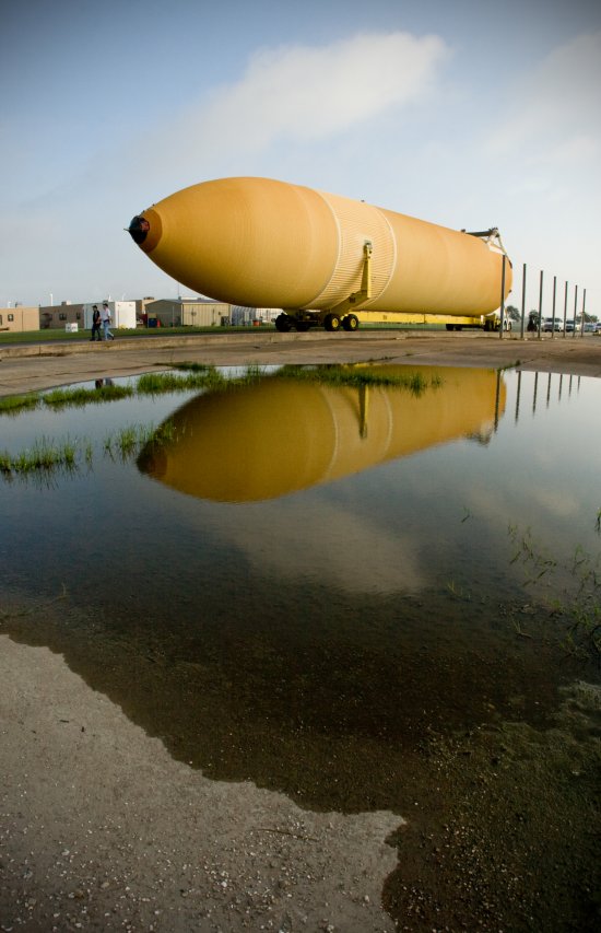
Behind the crew quarters is the cavernous cargo deck area housing ET-134. The cargo bay or deck is more than sufficient to house ET-134’s 154 foot-length, 27 foot-diameter, and 58,000 lbs. Vibration incurred during the transit is recorded throughout the trip, and analyzed after arriving at Kennedy Space Center. 

ET-134 is no longer entirely residing its original mobile transporter in quite the same way it arrived on deck. It actually is now suspended or mounted on four large pedestals lifting ET off the transporters’ four large wheel assemblies, but at the same time attached at three points to the transporters upper arms and rear structure. This permits ET to ride the seas and absorb motion just like Pegasus; no shifting to port or starboard, fore or aft.  ET is taking the second best voyage of its life; waiting for its flight into space.

Pegasus: The 'Winged Horse' of the Space Program


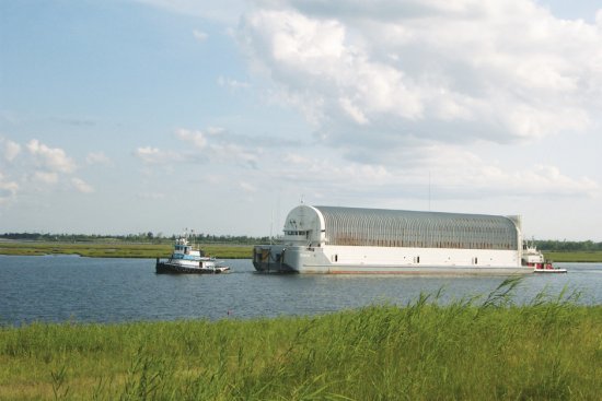
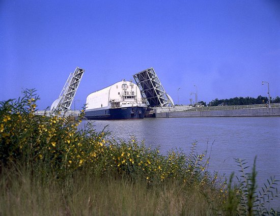
Transporting one of NASA’s external tanks from Michoud Assembly Facility (MAF) to the Kennedy Space Center in Florida is no simple operation. The external tank, which is 153.8 ft long, 27.6 feet in diameter and weighs approximately 58,500 pounds, is transported via a specially designed and built, ocean-going barge. The barge, known as the Pegasus, is 266 ft long and 50 ft wide and is currently utilized by the Space Shuttle Program to transport external tanks over 900 miles of inland and open ocean waterways from the Michoud Assembly Facility to the Kennedy Space Center in Florida. For this trip external tank number 134 (ET-134) is our Very Important Passenger — a genuine VIP. 


Three seamen and one technician crew the barge 24/7 when underway from the barge’s regular mooring site near the Vehicle Assembly Building at Kennedy Space Center.

In Greek mythology Pegasus is a winged horse, captured by and made to serve warrior Bellerophon. Among the many versions of Pegasus’ role and life there are two that seem to stand out. In one version Pegasus brings forth water or fresh springs where ever she steps. In another version Pegasus brings forth lightning or is the god of lightning. The role of NASA’s Pegasus seems to integrate both these mythological versions; NASA’s Pegasus lives, works and travels on water. And Pegasus delivers to the Kennedy Space Center the external tanks that feed the smoke and fire of a space shuttle launch; smoke, fire, thunder, and awe.

For many years the Pegasus, towed by the reusable solid rocket booster (RSRB) recovery ships, took the route through the Mississippi River — Gulf Outlet (MRGO) out to the Gulf of Mexico. Recently, MRGO was closed to larger ships due to significant shoaling and severe erosion caused by Hurricane Katrina. This route was utilized up through ET-128 and took approximately 4 -5 days for the barge to arrive on dock at Kennedy.

Today Pegasus is towed by two commercial tug boats along the Gulf Intracoastal Waterway (GIWW) through the Mississippi Sound to Gulfport, Miss. The Gulf Intracoastal Waterway route is approximately 25 miles longer, with one day added to the travel schedule.  Solid rocket booster recovery ship Liberty Star will meet Pegasus at Gulfport, take Pegasus in tow and depart south into the Gulf of Mexico. 

Pegasus is manned 24 hours a day from the time it leaves Kennedy, goes to MAF and returns to Kennedy. On average, a round trip takes between 10-11 days.  Once the last external tank is shipped, the barge will be utilized by Ares I Upper Stage which also plans to use the Gulf Intracoastal Waterway route.

Marshall Space Flight Center engineers developed the technical requirements for the Pegasus Barge, Halter Marine created the design and produced the drawings. Gulf Coast Fabricators of Pascagoula, Miss., constructed and completed the 1,648 ton Pegasus in June 1999. 

NASA has used many barges to transport large spacecraft components from their respective manufacturing sites to Kennedy. Other NASA barges including Orion, Poseidon, Little Lake, Palaemon, Pearl River, Promise and USNS Point Barrow were used to tow Saturn vehicle components between Marshall , MAF, California and Stennis Research Center to Kennedy in Florida. Of the older barges, only Poseidon remains docked at Stennis, awaiting final disposition.

A New Logistics System for the 'Right Stuff'


Hi everyone! We’re here at Michoud Assembly Facility waiting to sail with ET-134 to the Kennedy Space Center. Thought I’d share with you a little history about how NASA developed the logistics system to move and support all this heavy, outsized spacecraft hardware.


ET-134 moves inside the Pegasus covered barge at NASA’s Michoud Assembly
Facility. Credit: Lockheed Martin

When the space program kicked into high gear in the early 1960s the equipment necessary to move the very large components of spacecraft did not exist. In fact, the lack of necessary equipment almost became a limiting factor when preparing spacecraft designs and considering how to move them to launch sites, the primary location being Kennedy Space Center, Fla.


NASA used barges for transporting full-sized stages for the Saturn I, Saturn IB,
and Saturn V vehicles between the Marshall Space Flight Center; the  Michoud Assembly
Facility; the Mississippi Test Facility, now Stennis Space Center; and the Kennedy
Space Center. Credit: NASA

An agency-level logistics office was created at NASA Headquarters in Washington to orchestrate and coordinate a complex set of requirements based on a new and developing program, the Saturn/Apollo Program, and very geographically dispersed set of players, including various NASA centers, test sites, launch sites, suppliers, contractors, and manufacturers; an amazing challenge.

Spacecraft could be built, but now they had to be moved. In the early 1960s Marshall Space Flight Center developed its own logistics management office and began developing plans for a “fleet” of specialized transporters to move the “right stuff.”

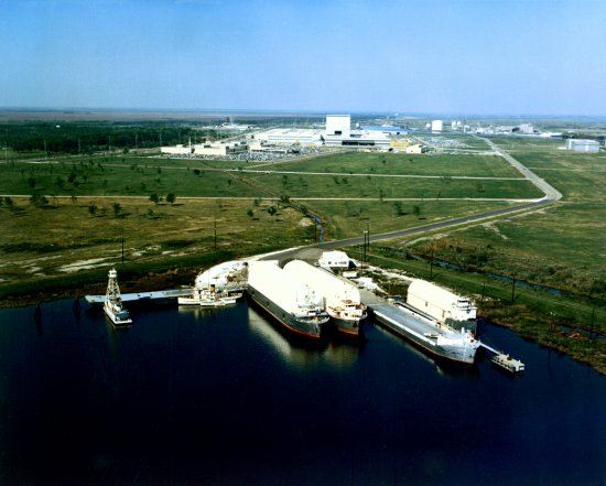
Eventually, with assistance and vessels from the U.S. Navy, NASA developed its own ocean-going fleet of seven barges capable of transporting most of the components of the Saturn/Apollo program from home bases to Kennedy Space Center for launch operations.


Aerial view of NASA Dock at Michoud Assembly Facility with four barges, left to right,
Paleamon, Promise, Poseidon and Orion. The barges ferried Saturn IB and
Saturn V stages between the Marshall Space Center; the Michoud Assembly
Facility; the Mississippi Test Facility, now Stennis Space Center; and the
Kennedy Space Center. Credit: NASA

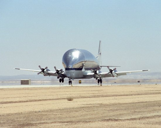
A smaller fleet of two oversize and heavily modified aircraft known as the Super Guppy and the Pregnant Guppy were procured for movement by air of Saturn F-1 engines, lunar modules and S-IVB stages.

 
NASA’s B377SGT Super Guppy Turbine cargo aircraft touches down at Edwards
Air Force Base, Calif., June 11, 2000, to deliver the latest version of the X-38 flight
test vehicle to NASA’s Dryden Flight Research Center. Credit: NASA

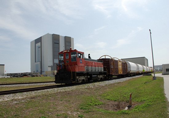
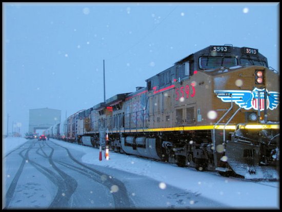
Also, NASA made use of the railroads for moving Saturn propellants and even U.S. Army CH-47 helicopters to move large components from long distances for testing at Marshall.


The NASA Railroad train moves along the track through NASA Kennedy Space
Center’s Launch Complex 39 area. Behind the locomotive car is the Vehicle Assembly
Building. The train is hauling solid rocket booster segments from the STS-122
mission. After a mission, the spent boosters are recovered, cleaned, disassembled,
refurbished and reused. After hydrolasing the interior of each segment,
they are placed on flatbed trucks and individual booster segments are transferred
to a railhead located at the railroad yard. Credit: NASA

The Space Shuttle Program inherited significant experience and a well-oiled logistics machine from the Saturn Program. Shuttle components are moved by a wide variety of outsized transporters just as in the days of Saturn/Apollo. 

Today, components that make up the solid rocket motors (segments and aft exit cones) are transported cross-country via rail beginning in Utah where they are manufactured. With the help of multiple railroad companies, these components typically spend less than two weeks riding over the rail before arriving at the Kennedy Space Center. Once the components are offloaded, assembled, and ultimately flown in space, they are recovered, disassembled, inspected, and ultimately the segments are transported back to Utah on the same rail that brought them to Kennedy. At this stage in the process the hardware is refurbished and made ready for future flight opportunities.  Solid rocket booster components (forward assemblies, aft skirts) are manufactured at the Assembly and Refurbishment Facility at KSC and transported via ground support equipment over the Kennedy road system to the respective Kennedy facilities where these components are integrated with the solid rocket motor segments. Solid rocket booster hardware and solid rocket motor hardware, when integrated together, make up the space shuttle reusable solid rocket booster. Essentially, NASA is a railroad man as well.


Space shuttle solid rocket motor segments are transported cross-country via rail from
Utah, where they are manufactured, to the Kennedy Space Center, Fla. Credit: NASA

External tanks such as ET-134, as you know already, move by barge and towing ship from New Orleans to Kennedy Space Center over water and space shuttle main engines move by truck. Some NASA equipment, such as specialized cargo or payloads for the International Space Station are moved by Super Guppy, stationed at Ellington Field in Houston, Texas.   

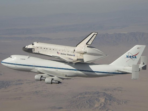
The space shuttle orbiter flies everywhere it goes, except for short distances over ground at Kennedy. If the orbiter has to land away from Kennedy due to weather, such as at Edwards Air Force Base, Calif., a special Boeing 747 pulls up and flies the orbiter back to Kennedy “piggy-back” style in just a few days.


Southern California’s high desert provides the backdrop as one of NASA’s two
modified 747 Shuttle Carrier Aircraft ferries Space Shuttle Atlantis back to the
Kennedy Space Center after departing NASA’s Dryden Flight Research Center
at Edwards Air Force Base. Credit: NASA/J. Ross

Future space program hardware will likely make use of this same or similar means of transportation for movement from point of origin to the Kennedy Space Center for launch operations. 

Liberty Star’s mission to tow ET-134 to Kennedy is essentially part of a bigger NASA logistics operation.

It has been said that logistics is everything. It may be. You simply have to have the “right stuff” at the right place at the right time…to make a difference.

ET-134 Loaded on Pegasus Barge — Aarg!!!!! Weather Delay!


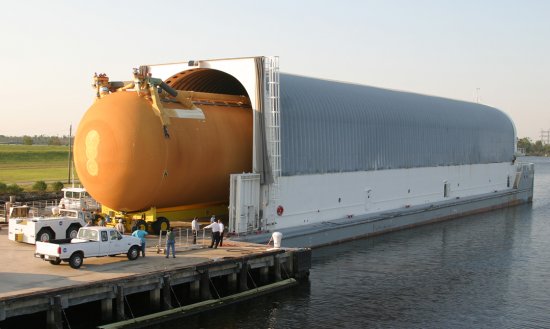
ET-134 completed a flawless early morning move across Michoud Assembly Facility to the dock and the awaiting Pegasus Barge.  Loading went perfectly as ET-134 rolled to a snug fit in the cargo deck area of Pegasus. The crew has completed final inspections, walk downs and the cargo doors are closed and sealed. Pegasus is in great shape and ready to sail.

Unfortunately, a cold front is forecast to pass through the east Louisiana area and be followed by high winds over the next several days. Weather teams are forecasting high winds during the time period when Pegasus would transit the Intracoastal Waterway and Mississippi Sound. We are definitely delayed sailing today, Thursday, Oct. 15. The Maritime Operations teams will be evaluating the forecast on a daily basis for an opportunity to proceed to Gulfport, Miss. 

Aarg!  Pegasus is chomping at the bit.  Stay tuned.

ET-134 Rolls Out to the Dock


ET-134 has rolled out to the dock at NASA’s Michoud Assembly Facility and loaded onto the Pegasus barge — the first step in its long journey. Walt Adams, supervisor of  Pegasus barge operations, discusses the weather delay in shipping ET-134, as well as conditions for safe shipment of the external fuel tank through the Intracoastal Waterway and the Mississippi Sound to Gulfport, Miss.

Watch the interview (Windows, streaming)


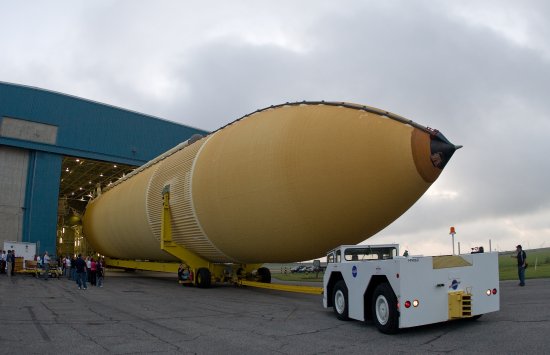
ET-134 rolls out of Building 420 at NASA’s Michoud Assembly Facility for
its trip to the dock and loading onto the Pegasus barge. Credit: Lockheed Martin


ET-134 continues its move to the dock at Michoud Assembly Facility on the
morning of Oct. 15. The move was executed flawlessly in approximately one hour.
Credit: Lockheed Martin


 ET-134 continues its trip to the Michoud docks. Credit: Lockheed Martin


ET-134 makes an early morning move on Oct. 15 across Michoud Assembly facility
to the dock in preparation for loading. Credit: Lockheed Martin 


Marshall television producer Mick Speer visually documents the movement of ET-134
through NASA’s Michoud Assembly Facility to the dock in preparation for loading
on board the Pegasus barge. Credit: Lockheed Martin


ET-134 moves inside the Pegasus covered barge. Credit: Lockheed Martin


ET-134 is moved onto the Pegasus barge. Credit: Lockheed Martin


Marshall Television producer Mick Speer, left, and Steve Roy, public affairs
spokesperson and blogger for Marshall Space Flight Center, are pictured during
loading operations of ET-134 on Thursday, Oct. 15.at NASA’s Michoud Facility
Assembly in New Orleans. Credit: Lockheed Martin


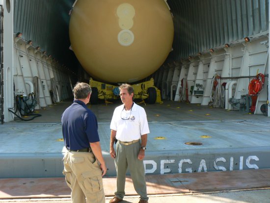
Pegasus barge operations supervisor Walt Adams, right, of United Space Alliance
discusses final loading procedures and weather forecasts for the next several days
with Marshall public affairs spokesperson Steve Roy, left. Credit: Lockheed Martin


Pegasus barge Able Bodied Seaman B.H. “Skip” Conway greets Marshall
spokesperson and blogger Steve Roy at the Michoud dock as ET-134 is loaded and
secured to the barge. Credit: Lockheed Martin


ET-134 as it is guided onto the Pegasus barge during the early morning hours of
Thursday, Oct. 15, in preparation for departure to Kennedy Space Center.
Credit: Lockheed Martin

 
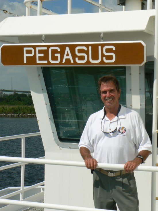
Pegasus barge operations supervisor Walt Adams stands on the bow of the barge
Pegasus during loading of external tank, ET-134, at the Michoud Assembly
Facility dock. Credit: Lockheed Martin