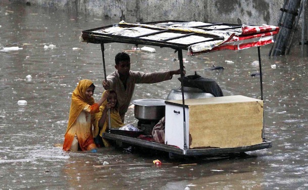
AGU2011: New Project Aims to Predict South Asian Floods

What’s happening to Himalayan glaciers, rivers, lakes, and streams has become one of the most important – and widely debated – topics in science.

There’s certainly no shortage of questions. Which of the 15,000 glaciers in the region are retreating and which growing? How many glacial lakes are on the verge of bursting their banks and flooding downstream communities? Will the region’s great rivers, such as the Indus and the Ganges, be able to withstand the region’s changing climate and rapid population growth and continue to sustain the hundreds of millions of people who depend on them? How can devastating floods, such as the one that struck Pakistan last year, be avoided?

Firm answers to such questions have been hard to come by in recent decades because of the limited monitoring resources available in many key countries in the region. Now, however, a new effort, dubbed HIMLA and led by Molly Brown of NASA’s Goddard Space Flight Center, aims to change this by harnessing state-of-the-art, satellite-based monitoring and modeling techniques.

As part of the effort, scientists will feed data from satellite instruments such as MODIS and ASTER into a hydrological model that will produce daily snow/water equivalence maps that will feed into other hydrological models to determine how much freshwater flows into the region’s rivers from snow and glaciers. The ultimate goal: an early warning system that, like the Famine Early Warning System Network does for drought, will help predict floods before they happen.
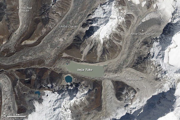
Text by Adam Voiland. Molly Brown spoke about the topic  at an American Geophysical Union Meeting on Dec. 6, 2011. Pakistan flooding photograph (top) ©2010 Tariq Saeed/IRIN. Image of Imja Tsho (bottom), one of the world’s fastest growing glacial lakes, originally published by NASA’s Earth Observatory.

Hydrology Takes the Cake at AGU

There’s a staggering amount of science presented every year at the American Geophysical Union meeting, Earth science’s equivalent of the post-season, prom, and a college reunion all rolled into one. This year, with more than 16,000 attendees and 15,815 abstracts on the docket, was no exception.

AGU groups all the abstracts into one of 27 categories. Hydrology garnered the most attention from scientists (12.2 percent of all abstracts) followed closely by Atmospheric Sciences (11.1 percent) and finally Volcanology, Geochemistry, and Petrology (8.0 percent). The full breakdown is below:

NASA, though best known for sending men to the moon and robots to Mars, had plenty of Earth science — including stories about black carbon, California’s carbon budget (and dwindling water supplies), greenhouse gases, and one of our Earth observing flagships — to add to the mix as well.

–Adam Voiland, NASA’s Earth Science News Team

The Uphill Road to Measuring Snow

One-sixth of the world’s population relies on melted snow for their freshwater, which means good estimates of snow are critical for making realistic predictions of a region’s water supply.
But measuring snow, especially the amount of water locked within that snow, challenges researchers across the globe. Why? The two means of estimating snow totals—weather modeling and satellite remote sensing—can vary as much as 30 percent.

Scientists like hydrologist Edward Kim of NASA’s Goddard Space Flight Center continue to seek ways to reconcile the gap between measurement results. Kim and colleagues Michael Durand (Byrd Polar Research Center), Noah Molotch (Univ. of Colorado), and Steve Margulis (UCLA) are wrapping up a short field campaign to measure snow at the Storm Peak Laboratory, perched atop Colorado’s famed mountain at Steamboat Springs.

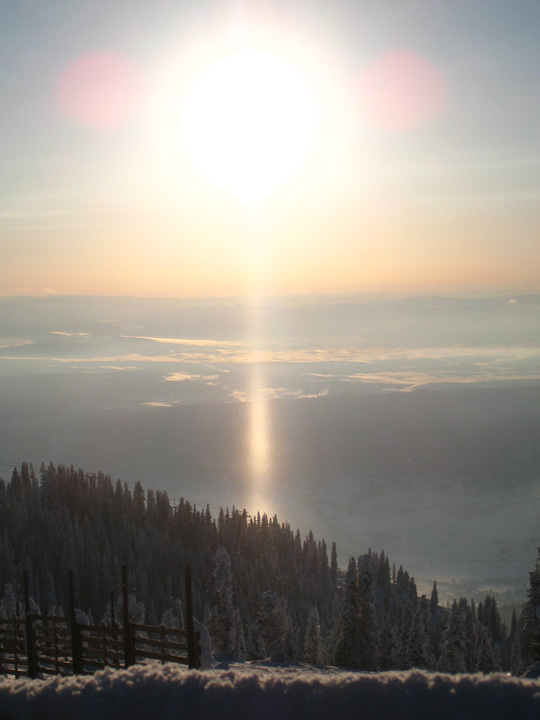
Their aim is to test and improve the accuracy of satellite-based snow measurements. In the midst of the expedition, they’ve also snapped some breathtaking photos, such as this sun pillar to the right. Sun pillars are typically caused by sunlight reflecting off the surfaces of falling ice crystals associated with certain cloud types.

This post was adapted from NASA’s Earth Observatory. For more updates on the expedition, please visit the Notes From the Field blog.

–Adam Voiland, NASA’s Earth Science News Team

Richard Alley on Earth's Biggest Climate Control Knob


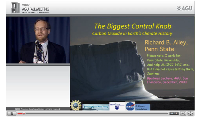
Click here for a multimedia presentation of Richard Alley’s AGU talk.  (Credit: AGU)

Scientists aren’t known for being the savviest of public speakers, but Penn State’s Richard Alley is that rare researcher who knows how to give a talk. Alley — who’s willing to sing, dance, and gesticulate vigorously to get a point across — gave a lecture about carbon dioxide to an overflow crowd of scientists at the American Geophysical Union meeting this year that’s well worth watching.

Blogger and University of Toronto computer scientist Steve Easterbrook has an excellent blow-by-blow of the talk, but the heart of it came down to this point, which Alley made on his last slide:

An increasing body of science indicates that CO2 has been the most important controller of Earth’s climate. 

If you want the details, (and the details are a pleasure to sit through in this case because of Alley’s gregarious speaking style) AGU has posted video and slides of the full talk. Still want to know more about carbon dioxide? NASA’s Jet Propulsion Laboratory (JPL) released new details about the distribution of carbon dioxide in the troposphere, the region of Earth’s atmosphere that is located between 5 to 12 kilometers, or 3 to 7 miles, above Earth’s surface. (JPL also released a ten question quiz about the gas that you can access here).  

Meanwhile, Alley participated in a NASA science update back in 2005 that explored the nature of sea level rise, a topic that NASA researchers continue to investigate and that you can explore interactively using our Sea Level Viewer.

–Adam Voiland, NASA’s Earth Science News Team