Up Close with Ice Bridge

NASA and partners are nearing the end of the 2009 Antarctic campaign of Operation Ice Bridge — a multi-year airborne survey to study Earth’s polar ice sheets, ice shelves and sea ice. Data collected from the DC-8 aircraft will help scientists monitor changes in West Antarctica and bridge the gap between the ICESat and ICESat-2 satellites. Also, the close-up look — not possible from satellites — will help scientists learn more about the region’s ice dynamics.

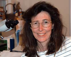
Ice Bridge scientist Seeyle Martin.  Credit: NASA

The detailed look with lasers and radar, sometimes from just 1,000 feet above the ice, is now returning a wealth of scientific information about the ice surface and what’s below. And to the human eye, the low-altitude view shows West Antarctica’s intricacies: the vast expanse of white giving way to deep crevasses and volcanoes, and sea ice resembling pancakes and oil slicks.

The 2009 Operation Ice Bridge campaign concludes no later than Nov. 21. Want to follow the remainder of the flights? Here’s how to connect:

  • Webisodes – Watch this series of YouTube videos for a behind-the-scenes look at Ice Bridge mission planning and flights in Antarctica.

  • Image gallery – Curious what pancake ice looks like or want to take a peek inside the DC-8? Check out the image gallery for photos added throughout the mission

  • Blog – Read about the campaign straight from the scientists and public affairs officers on site.

  • Twitter – Be among the first to know if a flight took off or if it was grounded due to weather, and discover the target of most flights — glacier, ice sheet or sea ice?

–Kathryn Hansen, NASA’s Earth Science News Team

The Uphill Road to Measuring Snow

One-sixth of the world’s population relies on melted snow for their freshwater, which means good estimates of snow are critical for making realistic predictions of a region’s water supply.
But measuring snow, especially the amount of water locked within that snow, challenges researchers across the globe. Why? The two means of estimating snow totals—weather modeling and satellite remote sensing—can vary as much as 30 percent.

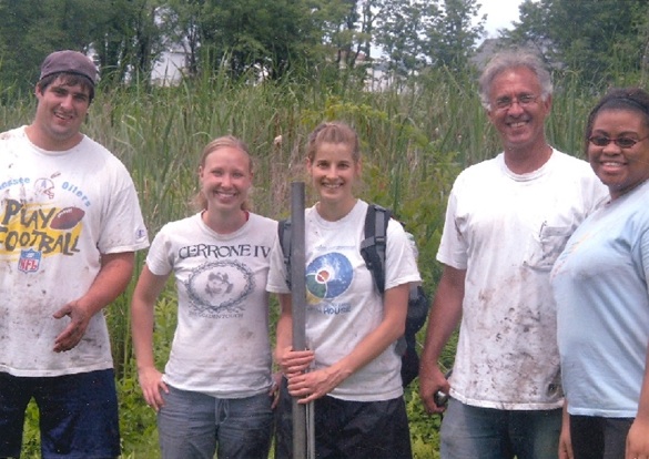
Scientists like hydrologist Edward Kim of NASA’s Goddard Space Flight Center continue to seek ways to reconcile the gap between measurement results. Kim and colleagues Michael Durand (Byrd Polar Research Center), Noah Molotch (Univ. of Colorado), and Steve Margulis (UCLA) are wrapping up a short field campaign to measure snow at the Storm Peak Laboratory, perched atop Colorado’s famed mountain at Steamboat Springs.

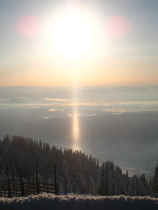
Their aim is to test and improve the accuracy of satellite-based snow measurements. In the midst of the expedition, they’ve also snapped some breathtaking photos, such as this sun pillar to the right. Sun pillars are typically caused by sunlight reflecting off the surfaces of falling ice crystals associated with certain cloud types.

This post was adapted from NASA’s Earth Observatory. For more updates on the expedition, please visit the Notes From the Field blog.

–Adam Voiland, NASA’s Earth Science News Team

The Mysteries of Muck (and the Collapse of the Laurentide Ice Sheet)

Field assistants tromped through bogs in Harriman, NY to collect sediment cores that NASA
scientist Dorothy Peteet is using to date the retreat of the Laurentide Ice Sheet.  Credit: Peteet

I spent big chunks of my childhood mucking through the lakes and bogs of New England with my brothers and looking for any number of critters hidden in the silt.

Turtles, of course, were the main draw (minus the snappers, which we knew were capable of mangling a toe or finger with a passing chomp), but actually snagging one always was a rare treat. Bullfrogs, salamanders, and newts were our standard catch.

If only we’d had a microscope. Watching Goddard Institute for Space Studies (GISS) botanist Dorothy Peteet show images of tiny fragments of pollen, seeds, and fossils that settled to lake bottoms and sat largely unchanged for thousands of years reminded me of the extraordinary oddness–and beauty–that’s lurking in the most unsuspecting of places.

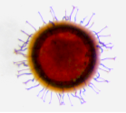
Look, for example, at this fossilized head shield of a daphnia, or water flea, which Peteet showed during presentations at GISS and the American Geophysical Union meeting last December. It’s a miniscule planktonic crustacean with a transparent body and a heart that beats visibly:


Or this statoblast, a peculiar little reproductive pod that can withstand desiccation and freezing and buds from aquatic creatures called bryozoans:


Or this one, a fossilized leaf of a fruit-bearing, cold-loving tundra plant, perhaps a blueberry:


Peteet isn’t poking around in the mud just for fun like my brothers and I did as kids, though. She’s collecting bog cores and scrutinizing the bits of fossilized plants and animals, which can be dated quite precisely using radiocarbon techniques, that turn up in the cores. Her goal is to pinpoint the timing of the collapse of the Laurentide Ice Sheet, a massive block of ice that stretched as far as Long Island during the peak of the last ice age. With Arctic ice currently undergoing rapid retreat, sorting out how the Laurentide Ice Sheet collapsed has big implications for understanding how climate change might proceed.

By analyzing material from some of the first creatures to colonize glacial lakes after the ice retreated, such as those water fleas, Peetet can estimate the date the ice sheet collapsed. Her findings suggests that the collapse occurred about 15,000 years ago, which would put it five-to-ten thousand years later than other dating techniques (particularly one influential technique that involves dating the beryllium from boulders dropped by the retreating ice sheet). 

“This was surprising, and it’s generated some controversy,” she told her colleagues. “I’d like to have your ideas about what’s going on.” To learn more about the topic, you can watch, listen, or view a pdf of Peetet’s full presentation here

Share your stories about exploring the muck in your neighborhood, your ideas on the dating controversy, and we’ll make sure that Peteet sees them and posts a reply.


Botanist Dorothy Peteet

                                                                                                                                                                 
–Adam Voiland, NASA’s Earth Science News Team       

An Award-Winning Scientist Who Came in from the Cold


NASA-funded researcher Ben Smith digs a snow pit at a West Antarctic Ice Sheet Divide core
site to try to infer the annual rate of snowfall. Credit: Ben Smith

Researchers who study glaciers and polar dynamics often get into it for the love of the field work — the challenging terrain, technicological adventures, and thigh-deep snow.

Benjamin Smith, a researcher at the Polar Science Center at the University of Washington’s Applied Physics Laboratory, was no exception. As a fledgling physicist in the 1990s, his first summer job after college turned into an eye-opening adventure — a 3-month stint at the Kamb Ice Stream in Antarctica as a field assistant mapping buried crevasses with snow-penetrating radar. The rest, as they say, was history.

These days, Smith is enjoying a rare honor as one of two NASA-supported researchers to receive the Presidential Early Career Award for Scientists and Engineers (PECASE), awarded at a White House ceremony last month.

WhatOnEarth: Field work was your entry into studying glaciers. Are you involved  in Arctic or Antarctic field work now?

Smith: After a few years of field work, I discovered that though being out in cold is great, the quicker way to learn about glacier change is by doing remote sensing work. That requires a great deal of data analysis indoors. So with that notion, I got onboard as part of NASA’s ICESat I mission while working on my doctorate in physics.

WhatOnEarth: What work do you believe was the basis for your presidential award?

Smith: Well, I have a few projects that I’ve been fortunate enough to be involved in.

Not too long ago, I wrote a paper where we found that several lakes beneath the glaciers in Antarctica have gained or lost water in the last five years, and at a rate much faster than things usually happen in Antarctica. We’ve been seeing lakes that fill or drain in half a year. In one case, 3 cubic kilometers of water drained last year from one of these lakes. That’s about the size of Lake Washington in Seattle.

My main objective in all of this is to figure out where that water went and how it has affected other subglacial lakes and glaciers downstream. Have those glaciers sped up from the water flowing under them? The warmth of the surface bed beneath glaciers allows them to slide faster. If you add more water, there’s potential for glaciers to slide faster. 

I’m also part of a team that is helping to design the ICESat II satellite – a project we hope will build on the success of ICESat I. The satellite will boast several laser beams rather than one, so it’ll provide much better spatial coverage of the Earth’s surface to measure glacier mass and area.

 
President Obama honored PECASE awardees, including Ben Smith and Josh Willis, in January at the White House.
Credit: The White House


WhatOnEarth: Were you aware that you’d been nominated for the PECASE award?

Smith: No. I was completely unaware of it until I was notified by the FBI about a background check! I can tell you I was relieved when I found out the background check regarded my visit to the White House. I understand now that my nomination was put forward by colleagues at NASA. Somehow, my nomination came out on top of the pile, and that’s pretty cool.

To read a few of Ben Smith’s ICESat-related scientific papers, click the topics below.

Ice stream elevation changes observed by ICESat

Increased flow speed on an East Antarctic glacier

An inventory of subglacial lakes detected by ICESat

Gretchen Cook-Anderson, NASA’s Earth Science News Team