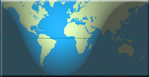
 People in many countries throughout the world use satellite images and data. It’s important to be able to determine the exact time a picture was taken or data collected. To meet this need, satellites use a time stamp standard for tagging images and data — Universal Time, referred to as UT; or Zulu Time, designated by the letter Z; or Greenwich Mean Time, abbreviated as GMT. All three designations refer to the same time. The recorded time is the time at the 0º line of longitude, which runs through Greenwich, England.
Link to the NES Virtual Campus home page.

 NASA will host a news conference at 1 p.m. EDT on Thursday, June 16, to reveal new images and science findings from the first spacecraft to orbit Mercury. The event will be held in the NASA Headquarters. NASA Television and the
  The NASA Explorer Schools project is adding 20 new teaching modules throughout the coming year to cover even more science, technology, engineering and mathematics topics across grades 4-12. NES will post the first set of new resources, focused on mathematics for algebra 1, algebra 2 and calculus classrooms later this summer. Other new content modules will focus on concepts in life science, physical science, engineering, chemistry and Earth science.
 The sun unleashed an M-2 (medium-sized) solar flare with a spectacular coronal mass ejection, or CME, on June 7, 2011. The large cloud of particles mushroomed up and fell back down looking as if it covered an area of almost half the solar surface.
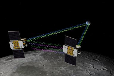
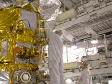
 NASA’s two Gravity Recovery And Interior Laboratory, or GRAIL, spacecraft have completed all assembly and testing prior to shipment to Florida.
 NASA’s Voyager probes are truly going where no one has gone before. Gliding silently toward the stars, 9 billion miles from Earth, they are beaming back news from the most distant, unexplored reaches of the solar system.
 In this episode, Kurt Sacksteder, Chief of the Space Environments and Experiments Branch at NASA’s Glenn Research Center talks about the importance of water on other planets and the tools being developed to mine water from Martian soil. NASA is working with a Canadian mining and space technology company to test designs for excavating natural resources from the surface of planets like Mars. They take measurements of forces applied to excavation devices, the traction of evacuation vehicles and even the flow of sand during simulated digs.
 Preparations continue for the June 9, 7:20 a.m. launch of the international Aquarius/SAC-D observatory satellite from NASA’s Space Launch Complex at Vandenberg Air Force Base, Ca. The satellite will study connections between ocean circulation, the water cycle and climate by measuring ocean surface salinity. Global ocean salinity has been an area of much scientific uncertainty. Past measurements of salinity have been limited mostly to summertime observations in shipping lanes. Aquarius will map the entire ocean every day for at least three years from an altitude of 657 km (408 miles). The measurements will help scientists understand how salinity changes over time. Because ocean surface salinity varies from place to place and over time, scientists can use it to trace the ocean’s role in Earth’s water cycle. Aquarius will reveal how salinity variations influence ocean circulation and the water cycle, which help determine the Earth’s climate.