This is the last of four dispatches from guest writer Karen Romano Young. She spent time on the ICESCAPE expedition…
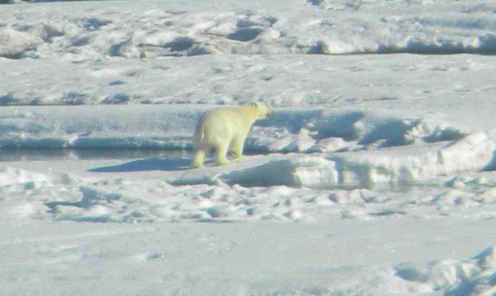
The hypothesis has been proved conclusively aboard the Coast Guard Cutter Healy: I can officially sleep through anything. Yesterday [June 26] we hit what chief scientist Kevin Arrigo calls the heavy ice, northwest of Point Barrow, the northernmost point in the United States. Almost immediately we spotted a polar (right) bear, but haven’t seen one since. You can’t blame them for staying away from the Healy as it slams its 16,000 tons — plus the combined weight of everyone who spent the day eating the chocolate croissants Emily Peacock baked — into the ice.
Early this morning, the ice scientists stood on the bridge and targeted a floe for an “ice station.” For nine hours, we tried to get to it. Slowly and steadily, the ship made a path, ramming, cracking, or backing and ramming again, and the chopped-up ice in our wake soon froze together behind us. Scientist Sam Laney wishes he had a computer application that would detect seismic disturbances, saying he has lived through earthquakes registering 5.5 on the Richter scale and the vibrations didn’t feel as strong as they do right now.
[Laney commented later: “I actually downloaded a program last night and took a few hours of measurements in the aft hose reel room. I am not a seismologist, of course, but I’m estimating between 4.3 and 4.9 on the Richter scale based on these crude measurements.” This is why I like to hang out with scientists. ]
You can see the ice on a map compiled from satellite data, but the reality of the sea ice is right here at sea level. It’s quite different thing to see it in a satellite image as opposed to falling over in the shower because your ship is tilting as it climbs a ridge of jammed-together ice floes and slides back down.
The sea ice measurements made by a dozen scientists on the ice for our station will help confirm details in the satellite maps, just as the work of those studying optics in the open sea will add to the sea color (chlorophyll) mapping that NASA does.
But there is an additional method of observing the Arctic Ocean that I’d like to tell you about because it has been so exciting to everyone here at ICESCAPE. You don’t have to interpret maps or charts of data. You just have to sit back, put your feet up, and check out Sam Laney’s pictures.
Sam’s images come from a stream of water coming up through a hose at Healy’s stern. All the microscopic organisms in the stream parade in front of a camera, sitting briefly for a snapshot before returning to the sea. The instrument, which is set up deep below in the aft hose reel room, is called the Imaging FlowCytobot (below right). It was developed at the Woods Hole Oceanographic Institution.
Flow cytometry has long been used in medicine for counting cells — such as platelets – in blood samples as they are squirted past a laser. Oceanographers use flow cytometers to count the small cells that live in seawater, such as phytoplankton (photosynthetic microbes) and other small organisms.
Imaging flow cytometry takes this approach one step further by triggering a camera every time a cell passes in front of the laser beam. Software on the imager immediately crops out the background from the picture to focus on the critter that was just photo-graphed. The revolutionary result is a steady flow of pictures of organisms as small as 2 microns living in seawater. It looks like a case of jewels: individual round-bodied gems, bigger broach-like diatoms chains (above right), and monster-like ciliates that prey on the smaller critters.
In the past, scientists were able to gather steady flows of water and videotape the plankton at magnification. But managing this huge amount of data would have taken such incredible man-hours that it was impractical for use at sea. The Imaging FlowCytobot does it for us, snapping off a continuous stream of pictures — as many as ten thou-sand cells in a volume of seawater no bigger than a AA battery
Laney’s sea-going imager is an outgrowth of an underwater Imaging FlowCytobot that his collaborators Heidi Sosik and Rob Olson have operated for several years at the Martha’ Vineyard Coastal Observatory off Massachusetts. ICESCAPE is the first time the instrument has been used at sea to survey broad regions of the ocean.
“We are seeing what’s in the water immediately, not after the fact in a lab,” Laney explained, “so it’s obvious when the water — and what’s in it — changes. In the images taken north of Dutch Harbor, there weren’t many cells out there because it’s the open ocean. But in the Bering Strait, the jewels were much more elaborate because we were closer to shore. A large diatom chain indicates an ecosystem that has a lot of nutrients and is highly productive.”
Laney, Sosik, and Olson hope to see Imaging FlowCytobots placed aboard long-term, deep-ocean moorings in the open sea, such as those that will be deployed as part of the Ocean Observing System.
Of course, some of the fun is just seeing the plankton in action. Sometimes you can simply tell that they’re ailing or dying. In one memorable stretch of sea, off Point Lay, the Cytobot caught a stream of diatoms in the act of dividing and reproducing. Then there are the horror shots, in which a ciliate stretches its cilia toward a hapless phytoplankton.
