by Kate Ramsayer / SALCHA, ALASKA /
In a birch forest in interior Alaska’s Tanana Valley, there’s a stake with pink plastic tape attached. More than three decades ago, a plane flew over it to take stereoscopic pictures of the surrounding plot, and scientists trekked out to survey the trees and vegetation. Now, scientists are re-flying and re-surveying the site, using advanced airborne instruments and satellite images to track changes in interior Alaska.
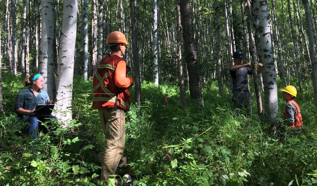
“This is going to be 10.3,” called out Sean Cahoon, a scientist with the University of Alaska, Anchorage. He was standing at the end of a tape measure radiating out from the stake, using another tape measure to check the diameter of the base of a birch tree.

Kate Legner, with the University of Washington in Seattle, recorded the number as well as the diameter at breast height, the distance from the stake, and the azimuth (angle from due north) of the tree’s location.
“That’s all you need to recreate this whole area,” Legner said. The area in question is a circle with a 53-foot radius out from the stake. Mostly birch, with a few aspen and white spruce trees, just sparse enough to let some sun filter through to shrubs, seedlings, moss and lichens thick on the ground.

The recreation of this and other plots in the Tanana Valley is a key part of the NASA-funded Arctic Boreal Vulnerability Experiment, or ABoVE. Scientists will compare ground surveys to surveys from 35 years ago, along with aerial photos from similar time periods. They’ll also incorporate data from NASA Goddard’s Lidar, Hyperspectral, and Thermal (G-LiHT) airborne imager, which provides vegetation heights and composition information along sample strips throughout the valley. The times between these ground and airborne observations are filled by periodic image data from Landsat satellites. Landsat provides a more continuous record of change, but the coarse resolution of the data does not capture tree-scale information.
“Our overall objective is to make use of a really rich historical inventory dataset that we have available,” said Hans Andersen, an ecologist with the U.S. Forest Service and co-investigator on the project. “We’ll be interested in changes in the vegetation cover that could be due to climate change over that period of time.”
The different sources of data complement each other, he said. Ground surveys allow researchers to identify and count individual trees, while aerial photos can cover more ground. The strips of G-LiHT data, covering the valley and collected by NASA Goddard’s Bruce Cook, who is leading the project, provide high-resolution data of tree heights, species composition and moisture conditions of the site.
Every time a Landsat satellite passes overhead and captures a cloud-free image, the team adds that to the data record as well. It’s not a coincidence that the 53-foot-radius plot matches up with a single Landsat pixel, Andersen said.
And it’s not just tree composition that the crew is interested in. As Legner and Cahoon were measuring and marking trees, Andersen and the fourth member of the survey crew were nearby digging a hole, collecting soil samples in plastic zippered bags.
“The soil samples are all about the carbon,” said Robert Pattison, with the U.S. Forest Service’s Anchorage Forestry Sciences Laboratory. “For interior Alaska, it’s really the biggest story.”

This summer, the crew is refining their field sampling protocols and investigating “road-accessible” sites. The birch site was a half-mile scramble up a hillside covered in prickly bushes and thick shrubs, with fallen trees and branches providing additional obstacles.
Next year, the crew will use helicopters to get to even more inaccessible sites across the Tanana Valley. They’ll survey about two dozen representative sites, measuring trees, soils and other sources of carbon, with the goal of making computer models to relate those findings to sites across the valley.
“The end product is essentially an estimate of carbon in various places across the entire Tanana,” Andersen said.
