By Erica McNamee, science writer for NASA’s Goddard Space Flight Center // GREENBELT, MARYLAND //
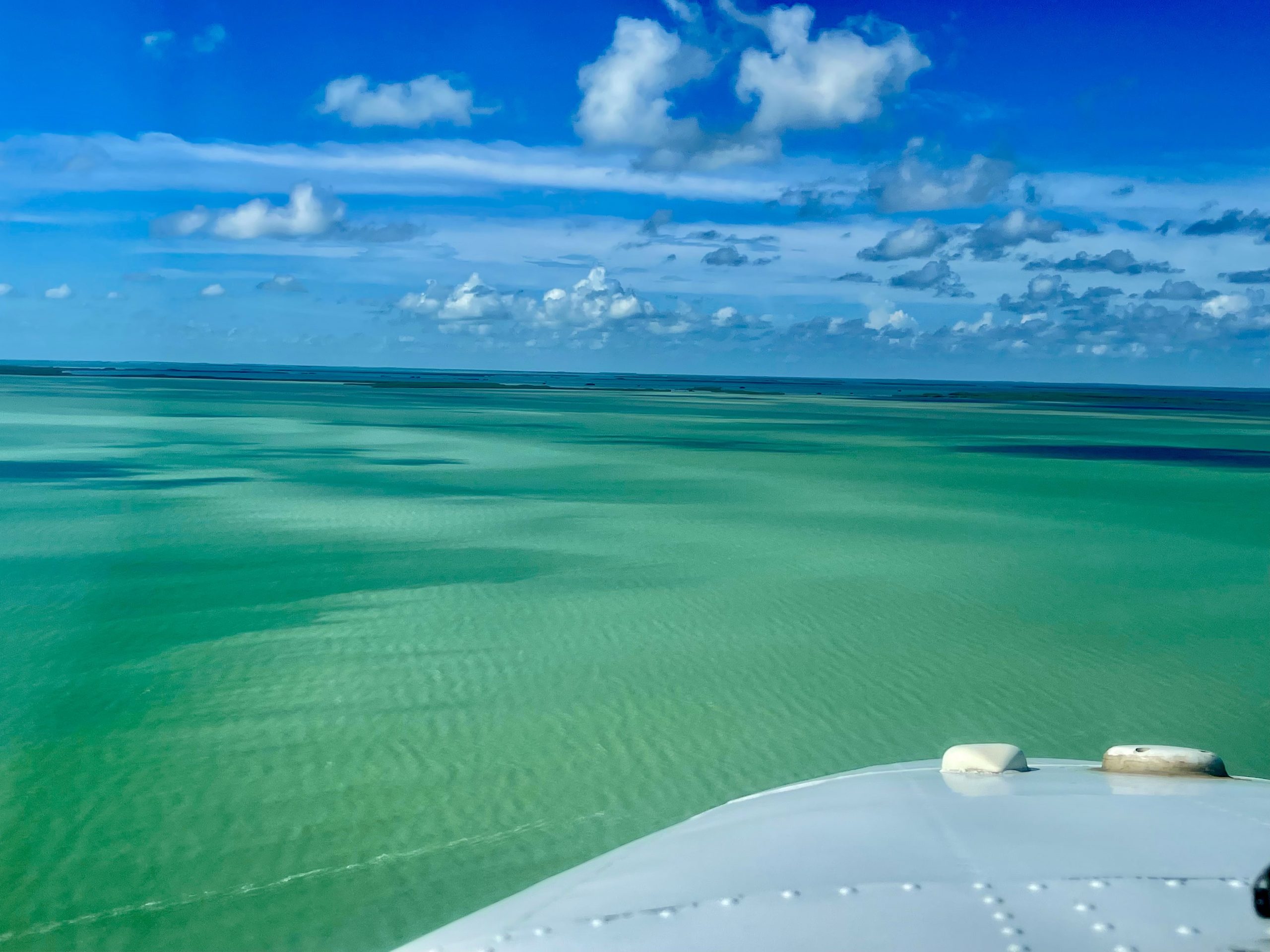
Look up to the blue skies, look right to the boats floating out at sea, look left to the deep green marshes of the Everglades and Big Cypress National Parks in Florida. This mangrove ecosystem contributes to the larger cycle of greenhouse gases, by both releasing and taking in carbon-containing compounds. How much, you might ask? Let’s find out!

This fall, scientists from NASA’s Goddard Space Flight Center in Greenbelt, Maryland, took to the skies (and sea and land) to take measurements of carbon dioxide and methane as part of the Blueflux field campaign.
Blueflux, funded by the NASA’s Carbon Monitoring System project, aims to create a database of carbon dioxide and methane fluxes – or intakes and emissions – of mangrove ecosystems, which exist in coastal areas.
“The mangroves are of interest for Blueflux because they’re really good at taking up and storing the carbon dioxide,” said Erin Delaria, post-doctoral associate at Goddard.
The mangroves’ ecosystem plays a role in the movement of climate-changing greenhouse gases: taking in carbon dioxide and emitting methane. Naturally, the Blueflux team was out to measure all that and more.
To make the measurements, Delaria flew aboard a plane, flying around 300 ft (91.44 m) above the marshy environments of the Florida coast below. The scenery was beautiful, she said, flying over the crystal turquoise water and even spotting dolphins from above. In addition to measuring carbon dioxide and methane, the onboard instruments also tracked wind speed and water vapor.
Even before analyzing the data, Delaria said she could see trends in the intakes and emissions of the compounds. In comparison to a previous field campaign taken during the dry season in April of 2022, there were significant increases in methane emissions during the wet season. Classifying the data by the vegetation below the plane, the mangroves had the highest carbon dioxide uptake, while sawgrass marshes indicated less.
On the ground below the plane, you could find Ben Poulter, research scientist with Goddard’s biospheric sciences lab.
“One of the exciting components of Blueflux is the diversity of partners, which is necessary because we’re taking quite a multidisciplinary approach to how we make the measurements,” Poulter said.
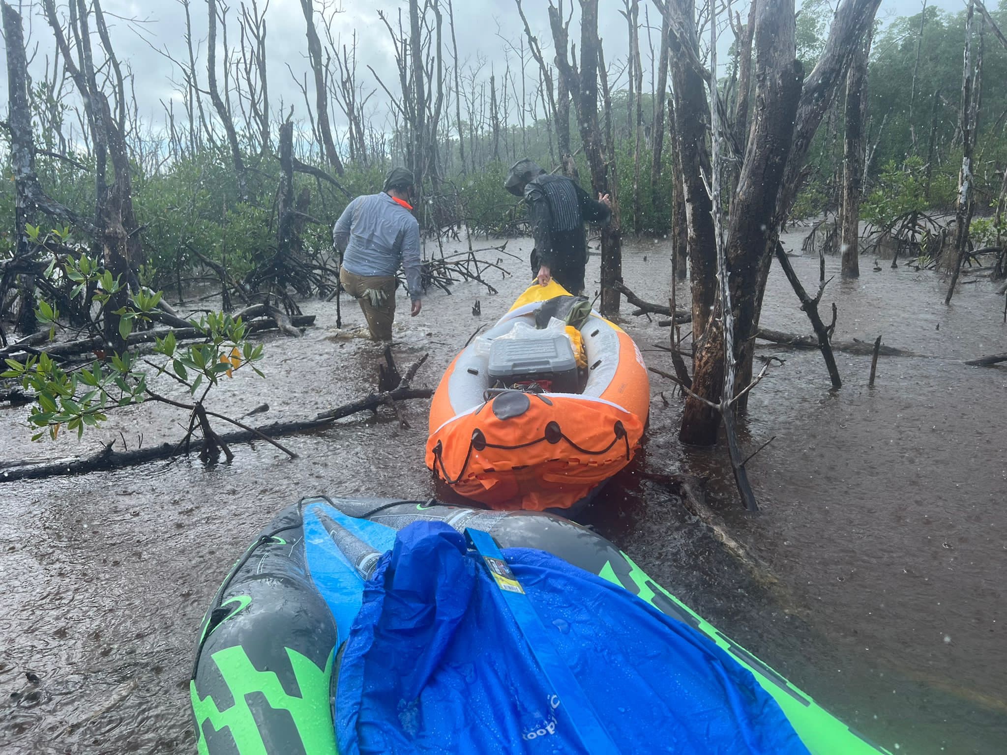
There were different teams working simultaneously, he said, with the plane flying over the scientists on boats, while others hiked through the mangrove swamps. All shared the common mission of measuring the compound fluxes in a bottom-up-top-down approach. Teams from NASA, the National Park Service, and universities all contributed in the campaign to tie together the various forms of measurements around the ecosystem.
“We hope to reduce the uncertainties in the flux estimates and start a discussion about how to balance the fact that these ecosystems are removing carbon dioxide, but at the same time they are releasing some methane,” Poulter said.
The final product of the project is set to be a collection of several maps that will give a timescale history of carbon dioxide and methane fluxes in mangrove ecosystems. The maps will hold valuable information for both scientists and stakeholders that are actively working to restore or protect mangrove ecosystems, for better understanding of their net benefit on the climate.
“Understanding what the natural world is doing when it comes to greenhouse gases is really important to contextualize the human impact on these systems,” Delaria said.
The team has four additional field campaigns scheduled to round out the collected data, with the next trips set to take place in February and April.