NASA’s Summer Storm Research Is Flying Into The Next Stage

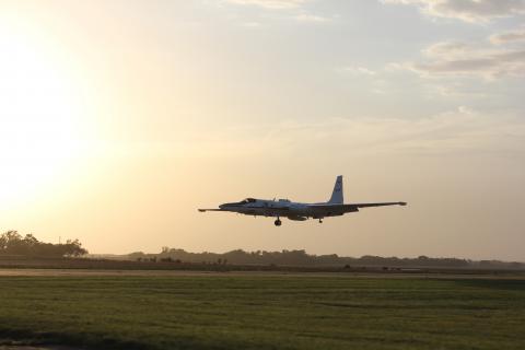
A small aircraft coming in for landing at sunset.
NASA’s ER-2 landing after a day spent flying above thunderstorms for the DCOTSS field campaign. Credit: NASA/Cameron Homeyer

By Jude Coleman

A low, surging wind picks up as the first few raindrops splatter onto dusty ground. Dense cumulonimbus clouds, like soot-stained cotton balls, knot tighter and tighter in the sky. While the thick scent of petrichor and ozone invades the air, an electric burst of lightning slashes through the sky; deafening cracks of thunder follow, like the footsteps of some celestial giant crashing through the atmosphere.

Summer thunderstorms like this may last just a few minutes, or for several hours. In their wake, the NASA Dynamics and Chemistry of the Summer Stratosphere, or DCOTSS, operations room buzzes with activity. After a storm, the Kansas-based crew sends out a high-altitude plane loaded with instruments to take measurements and make observations.

In a process called convection, thunderstorms’ roiling activity draws up warm air from the lower atmosphere and cools it as it travels higher, sometimes shooting it into the next atmospheric layer above called the stratosphere. The DCTOSS team aims to figure out exactly what material swirling in the air gets transferred between atmospheric layers when this happens.

“Until this mission, nobody had ever tried to do this,” said Ken Bowman, DCOTSS principal investigator. “There haven’t been direct observations to tell us how this happens or how important it is.” Bowman and his crew completed their final fight in July, and are now back at in the lab to begin sorting through the data they’ve collected.
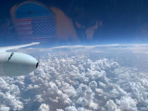
View out of the cockpit of the ER-2 cockpit while in flight. The view looks down on fluffly clouds below and the deep blue sky is above.
The view from the ER-2. Credit: NASA/Greg Nelson

For the last two summers, DCOTSS team meteorologists kept their eyes peeled for thunderstorms in North America, which is a global hotspot for thunderstorms that overshoot air into the stratosphere. When a storm erupted, the team had to estimate if and where the storm’s plume would overshoot and air at the top of the storm would mix with stratospheric air, called the storm’s outflow. While the meteorologists used radars and satellites to direct the pilot of NASA’s high altitude Earth Research or ER-2 aircraft to the storm outflow, scientists closely monitored water vapor measurements aboard the aircraft. A spike in water vapor indicated that the plane had entered the outflow plume.

“There’s definitely been some cheering,” said Kate Smith, a post-doctoral researcher at the University of Miami who works with instruments aboard the ER-2. “It’s really kind of amazing that they’re able to predict where [it’s] going to happen.”

The rapid updrafts in thunderstorms can push all kinds of material into the stratosphere, including water vapor and pollutants from both man-made and natural sources. Because the stratosphere has its own delicate chemistry, chemicals from the lower atmosphere could alter it, explained Smith. For example, some compounds can wreak havoc on the atmosphere as they break down and interact with the fragile ozone layer that protects Earth from the Sun’s harmful radiation.

Though scientists have known storms overshoot in the stratosphere, little is known about their interactions with the climate. Some compounds such as water vapor and methane are strong greenhouse gases and contribute to global warming. It’s important to understand their role in the atmosphere to predict how it will change in the future due to human-caused climate change, explains Bowman.
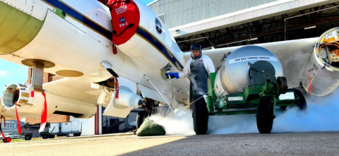
A shot of the underside and instrument pod under the wing, near the body of the aircraft.
Preparing the ER-2 for flight during the DCoTSS field campaign in Salina Kansas, July 2022. To the right in the image, under the wing is a pod that carries science instruments. credit: NASA/ Darick Alvarez-Alonzo

One instrument pivotal to those predictions is the Advanced Whole Air Sampler: a manifold of 32 canisters that collects air samples as the plane flies. The AWAS measures 50 different compounds, including carbon monoxide, methane, hydrocarbons, molecules made up of only hydrogen and carbon, and halocarbons, molecules that contain halogen atoms such as chlorine and bromine.

The halogen-containing gases break down and produce radicals, a kind of free-roaming atom that can destroy the ozone layer, explains Smith, who is part of the AWAS team. Smith and her colleagues are particularly interested in short-lived compounds that typically wouldn’t make it into the stratosphere on their own.

“Because of this chimney type process, where [the storm] shoots them up fast, we can identify and detect some of these species in the lower stratosphere,” added Smith.

Another instrument collecting short-lived compounds is the Compact Airborne Formaldehyde Experiment (CAFE) from NASA’s Goddard Space Flight Center, which measures levels of formaldehyde with a laser-based technique. Formaldehyde measurements help tease apart how air is transported into the stratosphere since only freshly transported air will have formaldehyde in it.

Both CAFE and AWAS will contribute vital information to the mission, but they are just two of a dozen total instruments the team depends on.

“They’re like your children, you know? You love them all equally,” said Bowman.

With the flights finished and the ER-2 back in the hangar, the next phase of the mission is analyzing all the collected data. While the team sampled around 20 storms during their deployment, hundreds more occurred that weren’t sampled. The first step in their analysis will be to use their data to make models that estimate how much collective material thunderstorms eject into the stratosphere. Then, they can start unraveling what that material does when it gets there—advancing NASA’s understanding of Earth’s climate and preparing for the changes ahead.


Storm (outflow) chasing high up in the stratosphere

Photo of the ER-2 Aircraft taking off.
ER-2 takeoff on 16 July 2021 for DCOTSS Research Flight 01. Photo credit: Dan Chirica

By Rei Ueyama, NASA Ames Research Center /SALINA, KANSAS/

It’s 3 a.m. in Salina, Kansas. The moon is out. Crickets are chirping on this balmy summer night. The light above the door to the hangar softly illuminates the sign that reads “DCOTSS.” Most teammates are just waking up.  I unlock the door and walk in to be the first to start this long but exciting day full of new discoveries. It’s yet another start of a typical day of a forecaster for the NASA Dynamics and Chemistry of the Summer Stratosphere (DCOTSS) field campaign.

Picture of the DCOTTS sign on the exterior of the team's hangar workspace
A picture of the door to the hangar taken by me (Rei Ueyama) on the morning of DCOTSS Research Flight 04 on 26 July 2021.

About 50 of us have gathered here (and 20 more to arrive later) in the middle of the continental United States in search of strong convective storms that penetrate high into the atmosphere. These so-called overshooting storms carry water and pollutants from the boundary layer and troposphere (where we live) into the atmospheric layer above us called the stratosphere. Small turrets at the top of these strong storms overshoot into the stratosphere, and hence its name “overshoots”.

The stratosphere is a much different environment than the troposphere.  For one, it is extremely dry. It also has many molecules of ozone that make up the ozone layer which protects us from harmful ultraviolet rays. Various materials pumped up from the troposphere into the stratosphere by these overshooting storms may alter the chemistry and composition of the stratosphere, which could ultimately affect Earth’s climate quite significantly.  So we’re here to find out exactly how and to what extent these strong convective storms influence our climate.

ER-2 Pilot in a pressurized suit steps up a mobile stair to the aircraft.
ER-2 pilot (Greg “Coach” Nelson) stepping into the aircraft for DCOTSS Research Flight 01 on 16 July 2021. Photo credit: Dan Chirica

Our vehicle for exploration is NASA’s ER-2 high-altitude research aircraft.  The ER-2 is a single-occupant, lightweight airplane with a long (31.5 meter) wingspan that flies gracefully at altitudes up to 70,000 feet in the stratosphere, which is about twice the altitude of commercial airplanes. Air is so thin at those high altitudes that the pilot must wear a pressurized spacesuit in case of a loss of cabin pressure. Inside the nose, body and pods under each wing is like a jigsaw puzzle of many scientific instruments. Each instrument measures specifics gases in the atmosphere which are later analyzed to hopefully tell us a story about how convective storms affect the stratosphere.

Researchers gathered in a room with tables to plan the flight.
A picture of forecasting and flight planning meeting on the morning of 15 July 2021. I am sitting in the front left corner (my back facing the camera), leading the meeting. Photo credit: Dan Chirica

My role in DCOTSS is to lead a group of forecasters and flight planners to provide our best assessment of where the outflow plumes from overshooting storms may be located on the day of a science flight and then design a flight plan to sample those plumes. This is no easy feat as these plumes of overshooting material are often tenuous and sparse such that our effort often feels like a search for a diamond in a haystack.

As we rub our just-awoken eyes and scrutinize the early morning images of overshooting plume forecasts from satellite and radar-based models, the instrument scientists begin to arrive at the hangar to prepare their instruments for a 6 to 7 hour flight. The flight plan is tweaked, the pilot is briefed, and we are ready to go.

Clouds under a blue sky in the stratosphere, taken from the window of the ER-2
A picture of non-overshooting convective storms reaching up to 45 kft taken by the pilot (Gary “Thor” Toroni) on DCOTSS Research Flight 02 on 20 July 2021. Photo credit: Gary “Thor” Toroni

Watching the pilot navigate the ER-2 just as we had planned is very humbling and satisfying. But at the same time, our nerves are running high as the measurements from the instruments start to trickle in from the aircraft to the mission operation center on the ground. How good was our plume forecast?  Do we see any indication in the measurements that the ER-2 had actually flown through a convective plume? On many occasions, it’s too early to tell. The diamond usually only shines through after the flight has been completed and after a thorough analysis of the collective measurements. Yet we are glued to our computer screens, holding our breath as we look for any signs of a convective plume in the real-time measurements.

Our job is mostly done for today, but there is no reprieve. We now look into the future to plan our next science flight. Time to hunt for another overshooting storm!