Exploring Barrow with Operation IceBridge


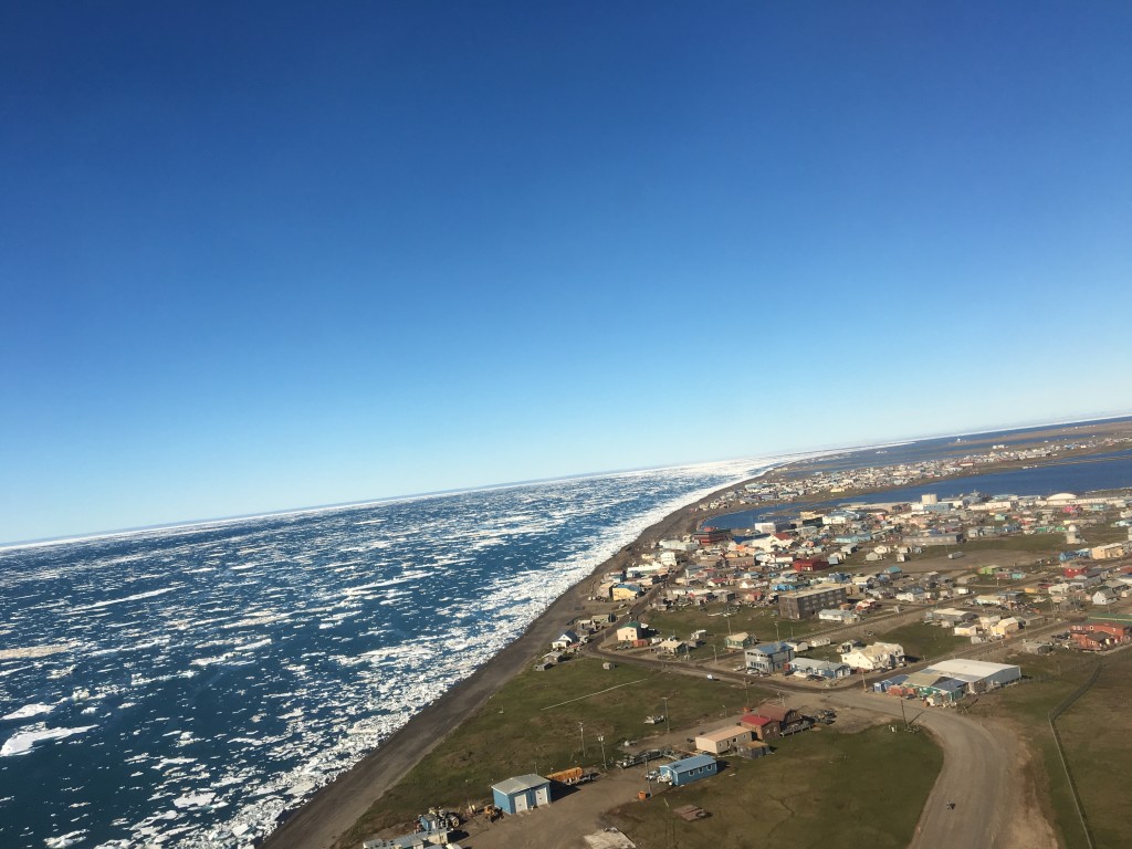
Taking off from the Wiley Post-Will Rogers Memorial Airport provides a view of Barrow and the neighboring Chukchi Sea, at 71° N latitude. Credit: NASA/Kate Ramsayer

by Kate Ramsayer / BARROW, ALASKA /

A cloudy day in the middle of Operation IceBridge’s summer campaign in Barrow, Alaska, meant no flights that day, so instead several members of the campaign showed local kids how to build and fly NASA-quality paper airplanes.

“This is what an engineer does, see what works and what doesn’t,” pilot Rick Yasky told one elementary-age summer camper.
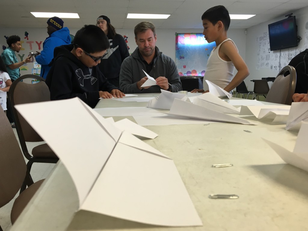
Children learning how to make paper planes
Pilot Taylor Thorson, of NASA’s Langley Research Center in Virginia, shows Barrow kids how to design different kinds of paper airplanes. “There’s no right or wrong way to do it, we’ll just try to make it fly” he said. Credit: NASA/Kate Ramsayer

The campaign, which measured melting sea ice in the Arctic, was the first IceBridge mission out of Barrow, so while in town the 11 scientists, pilots and flight crew explored the local science, culture and community.

One of the flight crew was walking along the beach when he came across fishermen pulling in a line of salmon—he helped, and walked back to the hotel with enough fish to eat for the rest of the campaign. Another chatted with local women who were removing reindeer tendons, which would dry out until the fall when the women would braid them together to use in sewing.

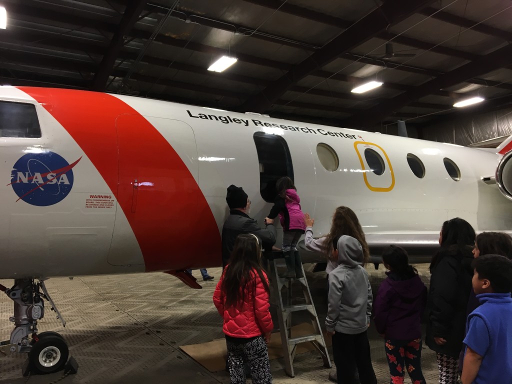
And in the middle of the campaign, they helped at a summer camp by making birdhouses, holding a paper airplane contest and showing the campers the NASA Falcon jet out of Langley Research Center in Virginia.

John Woods, Operation IceBridge project manager with NASA’s Goddard Space Flight Center in Greenbelt, Maryland, explains the rules of a paper airplane contest to day campers at a Barrow summer program. There were two categories – farthest distance, and longest aloft. Credit: NASA/Kate Ramsayer
John Woods, Operation IceBridge project manager with NASA’s Goddard Space Flight Center in Greenbelt, Maryland, explains the rules of a paper airplane contest to day campers at a Barrow summer program. There were two categories: farthest distance and longest aloft. Credit: NASA/Kate Ramsayer
Barrow day campers check out NASA’s Falcon jet, which IceBridge flew for its summer sea ice campaign. Credit: NASA/Kate Ramsayer

“When anyone comes up, we like to have them visit with the kids,” said Chris Battle, Barrow recreation director and deputy mayor. “We’re isolated so it’s good to let them have exposure to these things.”

John Woods, IceBridge project manager, also gave a library talk on how NASA measures sea ice and Arctic health, speaking to whaling captains, scientists, locals and three kids in astronaut suits. Woods and others also talked with local researchers working on the tundra with carbon monitoring stations, weather instruments and more.
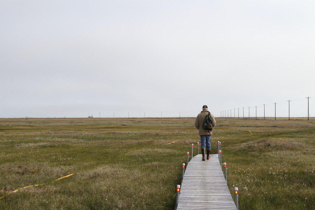
Man walking in Barrow.
Karl Newyear, chief scientist with the Ukpeagvik Inupiat Corporation in Barrow, leads a tour of the Barrow Environmental Observatory, where researchers come to study the tundra. Credit: NASA/Kate Ramsayer

This is the first time that IceBridge has been based in Barrow—the farthest north town in the United States. And the mission hopes to use it as a base to fly out again, Woods said.

“It’s an ideal location, between the Beaufort and Chukchi seas,” he said, referring to two of IceBridge’s research destinations. “We couldn’t have gotten better support from the City of Barrow and the local community. They’ve been terrific, and we’d love to see our relationship with them grow.”

Going with the Floe: Measuring Summer Arctic Sea Ice

Sea ice from an airplane
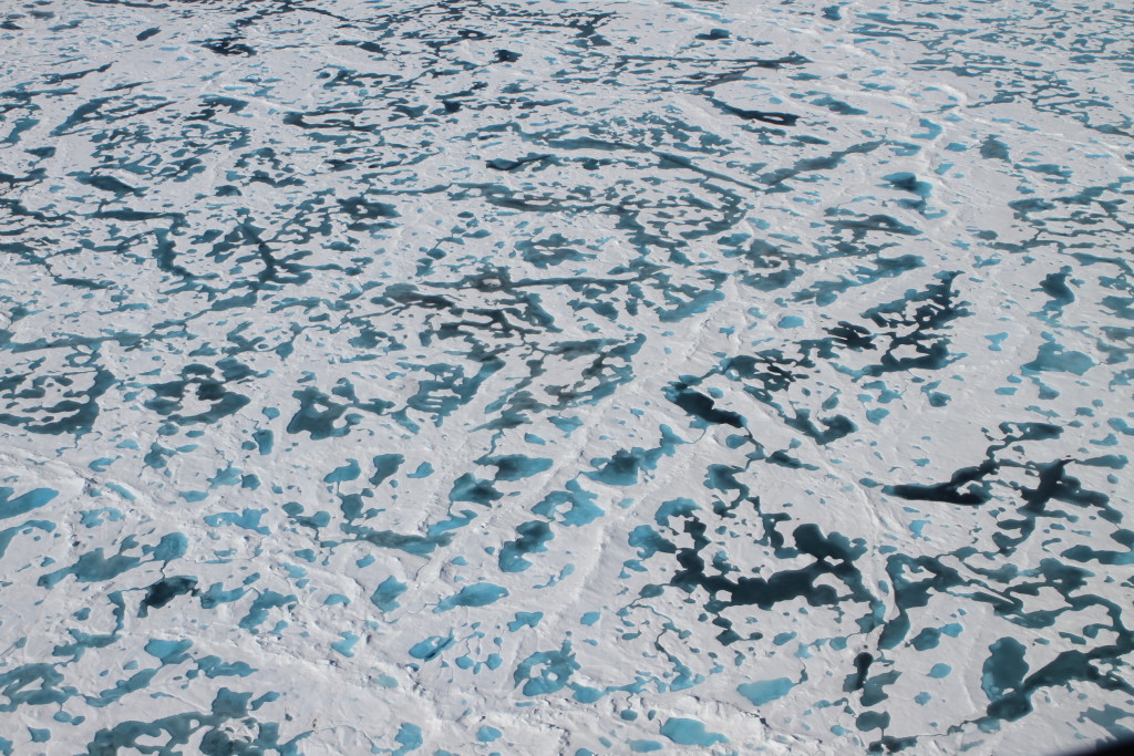
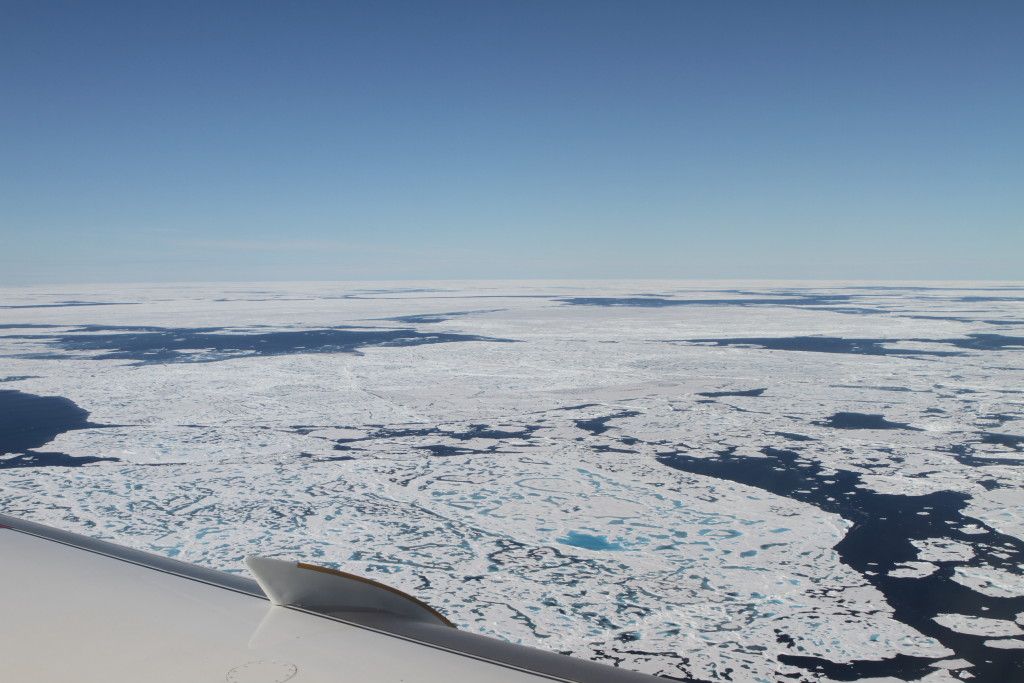
From 1500 feet above the Chukchi Sea, Operation Icebridge sees melt ponds, ridges and other topography on ice floes. Credit: NASA/Kate Ramsayer

by Kate Ramsayer / BARROW, ALASKA /

In July the Chukchi Sea, 300 miles north of Barrow, Alaska, is as varied as any land terrain.

Sheets of floating ice called floes are cracked into pieces like pottery shards and are dotted with ponds of melted snow. The deepest blue ponds, whose dark colors signify melting that’s occurring in thicker ice, connect to neighbors with winding black rivers that empty into the open sea. Giant chunks of ice form rough ridges where ocean currents and winds have slammed the ice floes into each other.

It’s summertime in the Arctic, and the ice is in flux.

“I’ve flown in the spring lots of times, and then the Arctic ice cover is just a flat expanse, it just goes out forever,” said Nathan Kurtz, Operation IceBridge project scientist from NASA’s Goddard Space Flight Center in Greenbelt, Maryland. “Now, in the summer, it’s just so variable. You see places where the floes are a lot more broken up, you see a mixture of places where the snow has melted and you see bare ice, and various depths of melt ponds … you see these patches all over of ice in different stages of melt.”

Melt ponds in the summer could be an indicator of how this year’s Arctic sea ice extent will be at the September minimum.
Melt ponds in the summer could be an indicator of this year’s Arctic sea ice extent at the September minimum. Credit: NASA/Kate Ramsayer

Operation IceBridge made two flights out of Barrow on Tuesday, July 19, as part of the campaign’s first effort to take airborne measurements of melting summer sea ice. Flying 1,500 feet above the ice floes were three instruments: a laser altimeter that measures the heights of the water, snow and ice; an infrared imager that provides temperature readings to help differentiate between water and ice; and a downward-facing mapping camera.

“We’ve never mapped melt ponds so extensively like this,” Kurtz said. And there were many melt ponds to map, as stretches of open water dotted with ice alternated with stretches of ice dotted with ponds and open water.

On the first flight, fog in Barrow and cloudy skies for the first couple hundred miles cleared up just as the agency’s Falcon jet, out of NASA’s Langley Research Center, reached the line the scientists wanted to measure. The goal? Take readings along the path that the European Space Agency’s CryoSat-2 would fly over shortly after 3 pm, local time. That would provide ways to compare the satellite and airborne data and see if scientists could use the summer satellite data.

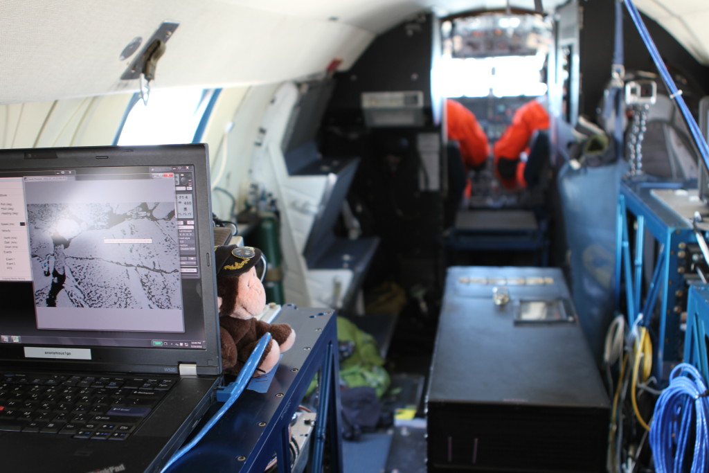
Instruments on NASA’s Falcon jet monitor the sea ice in the Chukchi Sea below.
Instruments on NASA’s Falcon jet monitor the sea ice in the Chukchi Sea below. Credit: NASA/Kate Ramsayer

Then, early Tuesday evening, the team took off on another flight to the northeast. This flight was designed to see the patterns and topography of sea ice in the Beaufort Sea along a path dubbed the Linkswiler line, after Matt Linkswiler, operator of the laser altimeter.

Kurtz and his colleagues are investigating whether a combination of measurements can help estimate sea ice thickness. It’s a tricky piece of information to get, but one that could provide clues to how fast the summer ice will melt, or whether it could stick around for another year.

They’re studying how well the laser altimeter can measure the depths of the melt ponds—another possible indication of the year’s overall melt season. It’s one of several ways the IceBridge campaign is preparing for the Ice, Cloud and land Elevation Satellite-2, or ICESat-2, scheduled to launch by 2018. How IceBridge can measure summer ice melt could help ICESat-2 scientists develop programs to analyze the satellite’s summer data.

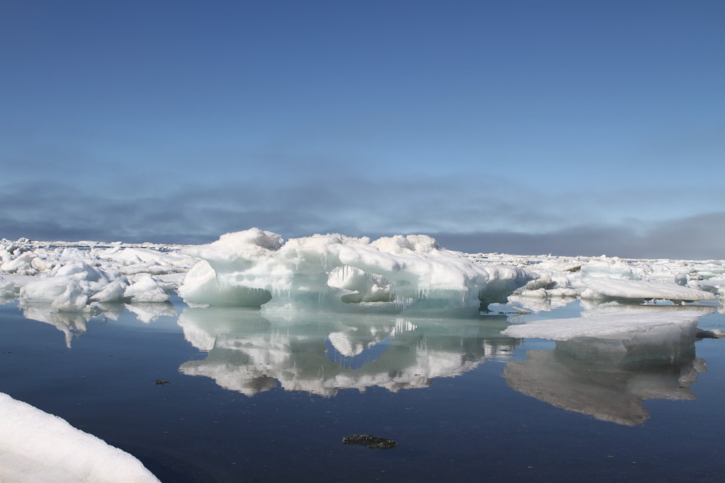
Sea ice melts off the beach of Barrow, Alaska, where Operation IceBridge is based for its Summer 2016 campaign. Credit: NASA/Kate Ramsayer

For Kurtz, the sheer variety of the summer ice is surprising and was especially noticeable on the Tuesday afternoon flight. Different shades of white gave hints to whether it was just ice or snow on top of the ice, while in some areas the ice was brown, possibly due to embedded algae, Kurtz noted.

After Tuesday’s two flights, Icebridge had completed five of its six planned flights for the Barrow summer campaign. With its clear skies, Tuesday afternoon’s expedition was the best yet.

“That was an excellent flight,” Kurtz said over the plane’s intercom system. “I don’t think we lost anything to clouds.”