A Nervous Flier’s Guide to Riding the Snowy Skies

By Erica McNamee, Science Writer at NASA’s Goddard Space Flight Center //OVER NEW YORK STATE//

I grew up flying in planes. I’m comfortable in them. But there’s one part of flying I’ve never gotten used to: turbulence. It’s common on commercial flights, so over the years I’ve learned a few tips and tricks on how to stay calm when my mind seems to take off at a sprint.

First, keep an eye on the professionals. On commercial flights, if the flight attendants are up and moving, I relax.

Second, look out the window! It not only helps to see what you’re headed into, but the views? Spectacular.

Finally, breathe deep and ignore the bumps.

But a recent flight, my tried and true tricks didn’t work. This blog comes to you from NASA’s P-3 plane for the Investigation of Microphysics and Precipitation for Atlantic Coast Threatening Snowstorms (IMPACTS) field campaign.

We’re flying through snowstorm clouds… seeking out turbulence … for 8 hours … on purpose. The scientists onboard want to find out how clouds form to ultimately improve the prediction of winter weather.
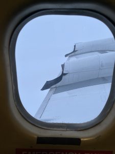
View out a plane window over the wing. The sky is entirely gray as the plane flies through a storm cloud.
Take a look out the window of the P-3 plane over the left wing as it through a winter weather cloud. Credit: Erica McNamee

The scientists were focused on the data they were gathering, and not often walking around, so it wasn’t as easy to gauge the severity of the turbulence by them. Unfortunately, there were also very few windows, and even looking outside of them didn’t prove helpful, because I could almost always only see into the gray clouds we were flying through. And finally, it was verydifficult to ignore the bumps as we chased down the storm clouds.

“It is important to get measurements of cloud properties directly,” said Greg McFarquhar, director of the Cooperative Institute of Severe and High Impact Weather Research and Operations (CIWRO) and professor at the school of meteorology at the the University of Oklahoma. “The detailed measurements of size distributions, high resolution particle imagery, humidity, total water content, and vertical velocities are not available by any other means.”

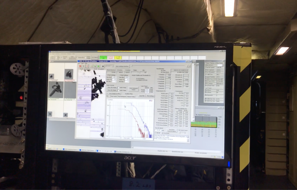
The P-3 is an impressive plane, and it has to be for the level of science occurring on board. Instead of rows upon rows of seats, the body of the plane is almost filled with monitors and computers, showing real time data collection from the instruments attached to the underside of the plane – in-situ probes.

“We’re basically looking at every possible aspect of a cloud,” said Christian Nairy.

Nairy and his colleague, Jennifer Moore, are both Microphysical Probe Operators for the University of North Dakota. They were two of the scientists aboard the P-3 during this flight, watching and gathering data from 10 instruments.

Microscope image of a snowflake that appears star-shaped.
tellar-like dendrite (snowflake). These snowflakes grow in the dendritic growth region (DGZ) typically between -12 and -18 degrees Celsius. Image courtesy of Christian Nairy.

These probes measured several forms of precipitation, from detecting icing and supercooled water to looking at the shape of the actual liquid and ice particles.

The P-3 is designed differently than most other commercial aircraft to allow for the data to be collected. It can fly long distances which allows it to transit winter storms to sample multiple parts of the storm as it evolves. It also can fly through supercooled water, which is common between 0°C and -20°C and is important when studying the processes of winter storms.

The plane is also increasingly louder than anything you’d experience on the everyday flight. It’s important for the scientists to keep in communication though, so each person on the flight is hooked up to headsets, constantly switching in and out of talking, frequently asking questions like “what habits are we seeing?” and “what does the cloud look like?” and “what are we seeing on the probes?” The scientists respond to the probed questions with descriptions of the data while the instruments measure in real time.
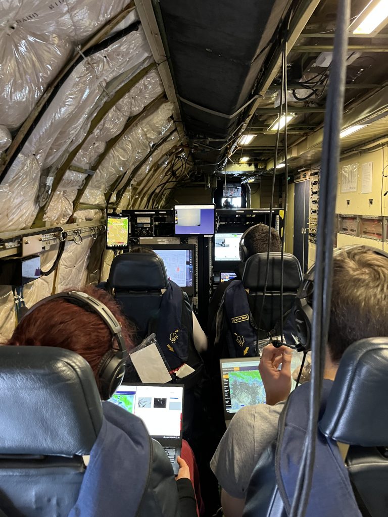
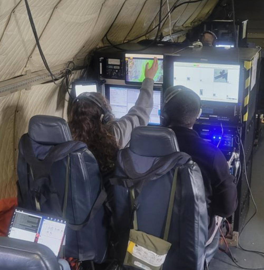
Four scientists strapped into their seats, focusing on the scientific data on the monitors and laptops in front of them. The photo is taken from behind them. the scientists are sitting in what appears to be the inside of a passenger plane that has been gutted and filled with scientific instruments.
Four scientists strapped into their seats are frequently checking and noting information from the monitors which are linked to the probes attached to the plane. Credit: Erica McNamee

Throughout this flight, I figured out another calming trick knowing what exactly is causing the turbulence is as logical an explanation as you can get. How can I petition for these probes to be on all commercial flights?

“Once you understand what turbulence is, how it’s normal, what is causing it, and how aircraft are built to withstand so much more than it actually takes on, you feel better about it,” Nairy said.

“You just kind of get used to it, and now I find it relatively funny,” Moore said, imitating bobbing up and down on the bumpy flight.

Though turbulence may be an inherently frightening or uncomfortable experience, there are real explanations as to why it is happening. So next time you experience turbulence – or for that matter, next time you experience a snowstorm from the ground – thank the scientists completing research from above.

If not from me, take it from the experts:

“Relax, enjoy the flight, and ask lots of questions,” McFarquhar said.

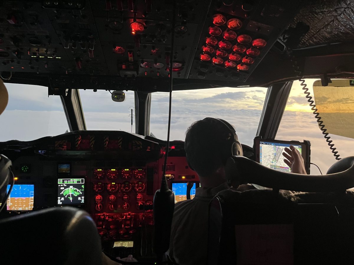
Photo into the cockpit of a plane, flying over storm clouds around sunset. There are two pilots in the cockpit, each with their own steering devices and monitors and gauges.
The pilots navigate the plane along the flight path as the sun begins to set for the day. Credit: Erica McNamee

Planning, Coordinating and Communicating: The Science Behind Winter Storm Chasing Experiments

by Abby Graf

As the snowstorm headed through New York on February 24, one professor at Stony Brook University in Stony Brook, New York spent the hours leading up to it preparing his students to head right into the storm.

Brian Colle, atmospheric science professor at Stony Brook University, is part of many operations in NASA’s Investigation of Microphysics and Precipitation for Atlantic Coast-Threatening Snowstorms (IMPACTS).

Whether it’s preparing a team to operate radars and mobile trucks, launching weather balloons, or flying in the cockpit of one of two aircraft used in the experiment, Colle’s job deals with the fun of coordinating and communicating, and the heart of the mission: science. IMPACTS aims to understand the precipitation mechanisms within snowstorms. The campaign uses two aircraft, ground-based radars, weather balloons, computer simulations, and airborne instruments to help answer questions about how snowstorms form and develop, and how to better predict them.

“One of my jobs is serving as the liaison between the teams,” said Colle. “We start with a briefing the morning of, then I’m making sure I know the plan of the day. I’m coordinating, sending emails, making sure the radar truck is ready. As the mission goes along, I’m in contact with the teams the whole time, making sure we’re collecting data. The job isn’t finished until the storm is over.”

Using Mobile Radar Trucks at Key Locations to Capture Data 

Colle sent teams of students out midday on February 24 to prepare for the overnight storm. One of the teams operates the mobile radar truck that has a Skyler-2 radar on it, which sends out pulse signals every few seconds to collect observations about the atmosphere from lower altitudes, providing high-resolution data from the large geographic regions it samples. “This is the next generation of radars; [helping us] understand rapid storm evolution,” said Colle.

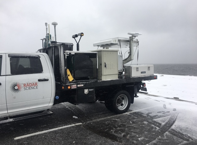
Radar truck parked in a snowy lot with instruments on the back.
The Stony Brook University radar truck deployed during a storm. The instruments on the back of the truck provide data from the Skyler-2 radar, snow size particle sizes from the Parsivel instrument, as well as pressure, temperature, humidity, wind direction, and wind speed of the storms they sample. Photo courtesy of Brian Colle.

The truck is also outfitted with a Parsivel instrument, which is a vertically pointed radar that samples the sizes of snowflakes or raindrops, along with a standardized weather instrument package including thermometers, gauges, pressure sensors, and more. Some of the team headed up to the storm hours before it began to find a location with good visibility in all directions. The goal is to have an area where trees and buildings are not blocking the sensing instruments. While collecting data would’ve begun around 1 a.m., internet issues prevented the team from getting the experiment running, but they have collected a great amount of data from past storms. 

Launching Weather Balloons in the Depths of the Storm

Back at Stony Brook University, Colle organized a group of students to launch weather balloons on campus to measure temperature, pressure, and humidity at different altitudes. An instrument package is attached to the balloon and can “communicate” with a computer on the ground, sending data back as the balloon rises in the air.

A group of students prepares to launch a weather balloon from a snowy field.
A group of Stony Brook students getting the weather balloons ready for a past storm on January 28, 2022. The instruments are tied to strings attached to the balloons, including a parachute and GPS system that provides the location of the balloon. Around 8 kilometers (5 miles), the communication drops off and contact is lost with the system. Photo Courtesy of Brian Colle.

These balloons are launched from a radar truck, which is also equipped with instruments to measure snowflake characteristics. The team started collecting data hours before the two aircraft reached the storms. The P-3 aircraft flies directly into the storm, with instruments aboard to collect data and images from various altitudes. This gives scientists a deeper look at the microphysical properties of the storm, while the ER-2 aircraft flies at roughly 65,000 feet, capturing data with six remote-sensing instruments from above the clouds. The ER-2 arrived at the storm around 4:30 a.m., but the P-3 faced mechanical issues that delayed its launch until the morning of February 25.

The Full Flight Experience

Though not on the P-3 flight this time around, Colle has had the opportunity to fly in the cockpit of the aircraft a few times the past two months, including the February 17 snowstorm in the Chicago area. This falls under his one of many roles but is one of the reasons he joined this mission early on. Interested in studying snowstorms for years, being in the cockpit of the plane during these storms is a lot of fun for Colle. He’s the mission scientist when on the plane, helping interpret the data collected, modify flight tracks, communicate any changes to the pilots, and helping with coordinating the instruments on the plane to make sure everything is functioning and communicating. 

One of the lessons he’s learned is how the pilots navigate the busy airspaces. In populated areas like Chicago or New York, there are a lot of planes taking off, flying, and landing, requiring the pilots to coordinate where the aircraft is headed. It requires a team effort to figure out how to best orient the aircraft. 

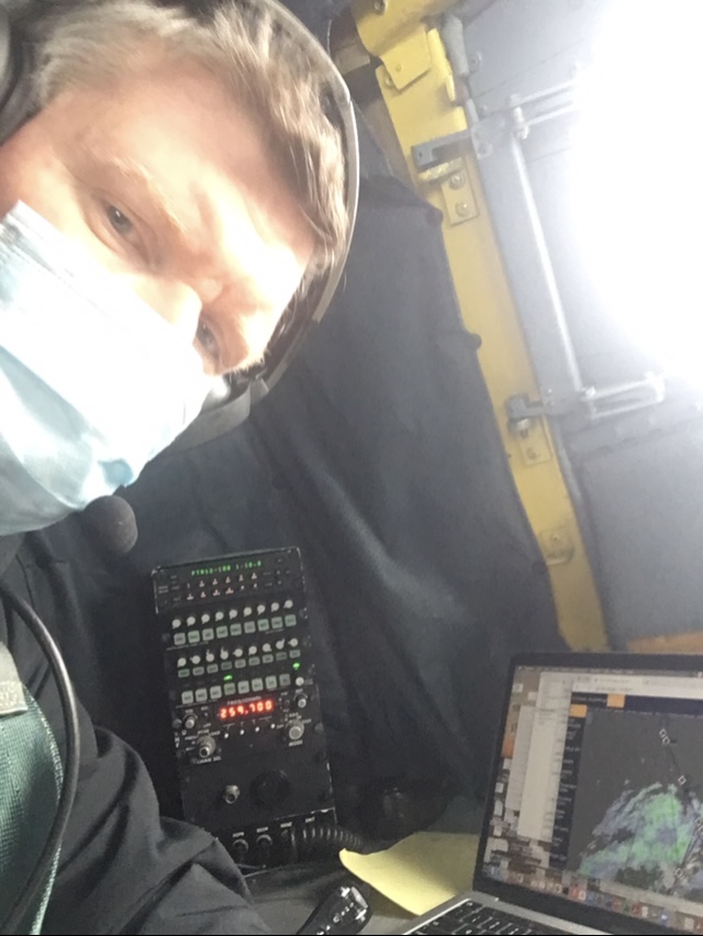
With a radar snapshot showing the storm being sampled by the P-3 aircraft, Colle snaps a selfie in the cockpit of the plane. Photo Courtesy of Brian Colle.

“It’s awesome to be a part of the mission. For many years we didn’t have these opportunities. In the past, I’d take measurements on the ground, collecting snowfall and looking under a microscope at the crystal shapes and habits. Looking at data in real-time, looking out the window, and then interacting with the pilots and hearing what they have to deal with…it’s a continuous science experiment and participating in regions we haven’t sampled before has been very exciting,” said Colle.

As IMPACTS winds down its science experiments this winter, Colle and the rest of the team are looking forward to their opportunities next time around. Winter storms aren’t always the easiest to sample, and the scientists are constantly learning. But the instances in which challenges and difficulties occur only make Colle more confident that the data collected this year will give them better opportunities for improvement next year.

Storm Chasing Scientists Fly Into the Clouds to Understand Winter Snowstorms

By Abby Graf

Imagine the feeling of flying on an airplane. Smooth sailing, clear skies, not a cloud in sight. It’s a relaxing ride that many take for work or recreational travel. Now imagine flying through clouds, with the turbulence of different intensities. While some sink and hold onto their seats, others view it like a rollercoaster ride with their adrenaline pumping. Christian Nairy and Jennifer Moore know a thing or two about that.

Nairy and Moore, two atmospheric science graduate students at the University of North Dakota, are part of NASA’s Investigation of Microphysics and Precipitation for Atlantic Coast-Threatening Snowstorms (IMPACTS). Their job is to operate probes on one of two aircraft used in the experiments. The P-3 aircraft that houses their airborne office flies directly into the snowstorms, allowing the instruments Nairy and Moore operate to measure snow particles and atmospheric properties within the storm clouds.

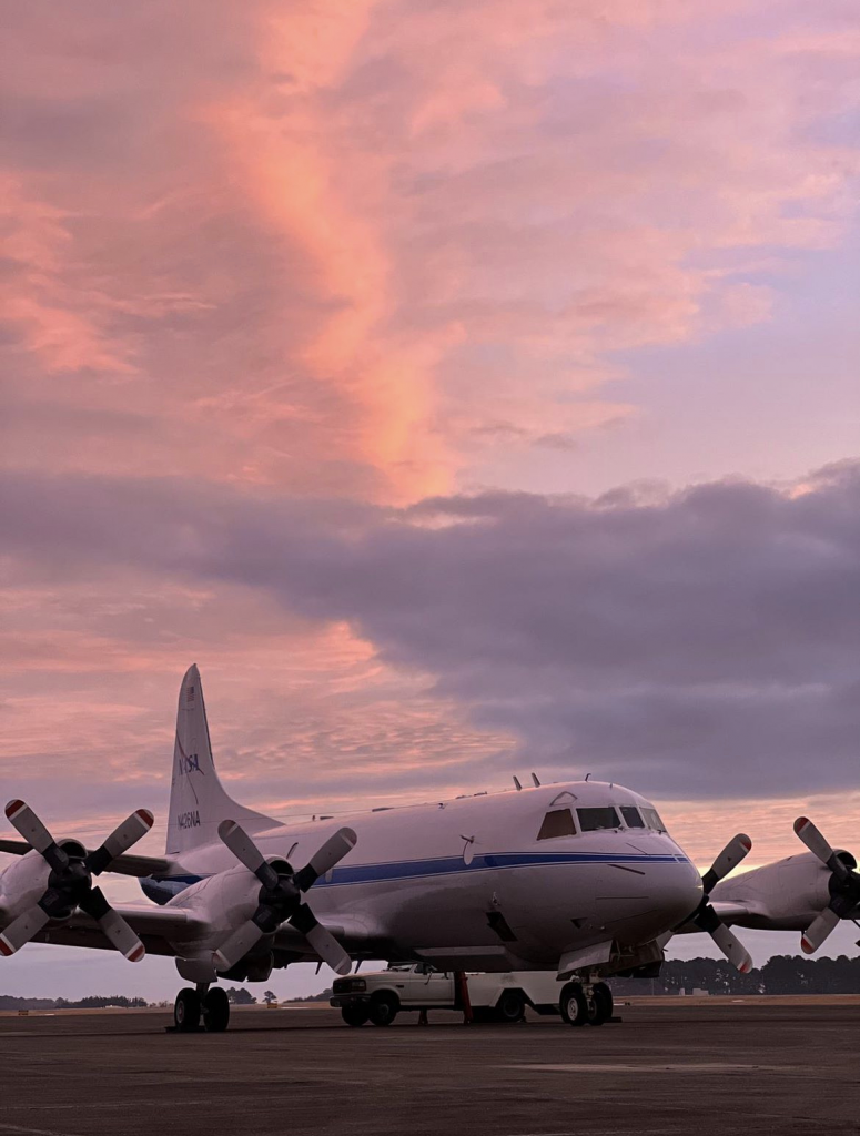
The P-3 aircraft on the tarmac at NASA Wallops.
The P-3 aircraft at NASA Wallops on February 3 before a science flight. Credit: Vidal Salazar

IMPACTS is the first comprehensive study of snowstorms in the Northeastern United States in 30 years. The campaign combines satellite data, ground-based radars, weather balloon launches, computer simulations, and airborne instruments to understand snowstorms. The goal is to develop greater comprehension of winter storm formation and development by using several instruments that examine the microphysical characteristics of snow particles at various temperatures and altitudes. The data collected during the multi-year IMPACTS campaign can help advance the future of snowstorm forecasting and predictions.

“If we understand the microphysics of the clouds, what we’re seeing, when we’re seeing them, and how we’re seeing them, it gives scientists in other disciplines a better understanding of what they’re studying,” said Nairy. The IMPACTS experiments will provide robust datasets about winter snowstorms for scientists to analyze and incorporate into their own research.   

Nairy and Moore have spent the last few months based at NASA’s Wallops Flight Facility in Virginia, spending their days troubleshooting problems and revamping the nine probes that are on each flight. When a storm is in the forecast, it’s go time. They arrive at the hangar to prepare the probes, computers, and flash drives that will accompany their research in the air. An hour before the plane takes off, they board the P-3 and continue prepping the cloud probes.

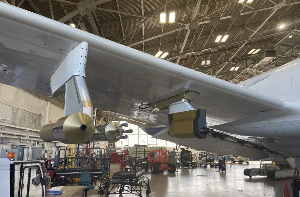
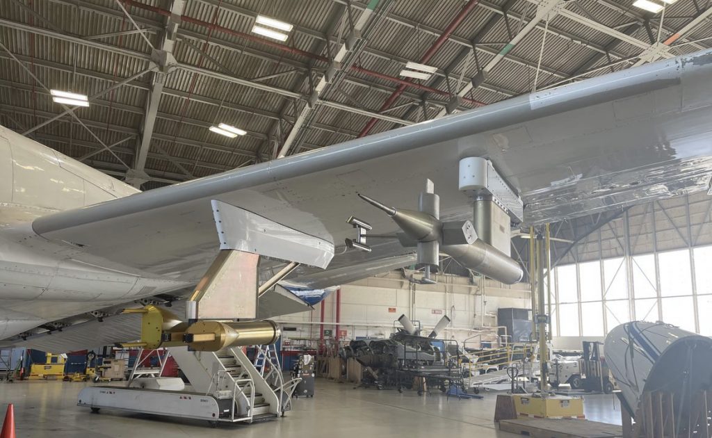
All but one of the probes hangs off the tips of the plane’s wings, away from the propellers, each having its own job: taking high-definition photos of ice particles, measuring the total amount of water (both in liquid and ice form),  measuring the size of full and partial snow particles, and sampling shattered particles. These data-collecting tools can sample over 30 million particles in a single eight-hour flight alone.


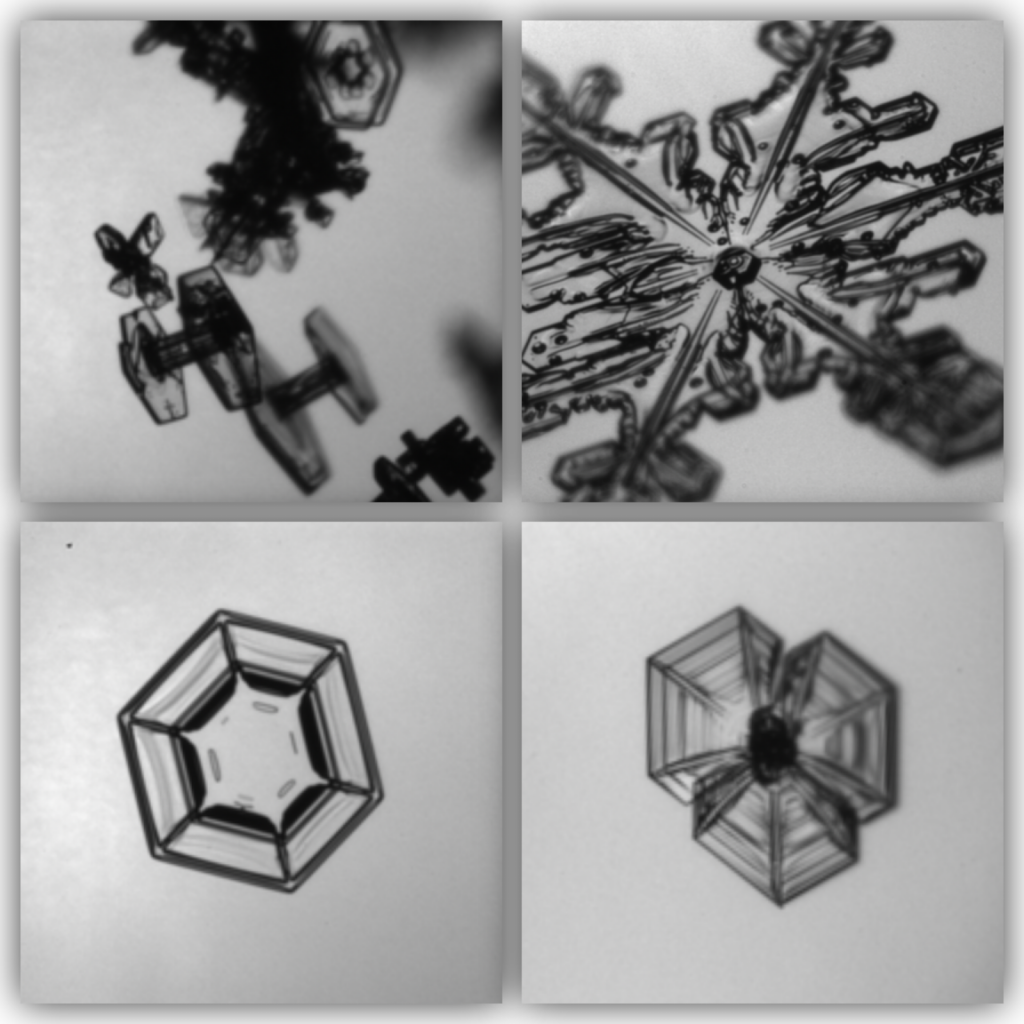
Close-up images of snow particles captured by one of the probes on the P3.
A few of several particle images that the probes captured. Dependent upon the temperature and humidity at which they’re formed, some are “Bullet Rosettes” which are star-patterned, near the top of cold clouds; There are also hexagon-shaped particles, a pencil-shaped particle with hexagons at each side, a conglomeration of “plates” that are connected and more. Photos courtesy of Christian Nairy taken on the PHIPS Instrument.

“The whole point is to measure as much as we can when it comes to particles, concentration, sizes and particle habits,” says Moore. “We want to further our understanding of these storms and why they dump snow over the Northeast.”

Probes hanging off the wing of the plane.
The left wing of the P-3 aircraft. The probes capture data in different ways, some particles entering directly into their openings, some read by lasers, and more. Photo Credit: Christian Nairy
Probes hanging off the wing of the P3.
The right wing of the P-3 aircraft with its probes. Credit: Christian Nairy

Once the plane takes off, the team settles in for eight hours of flying and collecting data. Flying through the clouds isn’t always smooth sailing, though. Sometimes there’s turbulence and sometimes the storm quickly changes from snowflakes one minute to liquid water droplets the next. The transitions are quick, but the technology that captures these changes furthers the researchers’ understanding of how snowstorms work. While much of the flight involves looking at data in real-time, there are downtimes where conversation and collaboration can happen. The team chats with other researchers onboard, cracks jokes, takes notes of what they’re seeing and communicates with the IMPACTS HQ ground team at NASA Wallops.

IMPACTS Principal investigator Lynn McMurdie is on the ground at NASA Wallops as the flights take place. While the planes cruise at 300 mph at various altitudes within the storm, she’s constantly communicating with the teams, directing them to sample certain parts of the storm – like snow bands and when to make in-flight adjustments.

Snow bands are narrow structures in the atmosphere that are created by the storm itself. These banded structures tend to cause heavy snowfall. Not all storms produce these bands, however, and sometimes the bands don’t dump lots of snow, which furthers the importance of understanding just why, how, and when they do or don’t form. 

“We decide where to fly based on forecasts of our storm of interest,” McMurdie shares. “We tend to draw a line or box of where we want to do our sampling, usually going across any banded structures from one side to the other. Going across the snow bands gives us variability in and outside of the band.” 

Sampling snow bands with variability offers researchers’ an improved understanding of how the distribution of snow varies from storm to storm. It’s dependent upon two factors: storm strength and location. There are times when snow bands will drop many inches of snow within a short period of time, but other times when there’s only a light dusting of snow.  Sampling from within and outside of the band, and at different altitudes, helps the team see the whole picture of precipitation and snow production.

Christian Nairy and Jennifer Moore seated at their in-flight computers in the P3 aircraft.
Jennifer Moore (left) and Christian Nairy (right) are seen here operating the monitors and looking at data that their nine cloud probes produce. Photo Courtesy of Christian Nairy.

“The more data we can get, the better we can predict and understand. It’s so important to try and fly in every storm we possibly can,” Moore says. “[The snow storms] can be really impactful, even if it’s an inch or two. You think you understand them, but then you actually get into the science of it. You learn so much more when you’re actually experiencing it.”

As the eight-hour flight prepares to land, Nairy and Moore’s work isn’t done. As soon as the P-3 touches down, the probes are shut off and covered, the data is downloaded to computers, and a post-flight briefing occurs. The two graduate students update and maintain the probes to ensure they’re ready for their next storm-chasing flight. And then it’s time to call it a day.

Up, up and away: Launching Balloons in a Blizzard

by Sofie Bates

Andrew Janiszeski and Troy Zaremba blow up a weather balloon in a dark hotel lobby. The weather was calm last night when they drove into Plymouth, Massachusetts, but this morning a blizzard is raging outside. Snow is piling up in the hotel parking lot, wind gusts are near 70mph, and the power is out – but they have a job to do.

Janiszeski and Zaremba, two graduate students at the University of Illinois at Urbana-Champaign, are one of several teams deployed throughout the northeastern United States to launch weather balloons during the approaching snowstorm. While the teams launch weather balloons from the ground, two NASA aircraft will fly overhead to study the storm from a different vantage. The experiments are part of NASA’s multi-year Investigation of Microphysics and Precipitation for Atlantic Coast-Threatening Storms (IMPACTS) mission, which is the first comprehensive study of snowstorms across the Eastern United States in 30 years. 

Satellite image of snowfall over the northeastern U.S.
The nor’easter dumped snow on the northeastern United States on January 28-29 and brought hurricane force winds and blizzard conditions to some states. Image by NASA Earth Observatory / Lauren Dauphin using MODIS data from NASA’s Aqua satellite.

Janiszeski and Zaremba bundle up and step out into the blizzard to prepare for the first balloon launch of the day. They bury a communications antenna in a snowbank next to their van and attach a small device, called a radiosonde, to the balloon with tape and zip ties. If all goes well, the radiosonde will measure the balloon’s position as well as the temperature, pressure and humidity at different altitudes as the balloon rises into the sky. This data will help the scientists understand the atmospheric conditions of the storm and how they change with altitude.

Andrew Janiszeski prepares to launch a weather balloon in a winter snowstorm.
Andrew Janiszeski prepares to launch a weather balloon near Geneseo, New York on a previous deployment for IMPACTS. Hanging below the weather balloon is the radiosonde, which will collect data as the balloon rises and then parachute back down once the balloon pops. Photo courtesy of Troy Zaremba.

They walk the balloon out of the hotel lobby. Double check that the communications antenna and radiosonde are working. Then they let the balloon go.

“It went fifteen feet up, caught a gust of wind, did a loop, dove down, almost hit a car, rag dolled around a tree, went over a gas station, and popped,” said Janiszeski. They tried again with another balloon. Same thing – pop! Hesitant to sacrifice more balloons to the winds, Janiszeski and Zaremba called the IMPACTS Headquarters team to report that they couldn’t launch.

Snow piles up in the hotel parking lot in Plymouth, Massachusetts where Janiszeski and Zaremba are launching weather balloons. Photo courtesy of Andrew Janiszeski.

Meanwhile at IMPACTS Headquarters, based at NASA’s Wallops Flight Facility located on the eastern shore of Virginia, scientists monitored the weather and coordinated with the various teams on the ground and in the air. Their goal is to fly the two aircraft – the ER-2 aircraft that flies above the storm clouds and the P-3 aircraft that flies within them – in a stacked formation, one above the other, providing a look at the storm from different perspectives. The team also plans the flights so that the aircraft pass over the teams launching weather balloons and the teams using ground-based radars. 

“We’re trying to coordinate all of the equipment to get a nice cross section of the storm. But the storm doesn’t sit still for us, so sometimes we have to adjust our plans,” said Bob Rauber, Director of School of Earth, Society and Environment at the University of Illinois at Urbana-Champaign and one of the assistant flight planners for IMPACTS. There are a lot of factors to consider, though: clearance from the Federal Aviation Administration (FAA), weather forecasts, where the storm is moving and points of interest in its path, and last-minute changes for the aircraft and ground teams – including problematic weather balloon launches.

The NASA P-3 Orion aircraft preparing to take off from NASA’s Wallops Flight Facility.
The NASA P-3 Orion aircraft preparing to take off from NASA’s Wallops Flight Facility. Photo courtesy of Andrien Liem.

By early afternoon the winds had subsided to around 40 mile per hour gusts at the balloon launch site in Plymouth, said Janiszeski, so he and Zaremba decided to attempt another launch. They tied the radiosonde to the weather balloon, adding extra zip ties and duct tape for good measure. Then they walked it out of the hotel lobby, took a breath, and let it go.

As soon as it was released, the balloon was taken by the wind. It flipped once, twice, three times, and Janiszeski’s hope plummeted. But then the balloon righted itself and kept rising, and rising, until it was impossible to see. 

“It was a miracle,” said Janiszeski. “I really thought we were going to get a whopping zero balloons up at the beginning of the day.” But from there on out, the balloon launches were largely successful, he said. The duo got five successful balloon launches before the storm moved away from Plymouth. 
“This was, without the remotest doubt, the most severe conditions we’ve experienced during IMPACTS,” said Janiszeski. “I was getting a little pessimistic, but five radiosondes in a storm like that… We’ll take it as a win.” 

Prepping for a High Altitude Flight

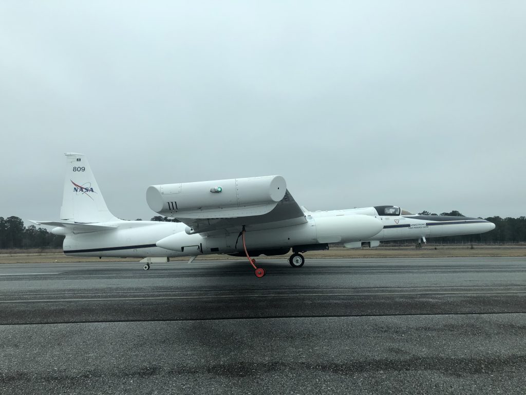
NASA's high-altitude ER-2 aircraft was part of the IMPACTS field mission to study snow in January and February, 2020. Credit: NASA/Katie Stern
NASA’s high-altitude ER-2 aircraft was part of the IMPACTS field mission to study snow in January and February, 2020. Credit: NASA/Katie Stern

By Katie Stern, IMPACTS’ Deputy Project Manager / HUNTER ARMY AIRFIELD, SAVANNAH, GEORGIA/

“Get in there and check it out!”

I was encouraged by “Corky” Cortes from the NASA ER-2 Life Support Team to see how the pilots prepare for their flight. This was my first NASA field campaign with the ER-2, a high altitude aircraft requiring a Life Support Team to help maintain the health and safety of the pilots. This aircraft is highly specialized and has been modified by NASA for conducting airborne science research.

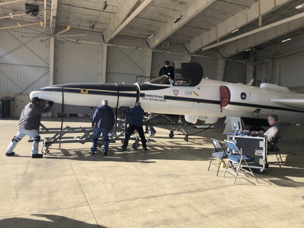
NASA ground crew preparing the ER-2 for a science flight at Hunter Army Airfield in Savannah, Georgia. There are seven scientific instruments located on the aircraft for the IMPACTS project and they are used to study snowstorms. Credit: NASA/Katie Stern
NASA ground crew preparing the ER-2 for a science flight at Hunter Army Airfield in Savannah, Georgia. There are seven scientific instruments located on the aircraft for the IMPACTS project, used to study snowstorms. Credit: NASA/Katie Stern

As the Deputy Project Manager for the NASA IMPACTS project (Investigation of Microphysics and Precipitation for Atlantic Coast-Threatening Snowstorms), I spent January and February at Hunter Army Airfield in Savannah, Georgia, managing the deployment site for the ER-2 and the mission scientists. Our project is specifically focused on studying snowbands across the Eastern seaboard. The ER-2 plays a critical role in capturing remote sensing data to better predict the severity of storms.

Deputy Project Managers Fran Becker and Katie Stern awaiting the ER-2 science flight. Cross winds were mild and the ER-2 was able to take off. Credit: NASA

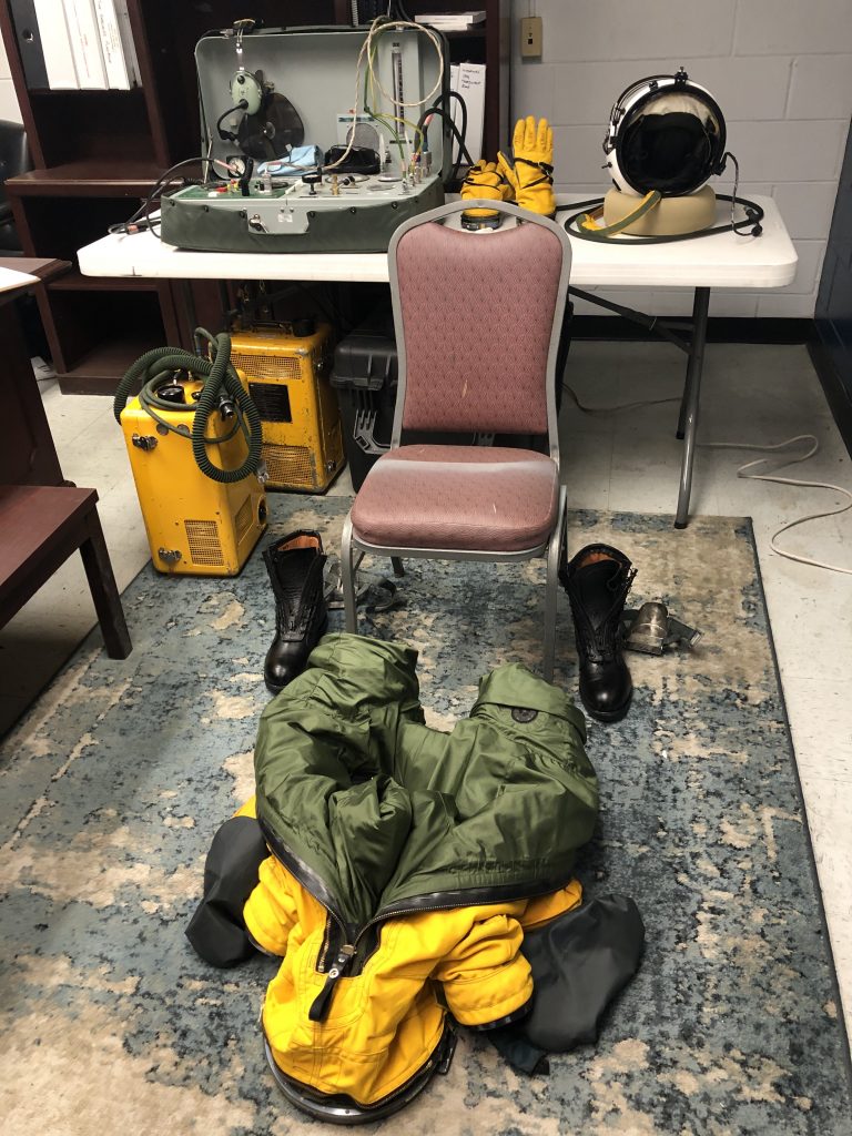
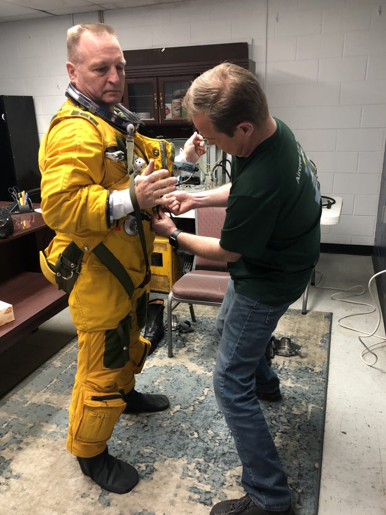
As a new member to the team, I was unfamiliar with what the Life Support crew and pilot needed to do before each flight. Determined to find out, I peered into the tiny office and saw Joey Barr from Life Support setting up the dressing area for pilot Cory Bartholomew. The full pressure suit was completely unzipped, its green lining visible. It was laid out on the floor to make the dressing process easier. Shiny black boots with metal stirrups used for the ejection seat were placed neatly on both sides of the vinyl chair. Behind Cory were two bright yellow gloves and a space helmet carefully placed on a donut shaped pillow. Everything was ready to go. All we needed was the pilot.

Prior to every flight, the ER-2 Life Support team lays out all of the equipment to aid in an easier suiting up process. The suits weigh between 35-40 pounds and every pilot wears long underwear inside the suit. It is important to make sure that the pilot does not overheat during the suiting process so the pilots are usually assisted by a Life Support crew member. Credit: NASA/Katie Stern

The actual suiting-up process looked a bit cumbersome. I could see why it would be easy to overheat if you tried dressing yourself. One foot, after another, Cory stepped into the matte yellow and green suit and then poked his head through a metal collar, which was used to secure his space helmet.

The two men worked silently, adjusting the suit, putting on the torso harness, tightening straps, and going over the checklist in their heads. They’ve both been through this routine hundreds of times, but for me it was fascinating to see the thought and care going into each movement.

ER-2 Pilot Cory Bartholomew being helped into his full pressure suit by Joey Barr from the Life Support Team. Credit: NASA/Katie Stern

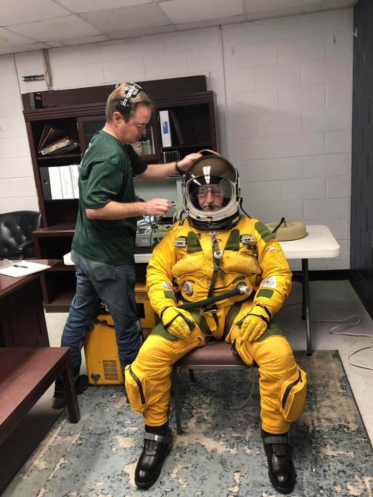
After a few adjustments to the velcro reading glasses that went inside the helmet, Cory snapped the visor shut, and Joey put on his headset to begin the suit pressure checks. A small yellow box filled with liquid oxygen was then connected to the front of the suit with a hose. These pressurized suits along with the liquid oxygen (LOX) allow pilots to fly at an altitude of 65,000 feet, so high the pilots can see the curvature of the Earth.

Joey Barr making sure that Cory Bartholomew is happy with his glasses. Once the helmet is shut, the pilot will not open the visor again until after landing. Credit: NASA/Katie Stern

A few moments later the suit began to inflate and Cory motioned for me to tap on his knee to feel the outward force from the pressure check. A few more checks were conducted and within 15 minutes Cory was ready to be escorted to the van that would take him out to the aircraft.

“If the pilot has an 8 hour mission, how does he eat or drink once he’s in his suit?” I asked Joey, knowing that it was probably a common question.

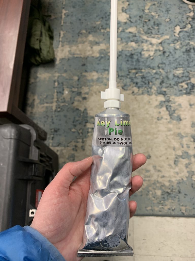
“See this small hole at the bottom of the helmet? We have a whole selection of food that we can give the pilots and they drink it through a straw that goes into that hole. They can have applesauce, beef stew, key lime pie, peaches, chocolate pudding, you name it!” Joey was excited to share the menu with me and I couldn’t help thinking that the key lime pie sounded pretty good. And after actually trying it, I can confirm it does taste exactly like key lime pie, just put through a blender.

The pilots get to choose what type of inflight food options they bring along. Squeezing the Key Lime Pie out of the tube was not very easy. Credit: NASA/Katie Stern

After answering a few other questions of mine, Joey escorted Cory out to the jet. Witnessing the amount of preparation to get ready for the flight only made me want to learn more about the ER-2 and its history. It also gave me a huge appreciation for all of the expertise that goes into ensuring the success of the IMPACTS mission and other NASA missions.

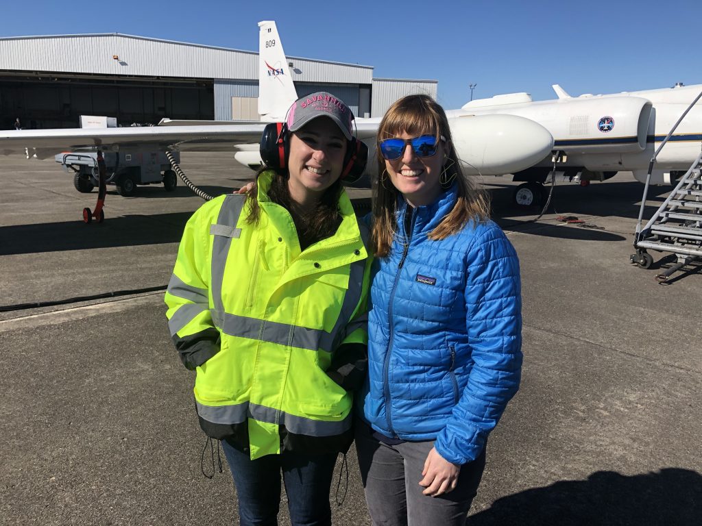
Pilots Tim Williams and Cory Bartholomew pose in front of the NASA ER-2 with Project Manager Bernie Luna and Deputy Project Manager Katie Stern. Credit: NASA

A Wintry Flight

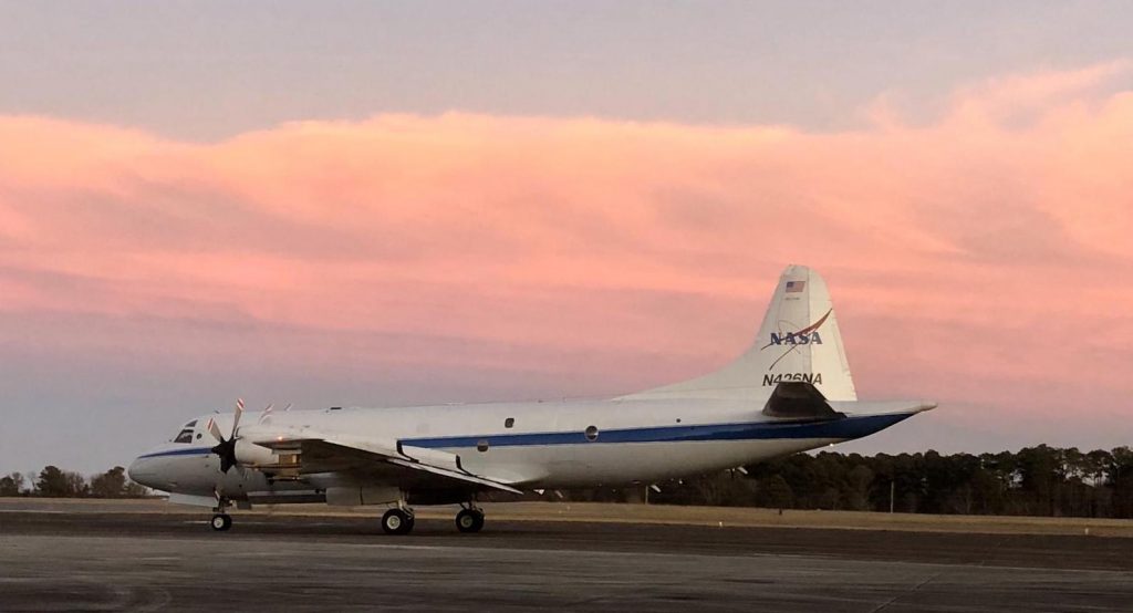
The NASA P-3 Orion on the runway ready for IMPACTS’ second science flight on Jan. 25, 2020, at NASA’s Wallops Flight Facility in Virginia. Credit: NASA/Katie Jepson

By Ellen Gray /NASA’S WALLOPS FLIGHT FACILITY, VIRGINIA/

After a cloudy and rainy morning, by 1:50 pm the sun had come out and the skies were clear for take-off at NASA’s Wallops Flight Facility in Virginia. The P-3 Orion research aircraft outfitted with eleven instruments to measure conditions inside snow clouds was heading north to a storm system over New York and Vermont for the second science flight of the Investigation of Microphysics and Precipitation for Atlantic Coast Threatening Snowstorms, or IMPACTS field campaign.

NASA’s high-flying ER-2 was already in the air. Based out of Hunter Army Air Field in Savannah, Georgia, it had an extra hour to fly so that the two planes—the ER-2 at 60,000 feet and the P-3 starting at 18,000 feet—would arrive at the same time and fly along the same path to make simultaneous measurements.

Three hours before takeoff at Hunter Army Air Field in Savannah, Georgia, ER-2 pilot Cory Bartholomew was helped into his full-pressure suit and breathed pure oxygen to help remove nitrogen from his bloodstream. This process prevents decompression sickness at high-altitudes. Credit: NASA/Katie Stern

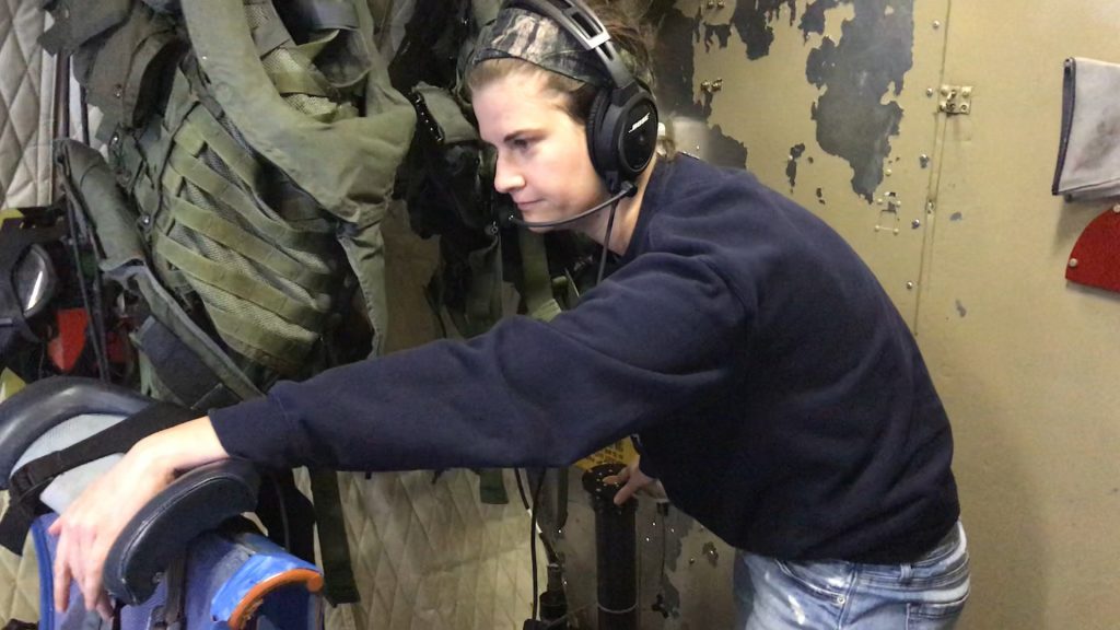
Since we were flying into bad weather, I was worried about a bumpy ride—and we got it. Our flight path led us out over the ocean first to approach Long Island from the south. At thirty minutes after take-off Claire Robinson from NASA’s Langley Research Center prepped the first of two dropsondes to drop from a tube at the back of the plane into the storm over the ocean. A dropsonde is a small instrument package in what looks like a paper-towel roll. It has a parachute and a radio transmitter that sends data on temperature, humidity and wind speed as it falls, giving a vertical profile of the atmosphere from the plane to the ground.

Dropsonde operator Claire Robinson of NASA’s Langley Research Center hangs on to her seat at the back of the plane through turbulence while she waits for us to fly over the drop point. The dropsonde is inside the black tube in the bottom center of the picture. Credit: NASA/Katie Jepson

While Claire was watching her monitor for the plane to be over the right spot, we hit turbulence that made it feel like we were going over bumps on a roller-coaster. It got bad enough we needed to return to our seats in the ten minutes between the first and second dropsondes. The turbulence evened out fairly quickly though, especially once we were back over land where the upward movement of air was less severe. Bumps returned periodically throughout the flight, but it ended up being smoother overall than expected.

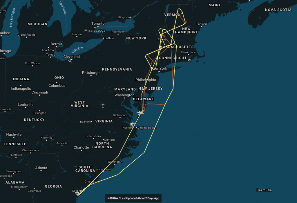
After the dropsondes were away we continued north over Connecticut and western Massachusetts where we turned left to start the first of three bowtie flight patterns, two over southeastern New York and one over Vermont. Bowties are these large triangular patterns that approach the storm from many different angles.

The P-3 flight path is shown in orange. We started out northbound over the ocean and then did the New York bowtie twice, then the Vermont bowtie once before flying home south over Philadelphia. Credit: NASA

The ER-2 flight path is shown in yellow on top of the orange P-3 track. For the majority of the flight the two planes were in a “stacked” formation. Credit: NASA

“The atmosphere is not a layer cake,” said atmospheric scientist Sandra Yuter from North Carolina State University, when I spoke with her before the flight. She’s in charge of plotting the flight paths to maximize the science measurements based on the forecasts two-days ahead of time, which she then sends to the pilots and aircraft coordinators who will iterate on it to make the final flight plan.

The atmosphere is instead more like a cake with a marbled interior—swirls and wiggly lines sliced one way, large patches and different swirls when sliced another. “We’re not expecting the same cross-sections in different parts of the storm,” Sandra said. “Bowties give you those multiple angles.”
At the top of the first bowtie over New York, we started out at 18,000 feet, high above the freezing level (0°C). (About half-way through we descended to 16,000 feet at the request of Air Traffic Control.) Mike Poellot of the University of North Dakota and today’s Flight Scientist, sitting in the cockpit to coordinate between the science team and the pilots, asked over the headset, “Cloud probes what are you seeing?”

Snowflakes flashed by at Greg Sova’s station as the multiple cloud probes imaged snowflakes, water droplets, and ice as we flew through the cloud. Credit: NASA/Katie Jepson

In the main cabin, Greg Sova, a grad student at the University of North Dakota and Starboard Wing Instrument Operator, answered the first of many such check-ins. On his monitor, streams of tiny pictures from his instrument scrolled by. The tiny pictures were of cloud, ice, and snow particles, most less than a millimeter big, that had just been imaged at ~300 mph.

On that first pass of the bowtie, he was seeing from the cloud probes, “Columns and dendrites but a lot of shattering.”

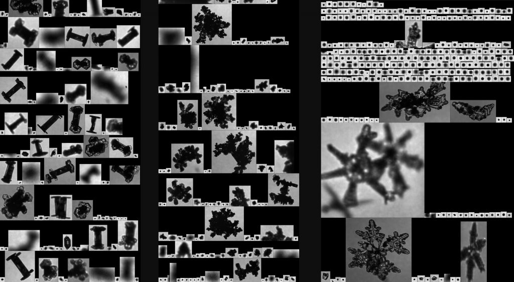
Images from the Hawkeye Cloud Particle Imager throughout the Jan. 25 flight. Left—capped columns. Middle—aggregates. Right—small spheres and dendrites. The cloud probes instruments logged 23,651,553 cloud particles during the 5.8-hour flight. Credit: NASA
Images from the Hawkeye Cloud Particle Imager throughout the Jan. 25 flight. Left—capped columns. Middle—aggregates. Right—small spheres and dendrites. The 2D-S cloud probe instrument logged 23,651,553 cloud particles during the 5.8-hour flight. Credit: NASA

Columns and dendrites are types of snow crystals and were also common in later check-ins as we continued on. So were aggregates, a bunch of snowflakes stuck together in a mass, thin needles, and at lower altitude, spheres that were probably water droplets as we did the second bowtie at lower altitude where the air temperature was warmer. Sometimes it was mix of all three. At times it would switch back and forth as we passed through air with different characteristics—remember that marble cake analogy?

At one point on the northern bowtie over Vermont, Greg reported that we’d passed from seeing more liquid droplet spheres to being back in crystals of snowflake plates, dendrites, with a column or two. Then he added, “And as soon as I said that we’re back into small spheres.”

While the P-3 flew through the clouds, the ER-2 paced us from high above with its suite of remote sensing instruments. The two planes were in sync, for the most part passing over the same legs of the bowties less than 5 minutes apart. Each bowtie took about an hour, and a little after 6:00 pm we dropped to 12,000 feet for the flight home, while the storm system continued east.

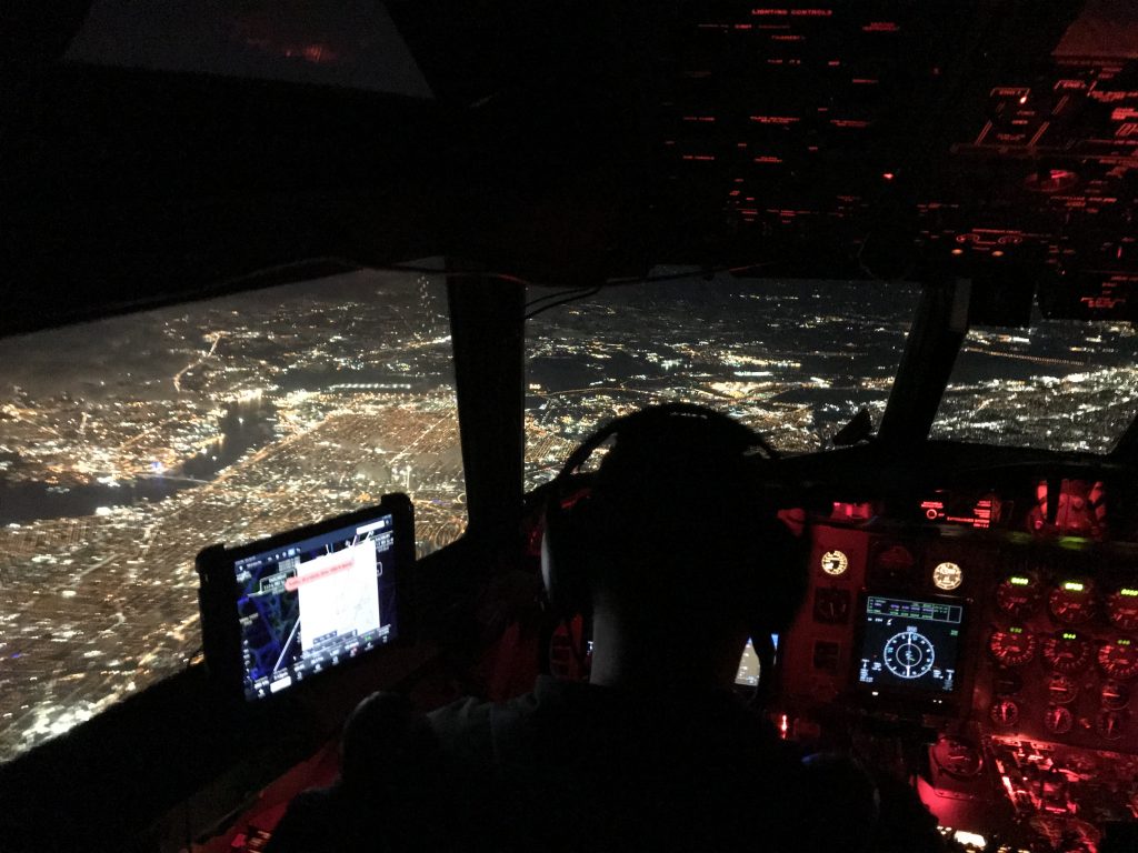
The view of Philadelphia at night from the cockpit of the P-3 on our way back to Wallops. Credit: NASA/Katie Jepson

“I think was good mission,” Mike said when we got back. “The instruments seem to work well, aircraft coordination seemed to go well, and we definitely got into some weather. A lot of precipitation down low that was occurring, and I think it was more along the lines of what we’re looking to do in this project.”

In the days that follow, the instrument teams will begin processing the data they collected, while the forecasters look out for the next storm on the horizon.

Meet IMPACTS’ Student Forecasters

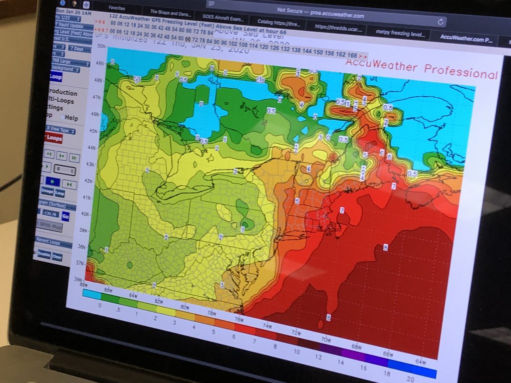
Map of freezing levels - the altitude at which the temperature is 0°C in the atmosphere. This is one of the things forecasters look at to find the snow the fly through and keep the plane safe. Credit: NASA
Map of freezing levels – the altitude at which the temperature is 0°C in the atmosphere. This is one of the things forecasters look at to find the snow the fly through and keep the plane safe. Credit: NASA

By Ellen Gray /NASA’S WALLOPS FLIGHT FACILITY, VIRGINIA/

The IMPACTS team is what makes the field campaign happen. Over 200 people are contributing to the project from aircraft crews and managers, to support and logistics staff, to the scientists running the instruments and asking the big questions. They include veteran pilots and mission managers, university and NASA researchers who’ve done field campaigns before, and graduate students on their first campaign.

Field campaigns provide valuable training and perspective in researchers’ early careers. We caught up with three students who are on the rotating roster for the IMPACTS forecasting team. Their responses have been edited for clarity.

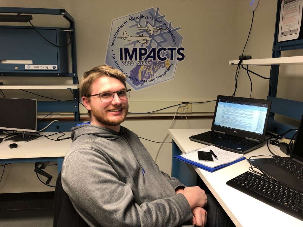
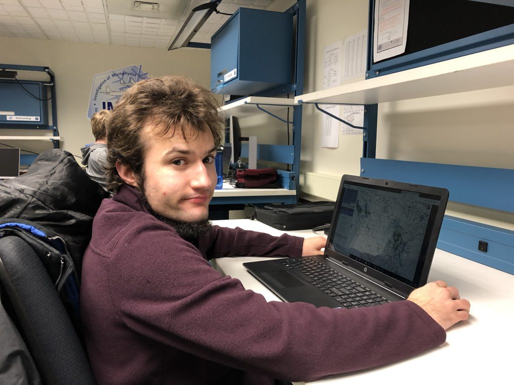
Sebastian Harkema is lead forecaster this week, working in IMPACTS Mission Operations Center just off the P-3 hangar at Wallops Flight Facility. Credit: NASA

My name is Sebastian Harkema. I’m a first year PhD candidate at the University of Alabama in Huntsville. This is my first field campaign in general so I’m super excited about this. I’m actually studying snowfall so I’m going to be using the IMPACTS data as part of my PhD for the next three years. Specifically, I’m looking at thundersnow, so I’m hoping to use some of the instrumentation to look at that and to understand how lightning and snowfall can be used in nowcasting—predicting heavy snowfall, where the models really have trouble in that near-term period where forecasters really need that information.

Being a forecaster is different. Going from research to being an actual forecaster is kind of challenging. Because when you’re a researcher you’re staring at a TV screen or a monitor all day. For forecasting you’re doing that but it’s in a completely different environment. As for my schedule, showing up at 5:45 am in the morning, having to put a presentation together by 8:45 am and presenting at 9 am, that’s a challenge unto itself, let alone trying to understand what is going on in the atmosphere. So I definitely give a lot of credit to all the forecasters throughout the United States, and the world—Props to you guys! It’s a lot of hard work and I definitely appreciate it a lot more than I did in the past.

Ben Kiel in the IMPACTS Mission Ops Center at Wallops Flight Facility. Credit: NASA

I’m Ben Kiel and I’m a Masters student at Stonybrook University in New York. With IMPACTS, I’m helping out with storm forecasts, if there are storms to forecast for. It’s been quite a bit of challenge I would have to say. We were hoping for more storms than what we’ve had so far. It’s kind of funny, most people want good weather, we want bad weather.

This one that we’re looking going after Saturday is one where, if the pattern was more active it’s one we wouldn’t prefer to chase because it’s a messy system. There’s a lot of dry air getting into it. It’s a very warm system. There’s going to be a lot of rain. At least there will be snow aloft. There’s certainly things we can learn from snow aloft, because that’s how this rain is forming as it’s staring out as snow and then falling down and then turning into rain. So we’ll take it.

My main focus will not actually be directly related to IMPACTS. I’m actually working with IMPACTS mission scientist Brian Colle, I’ll be doing a project related to machine learning. It’s a different sort of problem, trying to figure out or explain why our weather models are so variable. We’re trying to find better explanations so that we can pinpoint and improve them. So that’s not necessarily directly related to the IMPACTS project but the data that comes from here will probably certainly get ingested into my work as time goes on. All of these projects end up connected in some way that one acts as a validation for the other. We’ll see what happens there. I’m looking forward to it.

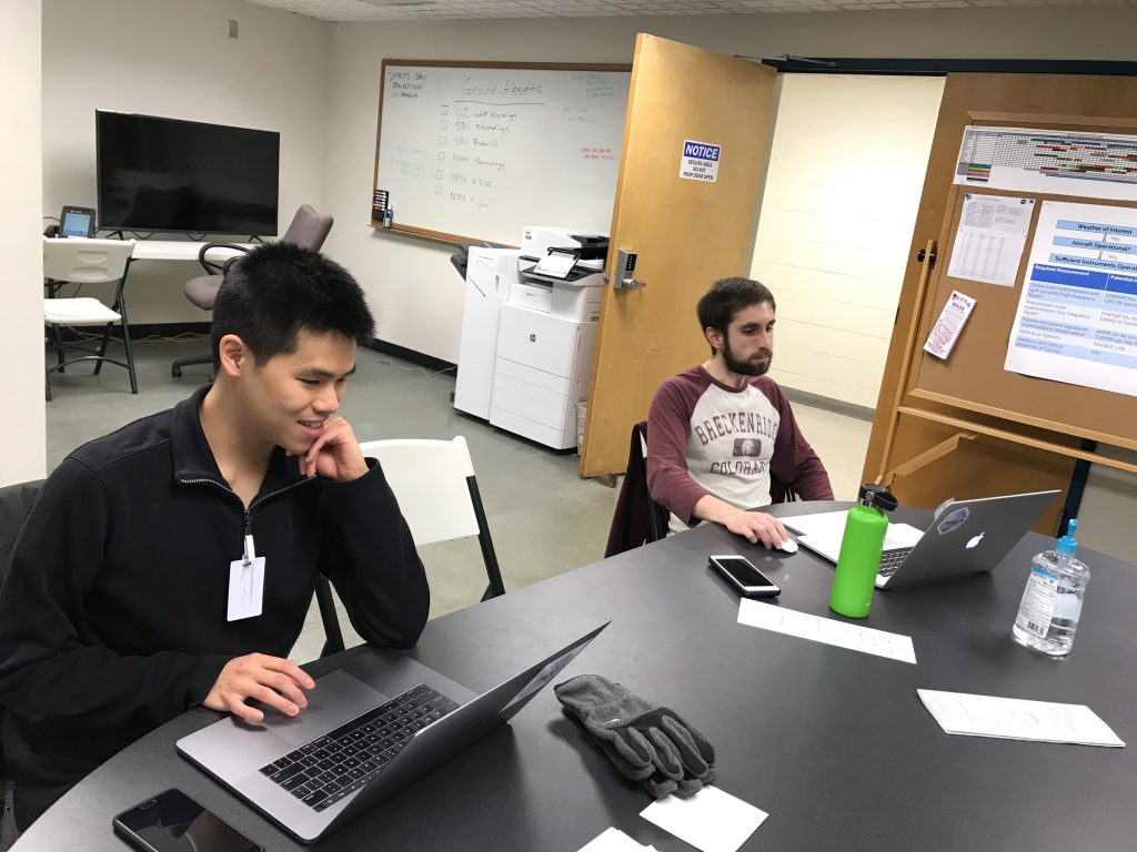
Phillip Yeh and Joe Finlon look at forecasts in the IMPACTS Mission Operations Center, at Wallops Flight Facility, Jan 23.
Phillip Yeh and Joe Finlon look at forecasts in the IMPACTS Mission Operations Center at Wallops Flight Facility, Jan 23. Credit: NASA

My name is Phillip Yeh and I grew up in Parsippany, New Jersey, and I’m currently at Stonybrook University as a PhD student. My focus for my PhD project will likely be using the data that we gather from the IMPACTS project to understand these snow bands associated with these snow storms here in the North East.

I am helping with forecasting for the IMPACTS project. So forecasting involves many things. A lot of it involves looking at the weather models and trying to figure out where the storm is going to be, especially in regard to the timing of the storm, in regard to where the rain/snow line is going to set up, and in regard to where we should be flying the plane. This is my first field campaign. I think the biggest thing I’m looking forward to is the opportunity to fly on the P-3 and the second biggest thing is being able to launch weather balloons, which I’ll do when I leave Wallops and go back to Stonybrook where we’re doing that.

I’ve always loved snow ever since I was young, and often times watched as a snow storm runs too far to the south or to the north and just misses us, or occasionally when the snow hits us perfectly, and also seeing how the forecast models may struggle with getting the location of a storm right.


Waiting for Good Snow

NASA's P-3 research aircraft will be flying through clouds during IMPACTS to study snow. Credit: Joe Finlan
NASA’s P-3 research aircraft will be flying through clouds during IMPACTS to study snow. Credit: Joe Finlon

By Ellen Gray / NASA’S WALLOPS FLIGHT FACILITY, VIRGINIA/

Nothing to be done.

When your field campaign depends on chasing winter storms you have to wait for the weather to arrive in its own time. For the science team of the Investigation of Microphysics Precipitation for Atlantic Coast-Threatening Snowstorms, or IMPACTS, campaign that means carefully watching the weather forecasts and then making the most of it when it arrives.

IMPACTS is a field campaign all about snow. This week, we’re with the team at NASA’s Wallops Flight Facility in Virginia, where the P-3 research plane is outfitted with instruments ready to fly into winter storms over the next six weeks in order to learn more about how snowstorms behave. A second plane, NASA’s ER-2 based out of Hunter Army Air Field in Savannah, Georgia, for the campaign, will fly high above the clouds with satellite-simulating instruments aboard to measure the snow clouds from above.

One of the big questions is why do snow clouds organize themselves into bands of heavy and light snow fall? The ultimate goal is to improve forecasts of where and how much snow will fall, especially over the densely populated U.S. East Coast where storms are nicknamed “Snowpocalypse” and “Snowmageddon” because of the disruption they can cause.

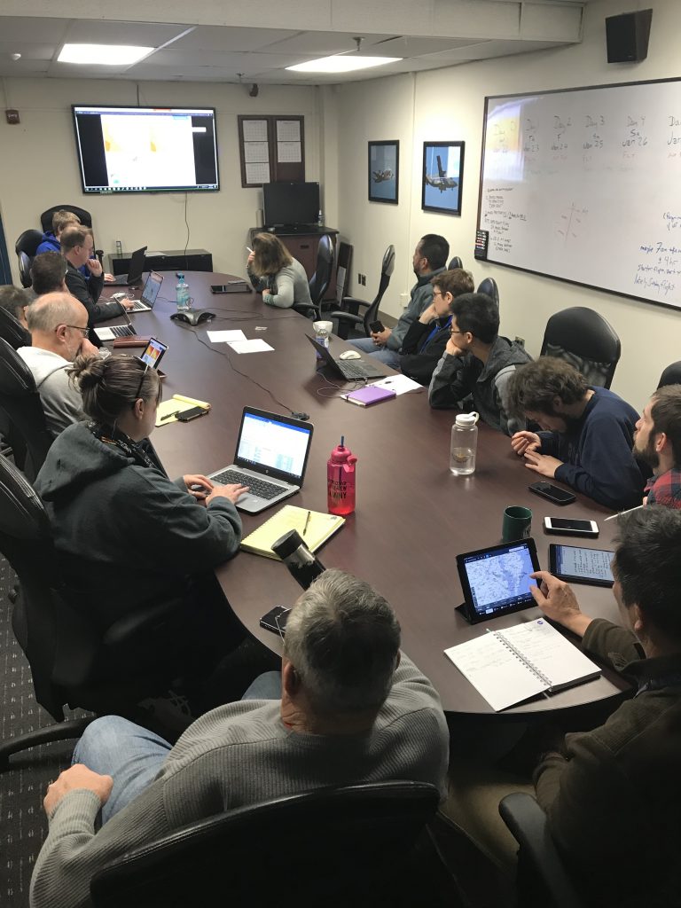
IMPACTS' 9am weather briefing on Jan 22 where the team discussed the upcoming snowstorm. Credit: NASA/ Katie Jepson
IMPACTS’ 9am weather briefing on Jan 22 where the team discussed the upcoming snowstorm. Credit: NASA/ Katie Jepson

At the daily 9:00 am weather briefing on Wednesday, the team looked at several different weather models – the same ones used by the National Weather Service, the Weather Channel and other forecasters – to find the next storm they want to target.

“High pressure is finally moving out! Whooo!” said Sebastian Harkema, the lead forecaster, to open the briefing.

If you’re familiar with your local weather news, high pressure usually accompanies sunny skies and clear conditions – the opposite of what the science team is looking for. Instead they’re interested in flying into the bad weather. And there’s a developing storm system that will move across Pennsylvania and up toward Massachusetts, New York and Vermont on Saturday and Sunday.

The big question of the day is, do they schedule one flight through it, or two on back-to-back days?

The advantage of flying twice would be more data collected. However, the human factor of flying two days in a row means that between flights is a 12-hour mandatory crew rest, so the timing of the second flight may not be the best time to sample the second part of the storm – and there’s a chance that the snowing part of the storm may have passed by the time they get out there.

The advantage of doing one flight is that the science team can pick the time and place they think will have the best snow.

The other logistical consideration is the mobile team of researchers from the University of Illinois, Champaign-Urbana, who are driving their vehicles on highways and back roads to be below the storm while the P-3 and ER-2 aircraft fly above it. From the ground they are sending up balloon sondes – instruments to measure the temperature and humidity from the ground to the clouds. They’d likely only be able to make one of two locations, since they’d have to drive through the very snow or cold rain the science team was measuring to get to the second spot three states away.

Forecasting the upcoming weather is a one of the most important jobs for planning flights for IMPACTS. Credit: NASA / Katie Jepson
Forecasting the upcoming weather is one of the most important jobs for planning flights for IMPACTS. Credit: NASA / Katie Jepson

In the end, the team waits for the next run of the models, which come out every 6 hours, before making a decision. At the times and locations that look the most promising – Central Pennsylvania, the tri-corner where Massachusetts, New York and Vermont meet – they look at how wet or dry the air is and the likely temperatures, trying to discern the best spots to sample snow.

“It’s a messy storm,” said IMPACTS Principal Investigator Lynn McMurdie of the University of Washington. The temperatures are on the warm side, and there’s indications of tendrils of dry air throughout, which can stop precipitation. It’s unclear in some spots whether they’d find rain or wet snow.

The verdict: one flight on Saturday to pick the best time and place. Three days out, they’re looking at Vermont, but they won’t make any final decisions until they have a better forecast to help narrow the timing and location down in the next day or so. Still, the flight planners are already working up a preliminary plan so they’ll be ready to refine it when conditions become more clear tomorrow.