Skier, Mountaineer, Snow Scientist: In the Field with the Women of SnowEx

By Gabrielle Antonioli, Montana State University /BOISE, IDAHO/

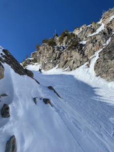
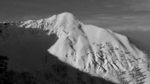
“Watch me,” I say to Megan as I tip my skis over the edge of snow at the top of a steep gully in the southern portion of the Sawtooth Mountains in Idaho. She nods knowingly from the ridge above. Not letting her eyes leave me, she watches as I quickly pop off my skis and get my shovel out of my backpack to dig a snow pit. Though this pit is smaller than the snow pit we dug the previous day at the Banner Summit weather station and radar site, it gives us a similar glimpse at the structure of the layered snow under our feet. After a quick test to assess the strength and stability of the snowpack as well as look at the overall structure of the top meter of snow, I determine the snow looks stable (which means the risk of avalanche is low) and we start our ski descent down the narrow snow gully. 
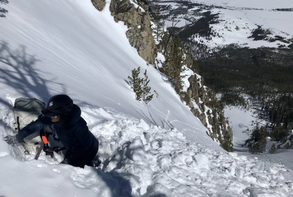
abrielle Antonioli assessing the snow atop the Elevator Shaft ski line in the Sawtooth mountains of Idaho.
The other side of snow science: Gabrielle Antonioli assessing the snow atop the Elevator Shaft ski line in the Sawtooth mountains of Idaho in March of 2021. Credit: Megan Mason

The intersection between scientists who study snow and those who are fascinated with mountaineering and avalanches is an interesting one, to say the least.  Like many other Earth sciences, we must venture out into the element of study and observe it carefully and with a curious mind to start to understand the complex dynamics by which it operates.  And though the snow-centric field of cryosphere science is infinitely interesting, it is an intimidating path to choose. Women in cryosphere sciences – whether on the path of data scientist, glacier researcher, or avalanche forecaster – are few and far between. I met like-minded women like Megan Mason and Isis Brangers when I joined HP Marshall’s Cryosphere Geophysics and Remote Sensing group (CryoGARS) at Boise State University and the NASA SnowEx 2020-2021 campaign he led as co-project scientist. Isis is currently finishing her Ph. D. with the CryoGARS group and previously worked on a project studying snow depth over the European Alps with the European Space Agency’s Sentinel-1 satellite. Megan is currently a research scientist for NASA’s Goddard Space Flight Center. 
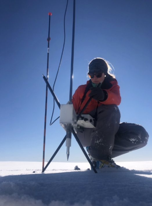
Megan Mason using an SMP on the Grand Mesa SnowEx campaign in 2020, photo: C. Hiemstra.

SnowEx campaigns utilize traditional snowpit observation techniques alongside techniques aimed at being able to monitor and infer properties about the snow from afar. These include Unmanned Aerial Vehicles (UAVs), light detection and ranging (LiDAR), SnowMicroPenetrometry (SMP), liquid water content sensors, ground-penetrating radar, and airborne inferometric synthetic aperture radar (InSAR).
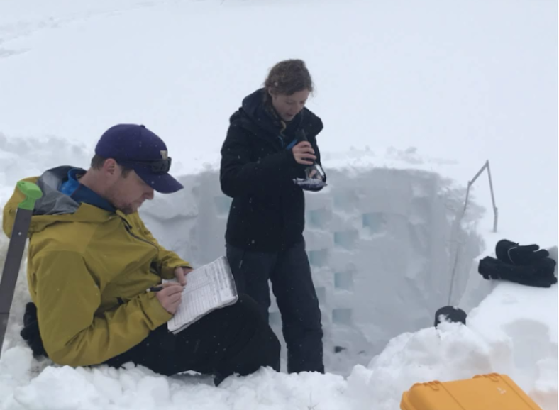
HP Marshall and Isis Brangers doing a full snow pit profile. Credit: Megan Mason

Remote detection of snow water equivalent (SWE) – or how much liquid water a snowpack contains – has long been a goal of hydrologic scientists. SWE is important to other branches of the snow world, like avalanche control and forecasting, which attracts a variety of scientists with specialized skill sets that enable them to reach mountain locations in winter. This work is challenging and involves risk, and I’m continually inspired by the women I meet that can troubleshoot a faulty weather station, dig a full profile science snow pit in a blizzard, and handle adversity of any kind with positivity and determination.
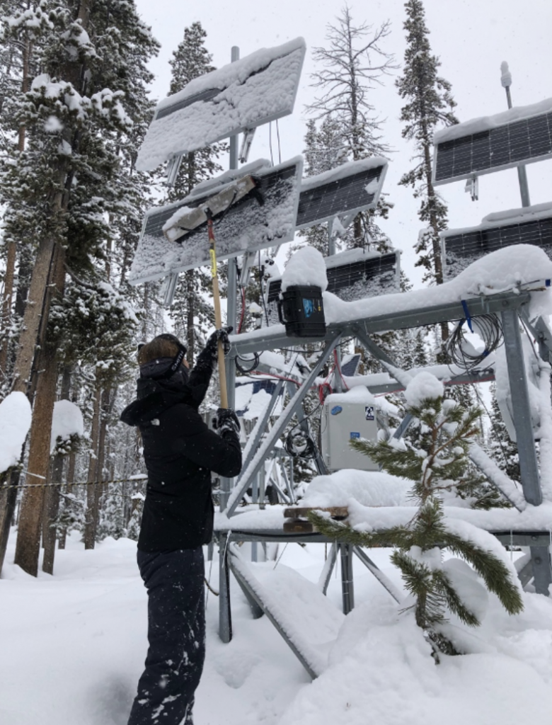
Isis clearing the solar panels on a radar station.
Isis clearing the solar panels on a radar station at Banner Summit, Idaho. Credit: HP Marshall

Large hydrology-focused projects like SnowEx can directly benefit the snow and avalanche community, and subsequently many economies across the mountain west. This is where the intersection between backcountry skier and snow scientist occurs. Mapping SWE throughout a mountain range in real-time would shift the entire landscape of forecasting for both snow hazard and spring water run-off monitoring. Currently, these monitoring efforts are based on using index sites such as Snowpack Telemetry sites, or SNOTELs, combined with historical knowledge and experience, to help extrapolate how much water the snowpack holds.  Even with current technology, precipitation estimates are relatively unreliable in some places and can be highly uncertain in both amount and type of precipitation. With remote sensing technologies like those being tested with SnowEx, and the women behind the scenes working to improve these technologies, we can fill that gap.
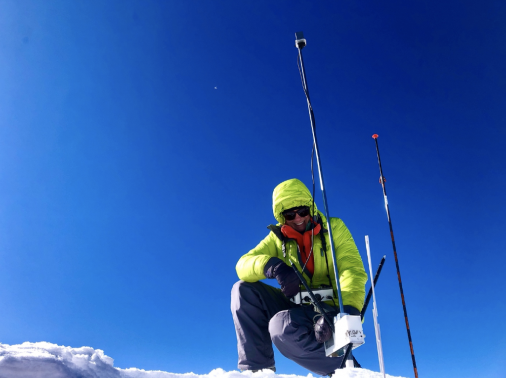
Megan Mason in the snow in Grand Mesa.
Megan Mason on the Grand Mesa 2020 campaign. Credit: K. Hale

The focus of the 2021 SnowEx airborne and field effort in Idaho was part of an experiment at sites in the Boise and Sawtooth mountains, in addition to sites in Utah, Colorado, and Montana. Radar sensors were flown at 40,000 feet each week across all sites from January through March, producing a time series. The sensor that was used has shown promise for mapping changes in SWE and a similar sensor may one day be launched into space in 2023 by a joint NASA and Indian Space Research Organization satellite mission called NISAR.  

Though the 2022 SnowEx campaign was canceled due to COVID-19 concerns, data collection continued at ground-based radar station sites and helicopter LiDAR flyovers continued over these zones. This data is key to refining remote sensing technologies for snow. Collecting data that is both accurate over large areas and sampled at frequent time points is important because accurate snow data estimations require that our instruments are precise. 

Snow research is a challenging field to enter, but barriers to that entry are getting lower. Women like Isis and Megan forge a path for others to enter the field with less resistance and support to reach even further. Snow’s ability to serve as a water reservoir is shifting beneath our feet due to climate change, whether we sense it or not.  Disparities in weather patterns, rising rain lines in the mountains, and unpredictable climate patterns are at our doorstep.  Research like the NASA SnowEx campaign is key in developing new tools to observe these environmental changes.  Our efforts to synthesize and utilize new and non-traditional tools as well as offer a diverse and supportive workplace can help us better understand the past and the changing future. 
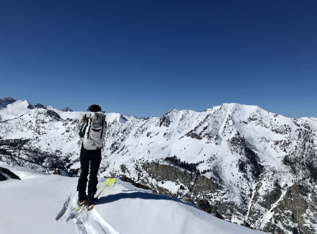
Gabrielle looking into the Sawtooth Range in Idaho.
Gabrielle looking into the Sawtooth Range in Idaho in March of 2012. Credit: Megan Mason
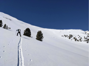
Gabrielle setting a trail on skis.
Gabrielle demonstrating some of the more unique skills of snow science– setting a good trail! Credit: B. Kniveton
Megan Mason skiing the Elevator Shaft in the Idaho backcountry.
Megan Mason skiing the Elevator Shaft in the Idaho backcountry. Credit: Gabrielle Antonioli


SnowEx: Little Blogs from the Prairie – Part 2

Madeline Beck, Undergraduate Student in Environmental Science, Montana State University

Being part of a NASA research team is an exciting experience! Knowing our work will correspond with further research endeavors and help validate remotely sensed measurements makes us feel like part of a greater effort and team.

The research site is in a beautiful part of Montana. It feels remote and reminiscent of earlier times, and it is a new area of science for most of us. Being a part of larger research is always exciting and offers opportunities to learn and expand on our own knowledge and being able to do so in such a different, harsh environment offers new challenges that we must work through.

The exposed landscape and high winds of prairie environments create drifts, buried ice and other challenging features for the SnowEx team to investigate. Credit: GEOSWIRL / Montana State University

When we show up to do research, we often must adapt to the day’s weather conditions. While some field days are sunny and warm with a light breeze, others have been frigid with wind too loud to hear others speak. This is one of the most difficult, but most gratifying, parts of fieldwork and causes you to think on your feet. Our field duties include digging snow pits and taking the full suite of pit measurements, walking snow-depth transects with a probe and GPS unit, assisting other students with UAV flights, and downloading data from the many sensors.

While many of us in the class had dug either snow or soil pits in the past, none of our previous experience was able to prepare us for the snow we found at the research site. “Ice” is a better word for the “snow” that we found, and even a day after new snow fell at the site, the snow became hard and solid. We also found ice layers in the snowpack from periods of melt and refreeze. Digging the pits themselves, although all relatively shallow, proved to be back- or shovel-breaking work! It was interesting coming from a background where I had dug snow pits for research or recreational use, and seeing how different the layers and characteristics of snow pits at a plains research site could be.

Depth transects were an informative way to see how variable snow accumulation and retention were across the different field types. In areas of high stubble, snow was retained longer and in greater amounts. However, field’s location was also important due to a windbreak on the western edge of the field that kept snow from being blown around so much. Additionally, helping other students and researchers with UAV flights was beneficial, and although I fly UAV’s frequently for my own research, the research site’s harsh environment added more factors for the flights to go wrong, and quick troubleshooting was required to keep operations going. Lastly, learning to operate scientific loggers and make sense of the data collected was a great skill to gain. Seeing how raw data is collected and transformed to make sense of the readings was beneficial because we could then connect the data we had collected to the environment we had seen in person.

Learning in a field environment is drastically different from a classroom setting and helps you learn to adapt quickly and efficiently. In a classroom, you can plan in extreme detail, but something always seems to go against the plan while at a field study. However, having the skills to adapt and remain levelheaded is something you can only pick up through conducting research, and it is a skill that takes time to acquire. This project has helped me better plan for the unexpected and not let malfunctions impede my ability to continue carrying out research. It has also taught me the importance of working with others across different academic and scientific disciplines and that every individual brings a unique and beneficial perspective to the table. I know the ability to develop these friendships and contacts so early in my own academic career will benefit me for years to come and will help me become a better researcher myself. Being a part of the NASA SnowEx team has been an influential and enjoyable opportunity, and I look forward to seeing where these experiences will take me in the future.
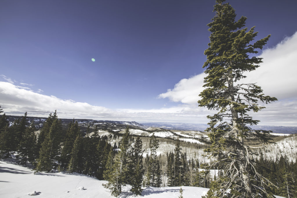
Max Smay, Undergraduate Student in Earth Sciences, Montana State University

Being part of the NASA SnowEx project has been a very cool and unique experience compared to classes I have taken. It is cool to know we are part of a larger effort affecting real-world applications. Learning how this type of work takes place in the “real world” has also been very valuable to me and motivated me to find similar applied, hands-on work after getting my degree.

The days in the field are coordinated and busy, but they have not been very stressful or overwhelming. Our team seems well suited to assigning the day’s tasks and everyone seems to be having fun. My favorite parts of the field days have been reconvening and talking about what difficulties and successes everyone had in the field, and learning about new ways to collect and process data. When we’re done collecting data, I am usually dog tired and have some relaxing evenings as I appreciate being out of the cold. Learning in this environment is great compared to a classroom: first because there is much more autonomy, and second because we get to be outside and active.

With COVID, it has been harder to make connections and friends in the classroom, so this project has been a welcome way to connect with peers in a more active environment. I have been very appreciative that I get to take this class because of this, and the reasons mentioned above!

Mitchell Burger, Undergraduate Student in Earth Sciences, Montana State University

Being a part of a NASA research team is an amazing opportunity to get experience collecting data in the field and learn about the intricacies of a large-scale research project like SnowEx. It has brought us out to a part of Montana that we may not have seen before or thought about if we were to drive through the area. After some field days at the CARC in Moccasin, I have a new respect for and curiosity about prairie landscapes and their processes. Before going to the study site, I thought collecting data there would be straightforward and simple, but quickly learned it was anything but simple. It has been so cool to see the effects that wind has on snow cover in this environment and think about its repercussions for the hydrology of the area.

A day at the CARC begins with a nice drive from Bozeman to the center of Montana, where the CARC is located. Once there, we go over the plans for the day, which were settled upon in class earlier in the week. We all then go out and complete our tasks, such as digging snow pits, checking on the soil moisture sensors, doing snow depth transects, and helping with UAV flights. Doing snow depth transects has been my favorite part of the fieldwork, as I get to see the variability of snow depth across the different crop types firsthand. Once everything is done for the day, we all caravan back to Bozeman.

Learning out in the field is different from the classroom in that we learn from what is around us and talk about processes that are occurring while we are there. For example, before we dug our first snow pits on “the berm”, we discussed why it was covered with so much debris and how the debris may have increased snow melt until it was covered with snow again. When digging snow pits in any location, I always try to learn something new from the snowpack. In this environment though, we encountered some very unique snowpacks, and I think it forced many of us who are used to mountain snowpacks to step out of our comfort zones and ask new questions.

Caitlin Mitchell, PhD student in Land Resources Environmental Sciences

It is interesting to try to distinguish between working on a NASA research team and any other research team. Some noteworthy items are the safety forms and instruction protocols, as well as the data record-keeping guidelines. The latter is interesting because it’s a constant reminder that the data we collect is part of a greater dataset – one being culled for ease of transcription and interpretation by project members outside of the group we work with in the field. It creates a sort of data language that we all share. Curating and documenting data products is also a focus of my primary research project (NSF MT EPSCoR CREWS). With “big data” becoming more commonplace, it makes sense that these items, or aspects of them, are a focus across different government-funded research projects.

A day in the field on the NASA SnowEx project for me, as a student with additional motivations to investigate snow in prairie environments, includes taking samples of snow at points where we map snow depth across the site and in snow pits we dig. I am interested in the water isotopic values of the snow and how they change over time and space in a prairie environment, with the motivation to better understand snow contributions to soil water for crop uptake and nutrient cycling. The samples I collect are analyzed in the lab isotopic values of the hydrogen and oxygen atoms that make up the snow water molecules. The variation in these values tell us about the origin of the water molecule as well as transformation processes it may have undergone, such as sublimation.

My favorite part of the research so far has been seeing and feeling the changes in snow depth and density along these transects as I walk them. I look forward to placing the water isotope value results at the GPS locations they were sampled to see if and how the snow is changing chemically across this landscape. I have always been a more visual learner, so witnessing things unfold in real time and experiencing them in the field really resonates with me and enhances my understanding of what is going on in the environment. Experiential learning opportunities like this one, and like most research that involves field sampling and collection, are incredibly valuable for building relationships among the people involved, as well as building a robust skill-set from accurate data collection to interpretation and understanding for each individual.

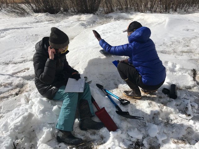
SnowEx researchers Caitlin Mitchell and Marika Feduschak investigate the physical characteristics of the shallow prairie snow. Credit: GEOSWIRL (Geospatial Snow, Water & Ice Resources Lab) / Montana State University
SnowEx researchers Caitlin Mitchell and Marika Feduschak measuring the physical characteristics of the shallow prairie snow. Credit: GEOSWIRL (Geospatial Snow, Water & Ice Resources Lab) / Montana State University

Ross Palomaki, 2nd year PhD student in Earth Sciences

I have really enjoyed working at the CARC SnowEx field site. Most of my personal and research experience with snow has been in the mountains, and this prairie site has offered a new perspective on snow as a water resource. Seeing and measuring the drifted snowbanks in person has prompted some interesting discussion on spatial variability and sensor resolution.

There is not really a “typical” day at the CARC – most of our activities are dictated by the weather. I am part of the unmanned aerial vehicle (UAV, or drone) operations team, and our Structure-from-Motion photogrammetry (using photography to map distances between objects) flights have been shut down numerous times by wind and blowing snow. It’s a great feeling to get a clear and (somewhat) calm day up there and complete all the planned flight missions.

I am looking forward to the upcoming data analysis, especially the opportunity to compare our site to the sites in the mountains. Hopefully we will have the opportunity to meet our fellow SnowEx teams in person someday.

SnowEx: Little Blogs from the Prairie – Part 1

Like so many other things, NASA’s SnowEx 2021 looks a little different than usual this year. But one thing is business as usual, and that’s the participation of undergraduate and graduate students.

Students play a pivotal role in SnowEx, from suiting up for data collection to crunching the numbers afterward. The field sites become a classroom for the students too – as they measure, record, process and analyze real data, they learn skills for their own research work.

We invited some of the students from Montana State University to share their experiences in this year’s campaign at the Central Agricultural Research Center (CARC) site. In addition to sharing what their typical days in the field look like, they shared some of the new experiences and discoveries they’ve had, and what they’re enjoying most.

Dr. Eric Sproles, Assistant Professor of Earth Sciences, Montana State University, Site Lead

Wow – this NASA SnowEx project has provided some amazing opportunities for hands-on learning for students and investigators alike. The snow-centric research at Montana State University has primarily focused on mountain snowpacks. Working in the prairie is different in many ways. First, it is much more variable than I imagined. Because of wind and vegetation, snow drifts can be over 3 feet deep in one location, and only 20 yards away you find bare ground. This allows you to really think about the effects of wind and vegetation in this food producing region of the world.

Secondly, measuring the snow in these areas is incredibly challenging, and makes you rethink the way you usually do things. Being forced out of your comfort zone has helped broaden my perspective as a scientist and mentor. We have some amazing students at Montana State, and in these types of hands-on environments, I think I learn as much from them as they do from me. 

Leading this SnowEx project has allowed me to better connect with fellow SnowEx Leads, and also other scientists from across the United States with an interest in prairie snow. These professional relationships underscore the value of team-based approaches to big-picture science.

Andrew Mullen, Master’s Student in Earth Sciences, Montana State University

The 2021 SnowEx field campaign has been a unique experience because I have never before participated in such a widespread, coordinated field data collection effort with so many different moving parts. Although we are physically distanced from the other research groups, it feels like we are part of one cohesive effort with the same objectives in mind. We are collecting a vast array of data types using a variety of methods, and I have enjoyed thinking about how we can link different types of data to answer specific questions. Our work here feels meaningful because this data is being used to develop and validate tools and methods that will improve how we monitor snow across the globe for years to come.

My role at the CARC field site has mainly been in conducting UAV-based broadband albedo (reflectivity) surveys of our 1 km x 1 km study area. With these UAV flights, I am mainly interested in observing the spatial variability in albedo across the field area that is composed of many different types of crop cover and microtopography that have a significant impact on the distribution of snow and snow properties. I have also been a part of the manual snow surveys (snow pits and snow depth transects, or predefined lines we measure along) where we are able to observe this variability firsthand.

The nature of this landscape forces you to think differently about processes of snow accumulation and loss that don’t get much attention in the literature. I feel that there is a lot of potential for new and impactful discoveries and insights to be uncovered here, with the quantity and quality of data we are collecting in this landscape that composes such a large portion of the Earth’s land surface. Something I have taken away from this field campaign is an appreciation for this type of landscape both in terms of the complexity in processes as well as its natural beauty.

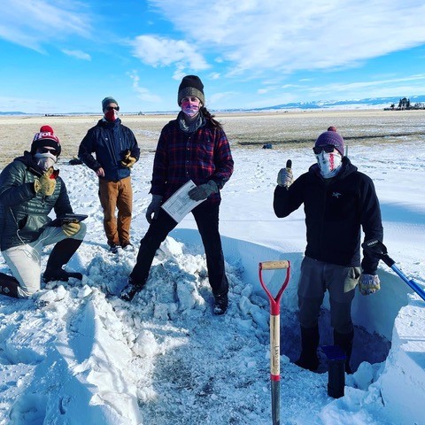
SnowEx researchers Andrew Mullen, Eric Sproles, Caitlin Mitchell, and Ross Palomaki finishing up a snow pit profile. Notice how the snow goes from 3 feet deep to almost nothing over relatively short distances.
SnowEx researchers Andrew Mullen, Eric Sproles, Caitlin Mitchell, and Ross Palomaki finishing up a snow pit profile. Notice how the snow goes from 1 meter (3 feet) deep to almost nothing over relatively short distances. Credit: GEOSWIRL / Montana State University

Guy Brisman White, Undergraduate Student in Earth Sciences, Montana State University

It is a very cool experience to be a part of something that is being used for a larger purpose. As an undergraduate student, I feel that a lot of the work I do is basic and mostly for my own education, so I am happy to contribute to a larger project like SnowEx. Another key experience is learning how data is collected. I have used many different data types throughout my college career, and seeing firsthand how hard it is to record quality data made me appreciate many of the sources I have taken for granted.

Our typical fieldwork days include a long but beautiful drive on often snowy and icy roads. Once we arrive at the site, we have a quick meeting to lay out the fine details of the plan and break into different pairs or groups to complete the tasks. Snow pits were labor-intensive but familiar to me, so I spent the most time working on them. Just a few of the other great learning experiences I had included obtaining weather data from stations, transects, and learning about collecting albedo with drones.

Kendall Wojick, Master’s Student in Land Resource and Environmental Science, Montana State University

Being a part of a NASA research team has been an amazing opportunity to test my fieldwork and teamwork skills in a new setting. I enjoy the responsibility and organization of the data recording set up by NASA. Seeing how they structure their data documentation has improved my personal data housing practices for my graduate studies.

A day in the field for us looking at prairie snowpack is really fun and unique compared to the other mountainous sites in this study. While we don’t get to ski in to our sites, we do get to interact with a beautiful prairie landscape and laugh at how impressive and unexpected the pits we dig are. With the residual berms (flat ridges) of snow that build up near large windbreaks, there are some hefty ice lenses (“bubbles” of ice in rock or soil) from months of melt and freeze patterns that we have to bust through. In order to break through these thick lenses, we even had to employ a “Montana Sharpshooter”, a weighted spade-shaped shovel, that was invented to bust through gravelly concrete-like soils in central Montana. It is always a team effort and a lot of fun to dig and study these pits. I am a soil scientist by trade, so it is an interesting thought experiment to compare how the temporary layers of snow develop compared to the longer-lasting layers of soil. I’ve realized how much snow is truly present on the prairies and what a difference capturing it with wind breaks and stubble can make for dryland agriculture. I feel that the prairies often get overlooked when it comes to snowpack so I am excited that it is included and appreciated in this study.

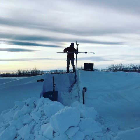
“This is what happens when you are expecting 75 - 90cm (2.5 - 3 feet) of maximum snow depth, and you get 200 cm (6 feet),” said Eric Sproles, site lead for the Montana SnowEx location and assistant professor of Earth Sciences at Montana State University. SnowEx researcher Zach Miller adjusts his instruments to compensate.
“This is what happens when you are expecting 75 – 90cm (2.5 – 3 feet) of maximum snow depth, and you get 200 cm (6 feet),” said Eric Sproles, site lead for the Montana SnowEx location and assistant professor of Earth Sciences at Montana State University. SnowEx researcher Zach Miller adjusts his instruments to compensate. Credit: GEOSWIRL / Montana State University

After a long day of collecting data – which involves a three-hour drive for us – I love getting to know my research partners better, often playing bluegrass on the drive home with a chance to take in the beautiful Montana landscapes. There is something about a shared passion for these landscapes and the open road that opens people up so we can joke, laugh and discuss everything from silly stuff to deep existential ideas about life and existing on this floating ball of water and rock we call Earth. This NASA project is about as close as I’ll get to being an astronaut, but it does make me think about the incredible progress we have made in remote sensing since NASA was formed in the 1950’s and how it has truly moved forward one small step at a time. Every aspect of a pit we collect seems so small in the moment, but when we repeat that a few hundred times, we have something robust. I can’t wait to see the results of this field season and the accuracy of the SAR sensor, and how this mission moves our collective capabilities forward.

Lightspeed: A Marvelous Method for Measuring Mountain Snow

By Dan McGrath and Randall Bonnell, Colorado State University /CAMERON PASS, COLORADO/

The word lightspeed conjures different images for different people. Star Wars fans may connect lightspeed to the Millennium Falcon, while radar scientists may think of the velocity of electromagnetic energy. Radio waves, a form of electromagnetic energy, travel at “lightspeed” through a vacuum, but when they encounter snow, they slow down drastically.  Sounds bad, right?  It might be if you’re trying to get somewhere fast, but if you’re trying to measure the amount of snow on the ground, it’s just what you’re looking for.

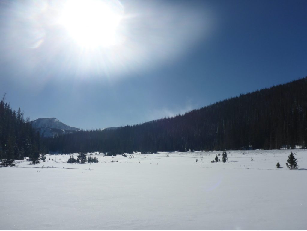
The field site at Cameron Pass, Colorado.
The field site at Cameron Pass, Colorado. Image courtesy of Lucas Zeller.

Over the past four months, our team from Colorado State University, along with teams across the western United States, has been tramping around in the snow each week trying to figure out just how much those radio waves might be slowing down. Why? In 2021, the NASA SnowEx campaign is focused on testing the use of airborne L-band Interferometric Synthetic Aperture Radar (InSAR). In this method, an instrument aboard a plane sends out radio waves to measure changes in snow-water equivalent (SWE) – or the amount of water stored in the snowpack – down below. The basic premise of this approach is that as more and more snow accumulates on the ground, it takes a radar wave longer and longer to travel from the aircraft, through the snow to the ground, and back to the aircraft. Each week, the NASA Uninhabited Aerial Vehicle Synthetic Aperture Radar (UAVSAR) team flies a plane overhead to collect InSAR observations of the snowpack. Meanwhile, we collect ground observations to document changes in snow depth, SWE, and other characteristics of the snow to help evaluate InSAR as a way of measuring SWE.

There are a lot of different ways to measure snow on the ground. You can probe it to measure its thickness or temperature, you can dig through it to measure its mass and density, and you can employ all kinds of fancy equipment to measure things like the surface area of grains of snow, or spectral reflectance. But trying to determine any of these details on a global scale from instruments in space becomes much more difficult.  Even a fundamental question, like how much SWE is in a basin, can be difficult to answer.

Radio waves might be one answer to this difficult question. As radio waves travel through the snowpack, their velocity depends on the density of the snow. For example, denser snow means the radio waves will move more slowly. If we can measure the travel time (or phase, more on that later) of those radio waves very precisely, we can calculate SWE accurately. For these reasons, the SnowEx21 campaign is an exciting campaign – but what makes it even more important is its applicability. In 2022, NASA and Indian Space Research Organization (ISRO) will launch NISAR, a space based InSAR mission. It will carry a L-band (1-2 GHz frequency) radar instrument, meaning that those slow radar waves we’re evaluating from UAVSAR will soon be making the trip from space!

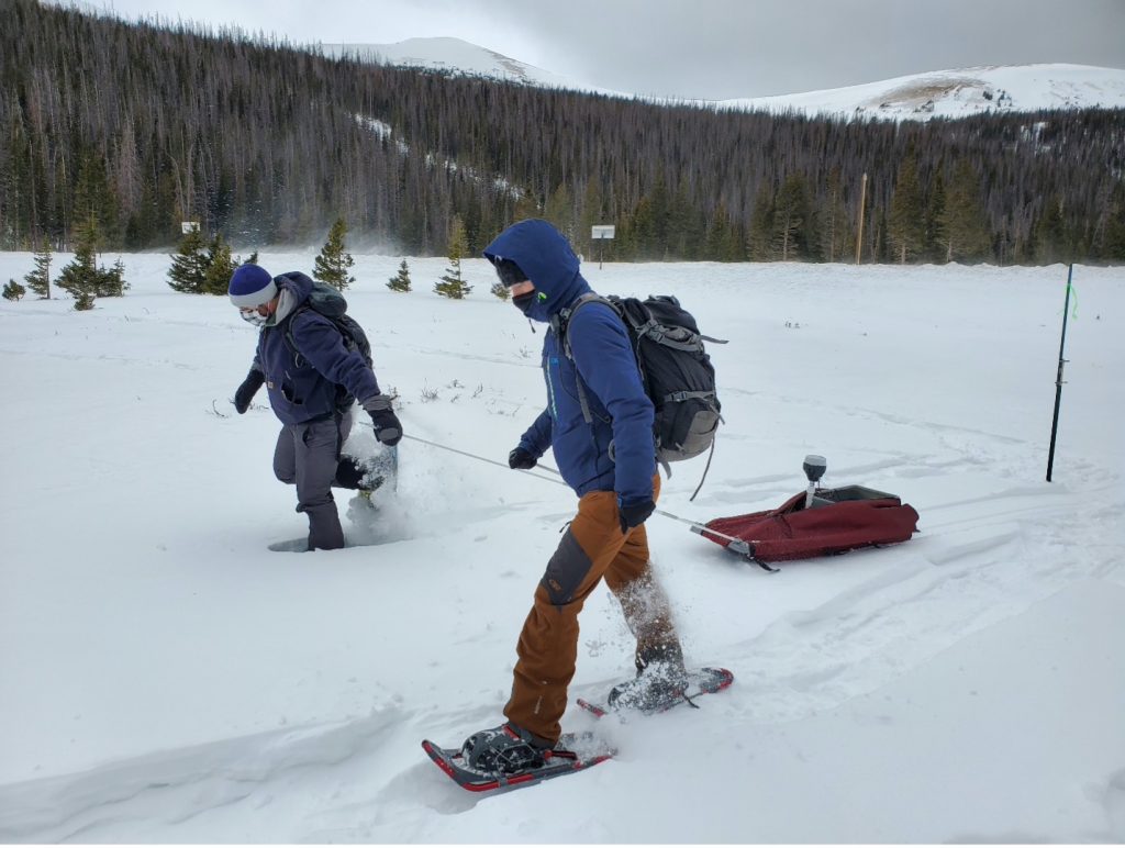
Two scientists trek through the snow to a site in Cameron Pass, Colorado.
Randall Bonnell (left), PhD student at Colorado State University, and Lucas Zeller (right), Master’s student at Colorado State University, pull the GPR sled at Cameron Pass, Colorado. Credit: Alex Olsen Mikitowicz

During the SnowEx21 Campaign, our team has been making weekly trips to Cameron Pass, a site at about 10,000-foot elevation about two hours west of Fort Collins, Colorado.  One of the key observations we made each week was repeat ground-penetrating radar (GPR) surveys along multi-kilometer transects. GPR works by transmitting a radar pulse into the snow and measuring the two-way travel time and strength of the returning signal to produce a radargram. These surveys are particularly valuable for evaluating UAVSAR, as there is significant overlap between the methods.

We dig snow pits and measure the density of the snowpack to determine a velocity for converting the GPR-measured travel time to depth and SWE. By taking repeat measurements in the same areas week after week, we can measure a change in travel time, snow depth, and SWE between each interval, thereby providing a direct comparison to what UAVSAR is measuring. UAVSAR and other InSAR-based approaches measure changes in phase (a portion of an electromagnetic wave) between two subsequent radar acquisitions. This change in phase, on par with the change in travel time for our GPR instrument, is the key to detecting changes in SWE. However, phase changes are inherently complex and there is still much to discover regarding their interpretation. That is where other ground observations come into play.

A radargram showing the snow surface and the ground surface.
Example of a processed radargram collected at Cameron Pass, Colorado. The red line highlights the picked ground surface, comprising the soil, rocks, and vegetation that the snow sits on. The top of the radargram is the snow surface. Credit: Randall Bonnell

Each week, we dug snow pits at two different sites to measure density, stratigraphy, and temperature of the snowpack. Density measurements are used to estimate a radar velocity for calculating snow depth and SWE from GPR travel times. Stratigraphy observations identify layers in the snowpack, which may influence InSAR or GPR observations. Temperature (and its corresponding gradient within the snowpack) is used to understand how snow crystals are changing and for identifying the presence of liquid water, as water strongly influences radar velocity. Additionally, understanding soil conditions – like whether the ground is frozen or thawed – and ground cover such as vegetation is key to interpreting InSAR observations. Outside of the pit, we also measured snow depths using a GPS-equipped probe, providing an additional approach to measure the change in SWE between each UAVSAR flight.

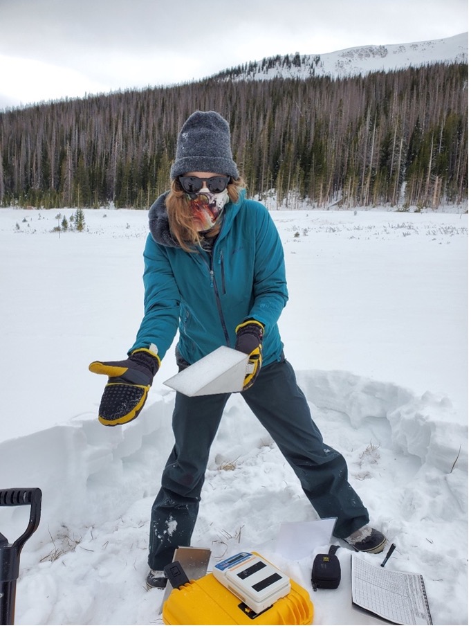
A scientist shows off a sample of a snow pit to measure snow density.
Ella Bump, Master’s student at Colorado State University, takes a sample of snow from the snow pit to measure density. Credit: Alex Olsen-Mikitowicz

While intergalactic space travel is still science fiction, the use of radar to measure our global snow resources from space is becoming a reality. The SnowEx21 campaign is providing a critical link between theory and practice and, after a good deal of data analysis, it will undoubtedly leave a refined view of the capabilities and limitations of L-band InSAR for measuring changes in SWE. Such progress is necessary, as snow is a critical and highly valued resource relied on by billions of individuals around the world.  Climate change is directly impacting this resource in a multitude of ways, including a reduction in the length of the snow-covered season and the total amount of snow that accumulates, and the impacts are predicted to become much more severe by mid-century. As such, the need for accurate, global estimates of SWE has never been more urgent. While SnowEx21 is only one small part of the puzzle, we’re hopeful that the progress made during this campaign will contribute to realizing this goal.

SnowEx Scientist Finds her Love of Snow Science on the Slopes

This dynamic environment of snow cover and texture outside of Cooke City, Montana, January 2021 is also a water reservoir for nearby communities.
This dynamic environment of snow cover and texture outside of Cooke City, Montana, January 2021 is also a water reservoir for nearby communities. Credit: G. Antonioli

By Gabrielle Antonioli, Montana State University /BOISE, IDAHO/

Being a snow scientist is an interesting career. Growing up in a small town in Montana, I was immersed in snow. But I saw it as one set thing—a blanket, unmoving, a cold, white mass. Only far later in life did I learn what a changing and integral role snow plays in our day-to-day life.  Snow drives the winter economies of most Western states, acts as water reservoirs for those same regions and far beyond and is a fundamental part of life—whether we see it fall on our city streets or not.

I wasn’t always interested in studying snow, though. I received my bachelor’s degree in organismal biology, aimed at a career in medicine.  A fundamental switch flipped in my brain as I worked in mountain environments, found snow science and ski mountaineering mentors, and realized that snow could be as changing and complex as any living organism. Mitigating risk and hazard while skiing – alongside trying to understand the evolution of a snowpack in a given mountain range – evolved into an encompassing and engaging mental and physical process for me. It is from this divergence in thought and passion that I found my path to the Earth sciences while skiing, teaching avalanche education, and backcountry ski-guiding. I am now completing a master’s in Earth sciences, focusing on snow science, at Montana State University. Amidst finishing this degree remotely due to the COVID-19 pandemic, I chose to move to Idaho and test my skills in a different environment. I am now working as a research technician for the NASA SnowEx project based in Boise, Idaho.

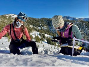
The author and another research assistant, Megan Mason, identify snow crystal types in an early-season snow pit at Copper Mountain, Idaho, December 2020. Credit: G. Antonioli
The author and another research assistant, Megan Mason, identify snow crystal types in an early-season snow pit at Copper Mountain, Idaho, December 2020.
Credit: G. Antonioli

SnowEx is a multi-year NASA campaign to study snow using remote sensing.  This involves things like radar, remote-controlled aircraft (UAVs), light detection and ranging (LiDAR), and more. This research is designed to inform plans for a future NASA satellite that would study snow from space. The primary instrument we’re using this year is Inteferometric Synthetic Aperture Radar (InSAR). InSAR flies over the Boise site each week, as well as other sites located near more distant mountain ranges, and uses radar to estimate the depth of the snow. We compare the measurements over time as InSAR continues its weekly flights over this site. The change in snow depth is directly related to the change in how much water is stored in the snowpack, which scientists call snow water equivalent (SWE). This is particularly important in mountain ranges that supply water to urban areas.

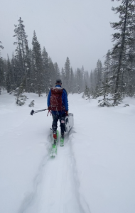
Even the most precise remote sensing instruments need to be validated with actual snow data collected in the field. For this reason, the field teams of technicians set out to various study plots across the Western U.S. each week to dig snow pits, identify the structure of the snowpack, measure density and liquid water content, and track each new snowfall.  We travel on snowshoe, ski, or snowmobile.  The teams I am on visit sites using backcountry skis with removable sticky skins and a special binding that rotates to either free the heel of a ski boot or lock it in place, designed for both uphill and downhill travel.

SnowEx scientists trek to the study site on cross-country skis. Credit: G. Antonioli

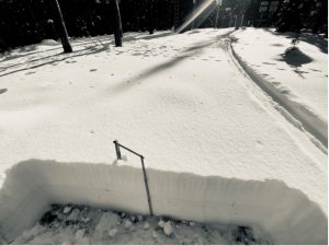
A shallow early-season snowpack at Banner Summit, Idaho in December 2020 with several layers of melting and freezing visibly preserved. Credit: G. Antonioli
A shallow early-season snowpack at Banner Summit, Idaho in December 2020 with several layers of melting and freezing visibly preserved.
Credit: G. Antonioli

For our first field campaign mid-January, our team drove a winding highway to reach a mountain trailhead far outside of Boise known as Banner Summit, the upper reaches of which source water for rivers and groundwater that Boise locals utilize. We loaded our packs with science gear and used skis to reach the Banner Summit research site. In addition to the density scales and SWE measuring devices we bring, each site has stationary equipment in place to measure a bevy of meteorological variables—like new snowfall, SWE, total depth of snow, and wind speed.  The depth and SWE measured by these set stations is also compared to the InSAR estimates, in addition to our on-the-ground measurements.

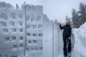
(L): Scientists dig these horizontal columns to sample the density in different parts of a snowpack. Each box represents a density sample taken every 10 cm. Multiple density cores of each layer are taken horizontally to account for any anomalies and for accuracy. (R): Measuring a later season snowpack stacking up outside of Boise, Idaho in January 2021. Credit: G. Antonioli
(L): Scientists dig these horizontal columns to sample the density in different parts of a snowpack. Each box represents a density sample taken every 10 cm. Multiple density cores of each layer are taken horizontally to account for any anomalies and for accuracy.
(R): Measuring a later season snowpack stacking up outside of Boise, Idaho in January 2021.
Credit: G. Antonioli

So, why is so much time and effort being devoted to finding a better way to monitor snow cover if we have things like snow telemetry stations (we call them SNOTELs) and stream gauges already in place to monitor snowfall and subsequent runoff? The answer is that there are disparities in weather patterns, rising rain lines (or the elevation at which rain is cold enough to turn to snow) in the mountains, and the ever-changing climate that is at our doorstep.  For my master’s thesis, I measured variability in snowfall amounts on different types of terrain and during various storms Hyalite Canyon, Montana. I ski in this canyon often and know that the upper elevation SNOTEL under-reports snowfall amounts by about half—not due to instrumentation error, but due to the location of the station as well as the terrain surrounding it. Not only is this a common problem, but disparities like this make a huge difference for avalanche and hydrologic forecasters alike. I am hopeful that in the future, fusing different technologies like those in use for SnowEx, along with validation from on-the-ground data like my snow pits, will alleviate these issues and help locations that rely on snow melt for water more accurately monitor and plan for the future.
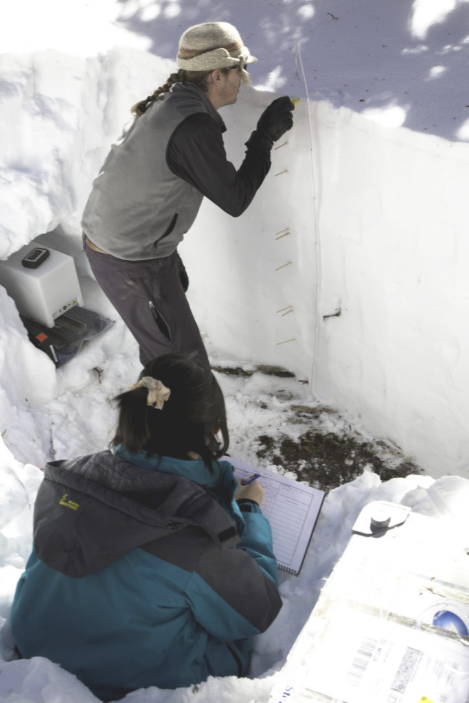
HP Marshall and Mitch Creelman enjoying some post-work field time.
Credit: G. Antonioli

A Breathtaking View – Literally

Credit: NASA / Jessica Merzdorf

By Jessica Merzdorf / GRAND MESA LODGE, COLORADO

After visiting with part of the SnowEx 2020 airborne team, we headed up the mountain to rendezvous with the ground team, stationed at Grand Mesa Lodge.

“Does anyone have a headache?” asked Jerry Newlin, SnowEx operations manager, as we left the little town of Delta and the rugged brown foot of the mountain range loomed up in front of us.

“Nope, feeling great” was our answer at the time. We traveled up the winding roads, commenting on the views that became more incredible the higher we went, and arrived at Grand Mesa Lodge in time for dinner and the evening briefing with the team.

But later that evening, at 10,500 feet, both video producer Ryan Fitzgibbons and I started developing symptoms of altitude sickness. Lower oxygen levels at higher elevations can cause headaches, nausea, shortness of breath, dizziness and other symptoms as the body adjusts. Sometimes the symptoms resolve on their own as the body gets used to the conditions; after a long, rough night of intense headaches and nausea, I gratefully accepted an herbal medication from the Grand Mesa Lodge owners. (Severe cases of altitude sickness require quickly moving back down to lower elevations. The ops team kept a close eye on me to make sure I didn’t need medical attention.)

After I took a nap back at my cabin and started to feel better, we checked in with Jerry and were cleared to snowmobile up to the snow pits.

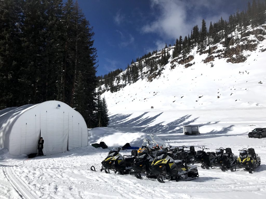
The ground team’s daily “commute” varies depending on where they’re working that day, but it can be as much as 16 miles of hills, curves, bouncy stretches and incredible views of the valley below.

The SnowEx team reached the field sites via daily snowmobile trips. The ride is bumpy and can take 45 minutes to 2 hours, depending on where they’re working on the mesa. They towed their instruments and gear on sleds behind the snowmobiles. Credit: NASA / Jessica Merzdorf

At each of the snow pits in this 3-week phase, the SnowEx ground team digs until they reach the ground, exposing a “wall” of snow where they take their measurements: Depth, density, water content, temperature, reflectance and particle size.

“We can see, and even hear, how the snow’s characteristics change from top to bottom,” said Chris Hiemstra, a researcher with the U.S. Army Corps of Engineers’ Cold Regions Research and Engineering Laboratory (CRREL). “The newest snow at the top is fluffy and loose. Below that, the wind has packed it into dense layers. The snow at the bottom has more water and the particles are sharper. When you dig into it, it sounds different than the other layers at the top.”

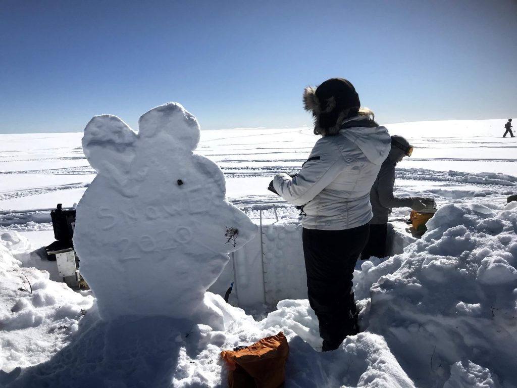
When we stopped by deputy project scientist Carrie Vuyovich’s pit, we heard the story of the “strong work mouse,” and saw a snow statue (made from wind-packed snow, incidentally) built in the mouse’s honor.

The SnowEx “mascot” for 2020 was the “strong work mouse,” honoring the small field mice that visited the snow pits during the first two weeks of data collection. Suzanne Craig of the National Snow and Ice Data Center records data next to a snow sculpture of the strong work mouse. Credit: NASA / Jessica Merzdorf

“There were these little mice that came to visit us in the first couple of weeks,” she said. “We’d be in pits, and these little mice would come running across the snow – one came down into the pit and hung out with us for a while, another team had a mouse running along beside them, and another member had a mouse come right up next to his boot. So that became our mascot – the ‘strong work mouse.’”

Not all of the research takes place in pits. Team members on skis used snow micro-penetrometers (SMP’s) to measure hardness and microstructure throughout the snow layers with incredibly high precision: The SMP takes 250 measurements every millimeter. Other snowshoe-wearing scientists used MagnaProbes, which have a magnetic probe that goes into the snow and a “basket” that rests on top. The distance between the two parts provides a highly accurate, GPS-tagged measurement of snow depth, and is many times faster than writing depth measurements in a notebook.

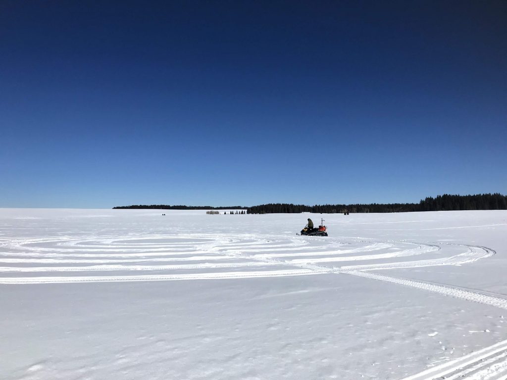
SnowEx 2020 project scientist Hans-Peter (HP) Marshall drives his snowmobile in a tight clockwise circle called a “radar Hiemstra spiral”, taking active radar measurements of the snow. The Twin Otter aircraft carrying SWESARR will later fly over this circle and take similar measurements. Credit: NASA / Jessica Merzdorf

SnowEx project scientist Hans-Peter (HP) Marshall and Mike Durand, an associate professor at Ohio State University, used snowmobiles to create tight clockwise circles of radar measurements. This spiral sampling strategy is called a “Hiemstra spiral” after Chris Hiemstra, who developed them using the MagnaProbe, Marshall said. His snowmobile carried an active radar instrument, which generates pulses that bounce off the snow and the layers.  These pulses are timed to nanosecond accuracy, allowing estimates of snow depth, water equivalent and thickness of major layers, 100 times per second. Durand’s had a passive instrument that measured the radiation naturally generated by earth and scattered by snow.

If these measurements sound familiar, that’s because they’re the same types, frequencies, and polarizations as the airborne instrument SWESARR, Marshall said. The Twin Otter aircraft flies over these spirals and takes the same measurements in the same location. Later, the two teams can compare the data and see how well they align with each other and the standard snow pit and depth observations.  Data from both the active radar and passive microwave sensors on SWESARR will be combined to estimate snow properties such as snow water equivalent.

On the last day of data collection, Vuyovich revealed that the team had successfully collected data from 153 snow pits and 6 SWESARR flights in just three weeks — even more than originally planned.

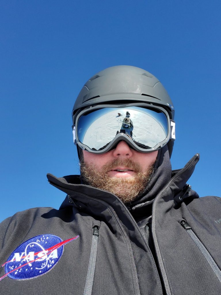
SnowEx 2020 operations manager Jerry Newlin (ATA Aerospace) caught Chris Hiemstra (U.S. Army Corps of Engineers’ Cold Regions Research and Engineering Laboratory) in the reflection of his goggles during one of their daily snowmobile commutes. "It looks like Chris is collecting data on the Moon," Newlin said. Credit: NASA / Jerry Newlin
SnowEx 2020 operations manager Jerry Newlin (ATA Aerospace) caught Chris Hiemstra (U.S. Army Corps of Engineers’ Cold Regions Research and Engineering Laboratory) in the reflection of his goggles during one of their daily snowmobile commutes. “It looks like Chris is collecting data on the Moon,” Newlin said. Credit: NASA / Jerry Newlin

But SnowEx is off to a great start, not wrapping up. SnowEx 2020 has another phase: The time series. Smaller, local ground teams are currently performing weekly snow measurements at sites in Colorado, Utah, Idaho, New Mexico and California through March, and bi-weekly in April and May, at the same time as UAVSAR overflights. UAVSAR is an L-band InSAR (radar) instrument developed by NASA’s Jet Propulsion Laboratory. The time series will give the researchers data on how snow changes over time, especially as it melts in the spring.

When asked about the best memories they will take home from the mesa, each team member’s answer was the same: The team.

“The best part has been the team,” Vuyovich said. “The people that have been out here have been working super hard, and it’s been a lot of fun.”

“These kinds of intensive field campaigns form bonds that last a career,” said Marshall. “Chris Hiemstra and I met during the last big series of field experiments 17 years ago, and we have been working together ever since.  The younger generation in particular really stepped up this campaign – it will be exciting to see where their careers take them.”

Snow Science Two Miles in the Sky

Grand Mesa, Colorado has an elevation of 10,500 feet, and from the Land’s End Observatory, you can see across the valley to Utah. The large, flat surface of the mesa is perfect for SnowEx 2020’s instrument testing and validation activities. Credit: NASA / Jessica Merzdorf

By Jessica Merzdorf / GRAND MESA LODGE, COLORADO

What is it like to do science nearly 2 miles above sea level?

At a majestic 10,500 feet elevation, Grand Mesa is the world’s tallest mesa, or flat-topped mountain. It’s also the site of an intense month of data collection by NASA’s SnowEx 2020, a ground and airborne campaign testing a variety of instruments that measure the water contained in winter snowpack.

Snow is vital for Earth’s ecosystems and humans, from its temperature-regulating reflection of sunlight and insulating properties, to its life-sustaining water as it melts in the springtime. SnowEx is taking coordinated measurements on the ground and in the air to compare how well different instruments work in different conditions. Not only does this help them improve measurement techniques in the future, but eventually, NASA can use this information in developing a future snow satellite mission.

The “golden” measurement they’re after is snow water equivalent, or SWE (pronounced “swee”).

“SWE is our measure of the volume of water held in the snowpack,” said Carrie Vuyovich, a research scientist at NASA’s Goddard Space Flight Center and SnowEx 2020’s deputy project scientist. “It’s such a crucial measurement because the winter snow is a natural reservoir – when it melts in the spring, it feeds the groundwater, lakes and streams.”

To understand SWE, imagine taking a cubic foot of snow, and measuring how much water is left in the container after you melt it. The amount of water depends on how densely packed the snow is and how big its particles are. Measuring these properties for small amounts of snow and calculating SWE is fairly simple – but measuring it spatially for an entire snowpack over a large mountain range? That requires instruments on planes or satellites that can sense snow properties from a distance in bigger swaths.

We met up with SnowEx operations manager Jerry Newlin of ATA Aerospace on Monday. We were invited to stay with the team during their final week of data collection for this phase of the project. Our first stop was with the airborne team, at Montrose Regional Airport in Montrose, Colorado.

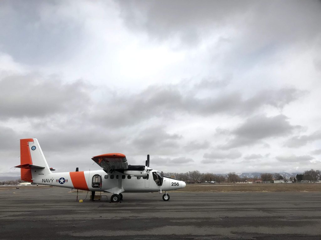
When we arrived, the DHC-6 Twin Otter aircraft was grounded due to high winds over the mesa. The Twin Otter carries SWESARR – the Snow Water Equivalent Synthetic Aperture Radar and Radiometer. Developed at NASA Goddard, SWESARR uses active and passive microwave instruments to calculate SWE. Its precise measurements require precise flying, and the 50-knot winds were too strong for the plane to collect good data.

“SWESARR’s active instrument transmits a pulse, which penetrates the snowpack, hitting and interacting with all these little snow particles, and bouncing back to the instrument,” said Batu Osmanoglu, a research scientist at NASA Goddard and the principal investigator of the SWESARR team. “The passive side is more like a thermal camera, collecting the natural radiation coming from the snowpack. These two pieces of information are what we use to infer the SWE for a given area.”

The plane also carries CASIE, the Compact Airborne System for Imaging the Environment. CASIE was developed at the University of Washington and collects data on snow surface temperature, which is important for both validating satellite data and improving models of snow’s surface energy balance – the exchange of energy between the snow, the atmosphere and the ground beneath.

Shortly after we arrived, the team convened for a new weather report: The winds had calmed in time for a late afternoon flight. The airport team prepped the plane for flight while the instrument team got SWESARR ready to go.

The DHC-6 Twin Otter carrying the SWESARR and CASIE instruments was grounded in the morning due to high winds, but took off late in the afternoon for one flight over the mesa. Credit: NASA / Jessica Merzdorf
The DHC-6 Twin Otter carrying the SWESARR and CASIE instruments was grounded in the morning due to high winds, but took off late in the afternoon for one flight over the mesa. The team completed all 6 planned SWESARR flights. Credit: NASA / Jessica Merzdorf

After takeoff, it was time for us to take off too: The trip from Montrose to Grand Mesa is just under two hours, and we wanted to reach the lodge before dark. We were hoping for a good night’s rest – after catching up with the airborne team, our next stop was traveling by snowmobile to spend time with the ground team on the mesa.

Puzzles Within Puzzles

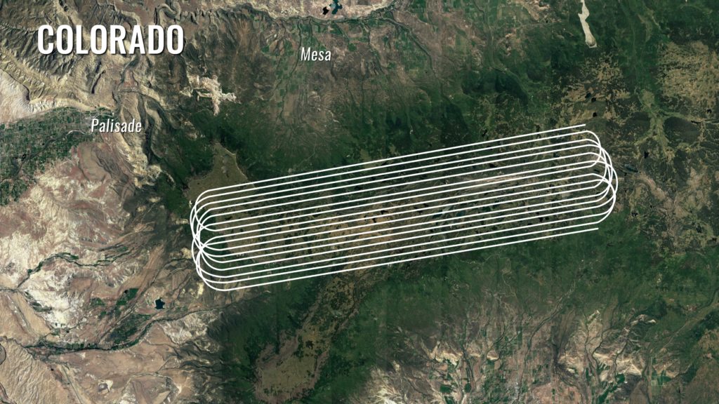
The SnowEx aircraft fly in "lines" above field sites set up on Grand Mesa, Colorado. Here, a satellite image of Grand Mesa in summer shows the topography with the flight lines superimposed on top. Credit: NASA/ Joy Ng
The SnowEx aircraft fly in “lines” above field sites set up on Grand Mesa, Colorado. Here, a satellite image of Grand Mesa in summer shows the topography with the flight lines superimposed on top.
Credit: NASA/ Joy Ng

by Ellen Gray / WESTERN COLORADO /

Eugenia De Marco loves puzzles. Her face lit up and she grinned broadly when asked what it was like to figure out how to get NASA instruments that measure snow on the ground attached and running on a Naval Research Lab P-3 plane.

“These aircraft have deliberate holes where things kind of hang off of or look out of so we can get data. But all the holes are different sizes, or in different locations in the aircraft,” she said as she described fitting aboard five unique instruments that have been designed to fit on several different types of aircraft. “These are all little puzzle pieces that you need to keep in mind when you design something.”

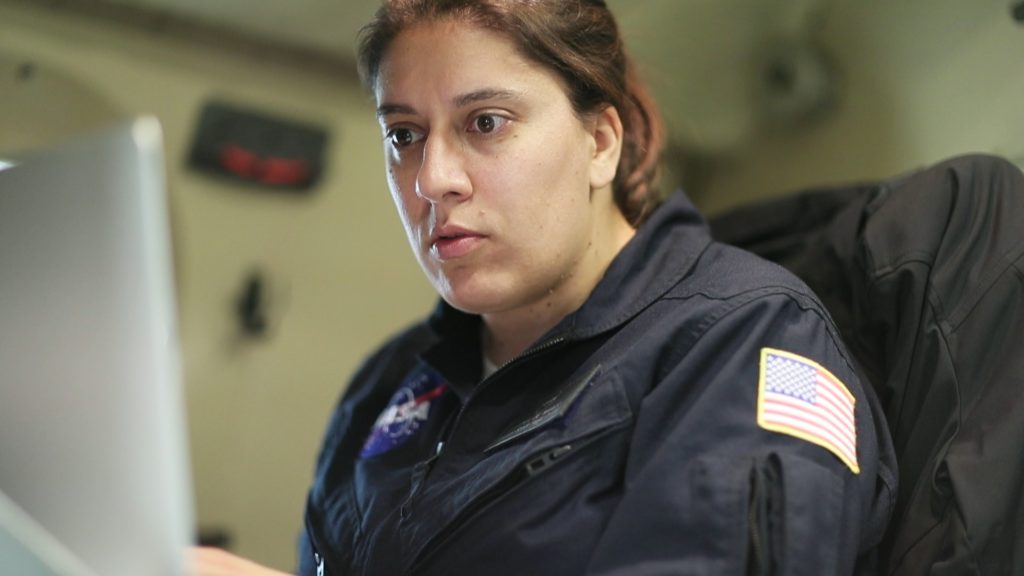
Eugenia De Marco is Snow Ex's lead integration engineer for the P-3 aircraft, responsible for each instrument aboard getting the data they need. Credit: NASA/ Joy Ng
Eugenia De Marco is Snow Ex’s lead integration engineer for the P-3 aircraft, responsible for each instrument aboard getting the data they need. Credit: NASA/ Joy Ng

As a mechanical engineer at NASA’s Goddard Space Flight Center in Greenbelt, Maryland, De Marco is part of a team that designs science instruments for airborne missions that study Earth. Many of these instruments are early versions of what may one day fly on satellites. For the past year, she has been working with a program called SnowEx, a five-year airborne campaign that is trying to figure out one of the most challenging puzzles in Earth observation: how do you measure from the air the amount of water in snow that’s on the ground?

Snow on the ground is easy to observe from space or the air, but not so easy to measure how wet or dense it is, and thus how much water may flow downstream into reservoirs and agricultural fields when it melts in the spring. One instrument is unlikely to be able to give scientists the observations they need, especially on rugged mountain slopes whose steep angels can complicate things. But many instruments, whose observations fit together like puzzle pieces to illuminate the bigger picture, just might.

Five of those instruments were De Marco’s responsibility aboard the Naval Research Lab’s P-3 aircraft this February during SnowEx’s first trip to their testbed, the snow-covered Grand Mesa and Senator Beck Basin outside Colorado Springs, Colorado. As the lead integration engineer for the aircraft, her job during the flights was to coordinate with the pilots and the instrument scientists to make sure that each instrument collects the data it needs.

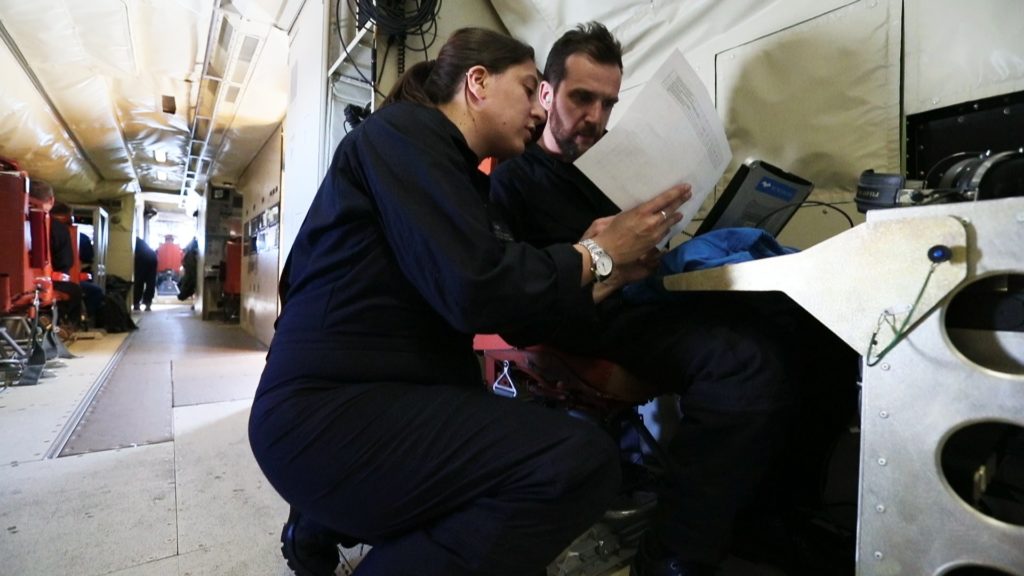
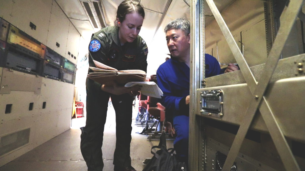
Engineer Eugneia De Marco consults with instrument scientists Alex Coccia during a SnowEx research flight aboard the Naval Research Laboratories P-3 aircraft. Feb. 16 2017. Credit: NASA/ Joy Ng
Engineer Eugneia De Marco consults with instrument scientists Alex Coccia during a SnowEx research flight aboard the Naval Research Laboratories P-3 aircraft. Feb. 16 2017.
Credit: NASA/ Joy Ng

“The pilots will call down to me and usually, in general, to everyone, ‘We’re this close to our target,’ and then I make sure everybody’s ready to go and then science starts happening. In the meantime, I keep track of every time we hit the line and start and stop [data collection],” she said.

The “line” she mentions refers to the pre-determined path the airplane flies along so that it will fly above ground stations set up by scientists below to measure snow directly. Dozens of researchers from a variety of universities and government agencies were camped out on Grand Mesa and in Senator Beck Basin, going out each day on snowmobiles, skis or snow shoes to dig snow pits or set up other sensors directly on the snow in the mountains.

“They’re doing that to compare what we’re seeing with our instruments,” De Marco said.” Our instruments will say, ‘Hey, we just saw ten feet of snow,’ and the ground will say, ‘Yep that was ten feet of snow.’ It’s a data comparison-type deal.”

Grand Mesa in the Colorado Rockies is NASA and its partners' testbed for figuring out how much water content is in snow. Credit: NASA/ Joy Ng
Grand Mesa in the Colorado Rockies is NASA and its partners’ testbed for figuring out how much water content is in snow. Credit: NASA/ Joy Ng

On a given flight, the P-3 aircraft flies 12 lines that lasts from three to ten minutes each. One instrument that looks at how light scatters after bouncing off snow on the ground actually needs to fly in a circle around a ground station so it can capture all the angles. Sometimes problems with the instruments crop up, usually small glitches that can be fixed on board, and De Marco will rejigger the flight pattern so when the instrument is ready to go again, they can still fly over that instrument’s line.

Weather, however, is the biggest thing that can impact a flight, said De Marco. Clouds get in the way of some instruments’ observations, so the plane may try to fly above or below them depending on the instrument. Choppy air can complicate flying over the lines. When planning flights, De Marco and the science team try to fly in good conditions, but with weather over the mountains difficult to predict, they often go out in less than ideal weather and adjust their flight plan as they go.

“I think the most exciting thing is when we land and we know that we hit those lines and everything was working well and the sky looked great and the weather was great,” De Marco said. “I mean that just feels really good and makes all that hard work totally worth it.”

A ‘Dizzying Dance in the Air’ for Science

by Joy Ng / WESTERN COLORADO /

As I walked down the aisle of a plane with a camera clasped between my two sweaty palms, I had two thoughts on my mind: First, my footsteps feel very heavy; second, I hope I can film without vomiting. As you might guess, this was no ordinary flight.

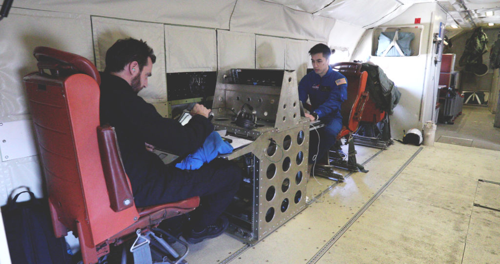
Scientists Alex Coccia (left) and Albert Wu during a SnowEx science flight over Colorado. Credit: NASA/Joy Ng

Why did this flight feel like a nauseating roller coaster ride? The Navy’s P-3 Orion aircraft was outfitted with a variety of instruments that required various flying maneuvers to collect data. The plane flew back and forth in a straight line and around in tight circles. It was literally a dizzying dance in the air.

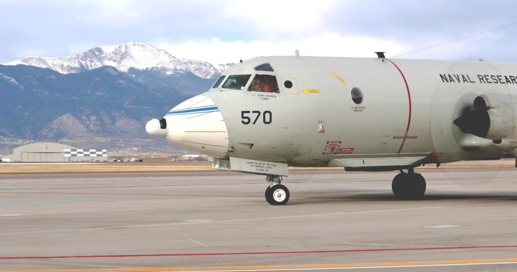
The P-3 Orion aircraft in the Peterson Air Force Base in Colorado Springs just before take-off. Credit: NASA/Joy Ng
The P-3 Orion aircraft at Peterson Air Force Base in Colorado Springs just before take-off. Credit: NASA/Joy Ng

This science flight was carried out as part of a new NASA-led campaign called SnowEx. At the moment, we have satellites that can see snow cover but no instruments in space that can accurately measure how much water they hold. Such a measurement is important, considering that roughly one-sixth of the world’s population relies on snow for their water resources. The campaign is exploring instruments and technologies for measuring snow that may eventually result in a snow-observing satellite.

One of the biggest land areas where snow falls is boreal forest, so SnowEx chose its first flights over the forests of Grand Mesa and Senator Beck Basin in western Colorado. Because leaves and branches can act like obstacles for some snow-measuring instruments, scientists are using these forests to investigate what combination of instruments can successfully measure snow over this kind of terrain.

The Grand Mesa in Colorado is one of the sites for this year’s SnowEx campaign. Credit: Ryan Cook
Grand Mesa in Colorado is one of the sites for this year’s SnowEx campaign. Credit: Ryan Cook

At the same time, scientists are working on ‘ground-truthing’ the airborne measurements. This involves more than 100 scientists measuring snow depth and density on the ground to get accurate snow measurements that can validate the measurements taken by the airborne instruments.

Travis Roth, Oregon State University looks at snow consistency at various depths as Jinmei Pan, Ohio State University logs data. Credit: Ryan Cook
Travis Roth, Oregon State University, looks at snow consistency at various depths as Jinmei Pan, Ohio State University, logs data. Credit: Ryan Cook

Collecting these in-flight measurements is tricky. Each instrument works at specific altitudes, over specific types of snow, and only in certain types of weather. This means that the aircrew and scientists have to work together to come up with a detailed flight plan—one that can change day to day—that allows all instruments to collect data successfully.

Lt. Denise Miller from the U.S. Navy speaks with Principle Investigator Edward Kim during a science flight. Credit: NASA/Joy Ng

While I was on the plane, most of the scientists were in seats next to their instruments. I, on the other hand, was swerving side to side as I did my own little dance to capture my shots. It’s not the ideal film set. The light is constantly changing. Every surface of the plane is vibrating and it’s very loud. In these conditions, I had one priority in mind: stabilization. Luckily, I used a handheld gimbal—an electronic device that counteracts any minor movements—that allowed me to film smooth shots while my feet were to the contrary.

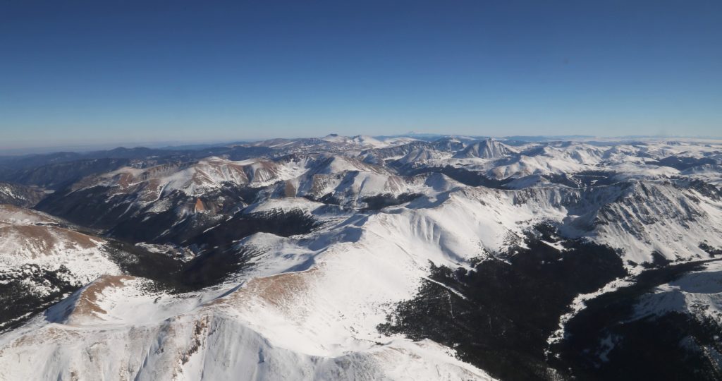
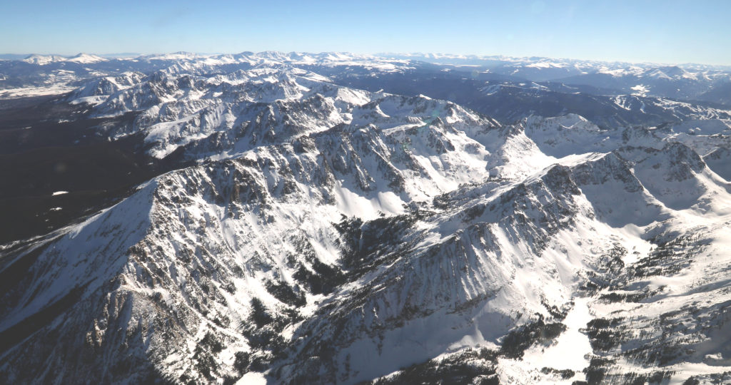
The view outside of the P-3 Orion aircraft during a science flight. Credit: NASA/Joy Ng

I managed to capture some great footage and discovered that, for me, the mountaintop views were a good remedy for any motion-induced mishaps.