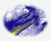
In the Water Vapor Satellite Imagery lessons, your meteorology students learn how to identify and analyze jet streams using water vapor imagery from weather satellites. There is a jet stream tutorial if you need a better understanding of “jet stream.” Then your students can complete each of the learning scenarios in the order listed below.

- The Meteorologist’s Challenge: A TV meteorologist challenges you to locate the jet stream axis using water vapor imagery.
- A Crisis in the Air: An airline pilot needs your help in analyzing data from water vapor imagery and weather models to plot a new flight path to take advantage of a jet stream.
- Launching and Tracking a Weather Balloon: A team of weather researchers needs you to decide whether or not to launch a weather balloon by analyzing water vapor imagery and other weather data.
Read more about these activities in NEON. Register, log in, and join the NASA Explorer Schools group and Satellite Meteorology forum. The complete write-up on the lessons is available in that forum.
Link to the NES Virtual Campus home page.
