by Samson Reiny / ANGELES CITY, PAMPANGA, PHILIPPINES /
Until now, no one had captured smoke plumes from a Borneo fire in all their chemical, radiative, and physical glory…
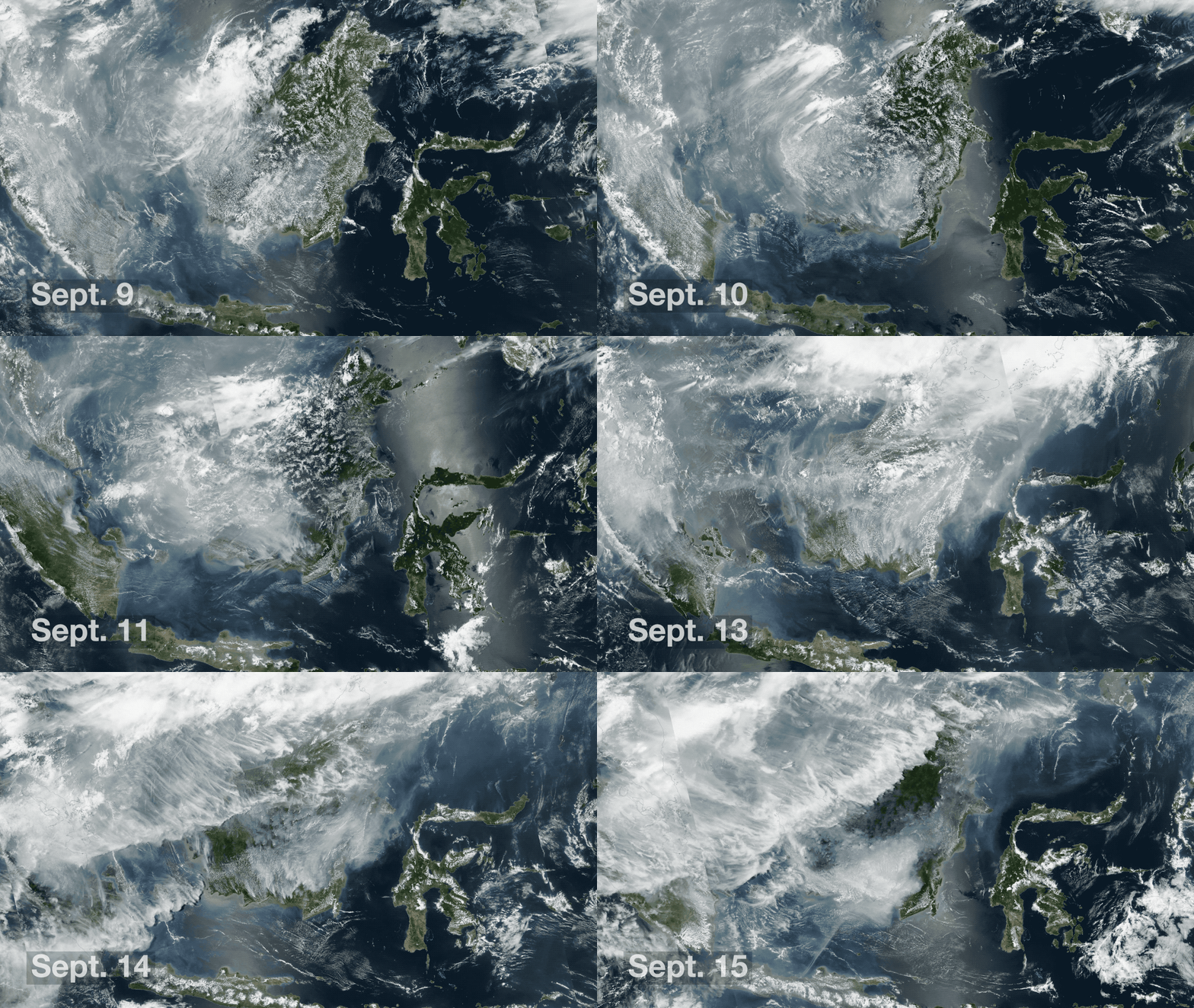
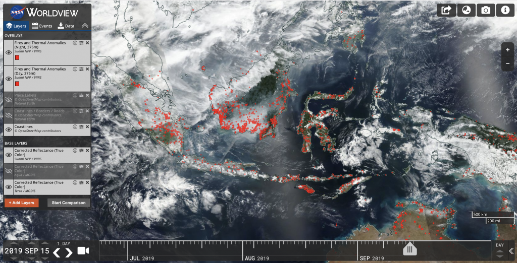
My work partner in crime, Katy Mersmann, and I left Washington, D.C., Saturday morning and arrived at our hotel near Clark Air Base in Angeles City, Pampanga, Philippines, shortly before midnight on Sunday. On Monday morning we dragged our feet into mission operations for the Cloud, Aerosol, and Monsoon Processes Philippines Experiment (CAMP2Ex),and not a minute later a giant monitor screen revealed a satellite-based map of Borneo peppered with red dots—the third largest island in the world was ablaze with hundreds of fires.
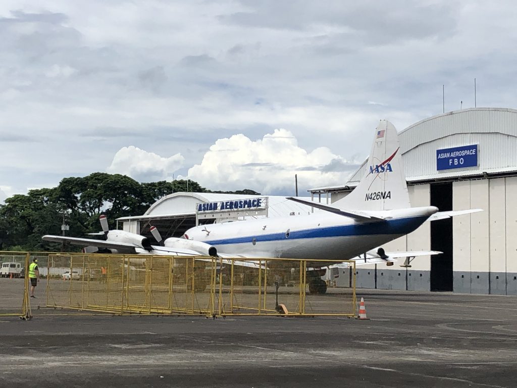
NASA’s P-3B science aircraft had already been having a field day, zooming in, over, and around those smoke plumes as they drifted north into the Sulu Sea. The plane is tracking the resulting smoke particles and their atmospheric interactions as part of CAMP2Ex’s nearly two-month-long investigation on the impact that smoke from fires and pollution have on clouds, a key factor in improving weather and climate forecasts.

Until now, no one had captured smoke plumes from a Borneo fire in all their chemical, radiative, and physical glory—said U.S. Naval Research Laboratory meteorologist and CAMP2Ex mission scientist Jeffrey Reid. “This is an historic day, and it’s happening in the middle of the largest fire event for the region in four years,” he said, noting that while agricultural fires in the region are common this time of year, the recent dry spell has made the peat soil perfect kindling for a prolonged burn. “Because the water table has dropped, these fires are going to continue to burn until the island sees some significant rainfall.”

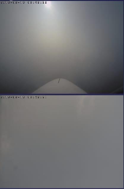
“There was tons of smoke east of Palawan [a Philippine island west of the Sulu Sea]—there was no visibility in the soup,” said Luke Ziemba, flight scientist for this flight and CAMP2Ex composition focus area lead from NASA’s Langley Research Center, who debriefed the science team following some eight hours in the air and more than 1,000 miles (1600 kilometers) of smoke tracking logged. “It was impossible to see the clouds.” But when better visibility did avail itself, the P3-B punched through as many clouds as possible—punch then descend, punch then descend—he recounted. As with any science flight that flirts with a wide range of altitudes—think 2,000 to 20,000 feet (600 to 6000 meters)—and commits to a number of maneuvers, from box spirals to pitches, it can be quite a stomach-churning experience.

“And tomorrow we hit it again after it has been transported into the Western Pacific,” Reid said with a smile. The NASA P-3B would rendezvous with the Scripps research vessel Sally Ride, which is on its own campaign to study air-sea interactions to better understand how weather develops on continental and even intercontinental scales through the Office of Naval Research Propagation of InterSeasonal Tropical OscillatioNs (PISTON) project. A Stratton Park Engineering Company (SPEC) Inc. Learjet would also be in tow, validating the P3-B’s data while also doing its own in situ measurements in clouds.
The instruments involved are among the crème de la crème of the science world. Among the NASA P-3B’s instruments is the High Spectral Resolution Lidar, or HSRL2, which is situated in the aircraft’s belly and is able to observe aerosols up and down the atmospheric column and gather information on their distribution, abundance, type, and size. During the flight, NASA Langley research physical scientist and HSRL2 co-investigator Sharon Burton had been tracking the instrument’s measurements on her laptop. Pointing to graph readouts on screen, she noted that much of the smoke from the fire is drifting in the boundary layer, low in the atmosphere, where monsoon and other clouds form. “Aerosols can seed clouds and produce water droplets that come down as rain, but they can also prevent rain from falling,” she said. “It’s extremely complex, but that’s why we’re here—to get a better handle on the quantitative processes that make these events happen.”
After the afternoon flight debrief, a steady shower descended on Clark Air Base, cooling the sticky, heavy air synonymous with the Philippines rainy season. Everyone stares out the window, mesmerized, smiling, and grabbing umbrellas. It’s all science, and yet it’s still very magical.
