Sep. 24, 2018 – NASA’s Terra Satellite Finds Subtropical Storm Leslie Drifting in Central Atlantic
NASA’s Terra satellite provided a visible image of Subtropical Storm Leslie as it was meandering around the North Central Atlantic Ocean on Sept. 24, 2018.
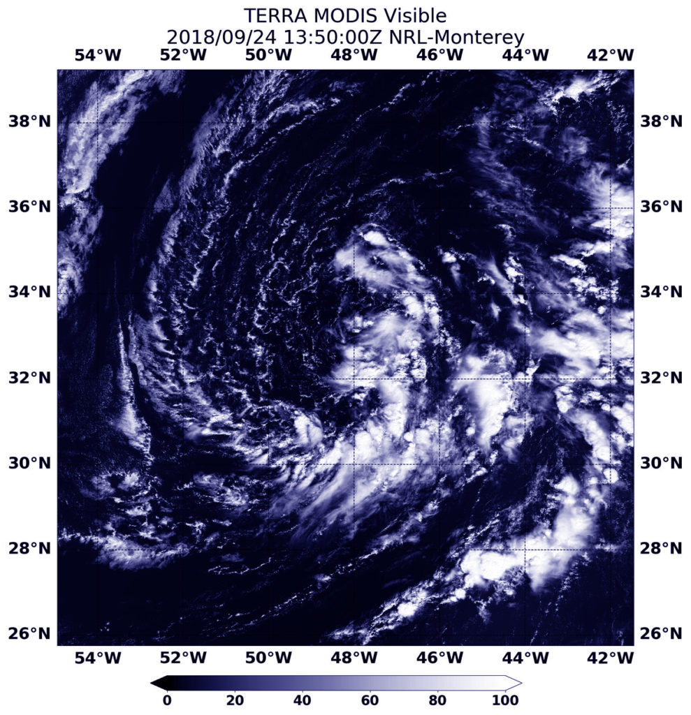
At 9:50 a.m. EDT (1350 UTC) on Sept. 24, the MODIS instrument aboard NASA’s Aqua satellite looked at Leslie in visible light. The large subtropical cyclone continued to produce patches of deep convection, mostly to the south and east of the center.
MODIS also found a few new isolated thunderstorms developing near the surface center.
According to the National Hurricane Center, a Subtropical storm is a non-frontal low-pressure system that has characteristics of both tropical and extratropical cyclones. Like tropical cyclones, they are non-frontal, synoptic-scale cyclones that originate over tropical or subtropical waters, and have a closed surface wind circulation about a well-defined center. In addition, they have organized moderate to deep convection, but lack a central dense overcast. Unlike tropical cyclones, subtropical cyclones derive a significant proportion of their energy from baroclinic sources, and are generally cold-core in the upper troposphere, often being associated with an upper-level low or trough. In comparison to tropical cyclones, these systems generally have a radius of maximum winds occurring relatively far from the center (usually greater than 60 nautical miles), and generally have a less symmetric wind field and distribution of convection.
At 11 a.m. EDT (1500 UTC) on Sept. 24 the center of Subtropical Storm Leslie was located near latitude 32.5 degrees north and longitude 48.0 degrees west. It is located far from land areas, and is about 1,240 miles (1,995 km) west of the Azores Islands.
The National Hurricane Center or NHC said the storm is moving toward the east near 5 mph (7 kph), and this general motion is expected to continue through Tuesday night. A turn toward the east-northeast with an increase in forward speed is forecast on Wednesday. Maximum sustained winds are near 40 mph (65 kph) with higher gusts. Little change in strength is forecast through tonight.
Leslie is forecast to strengthen by mid-week while it interacts and eventually merges with a frontal system.
By Rob Gutro
NASA Goddard Space Flight Center