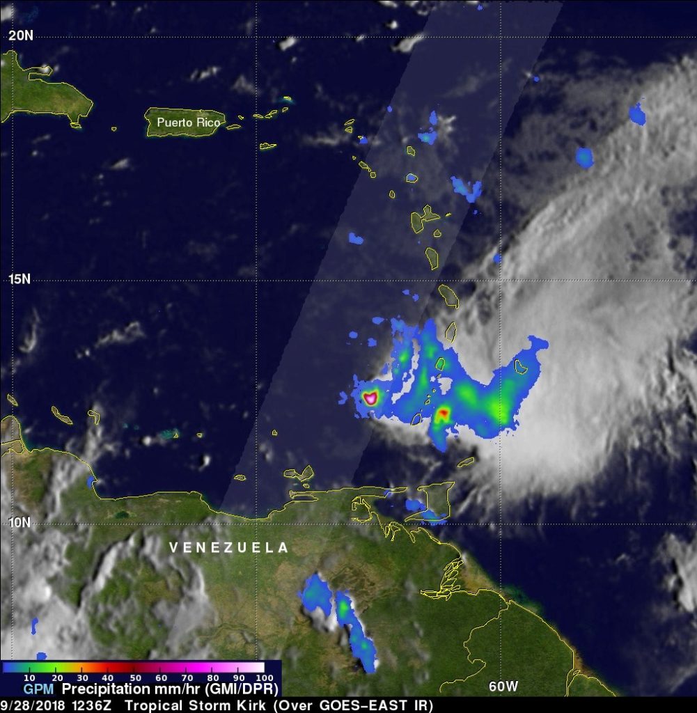
Sep. 28, 2018 – NASA Looks at Tropical Storm Kirk’s Caribbean Rainfall
Tropical Storm Kirk just passed through the Leeward Islands and when the GPM satellite passed overhead, it revealed that Kirk continued to bring rain to the chain on Sept. 28.

The Global Precipitation Measurement mission or GPM core satellite passed over Tropical Storm Kirk at 8:36 a.m. EDT (1236 UTC) on Friday, Sept. 28, 2018. GPM found the heaviest rainfall was around the center of circulation located west of the Leeward Islands. There, rain was falling at a rate of 100 mm (about 4 inches) per hour.
Rain extended east of the center over the island chain where rain was falling between 10 and 40 mm (0.4 and 1.5 inches) per hour. GPM is a joint mission between NASA and the Japan Aerospace Exploration Agency, JAXA.
Those rains are expected to continue affecting the islands over the next day. The National Hurricane Center said “Kirk is expected to produce total rainfall of 4 to 6 inches across the northern Windward and southern Leeward Islands with isolated maximum totals up to 10 inches across Martinique and Dominica. These rains may produce life-threatening flash floods and mudslides. Across Saint Croix and eastern Puerto Rico, Kirk is expected to bring 2 to 4 inches with isolated maximum totals of 6 inches today and Saturday, Sept. 29.”
Meanwhile, the Meteorological Service of St. Lucia has discontinued the Tropical Storm Warning for St. Lucia, and the Meteorological Service of Barbados has discontinued the Tropical Storm Watch for St. Vincent and the Grenadines.
At 11 a.m. EDT (1500 UTC), the center of Tropical Storm Kirk was located near latitude 13.8 degrees north and longitude 63.6 degrees west. That’s about 185 miles (295 km) west-southwest of Martinique.
Kirk is moving toward the west-northwest near 13 mph (20 kph), and this motion is expected to continue through Sunday. On the forecast track, the center of Kirk or its remnants will move across the eastern and central Caribbean Sea over the next day or two. Reports from an Air Force Reserve Hurricane Hunter aircraft indicate that maximum sustained winds have decreased to near 45 mph (75 kph) with higher gusts. Kirk is forecast to weaken to a tropical depression tonight, and then degenerate into a trough of low pressure on Saturday, Sept. 29.
For forecast updates on Kirk, visit: www.nhc.noaa.gov.
