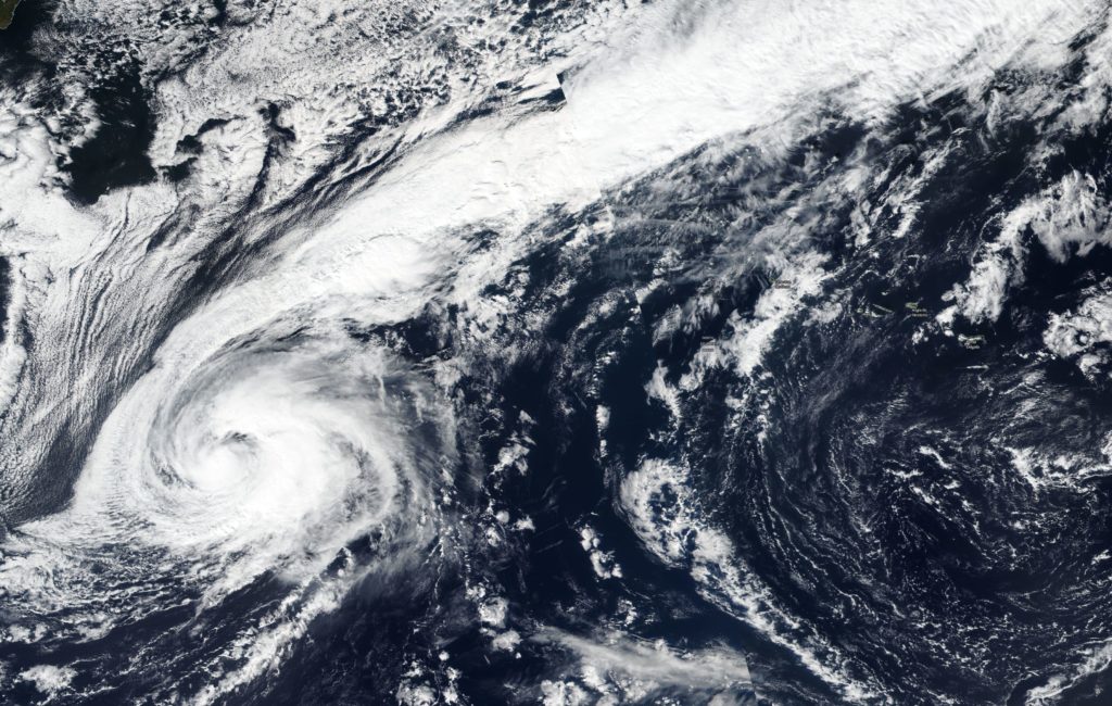
Oct. 09, 2018 – NASA Gets Tropical Storm Leslie by the Tail
What appears to be a long tail in satellite imagery of Tropical Storm Leslie is in fact clouds associated with a nearby elongated area of low pressure, or a trough.

On Oct. 8, the VIIRS instrument aboard NASA-NOAA’s Suomi satellite provided a visible look at Tropical Storm Leslie that showed a developing eye and a long stretch of clouds associated with an elongated area of low pressure that extends over the United Kingdom.
NOAA’s National Hurricane Center noted “Although the winds have not yet increased, the surface center of the tropical storm has become more embedded within its cold cloud tops and several recent microwave overpasses indicate that the cyclone is beginning to establish an inner-core. Strengthening is therefore still expected, and Leslie is forecast to become a hurricane by tomorrow.”
At 11 a.m. EDT (1500 UTC) on Oct. 9 the center of Tropical Storm Leslie was located near latitude 31.3 degrees north and longitude 43.5 degrees west. That’s 1,045 miles (1,680 km) west-southwest of the Azores Islands. Leslie is moving toward the south-southeast near 13 mph (20 kph), and this general motion is expected to continue for the next day or so. Maximum sustained winds are near 65 mph (100 kph) with higher gusts. Some strengthening is anticipated, and Leslie is forecast to become a hurricane again on Wednesday.
The National Hurricane Center cites different forecast modeling possibilities for Leslie. It could merge with a trough or elongated area of low pressure or Leslie could remain a tropical cyclone almost indefinitely if it continues meandering over the northern Atlantic.
For updated forecasts, visit: www.nhc.noaa.gov
