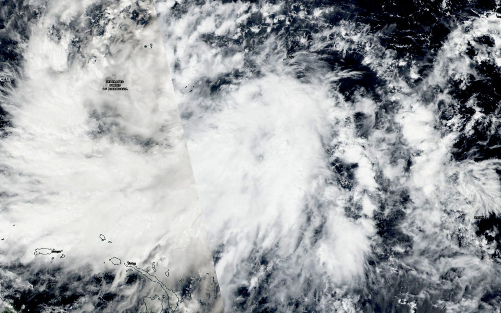
November 20, 2018 – NASA Sees Tropical Depression Man-yi, Warnings Triggered
Tropical depression Man-yi for med in the Northwestern Pacific Ocean and NASA captured an image of the storm. Yap state is already under watches and warnings.

The National Weather Service (NWS) in Tiyan, Guam has issued a typhoon watch and Tropical Storm warning on Nov. 20. A Typhoon Watch remains in effect for Faraulep in Yap State and for Puluwat in Chuuk State. A Tropical Storm Warning is in effect for Chuuk Lagoon, Lukunor, Losap, Fananu, Ulul, and Puluwat in Chuuk State and for Satawal in Yap State. A Tropical Storm Watch remains in effect for Guam and Rota.
Tropical Depression Man-yi formed on Nov. 20 and NASA-NOAA’s Suomi NPP satellite passed overhead. The Visible Infrared Imaging Radiometer Suite (VIIRS) instrument aboard NASA-NOAA’s Suomi NPP satellite provided a visible image of the storm. Man-yi is a large area of low pressure. The image showed powerful thunderstorms around the center of circulation and a large, thick band of thunderstorms feeding into the center from the west were bringing gusty winds and rainfall to the Federated States of Micronesia.
On Nov. 20 at 7 a.m. EST (1200 UTC/10 p.m. CHST local time), the center of Tropical Depression Man-yi was located near Latitude 4.8 degrees north and longitude 154.2 degrees east. Man-yi is moving west at 10 mph. It is expected to make a slight turn toward the west-northwest with an increase in forward speed through Thursday. NWS in Guam said that maximum sustained winds remain at 30 mph. Man-yi is forecast to intensify through Friday possibly becoming a tropical storm Wednesday.
For updated forecasts, visit: http://www.prh.noaa.gov/guam/cyclone.php
By Rob Gutro
NASA’s Goddard Space Flight Center
