December 14, 2018 – NASA-NOAA’s Satellite Tracks a Stronger Tropical Cyclone Owen Nearing Landfall
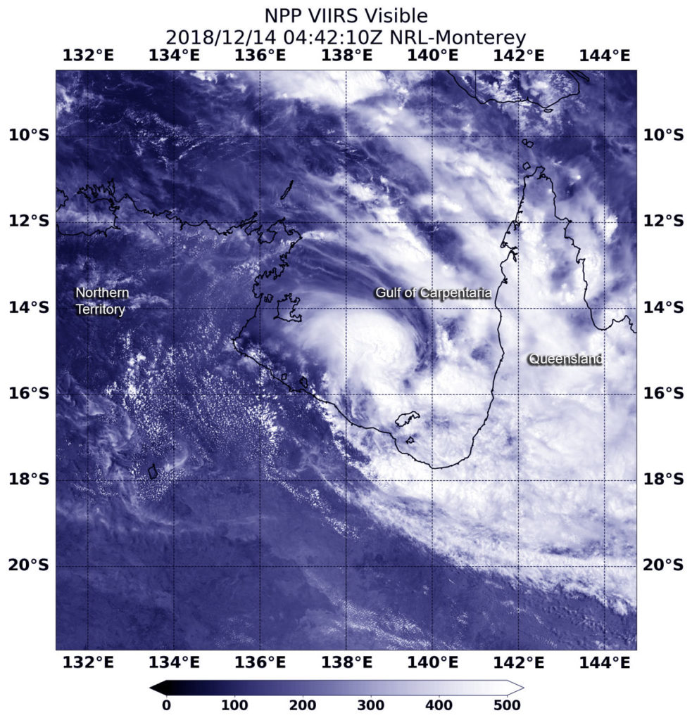
Tropical Cyclone Owen continued to strengthen as it moved east through the Gulf of Carpentaria and toward a landfall in western Queensland, Australia. NASA-NOAA’s Suomi NPP satellite provided a visible image of the storm.

On Dec. 14, the Australian Bureau of Meteorology or ABM posted a warning zone that includes coastal and adjacent inland areas between Karumba and Cape Keerweer, including Kowanyama, Pormpuraaw, Croydon and Palmerville.
Suomi NPP passed over Owen on Dec. 14 at 4:42 UTC (Dec. 13 at 11:42 p.m. EDT) the Visible Infrared Imaging Radiometer Suite (VIIRS) instrument provided a visible image. VIIRS showed the center was surrounded by powerful storms. Clouds and storms from Owen’s eastern side stretched over Queensland.
At 10 p.m. AEST (local time, Queensland) or 7 a.m. EST, Owen was a Category 3 storm with maximum sustained winds near the center of 120 kilometers (75 miles) per hour. It was located near 15.3 degrees south and 140.6 degrees east, estimated to be 120 kilometers west southwest of Pormpuraaw and 160 kilometers (99 miles) north northwest of Gilbert River Mouth. Owen is moving east at 31 kph (19 mph).
ABM said “Severe tropical cyclone Owen is expected to continue shifting eastwards into the early hours of Saturday as a low end Category 3 system. Owen is forecast to make landfall about the southeast Gulf of Carpentaria coast, between Gilbert River Mouth and Pormpuraaw, in the very early hours of Saturday, Dec. 15.”
For updated forecasts, visit: http://www.bom.gov.au
