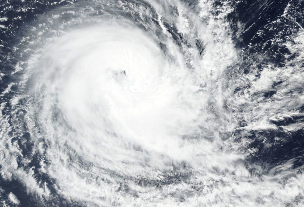
December 20, 2018 – Seeing Double: Tropical Cyclone Kenanga Same Strength as Other Storm
The Southern Indian Ocean is seeing double. Tropical Cyclone Kenanga was one of two storms at Category 2 hurricane strength in the Southern Indian Ocean on Dec. 20. Kenanga was sporting an eye on visible imagery from NASA-NOAA’s Suomi NPP satellite, and so was Tropical Cyclone Cilida, located west of Kenanga.

On Dec. 20, 2018 the Visible Infrared Imaging Radiometer Suite (VIIRS) instrument aboard NASA-NOAA’s Suomi NPP satellite showed a powerful thunderstorms circling Kenanga’s eye.
The Joint Typhoon Warning Center or JTWC noted that after the Suomi NPP image was taken, infrared imagery showed the loss of the eye and the erosion of the eyewall (powerful thunderstorms circling the open center).
Kenanga and Cilida are both Category 2 hurricanes on the Saffir-Simpson Hurricane Wind Scale, and both have maximum sustained winds near 90 knots (103.6 mph/166.7 kph) on Dec. 20 at 10 a.m. EDT (1500 UTC). Strongest storms appeared northwest of the eye.
Kenanga was located near 16.6 degrees south latitude and 81.2 degrees east longitude, approximately 773 nautical miles southeast of Diego Garcia. Kenanga was moving west.
The JTWC forecast calls for Kenanga to steadily weaken, and that will continue under the ongoing influence of moderate to strong vertical wind shear and passage over cooler water. The storm is expected to dissipate below 35 knots (40 mph/74 kph) in 5 days.
