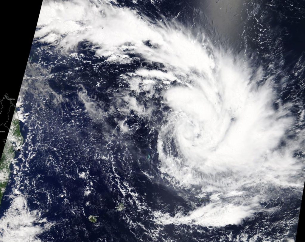
March 22, 2019 – NASA Catches Development of Tropical Cyclone Joaninha

Visible imagery from NASA’s Terra satellite showed Tropical Cyclone Joaninha in the Southern Indian Ocean, far to the east of Madagascar.
On March 22 the Moderate Resolution Imaging Spectroradiometer or MODIS instrument aboard NASA’s Terra satellite provided a visible image of Joaninha soon after it developed. Born as Tropical Depression 22S, it quickly intensified into a tropical storm and was renamed Joaninha. Convective (rising air that consolidates into clouds and storms) bands of thunderstorms spiraled into the center of circulation from the north and east. The center of circulation was obscured by high clouds.
At 11 a.m. EDT on March 22, 2019, maximum sustained winds near Joaninha’s center were near 46 mph (40 knots/74 kph). Joaninha was centered near 15.0 degrees south latitude and 62.4 degrees east longitude. That’s about 760 nautical miles southwest of Diego Garcia in the Central Indian Ocean. Diego García is an atoll, located just south of the equator.
Joaninha is forecast to move south, later southeast, while continuing to intensify. The Joint Typhoon Warning Center or JTWC expects Joaninha’s sustained winds to peak at 115 mph (100 knots /185 kph). The storm is forecast to pass far to the east of Mauritius and La Reunion Island. After four days, at the tropical cyclone will start to weaken as conditions deteriorate.
By Rob Gutro
NASA’s Goddard Space Flight Center, Greenbelt, Md.
