Apr. 01, 2019 – NASA Finds Wind Shear Tearing Apart Subtropical Cyclone Joaninha
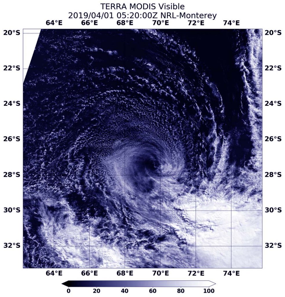
Visible imagery from NASA’s Terra satellite revealed that strong wind shear was adversely affecting Subtropical Cyclone Joaninha in the Southern Indian Ocean.

On April 1 at 1:20 a.m. EDT (0520 UTC), the Moderate Resolution Imaging Spectroradiometer or MODIS instrument aboard NASA’s Terra satellite provided a visible image of Subtropical Cyclone Joaninha. Joaninha transitioned into a subtropical storm over the weekend of March 30 and 31. Joaninha’s center was surrounded by a swirl of clouds around its center with most of its clouds and thunderstorms pushed southeast of center. Strong westerly to northwesterly vertical wind shear were tearing the storm apart.
In general, wind shear is a measure of how the speed and direction of winds change with altitude. Tropical cyclones are like rotating cylinders of winds. Each level needs to be stacked on top each other vertically in order for the storm to maintain strength or intensify. Wind shear occurs when winds at different levels of the atmosphere push against the rotating cylinder of winds, weakening the rotation by pushing it apart at different levels.
On March 31 at 0300 GMT, March 31 (11pm EDT March 30), the Joint Typhoon Warning Center issued the final bulletin on Joaninha. At that time, Joaninha was located near 26.8 degrees south latitude and 69.8 degrees east longitude, about 796 miles east-southeast of Port Louis, Mauritius. It was moving south southwest. Maximum sustained winds at the time were near 35 knots (40 mph/65 kph) and it was weakening.
Joaninha continued to dissipate from adverse atmospheric conditions.
