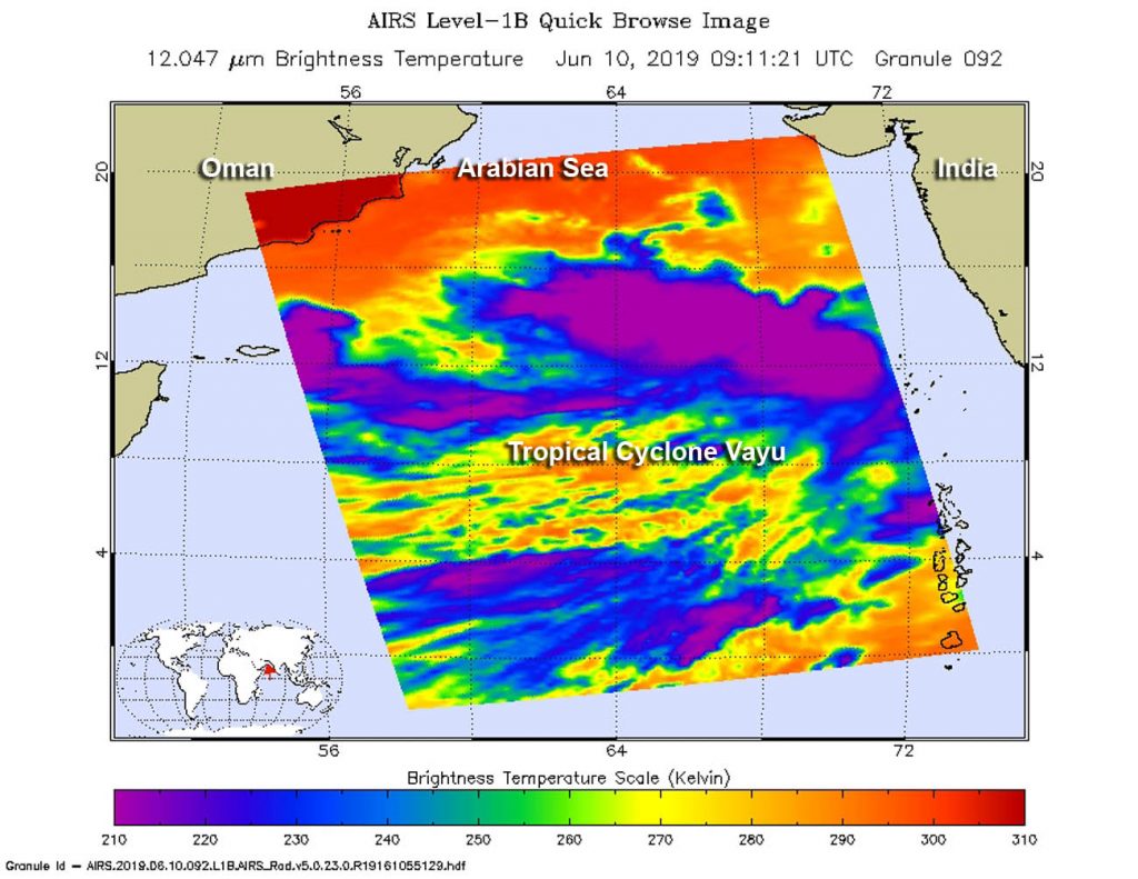
June 11, 2019 – NASA Takes Tropical Cyclone‘s Vayu’s Temperature
NASA’s Aqua satellite passed over the Northern Indian Ocean and took the temperature of Tropical Cyclone Vayu as it moved northward in the Arabian Sea. NASA found the storm intensifying. Warnings are now in effect for India’s Gujarat coast.

Infrared light enables NASA to take the temperatures of clouds and thunderstorms that make up tropical cyclones. The stronger the storms are indicate that they extend high into the troposphere and have cold cloud top temperatures.
An infrared look by NASA’s Aqua satellite on June 10, at 0511 UTC (0911 UTC) revealed where the strongest storms were located within Tropical Cyclone Vayu, formerly known as Tropical Cyclone 02A. The Atmospheric Infrared Sounder or AIRS instrument aboard NASA’s Aqua satellite analyzed cloud top temperatures and found cloud top temperatures of strongest thunderstorms as cold as or colder than minus 63 degrees Fahrenheit (minus 53 degrees Celsius) circling the center and in thunderstorms northwest of the center. Cloud top temperatures that cold indicate strong storms that have the capability to create heavy rain.
On June 11, cloud top temperatures continued to cool, as Vayu intensified. The Joint Typhoon Warning Center stated, “multi-spectral satellite imagery showed “tightly-curved banding wrapping into a formative, small eye, which supports the initial position with good confidence.” Satellite imagery showed Vayu has a compact core, approximately 90 nautical miles in diameter with bands of thunderstorms wrapping around it from the western quadrant.
On June 11 at 5 a.m. EDT (0900 UTC), the center of Tropical Cyclone Vayu was located near latitude 16.4 degrees south and longitude 70/9 degrees east. Vayu was moving to the north and had maximum sustained winds were near 65 knots (75 mph/120 kph) making the storm a category one hurricane on the Saffir-Simpson Hurricane Wind Scale.
The Joint Typhoon Warning Center expects Vayu to intensify quickly, peaking at 95 knots (109 mph/176 kph) on June 12 before starting to weaken on June 13. That means hurricane-force winds, storm surge and heavy rain can be expected along the western coast of India is Vayu moves north over the next several days.
For updated forecasts from the India Meteorological Department, visit: http://www.imd.gov.in
