June 14, 2019 – Update #2 – NASA Finds Tropical Cyclone Vayu Getting Stretched
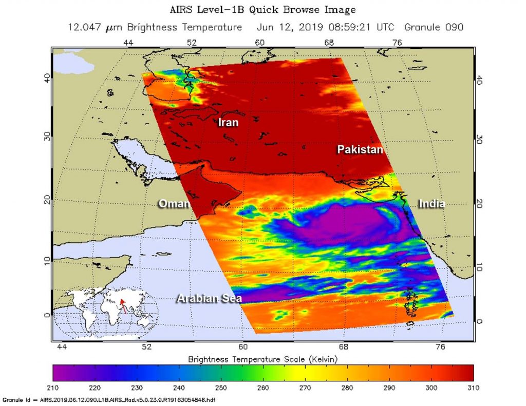
When NASA’s Aqua satellite passed over the Northern Indian Ocean, it captured an infrared image that revealed Tropical Cyclone Vayu was elongating. That’s never a good sign for a tropical cyclone, because they need a circular rotation to maintain strength.

On June 14, warnings remained in effect for India’s Gujarat coast.
Infrared light enables NASA to take the temperatures of clouds and thunderstorms that make up tropical cyclones. The stronger the storms are indicate that they extend high into the troposphere and have cold cloud top temperatures.
An infrared look by NASA’s Aqua satellite on June 14, at 0359 UTC (0859 UTC) revealed strongest storms within Tropical Cyclone Vayu. The Atmospheric Infrared Sounder or AIRS instrument aboard NASA’s Aqua satellite analyzed cloud top temperatures and found cloud top temperatures of strongest thunderstorms as cold as or colder than minus 63 degrees Fahrenheit (minus 53 degrees Celsius) circling the center and in thunderstorms northwest of the center. Cloud top temperatures that cold indicate strong storms that have the capability to create heavy rain.
On June 14 at 11 a.m. EDT (1500 UTC), the center of Tropical Cyclone Vayu was located near latitude 20.8 degrees south and longitude 68.2 degrees east. Vayu was moving to the southwest and had weakened. Maximum sustained winds were near 75 knots (75 mph/120 kph) making the storm a category one hurricane on the Saffir-Simpson Hurricane Wind Scale. The AIRS imagery showed that the storm appeared more elongated, indicating that vertical wind shear was increasing and having an adverse effect on it, so Vayu was weakening.
The Joint Typhoon Warning Center expects Vayu to turn to the northeast in a day and a half and make landfall near the India/Pakistan border by June 17.
For updated forecasts from the India Meteorological Department, visit: http://www.imd.gov.in
