July 11, 2019 – Update #2 – NASA’s Aqua Satellite Sees Formation of Tropical Storm Barry
The National Hurricane Center (NHC) confirmed that Tropical Storm Barry formed in the Gulf of Mexico today, July 11 at 11 a.m. EDT (1500 UTC). NASA’s Aqua satellite provided a view of the storm’s clouds and temperatures as Barry continued consolidating.
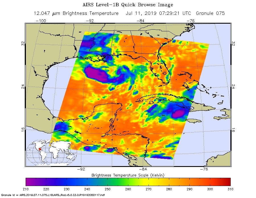
On July 11, 2019 at 3:29 p.m. EDT (0729 UTC) the AIRS instrument aboard NASA’s Aqua satellite analyzed cloud top temperatures in infrared light in what was at the time, Potential Tropical Cyclone 2. AIRS found coldest cloud top temperatures (purple) of strongest thunderstorms were as cold as or colder than minus 63 degrees Fahrenheit (minus 53 degrees Celsius). Cloud tops that cold can produce heavy rainfall and the NHC said dangerous storm surge, heavy rains, and wind conditions are expected across the north-central Gulf Coast from Barry.
The image also showed the storm had become better defined and bands of thunderstorms were wrapping around the low-level center.
For updates from the National Hurricane Center visit: www.nhc.noaa.gov
Credit: NASA JPL/Heidar Thrastarson