July 30, 2019 – NASA Finds Flossie’s Center Just North of Coldest Cloud Tops
Cloud top temperatures provide information to forecasters about where the strongest storms are located within a tropical cyclone. NASA’s Aqua satellite took Tropical Storm Flossie’s cloud top temperatures to get that information.
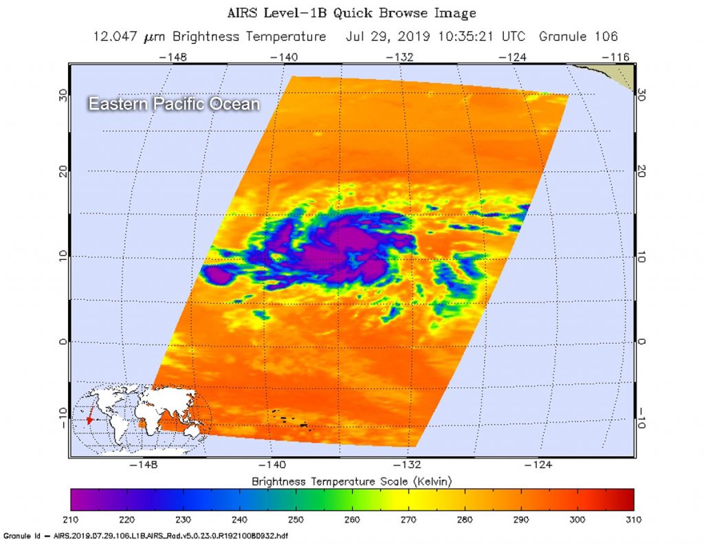
NASA’s Aqua satellite analyzed the storm on July 29, at 6:35 a.m. EDT (1035 UTC) using the Atmospheric Infrared Sounder or AIRS instrument. The stronger the storms, the higher they extend into the troposphere, and they have the colder cloud temperatures.
AIRS found coldest cloud top temperatures as cold as or colder than minus 63 degrees Fahrenheit (minus 53 degrees Celsius) south of the center. At 11 a.m. EDT, the National Hurricane Center analyzed infrared data and said, “Flossie’s low-level center has migrated southward toward the strongest convection and is positioned just north of the coldest cloud tops.”
Cloud top temperatures that cold indicate strong storms that have the capability to create heavy rain.
At 5 a.m. EDT (0900 UTC) on Tuesday, July 30, 2019, the center of Tropical Storm Flossie was located near latitude 12.2 degrees north and longitude 119.3 degrees west. That puts the center of Flossie about 965 miles (1,550 km) southwest of the southern tip of Baja California, Mexico. Flossie is moving toward the west near 16 mph (26 kph) and a turn to the west-northwest is expected later today. Maximum sustained winds are near 65 mph (100 kph) with higher gusts. The estimated minimum central pressure is 1001 millibars (29.56 inches).
Flossie is expected to strengthen to a hurricane later today, and then is forecast to become a major hurricane Wednesday night.
For updated forecasts, visit: www.nhc.noaa.gov