Aug. 29, 2019 – NASA Sees a Transitioned, Merging Extra-Tropical Storm Erin Off U.S. East Coast
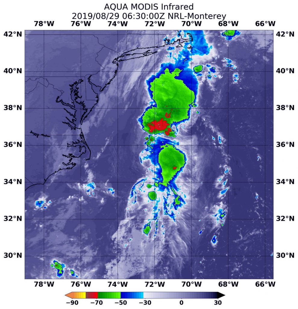
Former tropical depression Erin has made the transition into an extra-tropical system off the eastern coast of the U.S. Infrared imagery from NASA’s Aqua satellite provided temperature data on storms associated with Erin and the weather system it is merging with.
NOAA’s National Hurricane Center or NHC issued the final advisory on Erin on Aug. 29 at 5 a.m. EDT.

On Aug. 29 at 2:30 a.m. EDT (630 UTC), the Moderate Imaging Spectroradiometer or MODIS instrument that flies aboard NASA’s Aqua satellite used infrared light and found strongest thunderstorms associated with Erin where confined to a small area around the center. There, cloud top temperatures were as cold as minus 50 degrees Fahrenheit (minus 45.5 degrees Celsius). Infrared data provides temperature information, and the strongest thunderstorms that reach high into the atmosphere have the coldest cloud top temperatures.
Storms with colder cloud top temperatures were located far to the north of Erin’s center and are associated with the frontal system of which Erin is merging. Those storms had cloud top temperatures as cold as minus 70 degrees Fahrenheit (minus 56.6 Celsius). Cloud top temperatures that cold indicate strong storms with the potential to generate heavy rainfall.
Satellite imagery and scatterometer (wind) data indicate that Erin is merging with a frontal system and is now an extratropical low pressure area. On Aug. 30, Erin is expected to be absorbed by a larger extratropical low pressure area over eastern Canada.
When a storm becomes extra-tropical, it means that a tropical cyclone has lost its “tropical” characteristics. The National Hurricane Center defines “extra-tropical” as a transition that implies both poleward displacement (meaning it moves toward the north or south pole) of the cyclone and the conversion of the cyclone’s primary energy source from the release of latent heat of condensation to baroclinic (the temperature contrast between warm and cold air masses) processes. It is important to note that cyclones can become extratropical and still retain winds of hurricane or tropical storm force.
At 5 a.m. EDT (0900 UTC), NHC noted that the center of Post-Tropical Cyclone Erin was located near latitude 36.1 degrees north and longitude 71.6 degrees west. That puts the center of Erin about 225 miles (365 km) east-northeast of Cape Hatteras, North Carolina. The post-tropical cyclone is moving toward the north-northeast near 15 mph (24 kph). A turn toward the northeast and a faster forward motion are expected later today, with this motion continuing through Friday. Maximum sustained winds are near 35 mph (55 kph) with higher gusts.
The post-tropical cyclone is expected to strengthen a little on Friday, Aug. 30, before it is absorbed by a larger extratropical low over eastern Canada Friday night.
Additional information on this system can be found in High Seas Forecasts issued by the National Weather Service online at: http://ocean.weather.gov/shtml/NFDHSFAT1.php.
