Sep. 03, 2019 – Major Hurricane Juliette’s Emerging Eye Spotted in NASA Satellite Imagery
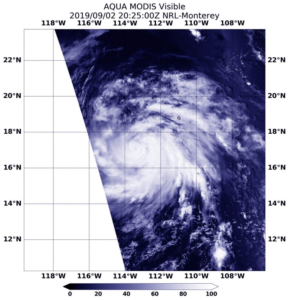
NASA’s Aqua satellite passed over the Eastern Pacific Ocean and provided an image of Hurricane Juliette as its eye began to emerge. Juliette has grown into a major hurricane, about 450 miles southwest of the southern tip of Baja California, Mexico.

Juliette developed on Sunday, Sept 1 around 5 a.m. EDT (0900 UTC) as a tropical storm. By 5 p.m. EDT on Sept. 2, the storm had strengthened into a hurricane.
On Sept. 2, 2019 at 4:25 p.m. EDT (2025 UTC) the Moderate Resolution Imaging Spectroradiometer or MODIS instrument aboard NASA’s Aqua satellite provided a visible image of Hurricane Juliette that revealed its emerging eye around a thick tight circle of powerful thunderstorms. Hurricane-force winds extend outward up to 35 miles (55 km) from the center and tropical-storm-force winds extend outward up to 125 miles (205 km).
NASA researches hurricanes to better understand their behavior, and provides data to forecasters at NOAA’s NHC or National Hurricane Center to assist in their forecasting.
On Sept. 3 at 11 a.m. EDT (1500 UTC), NOAA’s National Hurricane Center said the eye of Hurricane Juliette was located near latitude 18.4 degrees north and longitude 115.0 degrees west. That’s about 455 miles (730 km) southwest of the southern tip of Baja California, Mexico. Juliette is moving toward the northwest near 8 mph (13 kph), and a northwest to west-northwest motion is expected through Friday. Maximum sustained winds have increased to near 125 mph (205 kph) with higher gusts. Juliette is a category 3 hurricane on the Saffir-Simpson Hurricane Wind Scale. The estimated minimum central pressure is 953 millibars based on satellite estimates and data from the Mexican Navy station on Clarion Island.
NHC said. “Some strengthening is possible today, with weakening forecast to begin by late Wednesday and continuing through Friday.”
For updated forecasts, visit NOAA’s NHC: www.nhc.noaa.gov
