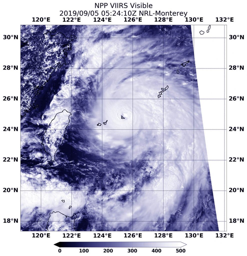
Sep. 05, 2019 – NASA-NOAA Satellite Sees Typhoon Lingling’s Eye Near Miyako
Typhoon Lingling’s eye was passing near the island of Miyako when NASA-NOAA’s Suomi NPP satellite passed overhead on Sept. 5. Miyako is one of the Ryukyu Islands located in the Northwestern Pacific Ocean.

The Ryukyu Islands are a chain of Japanese islands that stretch southwest from Kyushu to Taiwan.
On Sept. 5 at 1:24 a.m. EDT (0524 UTC), the Visible Infrared Imaging Radiometer Suite (VIIRS) instrument aboard Suomi NPP captured the visible image that showed the southwestern eyewall of Typhoon Lingling over the island of Miyako. In the image, Okinawa was being affected by the northeastern quadrant of the storm, and the islands of Senkaku and Yaeyama were experiencing winds and rain from the southwestern quadrant.
At 11 a.m. EDT (1500 UTC) on Sept. 5, the Joint Typhoon Warning Center (JTWC) noted that Lingling had maximum sustained winds near 115 knots. It was centered near 25.7 degrees north latitude and 125.3 degrees east longitude, about 143 miles west-southwest of Kadena Air Base, Okinawa Island, Japan. It was moving to the north.
Lingling is moving north and the JTWC forecasters noted it has reached peak intensity. The system is expected to weaken on approach to the Korean peninsula, but still be at typhoon strength at landfall near Pyongyang, North Korea.
For updates from the Japan Meteorological Agency, visit: https://www.jma.go.jp/en/typh/
