Sep. 17, 2019 – GPM Finds Heavy Rain in New Eastern Pacific Tropical Storm Lorena
The Global Precipitation Measurement mission or GPM core satellite provided information about the rate in which rain was falling within the Eastern Pacific Ocean’s tropical storm.
Lorena is close enough to the coast of Mexico to trigger a watch. A Tropical Storm Watch is in effect from Zihuatanejo to Cabo Corrientes, Mexico.
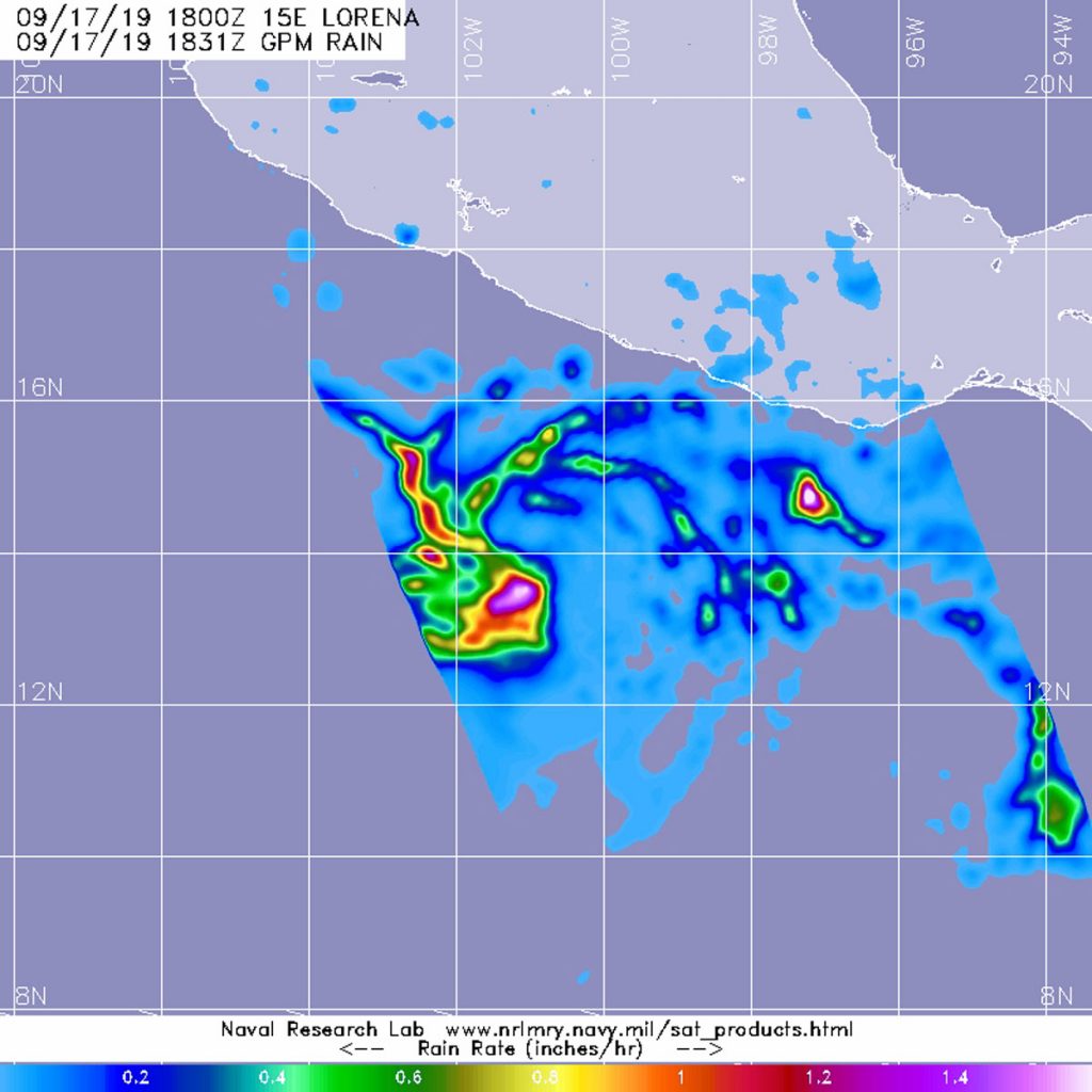
Tropical Storm Lorena formed today, Sept. 17. GPM passed over Tropical Storm Lorena in the Eastern Pacific on Sept. 17 at 2:31 p.m. EDT (1831 UTC). GPM found the heaviest rainfall around the center where it was falling at a rate of over 40 mm (about 1.6 inch) per hour. Lighter rainfall rates were measured throughout the north and west sides of the storm.
GPM is a joint mission between NASA and the Japan Aerospace Exploration Agency, JAXA.
NOAA’s National Hurricane Center or NHC noted at 2 p.m. EDT (1800 UTC), the center of Tropical Storm Lorena was located near latitude 13.9 degrees North and longitude degrees 100.4 West. The tropical storm is moving toward the northwest near 15 mph (24 kph). Recent satellite-derived wind data indicate that Lorena’s maximum sustained winds have increased to near 45 mph (75 kph) with higher gusts. The estimated minimum central pressure is 1004 millibars.
A northwestward motion at a slightly slower speed is expected for the next couple of days. Lorena is expected to move near the southwest coast of Mexico by Thursday. Continued gradual strengthening is anticipated during the next couple of days as Lorena approaches the coast of Mexico.
For updated forecasts, visit: www.nhc.noaa.gov