Oct. 29, 2019 – NASA Identifies a Strong Arabian Sea Tropical Cyclone Kyarr
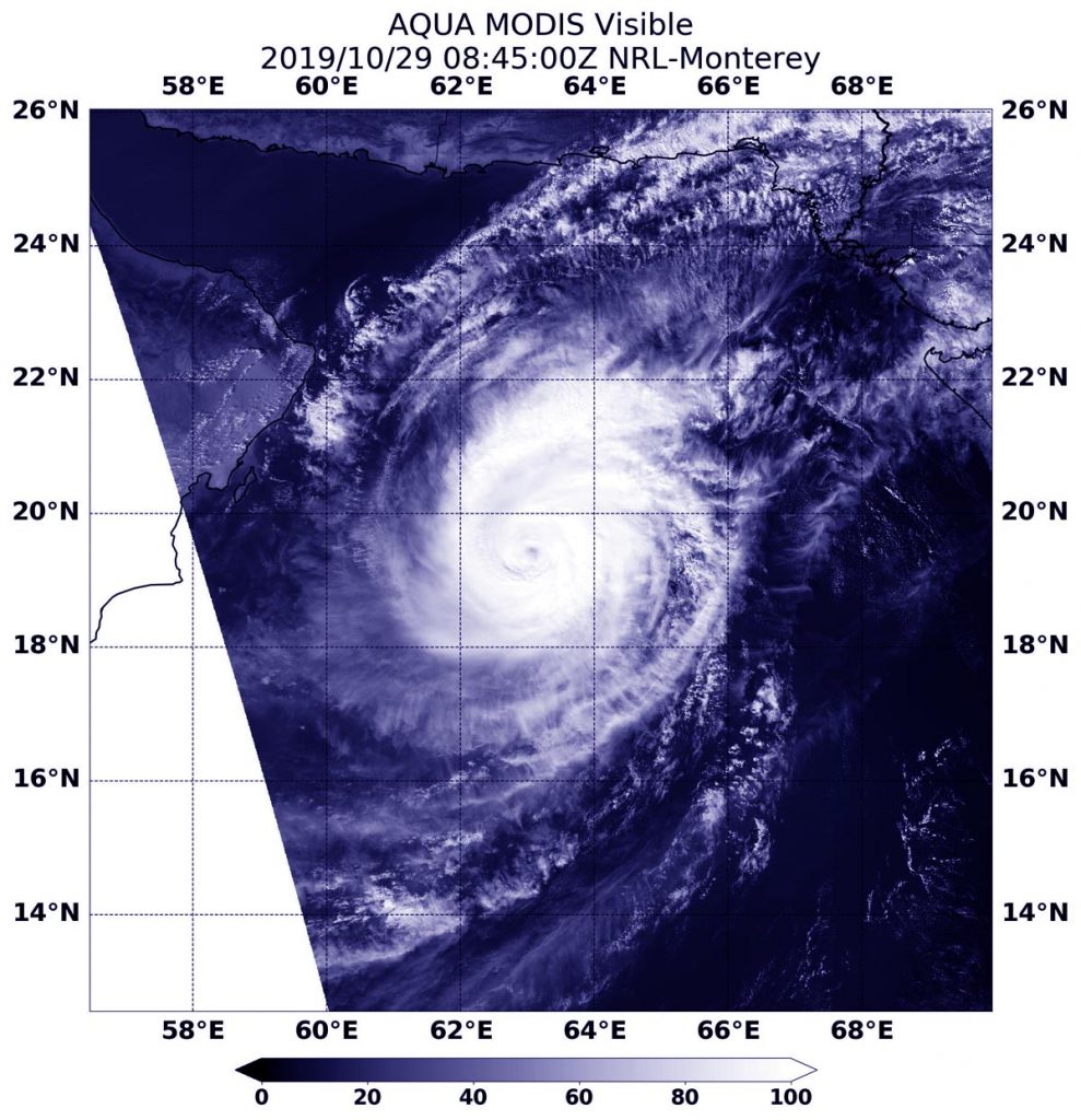
NASA’s Aqua satellite captured an image of Tropical Cyclone Kyarr in the Arabian Sea is it headed west toward Oman. The visible image showed a powerful and organized storm with an eye.

On Oct 29 at 4:45 a.m. EDT (0845 UTC), the Moderate Imaging Spectroradiometer or MODIS instrument that flies aboard NASA’s Aqua satellite provided a visible image of Kyarr. The MODIS image showed the cyclone continues to produce a large area of deep convection and strong thunderstorms around the visible eye. Satellite imagery showed the ragged eye is about 19 nautical miles in diameter. Bands of thunderstorms were wrapping into the low-level center from the north and east of the center.
At 5 a.m. EDT (0900 UTC), the center of Tropical Cyclone Kyarr was located near latitude 19.4 degrees north and longitude 63.1 degrees east. That is about 257 nautical miles east-southeast of Masirah Island. The storm has tracked northwestward. However, two large areas of high pressure are expected to turn the storm to the southwest. Maximum sustained winds were near 115 knots (132 mph/213 kph) and the storm is on a weakening trend.
Kyarr is forecast to turn to the southwest and parallel the coast of Oman and Yemen, move through the opening of the Gulf of Aden, pass just west of Socotra Island and make landfall in Somalia.
NASA’s Aqua satellite is one in a fleet of NASA satellites that provide data for hurricane research.
Hurricanes are the most powerful weather event on Earth. NASA’s expertise in space and scientific exploration contributes to essential services provided to the American people by other federal agencies, such as hurricane weather forecasting.
For updated forecasts, visit: https://www.nhc.noaa.gov
