Nov. 01, 2019 – NASA Satellite Imagery Finds Rebekah Now Post-Tropical
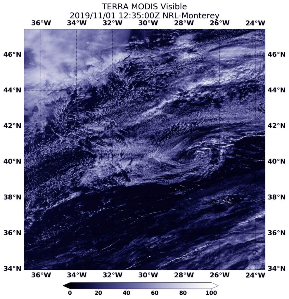
NASA’s Terra Satellite provided a visible image of Post-Tropical Cyclone Rebekah as it continued moving in an easterly direction through the North Atlantic Ocean. Satellite data has confirmed that Rebekah is now a post-tropical cyclone.

At 5 a.m. EDT (0900 UTC) on Nov. 1, the center of Post-Tropical Cyclone Rebekah was located near latitude 40.6 degrees north and longitude 29.0 degrees west. That puts the center about 140 miles (225 km) north of Faial Island in the central Azores islands. The Azores are an archipelago or group of islands that are an autonomous region of Portugal.
The post-tropical cyclone is moving toward the east near 20 mph (31 kph) and this motion is expected to continue through tonight. Maximum sustained winds have decreased to near 35 mph (55 kph) with higher gusts. The estimated minimum central pressure is 1005 millibars. The National Hurricane Center (NHC) issued the final advisory on the system and Rebekah was designated post-tropical.
On Nov. 1 at 08:35 a.m. EDT (12:35 UTC), the Moderate Resolution Imaging Spectroradiometer or MODIS instrument that flies aboard NASA’s Terra satellite provided a visible image of Rebekah just after it was designated a post-tropical cyclone. The image revealed that Rebekah has degenerated to a remnant low-pressure area because the circulation was devoid of deep convection and strong thunderstorms. Rebekah appeared as a circulation of wispy clouds in the Terra satellite image.
A Post-Tropical Storm is a generic term for a former tropical cyclone that no longer possesses sufficient tropical characteristics to be considered a tropical cyclone. Former tropical cyclones can become fully extratropical, subtropical, or remnant lows, which are three classes of post-tropical cyclones. In any case, they no longer possesses sufficient tropical characteristics to be considered a tropical cyclone. However, post-tropical cyclones can continue carrying heavy rains and high winds.
NOAA’s National Hurricane Center discussion noted that Rebekah is starting to merge with a weak frontal system over the northeastern Atlantic. The remnants of Rebekah are expected to weaken to a trough or elongated area of low pressure between 12 and 24 hours.
Hurricanes are the most powerful weather event on Earth. NASA’s expertise in space and scientific exploration contributes to essential services provided to the American people by other federal agencies, such as hurricane weather forecasting.
For updated forecasts, visit: www.nhc.noaa.gov
