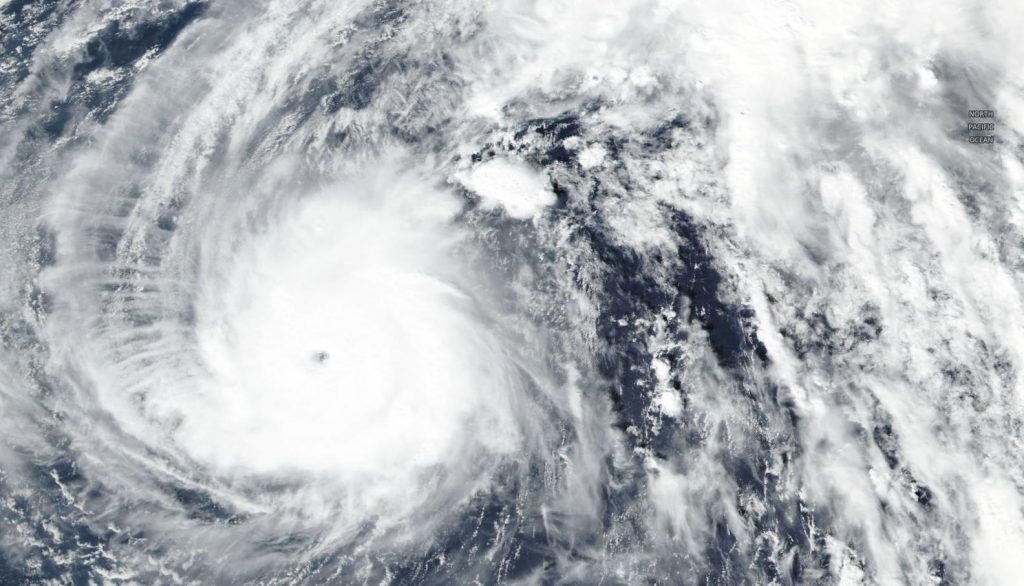
Nov. 06, 2019 – NASA-NOAA Satellite Finds Super Typhoon Halong Finally Weakening
Super Typhoon Halong has finally peaked in intensity and is now on a weakening trend. NASA-NOAA’s Suomi NPP satellite passed over the Northwestern Pacific Ocean and provided a look at the storm.

On Nov. 5, Halong was a powerful Category 5 hurricane on the Saffir-Simpson Hurricane Wind Scale. When the Suomi NPP satellite passed overhead on Nov. 6 the Visible Infrared Imaging Radiometer Suite (VIIRS) instrument aboard provided a visible image of the storm, after it had weakened slightly to a Category 4 storm. The VIIRS imagery showed bands of thunderstorms wrapping into the 10 nautical-mile wide eye.
At 10 a.m. EDT (1500 UTC) on Nov. 6 (or 1 a.m. CHST on Nov. 7) the National Weather Service in Tiyan, Guam noted the eye of Super Typhoon Halong was located near latitude 22.0 degrees north and longitude 150.8 degrees rast. That puts the center of Halong about 255 miles southwest of Minamitorishima, 420 miles northeast of Pagan, 580 miles northeast of Saipan, and 710 miles northeast of Guam.
Halong was moving north-northeast at 6 mph. Halong is expected to maintain this north-northeast heading through Thursday, Nov. 7, with a gradual increase in forward speed. By Saturday, Nov. 9, Halong is forecast to move toward the east-northeast at a faster pace.
Maximum sustained winds have decreased to 155 mph. A Category 4 hurricane contains sustained winds between 130 and 156 mph (113 and 136 knots/209 and 251 kph). Typhoon force winds extend outward from the eye up to 35 miles and tropical storm force winds extend outward up to 145 miles southeast of the center and up to 105 miles elsewhere.
Halong is forecast to weaken further today with a steady weakening trend expected to commence Friday, Nov. 8. On Nov. 8 upper-level winds are forecast to begin to affect the typhoon as Halong moves over cooler sea surface temperatures. Both of those factors are expected to help the storm transition into an extra-tropical cyclone.
Hurricanes are the most powerful weather event on Earth. NASA’s expertise in space and scientific exploration contributes to essential services provided to the American people by other federal agencies, such as hurricane weather forecasting.
For updated forecasts, Visit: https://www.weather.gov/gum/Cyclones
