Nov. 15, 2019 – NASA Looks at Tropical Depression Kalmaegi’s Water Vapor Concentration
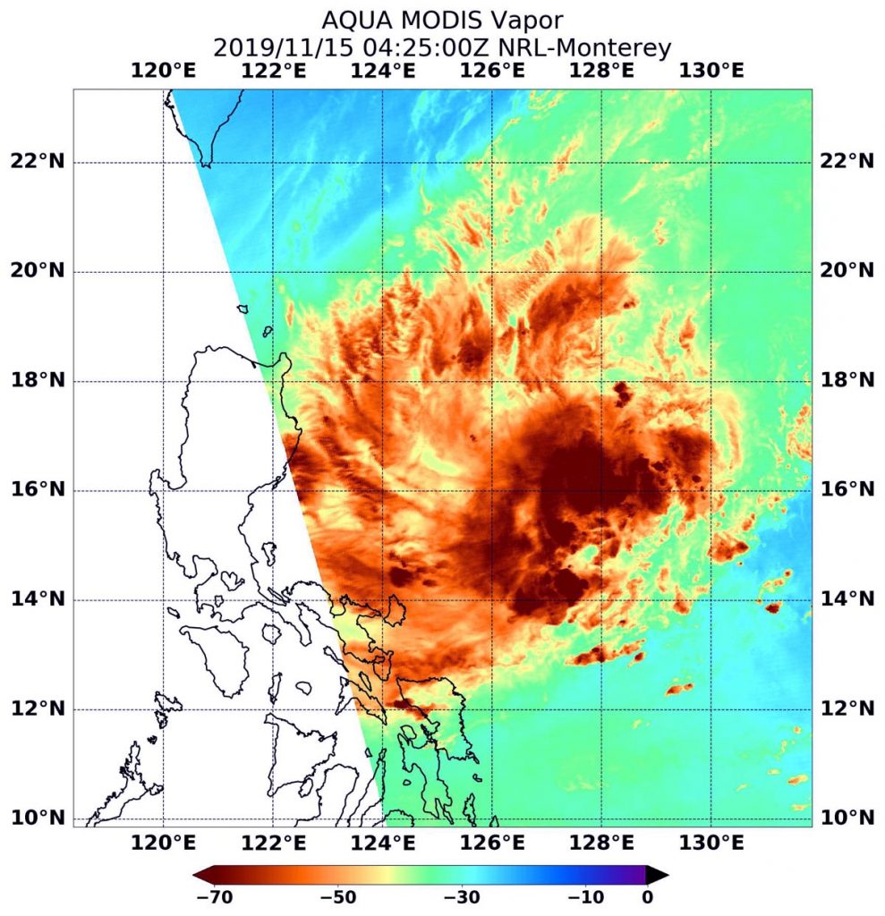
When NASA’s Aqua satellite passed over the Philippine Sea, water vapor data provided information about the intensity of Tropical Depression Kalmaegi.

NASA’s Aqua satellite passed Kalmaegi on Nov. 15 at 0425 UTC (Nov. 14 at 11:25 p.m. EST) and the Moderate Resolution Imaging Spectroradiometer or MODIS instrument gathered water vapor content and temperature information. The MODIS image showed highest concentrations of water vapor and coldest cloud top temperatures were north and west of the center. MODIS data also showed coldest cloud top temperatures were as cold as or colder than minus 70 degrees Fahrenheit (minus 56.6 degrees Celsius) in those storms. Storms with cloud top temperatures that cold have the capability to produce heavy rainfall.
Water vapor analysis of tropical cyclones tells forecasters how much development potential a storm has. Water vapor releases latent heat as it condenses into liquid. That liquid becomes the clouds and thunderstorms that make up a tropical cyclone. Temperature is important when trying to understand how strong storms can be. The higher the cloud tops, the colder and the stronger they are.
At 10 a.m. EDT (1500 UTC) on Nov. 15, Kalmaegi was located near latitude 15.8 degrees north and longitude 125.9 degrees east. Maximum sustained winds were near 30 knots (34.5 mph/55.5 kph). The depression was moving to the west.
Forecasters at the Joint Typhoon Warning Center expect the storm to strengthen into a tropical storm, make landfall in the northern Philippines and cross into the South China Sea by Nov. 19.
NASA’s Aqua satellite is one in a fleet of NASA satellites that provide data for hurricane research.
Typhoons and hurricanes are the most powerful weather event on Earth. NASA’s expertise in space and scientific exploration contributes to essential services provided to the American people by other federal agencies, such as hurricane weather forecasting.
