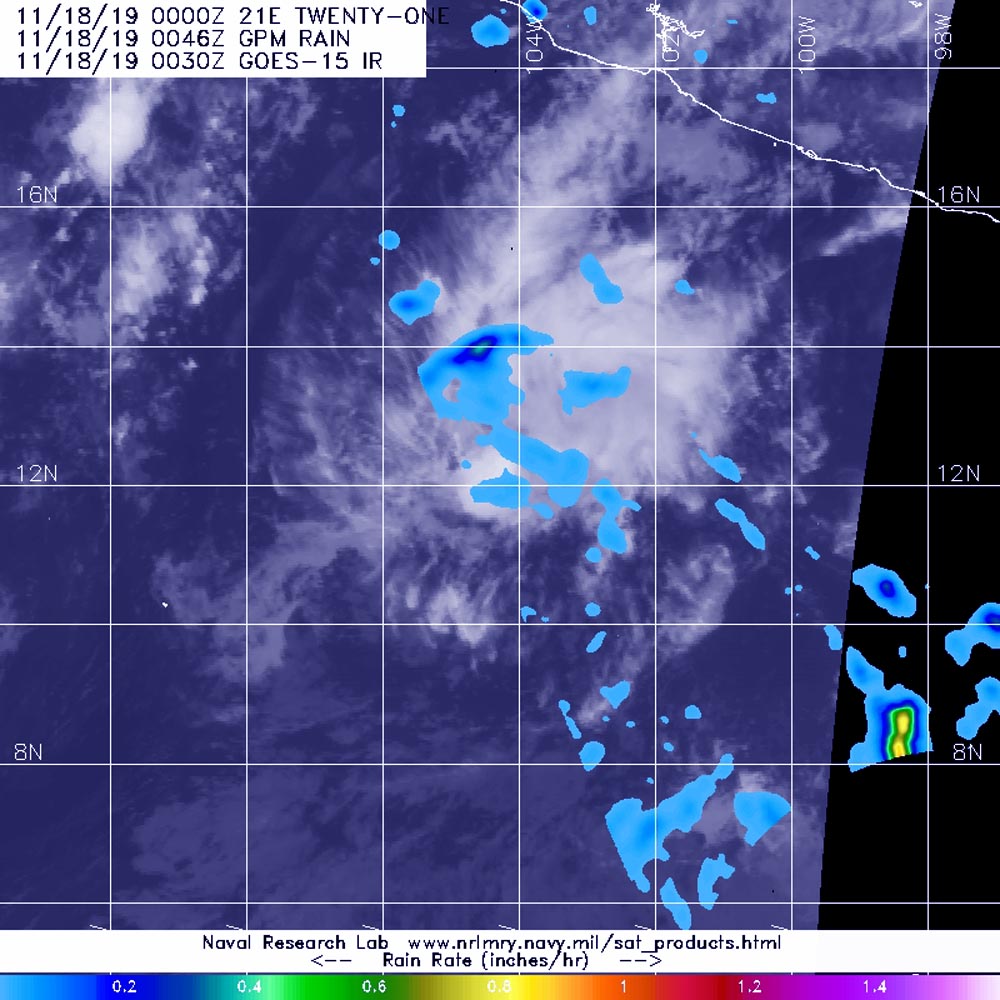
Nov. 18, 2019 – NASA Finds Light Rain in Fading Tropical Depression 21E
Tropical Depression 21E never matured into a tropical storm and a NASA analysis of rainfall rates show the storm won’t have that chance.

NASA has the unique capability of peering under the clouds in storms and measuring the rate in which rain is falling. Global Precipitation Measurement mission or GPM core passed over Tropical Depression 21E (TD21E) from its orbit in space and measured rainfall rates throughout the storm.
TD21E formed on Saturday, Nov. 16 and maintained depression status over the weekend.
The GPM’s core satellite passed over TD21E in the Arabian Sea, Eastern Pacific Ocean on Nov. 18 at 0046 UTC (Nov. 17 at 7:46 p.m. EST) and found a few areas of light rain falling at a rate of 0.4 inches (10 mm) per hour. There was one small area north of the center where heavy rain was falling at a rate of 1 inch (25 mm) per hour, but forecasters said that area “doesn’t seem to be directly associated with the depression’s circulation.” Forecasters incorporate the rainfall data into their forecasts.
NOAA’s National Hurricane Center or NHC noted at 4 a.m. EST (0900 UTC), the center of TD21E was located near latitude 12.2 north, longitude 105.0 west and is located about 470 miles (760 km) south of Manzanillo, Mexico.
The depression is moving toward the northwest near 7 mph (11 kph). A westward motion at a slower forward speed is expected for the next couple of days.
Maximum sustained winds are near 30 mph (45 kph) with higher gusts. The estimated minimum central pressure is 1007 millibars.
The depression is expected to become a remnant by early Tuesday and dissipate by Wednesday night or Thursday, Nov. 21.
Hurricanes are the most powerful weather event on Earth. NASA’s expertise in space and scientific exploration contributes to essential services provided to the American people by other federal agencies, such as hurricane weather forecasting.
Both the Japan Aerospace Exploration Agency, JAXA and NASA manage GPM.
