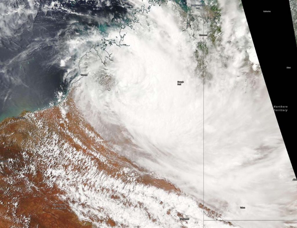
March 02, 2020 – NASA Finds Ex-Tropical Cyclone Esther Moving Back Inland
Ex-Tropical Cyclone Esther just won’t give up. The storm formed in the South Pacific Ocean, tracked across Australia’s Northern Territory and reached the Kimberley coast of Western Australia, and has now turned around. NASA’s Aqua satellite provided forecasters with a visible image of the storm turning back into Western Australia on March 2.

On March 2, the Moderate Resolution Imaging Spectroradiometer or MODIS instrument that flies aboard NASA’s Aqua satellite provided a visible image of Esther’s remnant clouds that showed the storm moved back inland and away from the coast.
The Australian Bureau of Meteorology (ABM) issued a Flood Watch for the Tanami Desert, Central Desert, MacDonnell Ranges, Barkly, Georgina River and Simpson Desert on March 2. A flood warning is current for Sturt Creek District in Western Australia.
At 10:48 a.m. ACST on Monday, March 2, the ABM forecast said, “Rainfall is expected to increase from today with widespread daily totals of 50 – 80 mm [2 to 3.1 inches] and isolated falls of 150 mm [5.9 inches] expected for the northern Tanami Desert. Rainfall into Tuesday is expected to increase with widespread falls of 70 – 120 mm [2.8 to 4.7 inches] expected in the Central Desert and southeastern Tanami Desert. Isolated falls of 180 mm [7.0 inches] could also be possible in places.
Rainfall is expected to increase in the MacDonnell Ranges and southern Barkly during Tuesday with 40 – 100 mm [1.6 to 3.9 inches] daily totals expected into Wednesday. Rainfall extends to the upper Georgina River and Simpson Desert during Wednesday with daily rainfall totals 20 – 80 mm [0.8 to 3.14 inches] expected in many areas.”
Many roads including major transportation routes in the flood watch area can expect to be affected on Mar. 2 and become impassable with some communities and homesteads becoming isolated.
Later today, ex-Tropical Cyclone Esther is expected to move into the northern Tanami District from the west as a strong arc of tropical low pressure.
NASA’s Aqua satellite is one in a fleet of NASA satellites that provide data for hurricane research.
Tropical cyclones/hurricanes are the most powerful weather events on Earth. NASA’s expertise in space and scientific exploration contributes to essential services provided to the American people by other federal agencies, such as hurricane weather forecasting.
For updated forecasts from ABM, visit: http://www.bom.gov.au/
