Mar. 04, 2020 – NASA Tracks Ex-Tropical Cyclone Esther Over Northern Territory
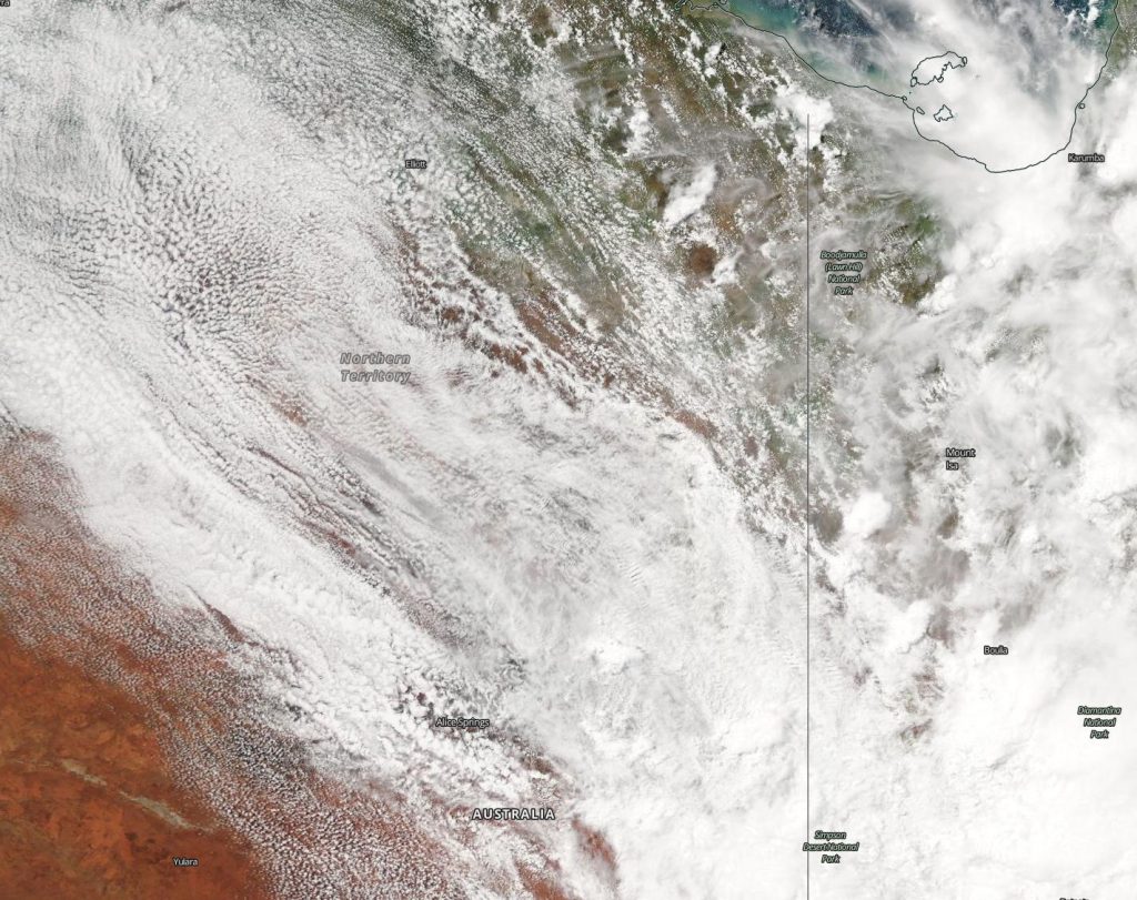
NASA’s Aqua satellite continues to provide forecasters with a visible image ex-tropical cyclone Esther’s remnant clouds and storms, now over the Barkly Region of Australia’s Northern Territory.

On March 4, the Moderate Resolution Imaging Spectroradiometer or MODIS instrument that flies aboard NASA’s Aqua satellite provided a visible image of Esther’s remnant clouds that showed the center over the Barkly region of the Northern Territory.
The Barkly Region is located in the west central part of the territory and the region’s main town is Tennant Creek. The region covers an area of 124,600 square miles (322,713 square km). Esther’s clouds stretched into Queensland.
On March 4, the Australian Bureau of Meteorology (ABM) issued a Flood Watch for the Tanami Desert, Central Desert, MacDonnell Ranges, Barkly, Georgina River and Simpson Desert.
At 10:38 a.m. ACST on Mar. 4 (8:08 p.m. EST on Mar. 3), ABM cautioned that widespread disruption to roads expected to continue in central parts for next few days.
Ex-tropical cyclone Esther is expected to move across the southern Barkly District and into southwestern Queensland later today, Mar. 4.
ABM noted, “During the past 48 hours widespread rainfall totals of 50 to 150 mm (2 to 6 inches) have been recorded in many parts of the southern Northern Territory with some totals even higher, mainly in the Tanami Desert and Barkly. Rainfall is expected to contract east during today with 20 – 50 mm (0.8 to 2 inch) daily totals expected into tomorrow in the upper Georgina River and Simpson Desert.”
Many areas have experienced localized flooding and areas of inundation during the past 48 hours. ABM noted, “Many roads including major transport routes in the flood watch area are expected to continue to be affected and become or remain impassable with some communities and homesteads becoming isolated.”
NASA’s Aqua satellite is one in a fleet of NASA satellites that provide data for hurricane research.
Tropical cyclones/hurricanes are the most powerful weather events on Earth. NASA’s expertise in space and scientific exploration contributes to essential services provided to the American people by other federal agencies, such as hurricane weather forecasting.
For updated forecasts from ABM, visit: http://www.bom.gov.au/
