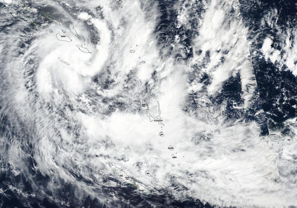
Apr. 03, 2020 – NASA-NOAA Satellite Catches Tropical Cyclone Harold Develop Near Solomon Islands
NASA-NOAA’s Suomi NPP satellite passed over the Southern Pacific Ocean and provided forecasters with a visible image of newly formed Tropical Cyclone Harold. Harold formed near the Solomon Islands and now threatens Vanuatu, which has already issued some warnings.

The Visible Infrared Imaging Radiometer Suite (VIIRS) instrument aboard Suomi NPP provided a visible image of Tropical Cyclone Harold on April 3, 2020. The VIIRS image showed the center near the Solomon Islands, with bands of thunderstorms wrapping tightly into the low-level center from the southeast and western quadrants. A long band of thunderstorms on the eastern side of the storm stretched from southeast of the center to northeast of the center. Outer fragmented bands of thunderstorms extended southeast to Vanuatu. Microwave satellite imagery has detected an eye forming.
At 1500 UTC, (10 a.m. EDT) Tropical cyclone Harold was located near latitude 13.0 degrees south and longitude 163.2 degrees east, about 429 nautical miles northwest of Port Vila, Vanuatu. Harold was moving to the south-southeast and had maximum sustained winds near 55 knots (62 mph/102 kph).
On April 3 EDT (April 4 local time), the Vanuatu Meteorology and Geo-Hazards Department, Port Vila issued Tropical Cyclone Warning Number 4 on Tropical Cyclone Harold for Torba and Sanma. The warning noted, “damaging gale force winds of 75 kph (40 knots/46 mph), gusting to 105 kph (55 Knots/65 mph) are expected to extend closer to Torba and Sanma today.” For updated forecasts, visit: https://www.vmgd.gov.vu/
The Joint Typhoon Warning Center (JTWC) noted that rapid intensification is possible. JTWC expects Harold to move south-southeast and intensify to hurricane strength. JTWC currently forecasts Harold to cross over Vanuatu on April 6 on its track to the southeast.
Tropical cyclones/hurricanes are the most powerful weather events on Earth. NASA’s expertise in space and scientific exploration contributes to essential services provided to the American people by other federal agencies, such as hurricane weather forecasting.
