Sep. 01, 2020 – NASA Sees Typhoon Maysak’s Eye Reopen
NASA’s Terra satellite obtained visible imagery of Typhoon Maysak is it continued moving north though the East China Sea. The imagery revealed the eye of the storm had reappeared.
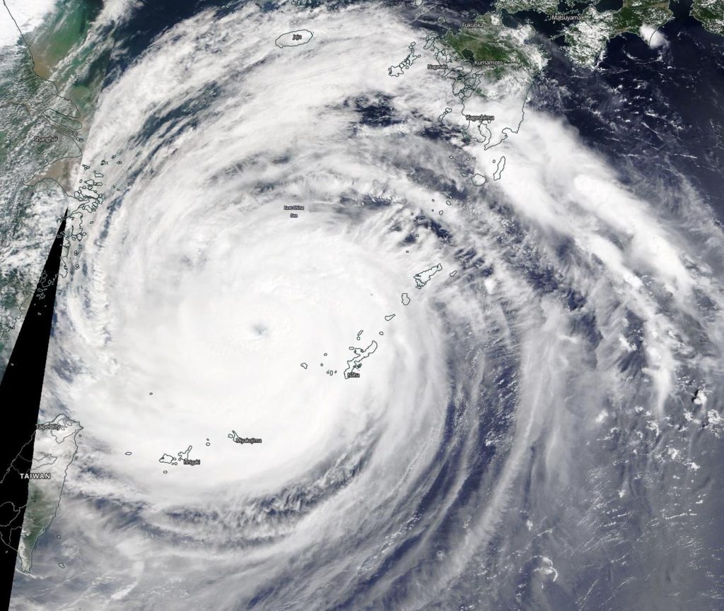
NASA Satellite View: Maysak’s Organization
The Moderate Resolution Imaging Spectroradiometer or MODIS instrument that flies aboard NASA’s Terra satellite captured a visible image of Tropical Storm Maysak on Sept. 1. In the image, the eye was again visible after being obscured by clouds during the previous day, Aug. 31. Satellite imagery depicts deep convection and spiral banding of thunderstorms wrapping tightly into a low-level circulation center.
Satellite imagery was created using NASA’s Worldview product at NASA’s Goddard Space Flight Center in Greenbelt, Md.
Maysak on Sept. 1
At 11 a.m. EDT (1500 UTC) on Sept. 1, the Joint Typhoon Warning Center (JTWC) in Honolulu, Hawaii noted that Typhoon Maysak was located about 427 nautical miles south-southwest of Busan, South Korea near latitude 28.4 degrees north and longitude 126.3 degrees east. Maysak was moving to the north with maximum sustained winds of 120 knots (138 mph/222 kph).
Maysak is forecast to make landfall to the west of Busan on Sept. 2. Then it is expected to weaken rapidly as it passes over the length of the Korean peninsula, and will dissipate over northeastern China.
About NASA’s Worldview and Terra Satellite
NASA’s Earth Observing System Data and Information System (EOSDIS) Worldview application provides the capability to interactively browse over 700 global, full-resolution satellite imagery layers and then download the underlying data. Many of the available imagery layers are updated within three hours of observation, essentially showing the entire Earth as it looks “right now.”
NASA’s Terra satellite is one in a fleet of NASA satellites that provide data for hurricane research.
Tropical cyclones/hurricanes are the most powerful weather events on Earth. NASA’s expertise in space and scientific exploration contributes to essential services provided to the American people by other federal agencies, such as hurricane weather forecasting.
For updated forecasts, visit: www.nhc.noaa.gov